
18 Jul 2025
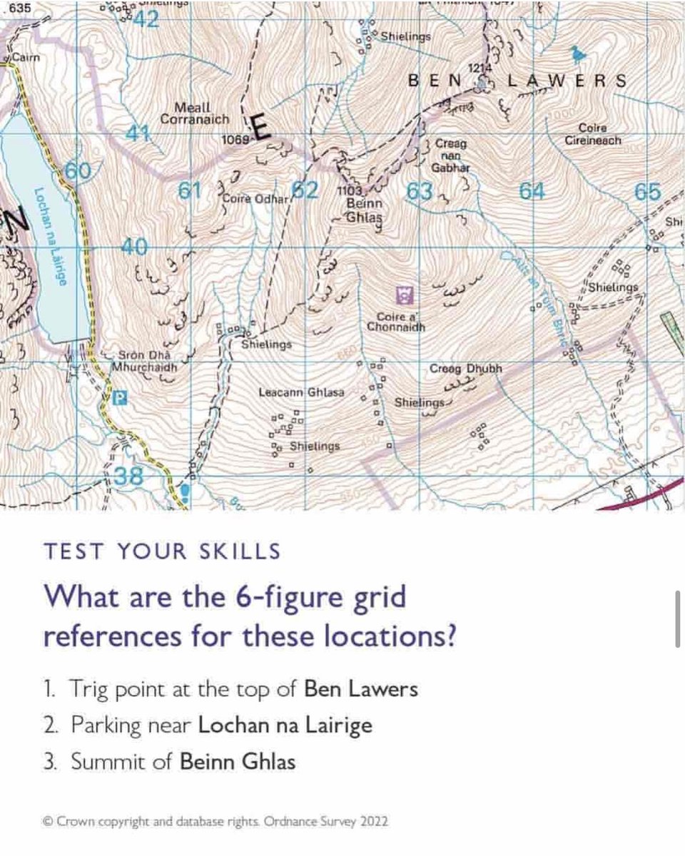
Up the hill, across the ridge, and into the wild… can you crack the 6-figure grid references? 🧭 Drop your grid guesses in the comments ⬇️
It’s #NationalMapReadingWeek - the perfect time to sharpen your navigation skills and celebrate the art of exploring with confidence.
1
1
3
1,234

16 Jul 2025
It's #nationalmapreadingweek - a campaign run by OS encouraging us to #getoutside and learn map reading.
Did you know we have an extensive blog library? We have many blogs that cover map reading skills and the adventures you can have using your maps. dennismaps.co.uk/blog/
3
26

10 Jul 2025
On #daytime today:
Holiday Spending - @SimonCalder
#NationalMapReadingWeek - @OrdnanceSurvey
All that and much more from 10am to 1pm here on @Gateway978 gateway978.com/live
1
2
23

9 Jun 2024
Just in time for @OrdnanceSurvey #NationalMapReadingWeek 🗺️
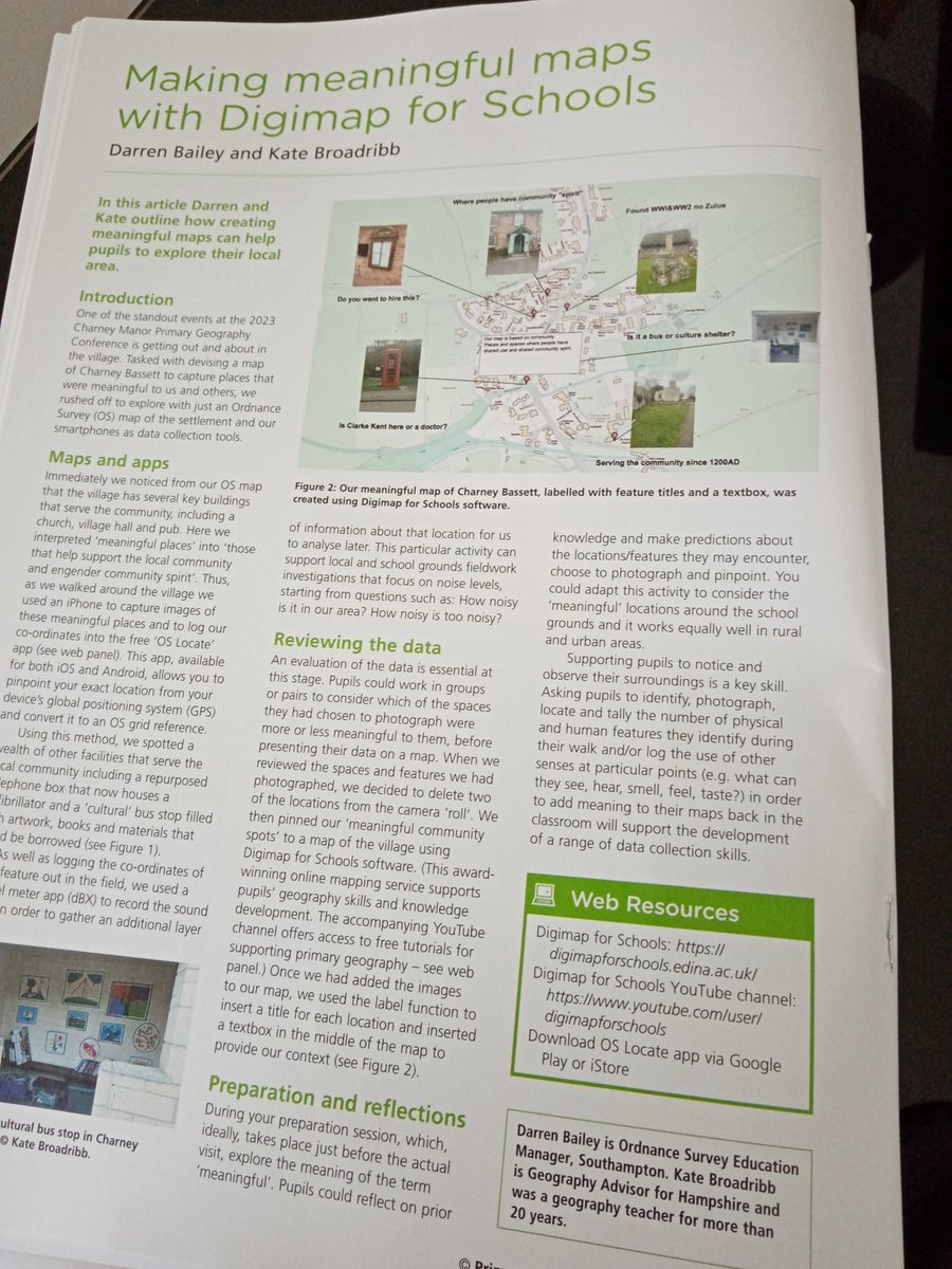
See this in latest @The_GA 's Summer Issue of #PrimaryGeography (essential reading for EYFS, KS1&2 #geography)
"Making Meaningful Map with @Digimap4Schools"
To subscribe see bit.ly/3x9QBPY
4
6
625

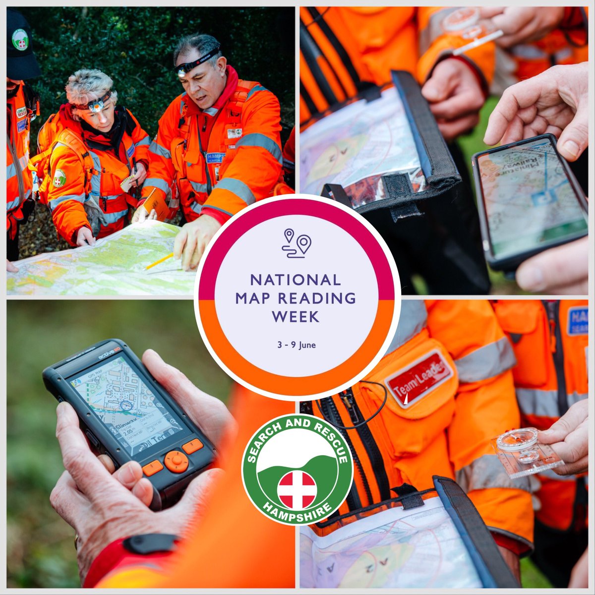
@OrdnanceSurvey #NationalMapReadingWeek is coming to an end but @HANTSAR can continue to be called out at any time of the day or night, and map reading is a key skill that our members use to help save lives in #Hampshire
#maps #navigation #searchandrescue #247volunteers
3
54
9 Jun 2024
Flex your map reading skills with our #NationalMapReadingWeek Quiz! What score did you get? ow.ly/YaH450SbOyy #NMRW

3
11
2,330
8 Jun 2024
This #NationalMapReadingWeek, we're inviting people to grab a map (paper or digital), and get outside safely for an adventure: ow.ly/qo6S50SbNZz #NMRW
Mountain Rescue England and Wales also recommend the OS Maps App when heading out to UK's National Parks.
3
11
1,867

7 Jun 2024
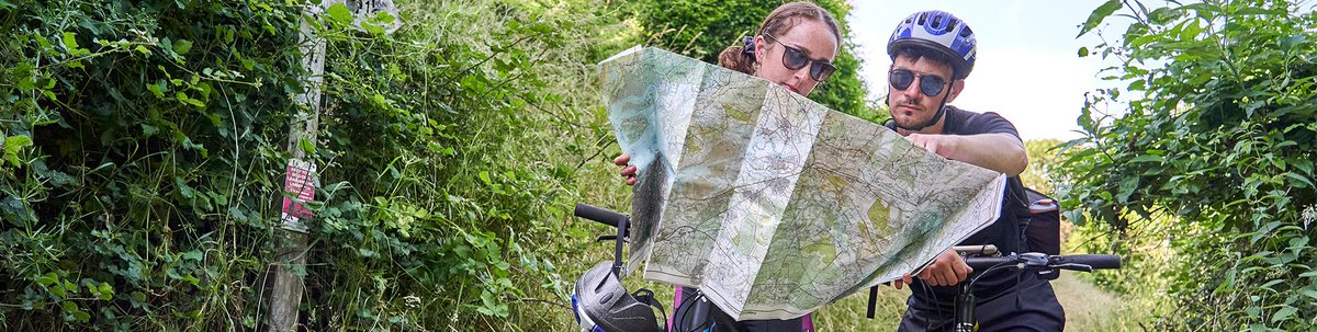
It's National Map Reading week! 🗺️
Our long-distance maps in Sustrans Shop are great for a summer challenge. Explore greater distances and tackle some of the most iconic cycling routes the UK has to offer 🚴♀️
#NationalMapReadingWeek #Sustrans
buff.ly/3Xa6W1G

ALT Two women on a bike ride read a map together
3
9
1,080

7 Jun 2024
Get little legs walking - add a picnic stop and play some games.
National Map Reading Week offer - 20% OFF map print PACMATs ends at midnight.
Use ‘NationalMapReadingWeek24’ at checkout.
#map #mapreading #nationalmapreadingweek #lakedistrict #outdoorkids #outdoorfamilies
1
35

6 Jun 2024
Time to get excited about maps - It's National Map reading Week
Lots of great free resources here to improve your map reading skills bit.ly/3DC0IwQ #GetOutside #NMRW #osmaps #nationalmapreadingweek
1
5
156

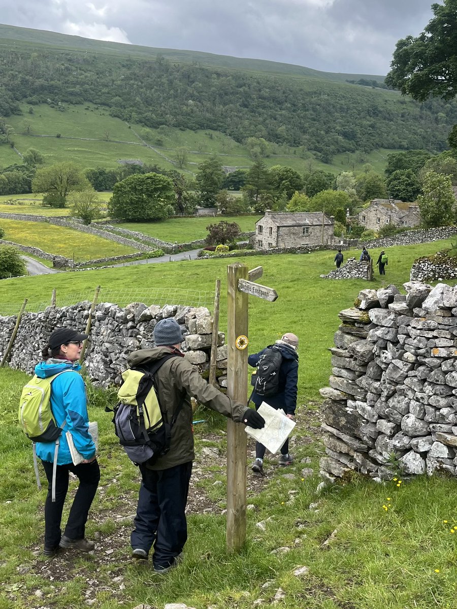
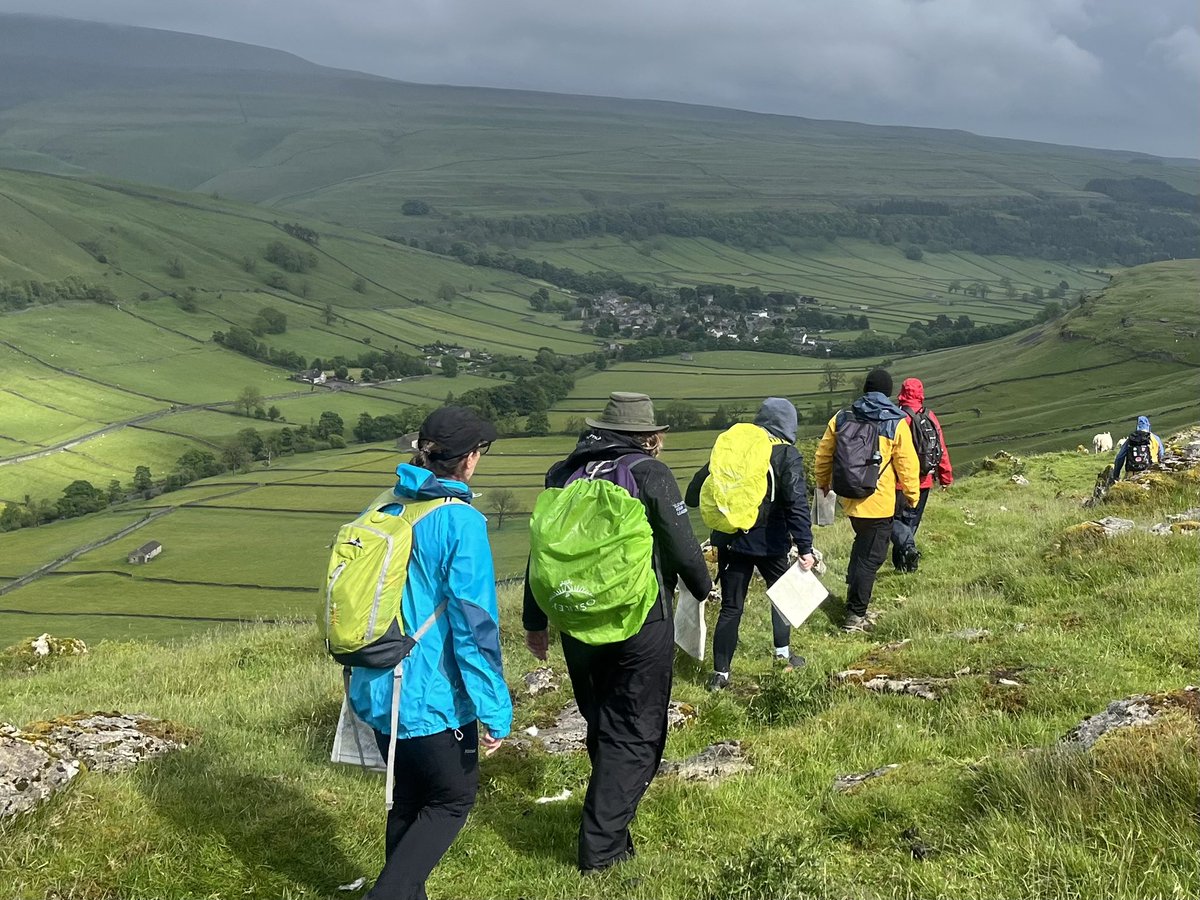
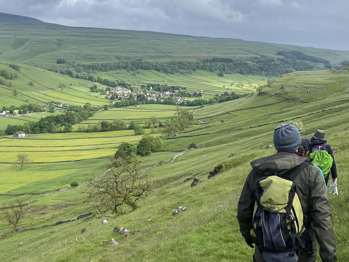
6 Jun 2024
It’s #NationalMapReadingWeek and I was out yesterday running my 1-day Map Reading course at Kettlewelll in Wharfedale.
A beautiful day in the Dales with a really lovely group. A day of learning, developing skills and building confidence outdoors.
teamwalking.co.uk/event-cate…

1
11
456

5 Jun 2024
This week we're celebrating #NationalMapReadingWeek 🗺️ 🤓
Here's a handy to do list to get you started:
1) Grab a 30% discount off an @OrdnanceSurvey annual maps subscription: bit.ly/3KttO4H
2) Refresh my map reading skills: bit.ly/3yO9dpi
3) Get outdoors! 🌲
1
6
1,140

5 Jun 2024
This week is #DDay80 it's also
@OSLeisure #NationalMapReadingWeek. The Great British Weather! D-Day was planned for the 5th June but the weather was bad so it was postponed until the 6th. Check Today's Weather metoffice.gov.uk/weather/map…
2
95

If you want to join #NationalMapReadingWeek, check out our medieval murder maps of #London, #York & #Oxford.
medievalmurdermap.co.uk/maps…
#NMRW
3
4
368

5 Jun 2024
1
3
202

4 Jun 2024
Did you know that 1 in 5 of us aren't very confident in reading maps? 🗺️ It's a great skill to help keep you safe and feel confident outdoors. 🌳📍 For #NationalMapReadingWeek @OrdnanceSurvey are inviting people to brush up on their skills getoutside.ordnancesurvey.co…
1
271
4 Jun 2024
🗺️ Web - allowing users to interact, with functionality to search for things included within it.
#NationalMapReadingWeek #NMRW
1
945

4 Jun 2024
Its #NationalMapReadingWeek - did you know we have guides to understanding the abbreviations and symbols used on historic @OrdnanceSurvey maps? maps.nls.uk/os/ #TuesdayTip #HistoricMaps
7
16
1,741

3 Jun 2024
It's #NationalMapReadingWeek!
We love an outside map. ❤️
Especially one which has had the 'You are here' blob worn away with many digits. 👈
Have you got a favourite outside map?
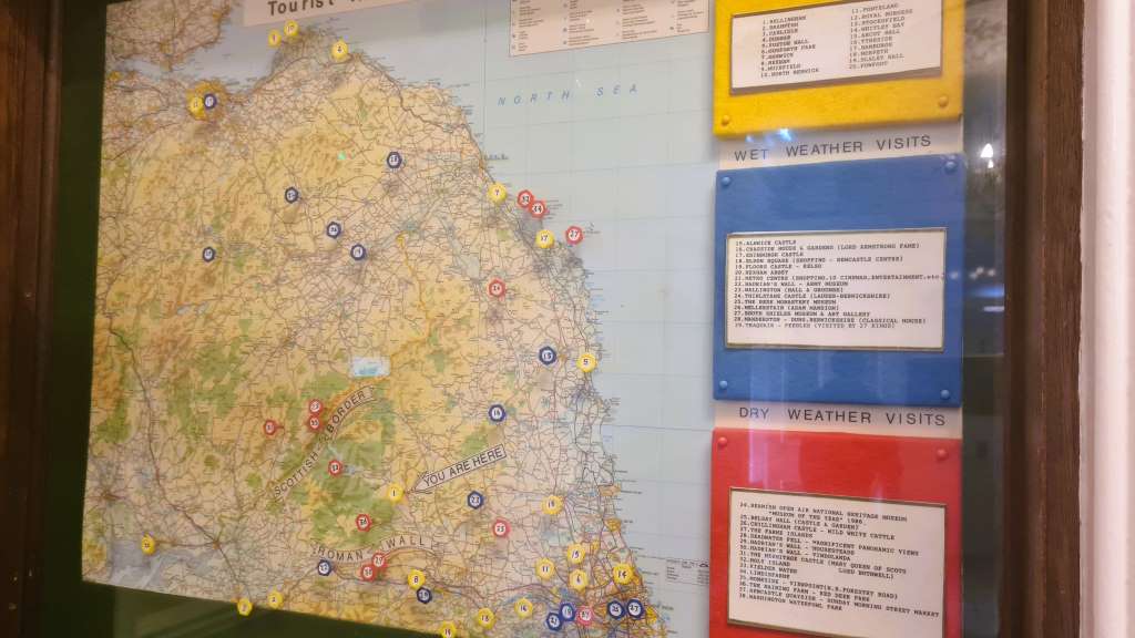
ALT map of the north east with helpful suggestions about locations to visit on dry and wet days.
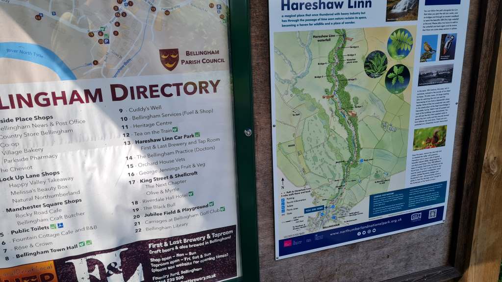
ALT outside map showing a three mile hike to a waterfall. and a directory to shops and attractions in the village
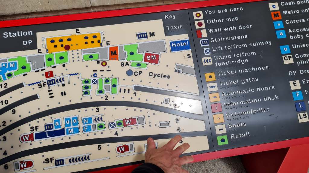
ALT tactile map showing the layout of newcastle train station

ALT map of walks in one area of the Northumberland National Park.
2
1
13
958

3 Jun 2024
In honour of #NationalMapReadingWeek, here is a map of all the places where 'humane slaughter' exists.
2
137