
Navigation may be becoming a strategic sovereignty technology.
As electronic warfare, signal jamming, and contested environments become more common, relying solely on GPS is becoming an increasing operational risk.
To address this challenge, Safran is investing €120 million to expand its Montluçon facility in France, significantly increasing production of Hemispherical Resonator Gyroscopes (HRGs) - a critical technology for resilient navigation when external signals are unavailable.
Key signals:
• HRG production capacity is expected to triple from 10,000 to 30,000 units annually by 2032
• The expansion includes 10,500 m² of new industrial space and 3,000 m² of cleanrooms
• HRGs enable precise navigation in GPS-denied environments across air, sea, space, and defense systems
• The project will create 500 new jobs and deploy next-generation manufacturing capabilities
Why this matters:
Navigation is no longer just an operational capability - it is increasingly a strategic asset.
As military and aerospace systems operate in more contested environments, the ability to maintain positioning without external signals is becoming essential for mission effectiveness, resilience, and technological sovereignty.
What's changing:
From GPS-dependent positioning → to sovereign and resilient navigation systems
For decades, satellite-based navigation has been the foundation of modern positioning.
A new priority is emerging: ensuring systems can continue to operate when those signals are disrupted, denied, or unavailable altogether.
Could resilient navigation systems become as strategically important as communications networks and cybersecurity infrastructure in future defense operations?
#DefenseTechnology #Aerospace #NavigationSystems #InertialNavigation #MilitaryTechnology #SpaceTechnology #DefenseInnovation #AdvancedManufacturing #Engineering #InnoDexis
19


May 20
Modern FPV operations demand more than standard GPS-based navigation.
Explore EW-resilient FPV systems engineered for contested environments by DroneVerse
🌐 droneverse.in
#gnss #fpvdrones #uavtechnology #navigationsystems #droneverse

2
4
39

Instrumentation check... everything good to go.
That’s what you want to see.
#MarineSurvey #NavigationSystems #QualityCheck #DavisCoLTD
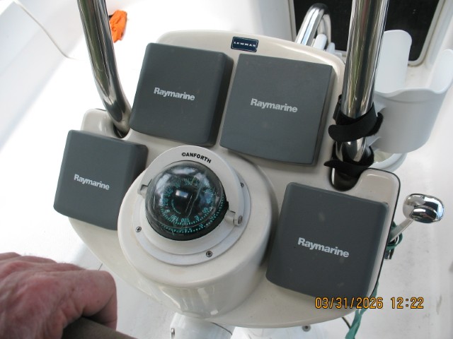
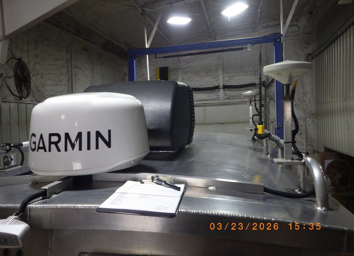
Navigation gear is only as good as its install.
We check it all—topside included.
#MarineSurvey #NavigationSystems #AttentionToDetail #DavisCoLTD
1


Apr 25
স্যাটেলাইট ও জিপিএস: আধুনিক যুদ্ধের নতুন হাতিয়ার
#SatelliteWarfare #GPS #ModernWarfare #SpaceTechnology #MilitaryTechnology #MissileSystems #DroneWarfare #NavigationSystems #WarTech #Geopolitics #AirPower
9

India is set to carry out GNSS jamming trials in the Bay of Bengal on April 11–12, aiming to test and evaluate navigation signal resilience in a controlled environment.
#India #GNSS #NavigationSystems #DefenceTesting #BayOfBengal

1
26

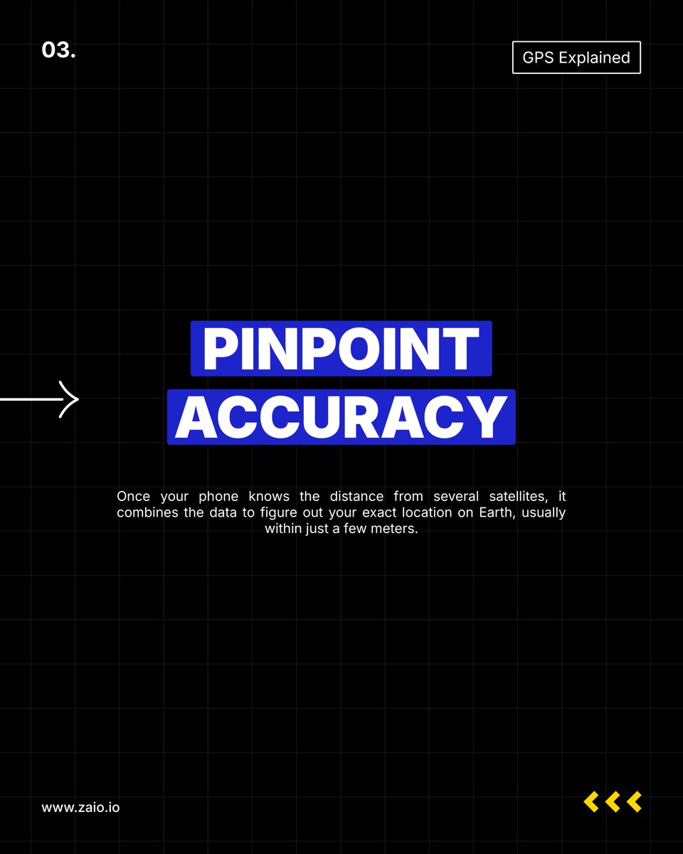
Navigation systems make it possible for your phone to know exactly where you are.
It all comes down to satellites, signal timing, and smart calculations happening in seconds.
Simple on the surface. Powerful underneath.
#GPS #TechExplained #NavigationSystems #LearnTech #FutureInTech


16

Mar 30
2-D to 3-D conversion or mapping… This is very important for any scientific model… and be honest with you a 3-D space to work in is even better…. Anything in the #astrophysics / #GeneticMapping / #NavigationSystems … Etc. If you have a large program like yours, a block chain face, unseen, correlation database for empirical data Sets … that is just to name a few real world constraints needed in proper AI, derived scientific models… where are AI systems can verify and quantify “man’s theorem”…
4

Mar 16
BUSINESS
War you do not, and cannot, see
Click- dailypioneer.com/news/war-yo…
#GPSSpoofing #MaritimeSecurity #PersianGulf #GlobalTrade #SatelliteInterference #NavigationSystems #ShippingLaneSafety #AviationSafety #MiddleEastConflict #StraitOfHormuz #MaritimeRisk #AirlineNavigation #ElectronicWarfare #DigitalDisruptions #GlobalLogistics #TransportSafety #StrategicCorridors #GPSVulnerabilities #CyberNavThreats #MaritimeIntelligence #WindwardAnalytics #OilShipping #MilitaryConflictImpact #GlobalCommerce #InfrastructureSecurity #AlternativePNT #TechSecurity #SatelliteNavigation #NavigationReliability #MaritimeRiskInsurance #LogisticsDisruption #EnergyMarketsImpact #TelecomDependence #FinancialSystemsRisk #CriticalInfrastructure #GlobalShipping #AviationIncidents #GPSJamming #DigitalNavigation #StrategicShipping #MiddleEastShipping #GlobalSupplyChains #TransportationSecurity #SatelliteSignals #Cybersecurity
3
30

Introducing NashmarkAI Nav — powered by NashmarkAI.
Most people still hear “AI” and think of chatbots, prompts, or generative interfaces. This paper is not that. It sets out a different class of system: a navigation architecture grounded in mathematical continuity, equilibrium, drift recovery, temporal commit gating, and label-light traversal rather than language generation.
The paper’s position is precise. It is not claiming to replace every conventional navigation stack. It defines the problem more carefully: navigation is not always mere fix estimation on a clean labelled map. In harder conditions, the real task is preserving continuity when observations are partial, delayed, degraded, or structurally sparse.
That is where NashmarkAI Nav sits.
It is designed for ambiguity-sensitive continuity in environments where rooted labels may be weak or absent:
🚀 deep space
🪨 asteroids, planetoids, and moons
🌊 underwater and subsea terrains
📡 blackout-prone, degraded, or low-confirmation traversal fields
In those environments, the challenge is not simply “where am I?”
It is “how do I continue coherently without collapsing into false commitment?”
That is why this is not Gen AI.
This is ground-rooted AI, where the formula is the intelligence.
NashmarkAI is the governing core.
NashmarkAI Nav is the deployed navigation system.
A navigation system for continuity under uncertainty.
A system built not for chatter, but for traversal.
Paper: NashMark AI for Ambiguity-Sensitive Continuity and Drift Recovery in Navigation
truthfarian.co.uk/Mathematic…
@SpaceX @NASA @deepseauwa
#NashmarkAI #NashmarkAINav #NavigationSystems #AutonomousNavigation #DriftRecovery #ContinuityEngineering #AmbiguitySensitiveAI #LabelLightNavigation #SignalDegradedEnvironments #TemporalCommitGating #DynamicGainModulation #GovernanceStability #SystemsEngineering #MathematicalModelling #AppliedAI #NonGenerativeAI #GroundRootedAI #SpaceNavigation #DeepSpaceSystems #OrbitalSystems #AsteroidNavigation #MoonTraversal #SubseaNavigation #UnderwaterAutonomy #Robotics #AdvancedMobility #AerospaceEngineering #ResearchPaper #Truthfarian
15

Mar 13
#somaliaprobe
#GPS #GPSSignal #NavigationSystems
GPS Signal War: Why GPS Is Breaking Down somaliprobe.com/gps-signal-w…
17

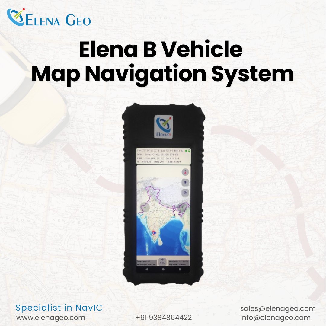
Sovereignty in every coordinate.
Key specs: Hybrid positioning (India/US/Russia sats), 1m accuracy on borders, unified grids (ESM/DSM/Geo), IP67 rugged, army net integration.
elena-bvmns.com/
#MultiGNSS #NavigationSystems #MilitaryTech
1
42

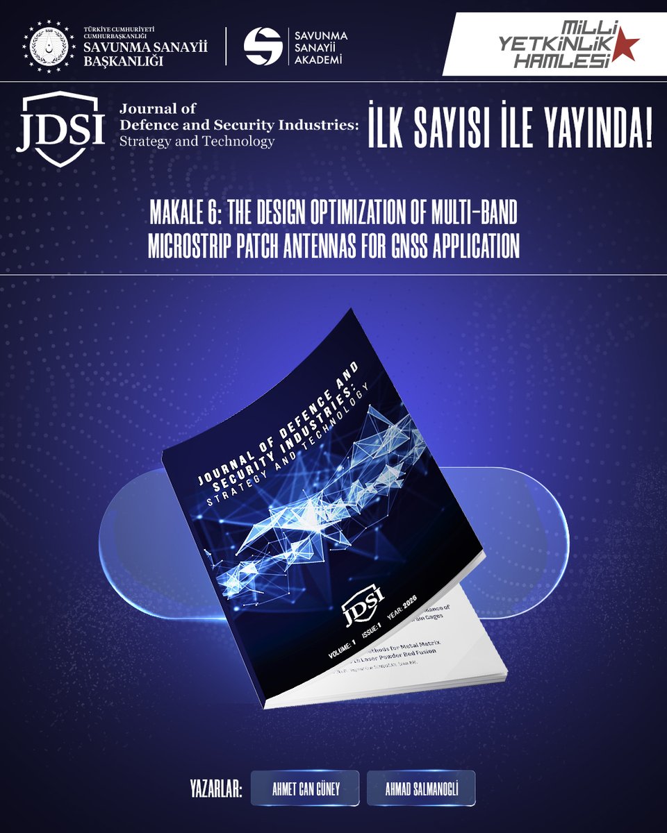
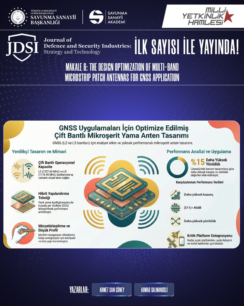
JDSI’de yayımlanan “The Design Optimization of Multi-Band Microstrip Patch Antennas for GNSS Application” başlıklı çalışma, L2 (1227.60 MHz) ve L5 (1176.45 MHz) bantlarında çalışan çift bantlı mikroşerit yama (patch) anten tasarımını kapsamlı şekilde analiz ediyor.
📡 Çalışmanın Öne Çıkan Katkıları:
➡️Tek bir anten elemanı ile çoklu GNSS takımyıldızlarından sinyal alabilecek çift bantlı yapı tasarımı
➡️Slotlu patch kusurlu toprak düzlemi (defective ground plane) yaklaşımıyla miniaturize ve düşük profilli çözüm
➡️L2 ve L5 bantlarında edge feed ve inset feed tekniklerinin karşılaştırmalı performans analizi
➡️2x1 anten dizisi konfigürasyonu ile:
- L2 bandında inset feed için G’ye varan kazanç artışı
- Edge feed için ( kazanç artışı
➡️VSWR ≈ 1 değerlerine yaklaşan tasarım ile yüksek empedans uyumu ve yüksek verimlilik
📊 Simülasyon sonuçları; bant genişliği, S11 parametreleri ve kazanç değerleri açısından tasarımın GNSS/GPS standartlarını karşıladığını göstermektedir.
Bu çalışma, modern navigasyon cihazlarına entegre edilebilecek maliyet-etkin ve yüksek performanslı çift bantlı anten çözümü sunmaktadır.
🔗 Makaleye erişmek için: doi.org/10.65834/jdsi.11.13
#JDSI #GNSS #GPS #AntennaDesign #MicrostripAntenna #DualBand #RFEngineering #NavigationSystems #DefenceTechnology #SatelliteSystems
1
2
11
6,471

#GrupoOesía #UAVNavigation #Ekolot #EkolotAerospace #EkolotAerospaceAndDefence #ZEUSVTOL #ZEUS #VTOL #UAV #UAS #Drones #UnmannedSystems #AerialRobotics #Autopilot #FlightControl #Avionics #NavigationSystems #GNC #GuidanceNavigationControl #GNSS #INS #MissionSystems #DataLink #C2 #ISR #NATOInterop #EuropeanDefence #DefenceIndustry #SpainPoland #Cooperation #MadeInEurope @WypartowiczBa @TrompBK @Krystian_Pogr @dronesdeguerra @Defence_blog
1
1,117

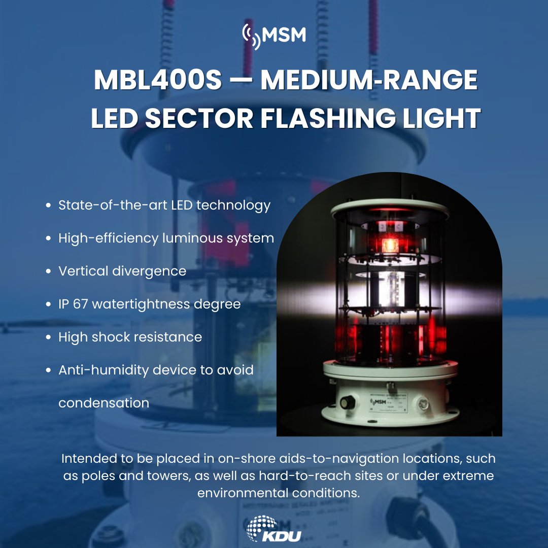
The MBL400S delivers up to 12 NM range with 0.5° sector accuracy, ideal for on‑shore AtoN installations.
#Kdugroup #Kduworld #MarineSafety #AtoN #MSM #MarineLanterns #NavigationSystems #MarineTechnology #ShipSafety #NavigationSolution #MarineIndustry #Maritime #Automation
15
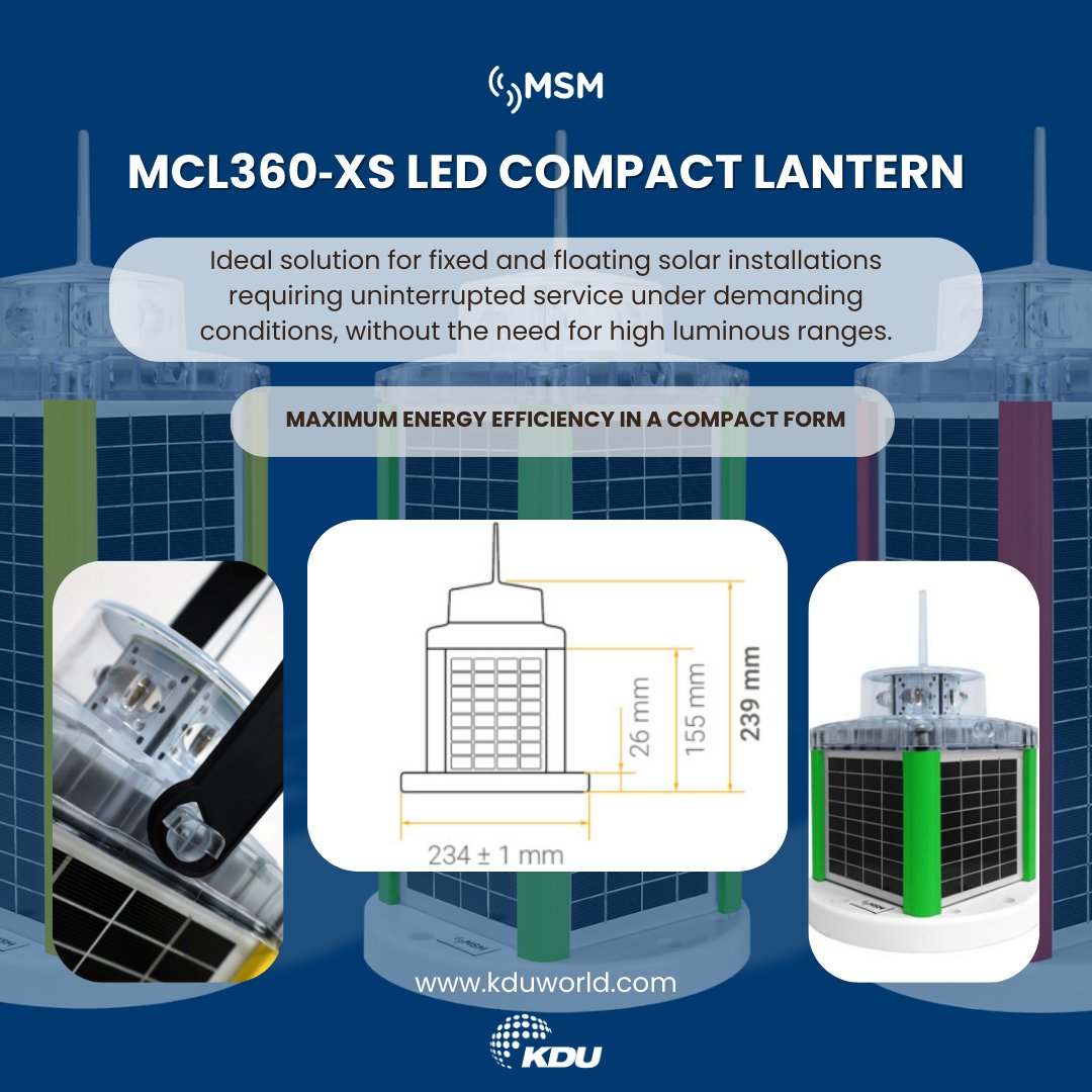
Introducing the MSM's MCL360‑XS — An ultra‑efficient compact lantern built for reliable performance anywhere.
#Kdugroup #Kduworld #MarineSafety #AtoN #MSM #MarineLanterns #NavigationSystems #MarineTechnology #ShipSafety #NavigationSolution #MarineIndustry #Maritime #Automation
15

Inertial Labs, a VIAVI Solutions company, has launched IRINS, a LEO-aided inertial navigation system enabling resilient positioning, navigation, and timing for land, air, and sea operations in GNSS-denied environments.
| More info at: international.electronica-az…
#PNT #InertialNavigation #LEO #GNSSDenied #DefenseTech #NavigationSystems #Aerospace

62