
3 Nov 2025
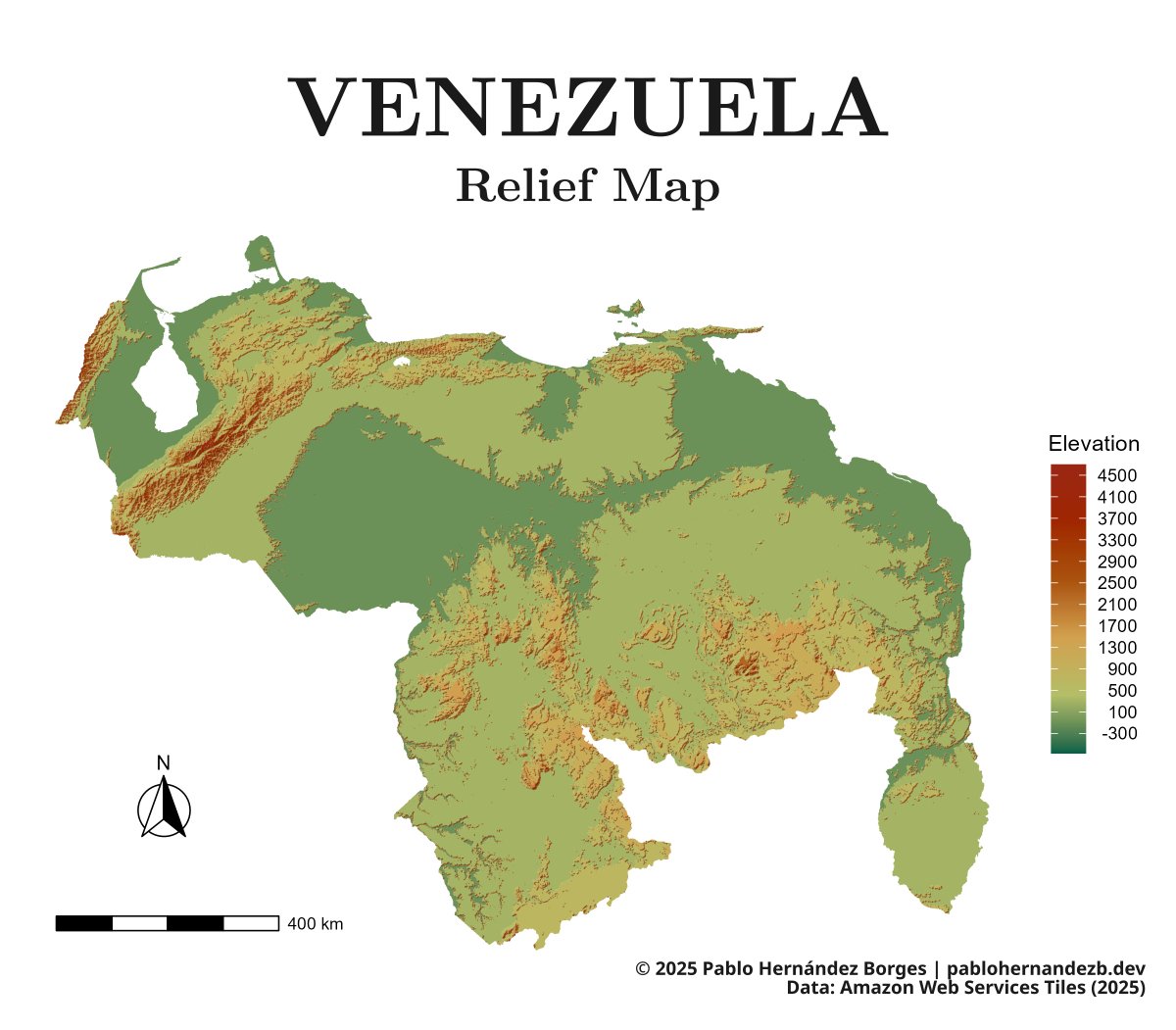
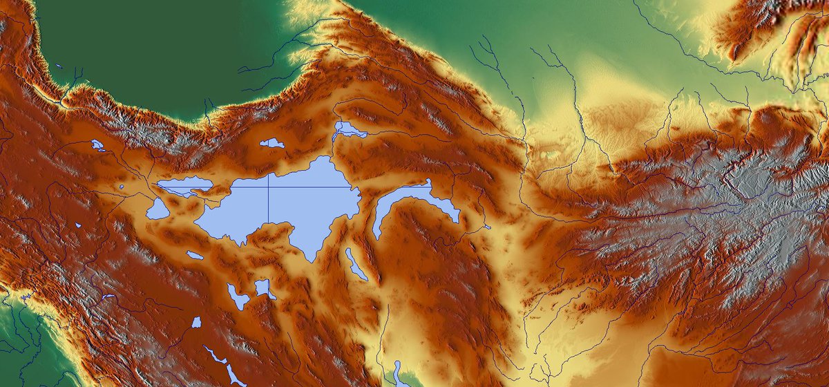
🇻🇪 Venezuela in Tanaka relief 🌄
From the Andes in the west, to tepuy country in the south, to the coastal mountain ranges facing the Caribbean—Venezuela’s terrain tells the story of its landscapes.
What country should I map next?
#GeographicArt 🌐🎨
#ReliefMap ⛰ 🗺
1
6
22
3,648

16 Dec 2023
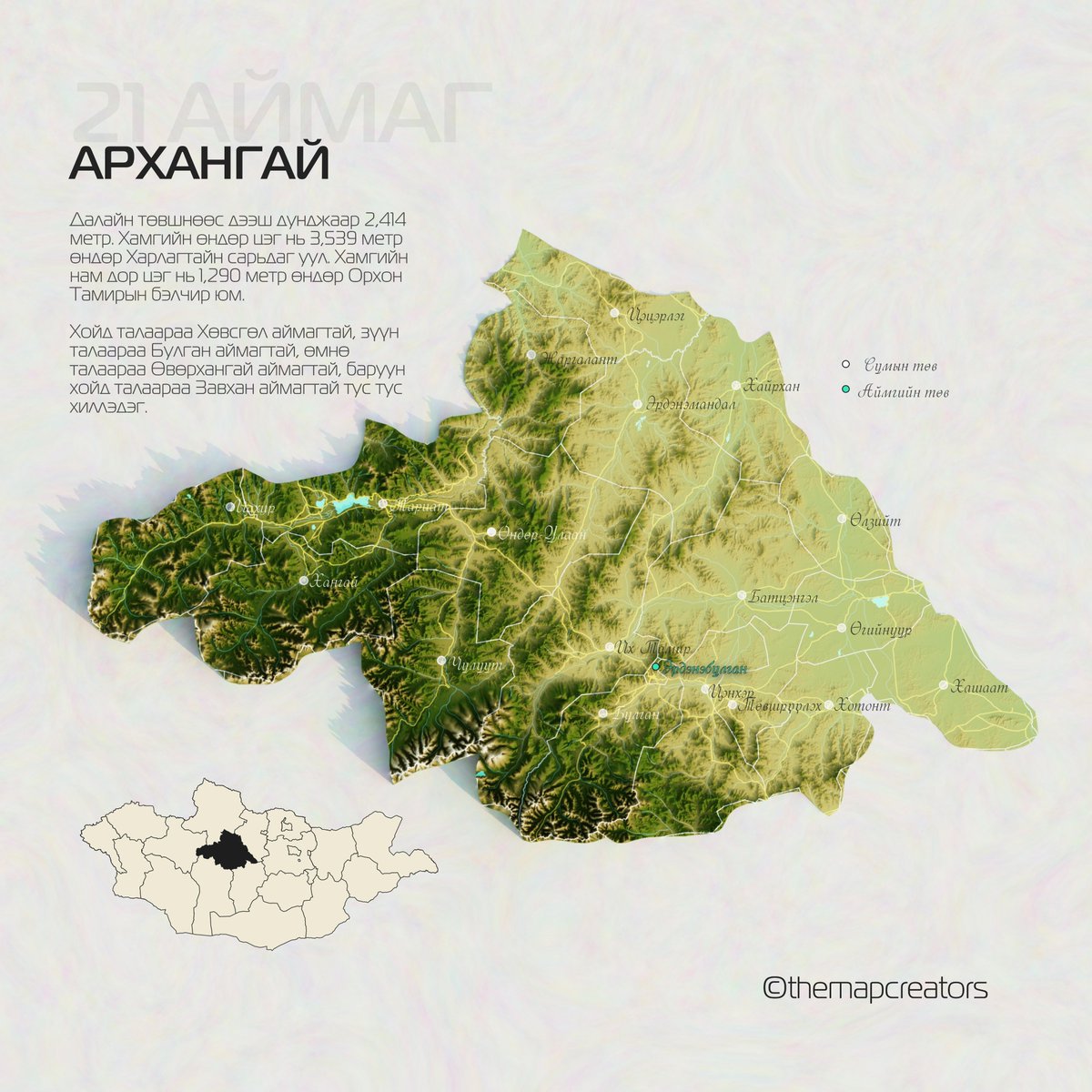
Говь-Алтай аймаг📷
#GoviAltai #Sutai #IkhOvoo #BurkhanBuudai #DarviinNuruu #ГовьАлтай #ReliefMap #ShadedRelief #Mongolia #themapcreators

1
3
329

9 Sep 2023
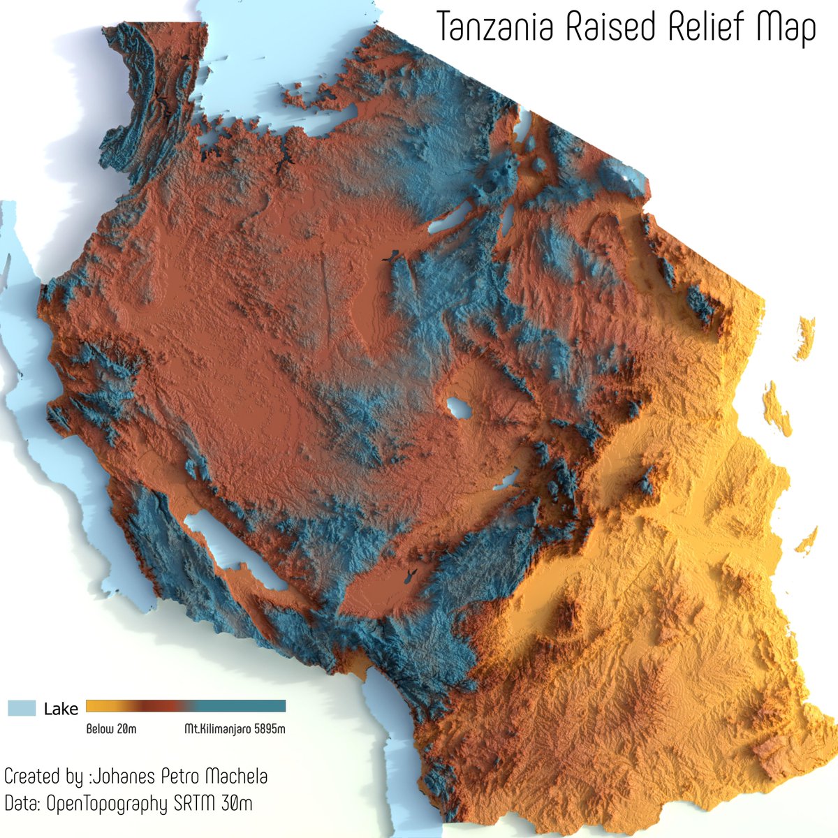
Just completed three days of intense #GIS training internal capacity building at @OMDTZ Using #QGIS and #Blender3d We are excited to share our 3D #Tanzania Raised #Reliefmap. Thanks to @OpenTopography for the topography data and @openstreetmap for the lake data. #chatgis
4
12
54
3,144

14 Jul 2023
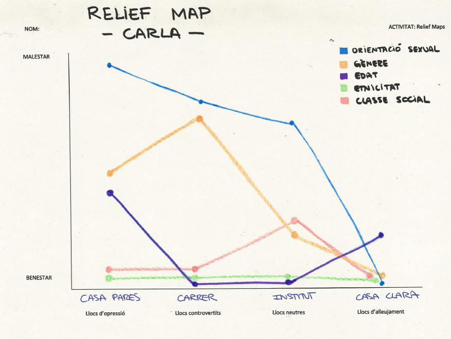
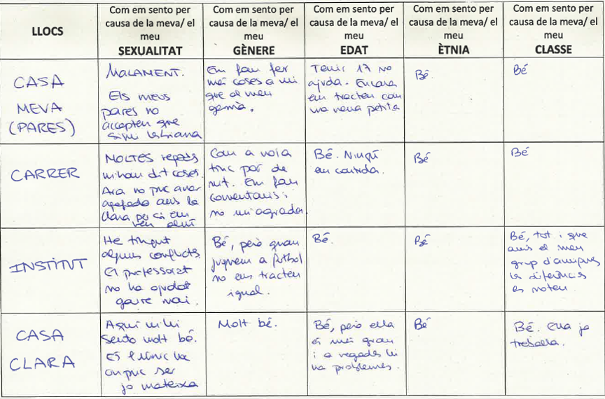
Formació de @coopolis_bcn on ens han presentat el #reliefmap com a eina metodològica a tres dimensions: desigualtats socials, emocions i espais.
I tu, com et sents a 🏡, a la feina o a l'espai públic en clau de gènere?
reliefmaps.cat/es/about
#GeografiaFeminista
2
6
398

16 Apr 2023
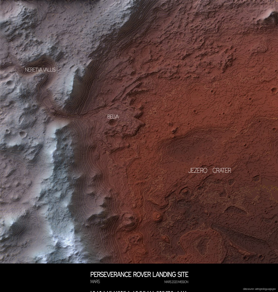
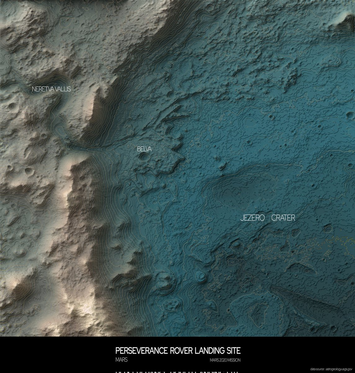
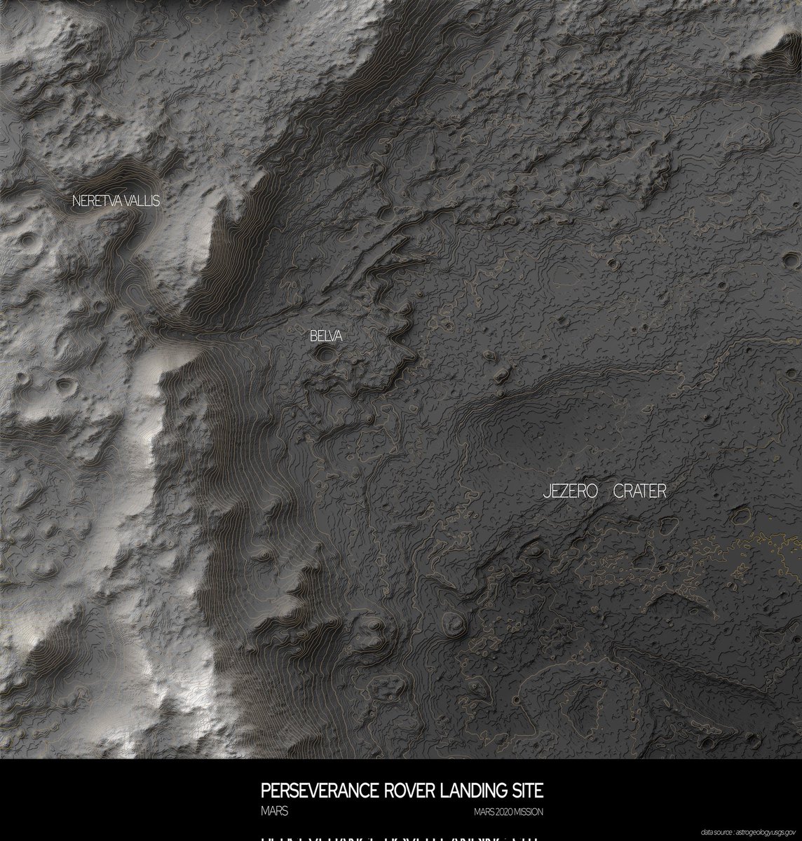
Terrain map of The Jezero Crater on Mars
#blender #qgis #arcgis #mapping #topography #elevationmap #reliefmap #datavisualization #cartography #mars #perseverance #rover #nasa #space #research

1
1
5
469

28 Dec 2022
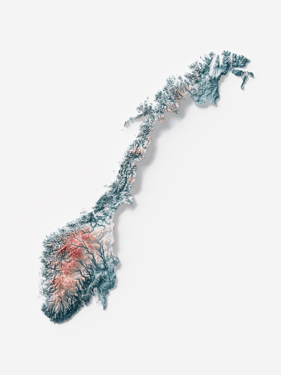
Ice and fire, this is our new interpretation of #Norway on Irid elevation tint.
Maybe you're waiting for the Geo tint, but we predilige the eccentric palettes first!
Are you interested in a particular palette combination?
-
#blender #datavisualization #reliefmap #qgis
3
15
1,530
12 Dec 2022
5
8

12 Sep 2022
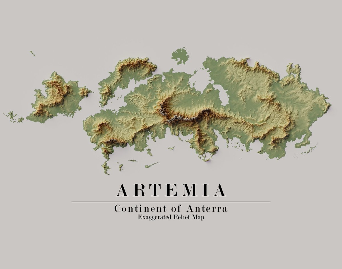
🗺️ An exaggerated #reliefmap of Artemia, Anterra's northeast continent. Made by member Alcardens on Instagram #cartography #worldbuilding
7

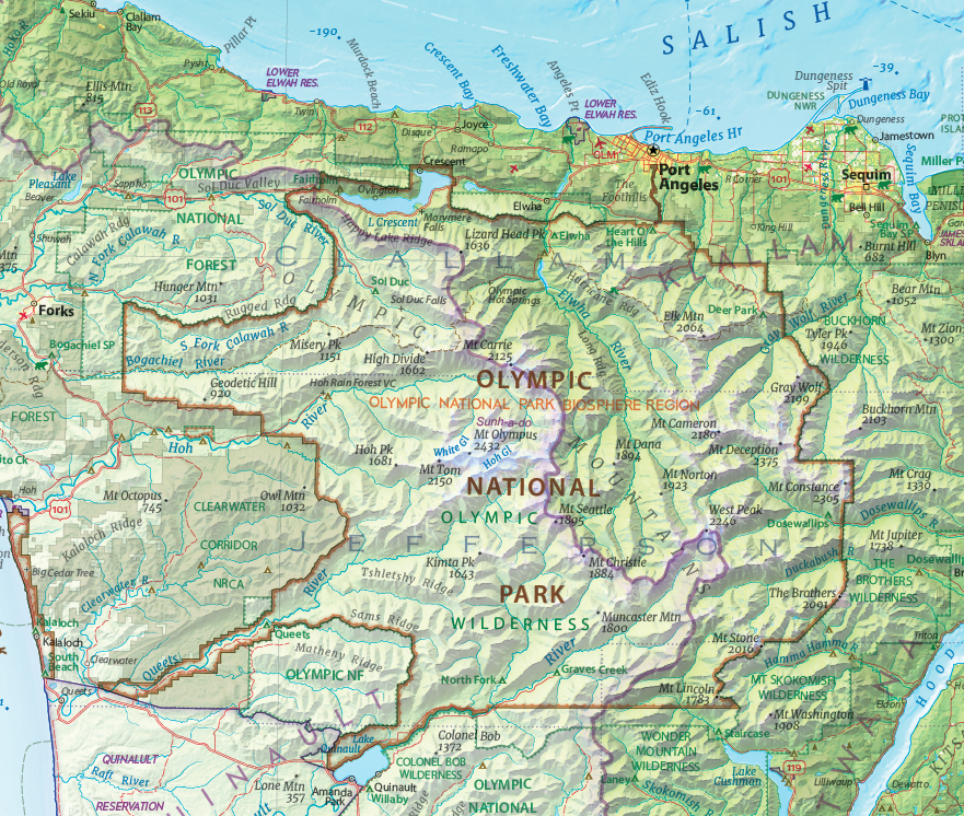
#DYK Olympic National Park is also a @UNESCO Biosphere Region?
#geography #mapping #cartography #lovemaps #reliefmap #britishcolumbia #washingtonstate #SalishSea
1

12 Jul 2022
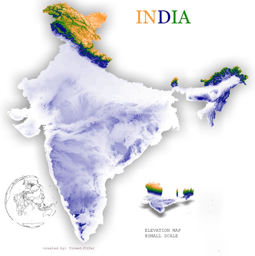
#India topographical map in its flag colors using #rayshader #rstats
#reliefmap #elevationmaps #topography #maps
#mapsofindia
#AzadiKaAmritMahotsav
2
2
11
Very close to publishing this important map - for sale soon! First of its kind for the #SalishSea bioregion.
Please RT to get the word out to the 7 million people living here - Thanks!
#geography #mapping #cartography #lovemaps #reliefmap #britishcolumbia #washingtonstate

3
38
137
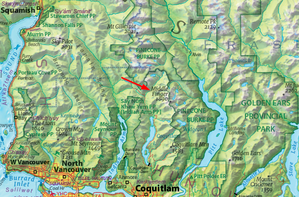
The Middle Finger is a mountain in the Five Fingers Group located between Pitt Lake and Coquitlam Lake, in British Columbia. Who knew?
#SalishSea #geography #shadedrelief #cartography #lovemaps #reliefmap #britishcolumbia #maps #gis #mapping
2
1
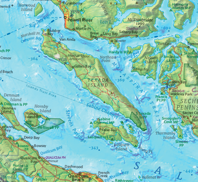
I'm adding bathymetric depths to my Salish Sea map and noticed Texada Island is surrounded by some deep water (depths in metres)!
#SalishSea #geography #shadedrelief #cartography #lovemaps #reliefmap #canada #maps #gis #mapping
4

18 Mar 2022
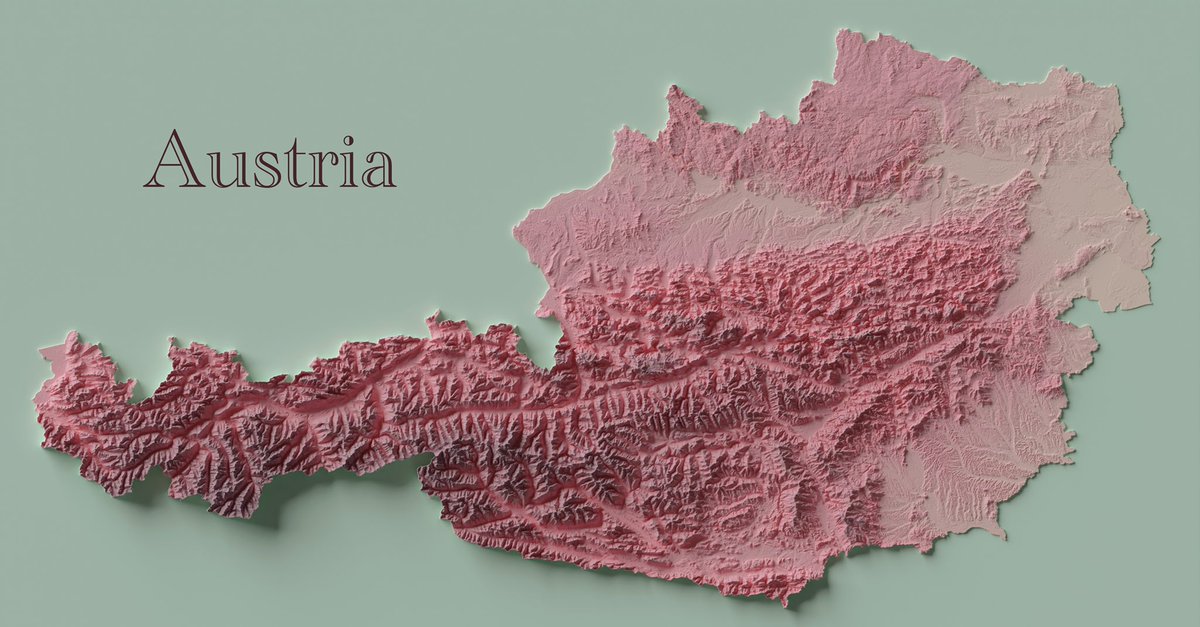
Austria - Shaded Relief
This is the relief I made this week. Had lots of fun tweaking the symbology and found the look that I like in the end.
Source: (SRTM GL1) Global 30m
#austria #geospatial #GIS #geology #geography #cartography #reliefmap #topography #3dmapping
2

10 Dec 2021
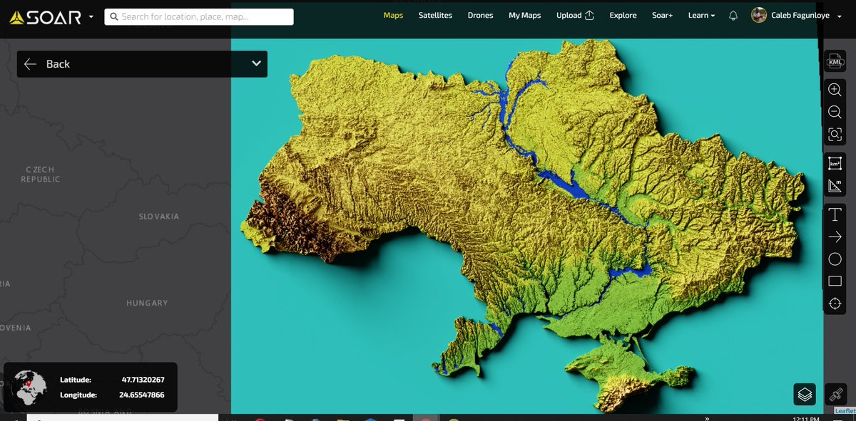
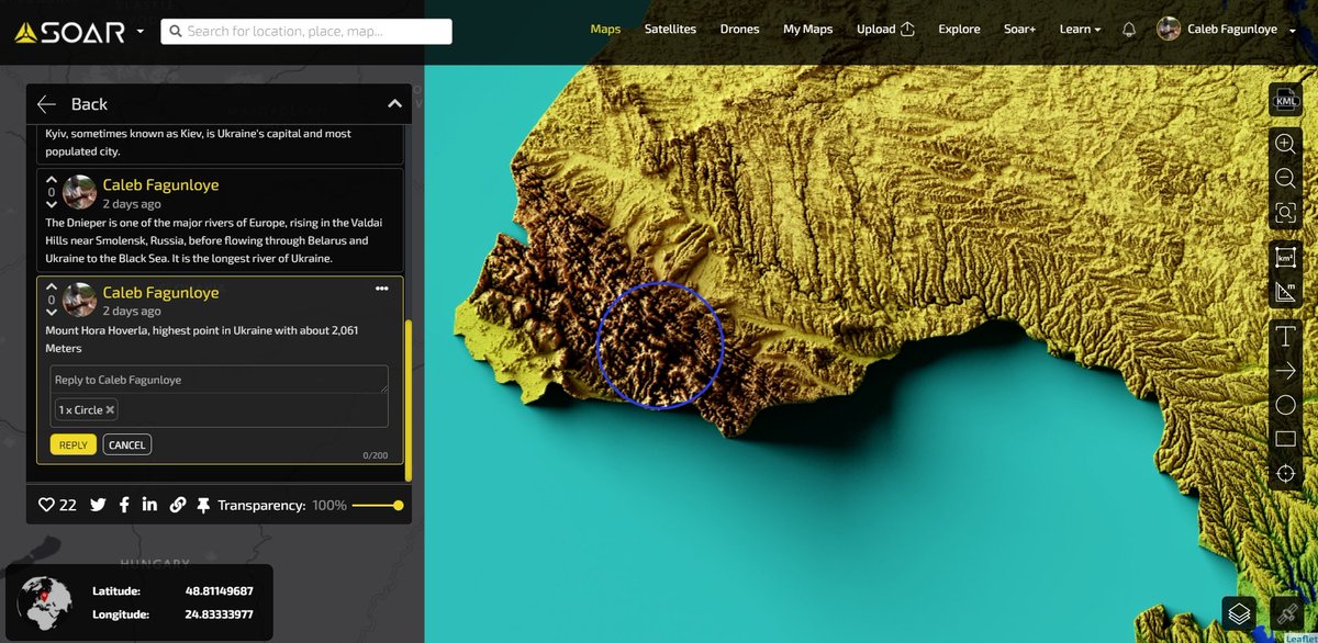
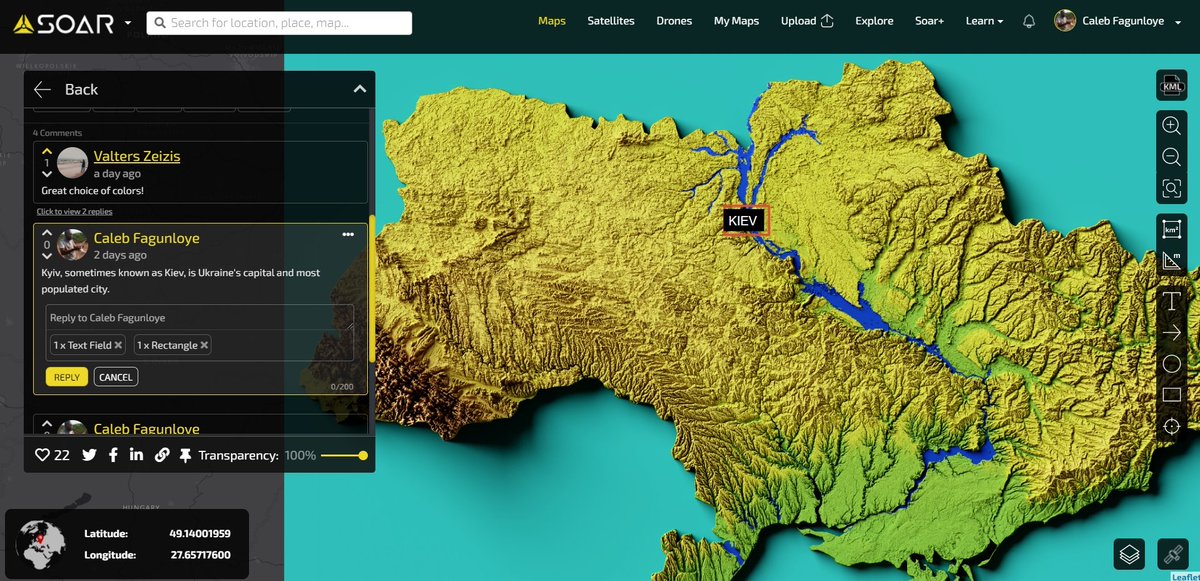
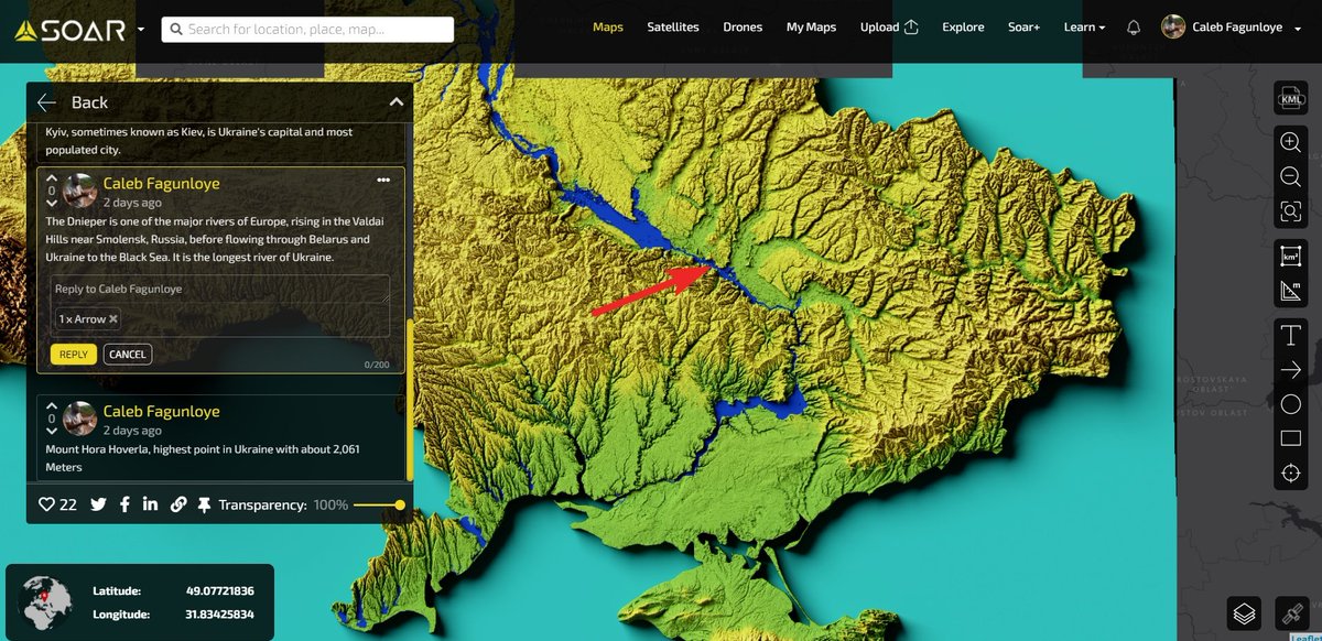
This one is dear to me! High-resolution relief map of Ukraine. Very visible on the map is the fourth-longest river in Europe. Explore the full map on @Soar_Earth here bit.ly/3Gy2deU. Please add your comments directly on the map and annotate.
#SoarEarth #ReliefMap
1
6
13


24 Nov 2021
A #reliefmap of the days ahead. Wishing you and your families a happy #Thanksgiving. Comic by @grantdraws

1
2
6

15 Nov 2021
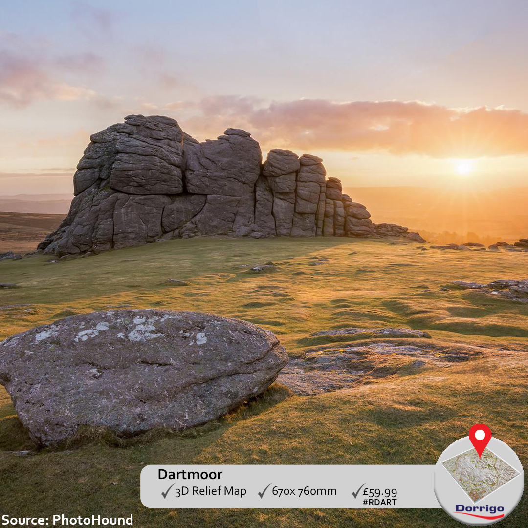
#Dartmoor at Sunrise
#Haytor is perhaps one of the most popular Tors and is easy to reach. Join other people in making the most of the views and climbing the rock formation on a sunny day.
Get a #3DReliefMap of Dartmoor.
.
bit.ly/30oKq9W
.
#MapsUK
#ReliefMap
#ReliefMapUK
2

14 Nov 2021
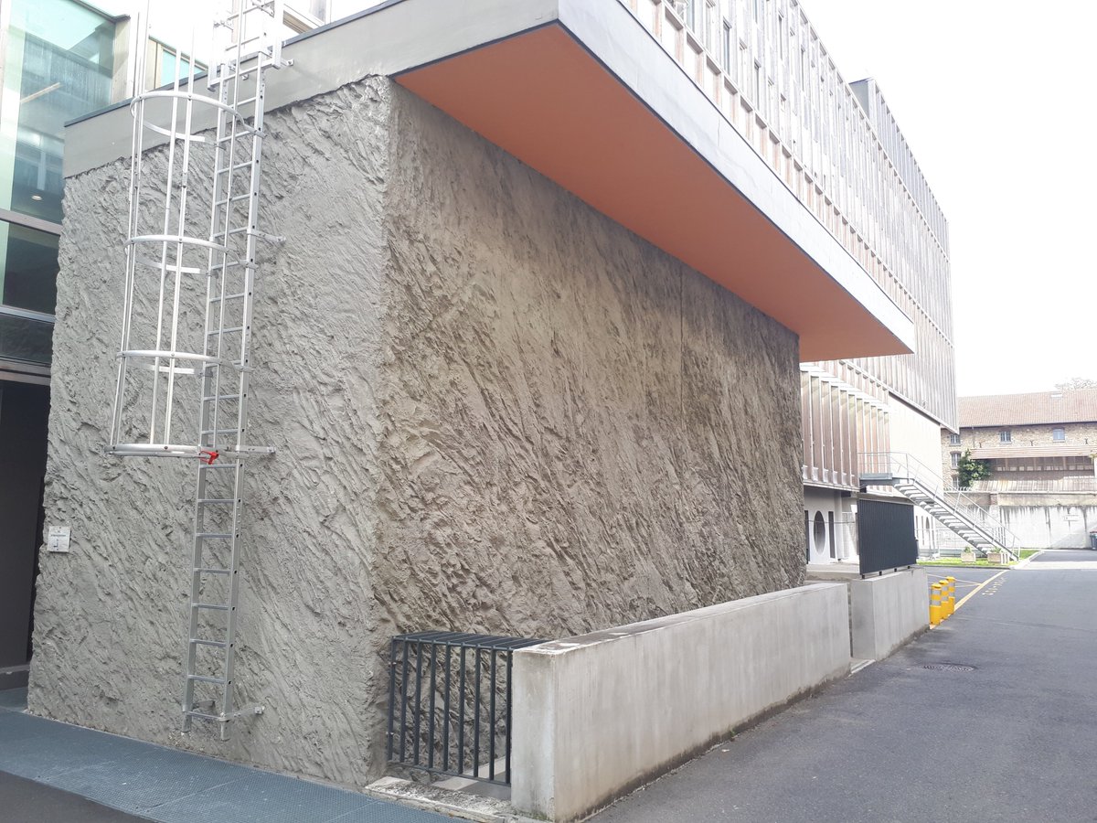
#30DayMapChallenge #day14 - Map with a new tool
🚧👷♂️#ReliefMap made with concrete mixer and trowel🧗♂️🏗️👨🔧
2
11 Nov 2021
#30daymapchallenge #day11: 3D
⛰️#ReliefMap of the @PnEcrins with @QGIS @threejs #qgis2three - DEM #BDAlti 🗺️#SCAN50 @IGNFrance
View it online 👉viglino.github.io/maps/stati…
How to #DIY #tutoCarto with @geotribu ⬇️⬇️ static.geotribu.fr/articles/…
1
6
22