

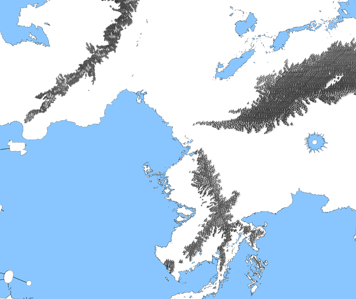
17 Oct 2025
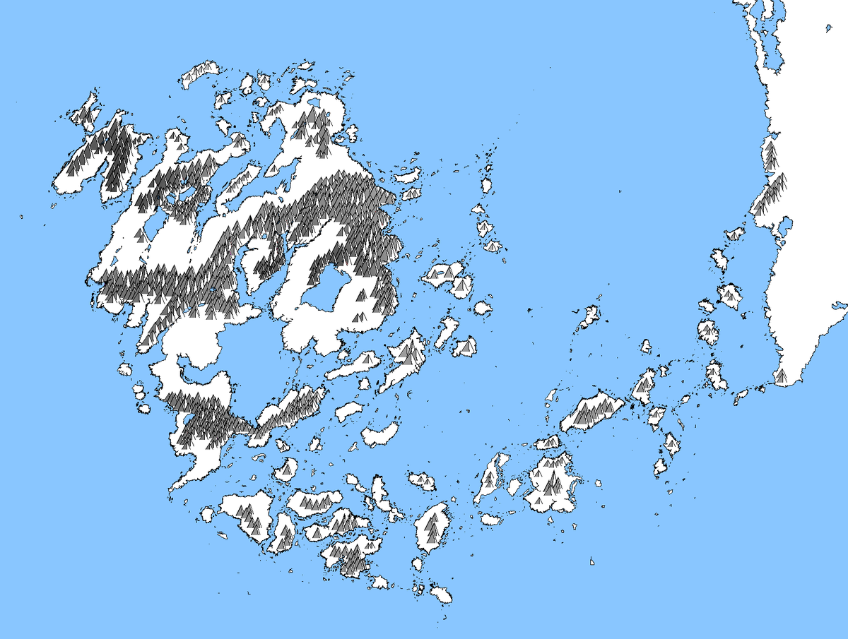
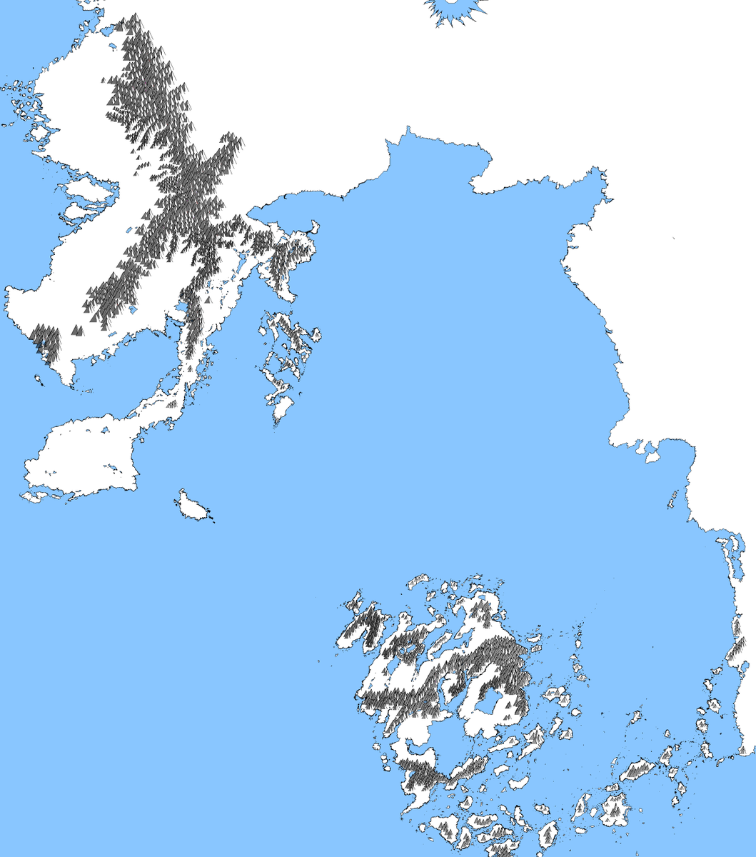
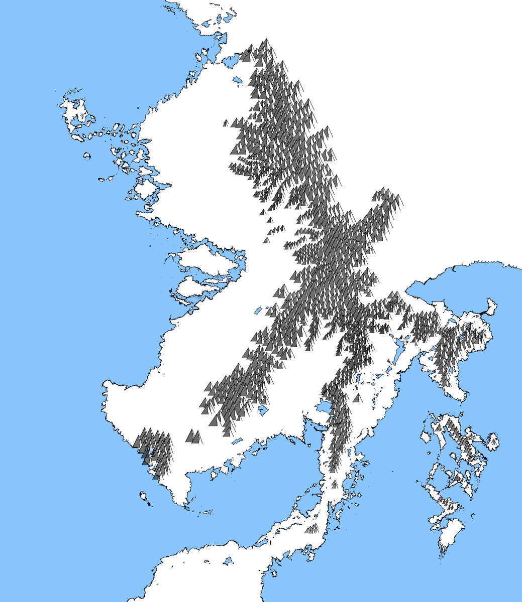
Added mountains to the island of black magic - Okhost.
Next I'll do the mountains of the Gnoll Empire. Again back to a bigger mountain-range.
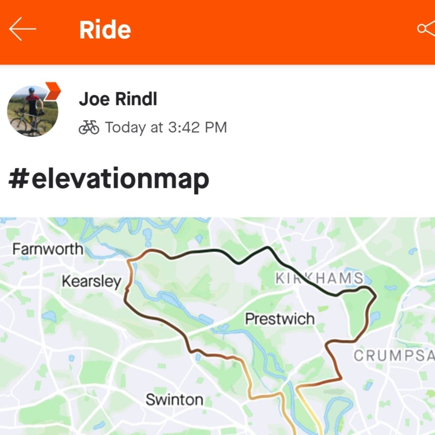
#map #elevationmap

3
348

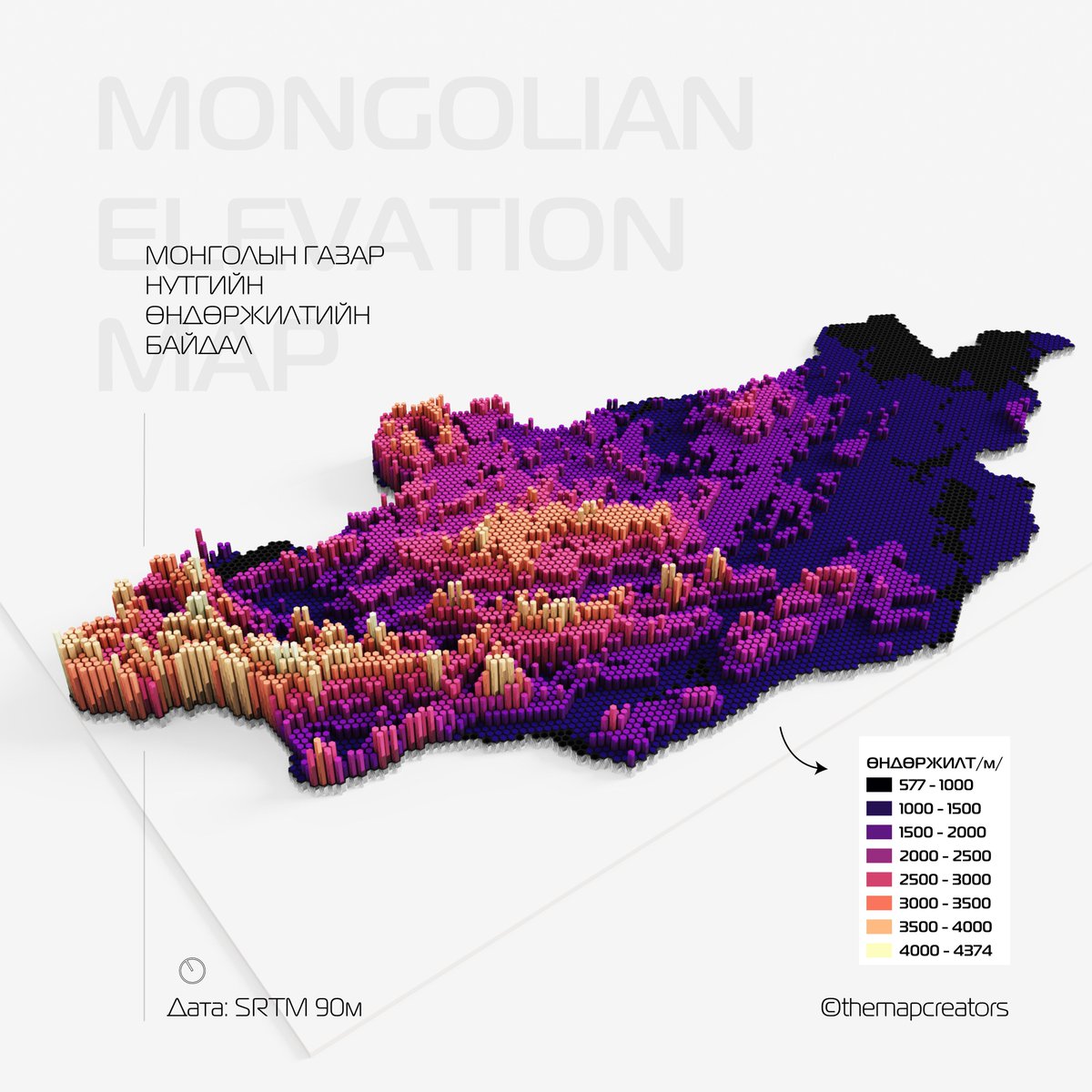
27 Nov 2023
Монголын газар нутгийн өндөржилтийн байдал 3D🗺
#Hexagon #ElevationMap #Elevation #ElevationMapofMongolia #HexMap #HexbinMap #Mongolia #themapcreators
1
3
6
318

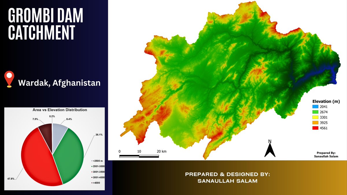
5 Jul 2023
Catchment of the Grombi Dam, Wardak Province, Afghanistan.
#gis #reservoirs #delineation #elevationmap #dam
2
78

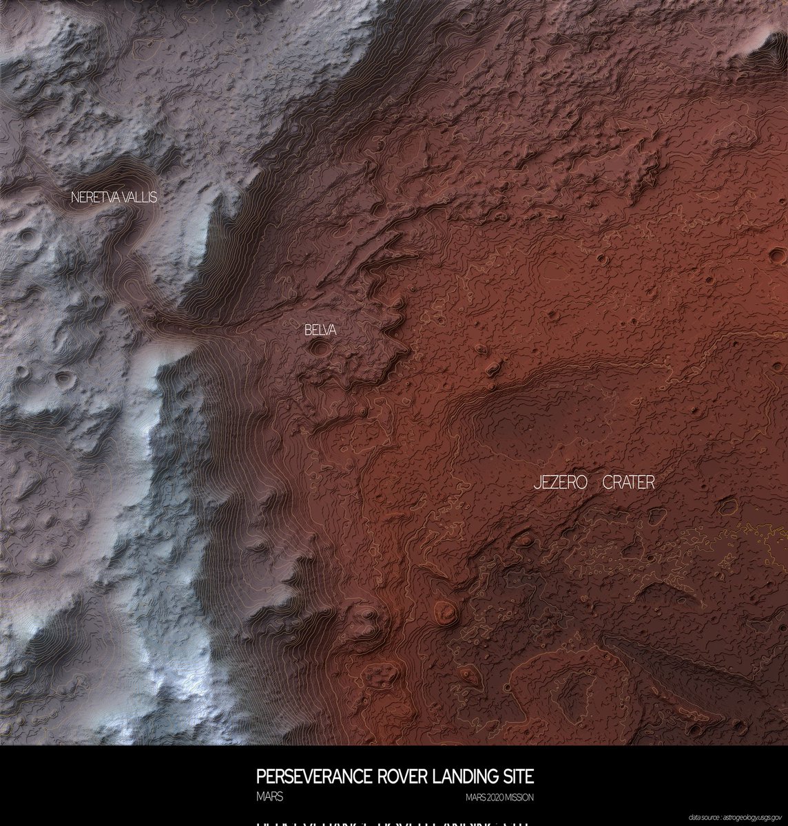
16 Apr 2023
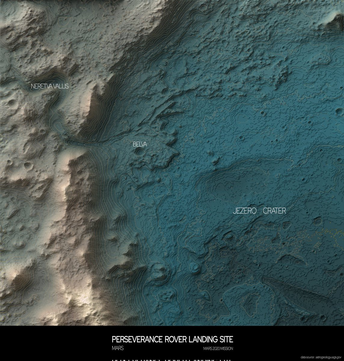
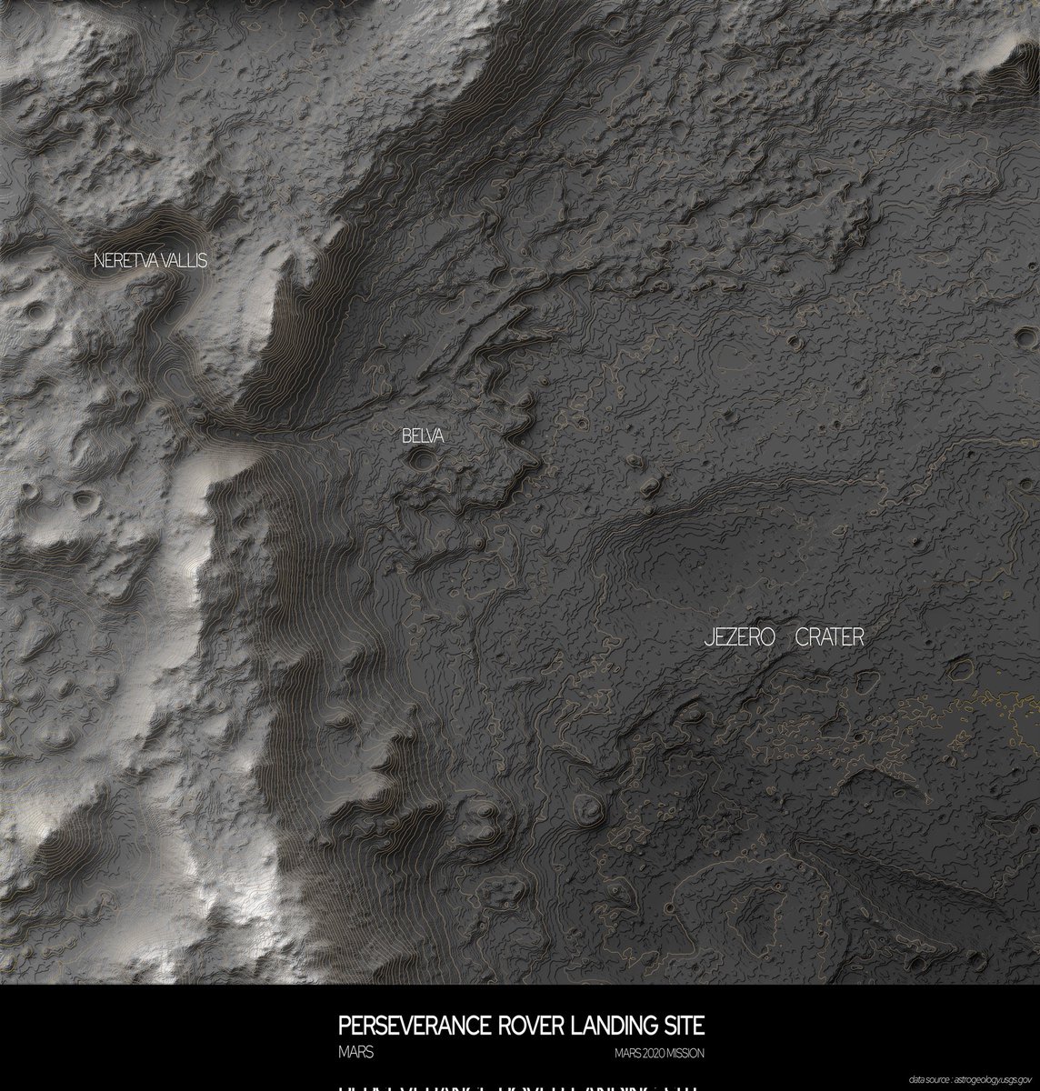
Terrain map of The Jezero Crater on Mars
#blender #qgis #arcgis #mapping #topography #elevationmap #reliefmap #datavisualization #cartography #mars #perseverance #rover #nasa #space #research

1
1
5
469

30 Mar 2022
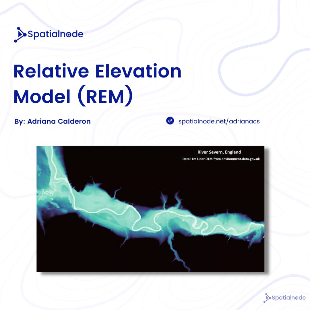
Relative Elevation Model for the River Severn in England.
There's a tutorial link attached to the project in which you can learn how to create a REM map.
Access the project here: spatialnode.net/project-deta…
#projectshowcase
#elevationmap
#geospatial
4
8
23 Mar 2022
An SRTM of the Tanga region (Tanzania) to feed your eyes.
Want to know the tools and techniques Heed Lung used in creating this beautiful project?
Check here: spatialnode.net/project-deta…
You can also do well to like and comment on the project.
#projectshowcase
#srtm
#elevationmap

1
3

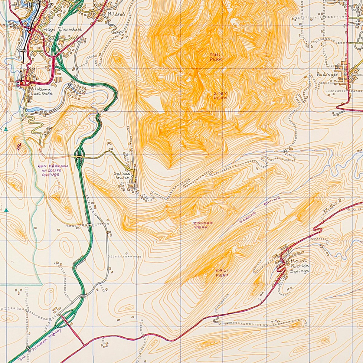
21 Nov 2021
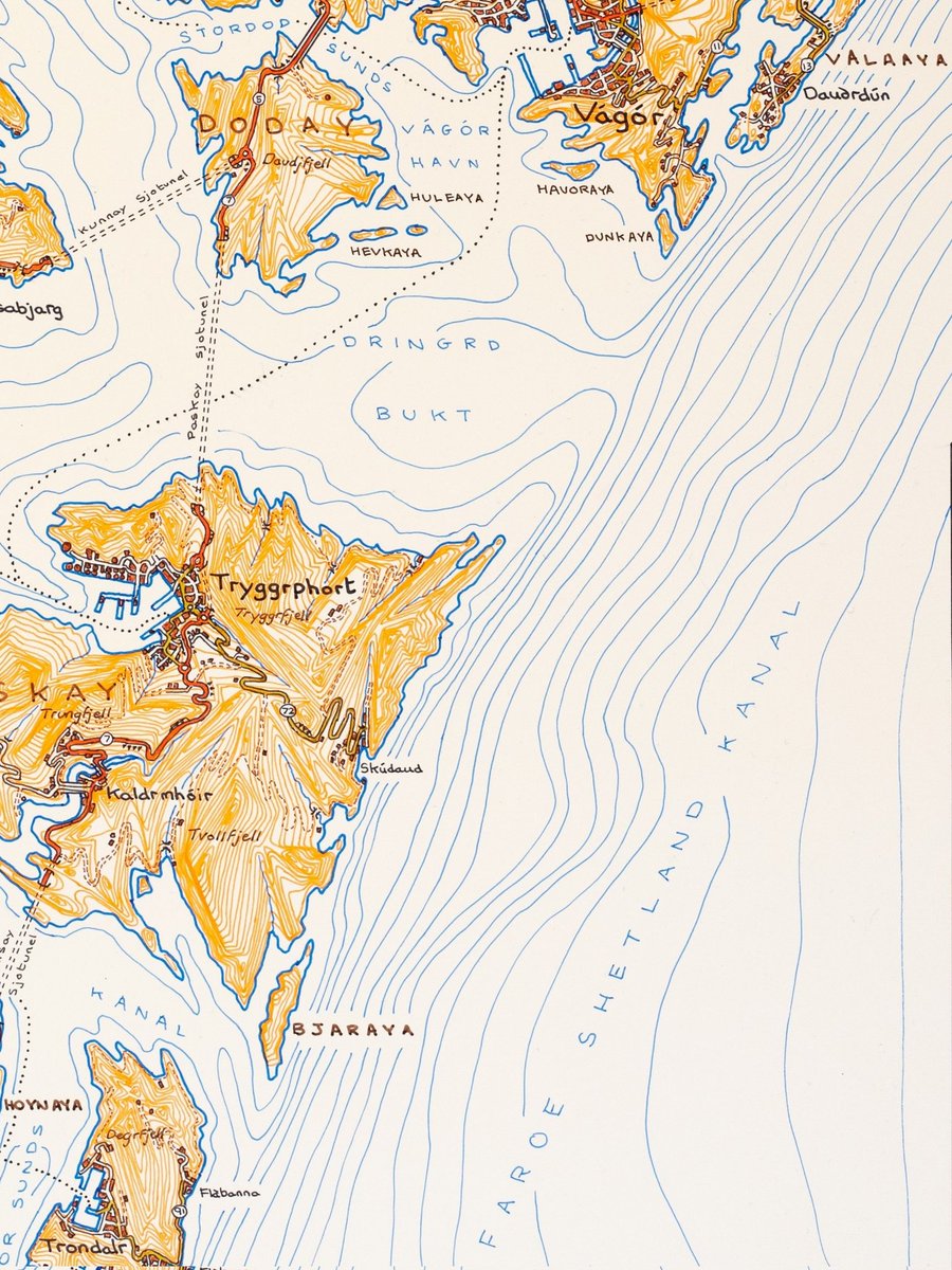
#30daymapchallenge
Day 21: #elevation
Bathymetric and land contours!
Fictional islands between Shetland and Faroe.
Hand-drawn on board.
#elevationmap #contours #depthcontours #bathymetry #contourmap #lineart #cartography #mapmaker #handdrawnmaps #islands #coastline #fiction
20
18 Nov 2021
#30daymapchallenge
Day 17: Land
Mountains and surrounding foothills in a fictional Washington State.
#handdrawn with pen and coloured pencil on board.
#handdrawnart #freehand #contours #elevationmap #cartographer #mapmaker #fiction #washingtonstate #landscape #drawing
6

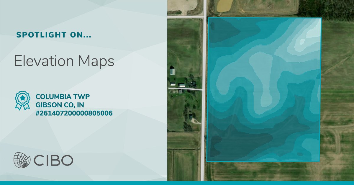
Understanding elevation is critical to see what drives yield patterns within a field. Check out a CIBO #elevationmap showcasing #IndianaFarmland. #IndianaFarmers ow.ly/FLPD50EXIIM
2

7 Jun 2021
For #PrideMonth add 🌈 to your title or description and the rest you can use #Heartratemap #ElevationMap #Pacemap #Gradientmap just to name a few
1
1
2

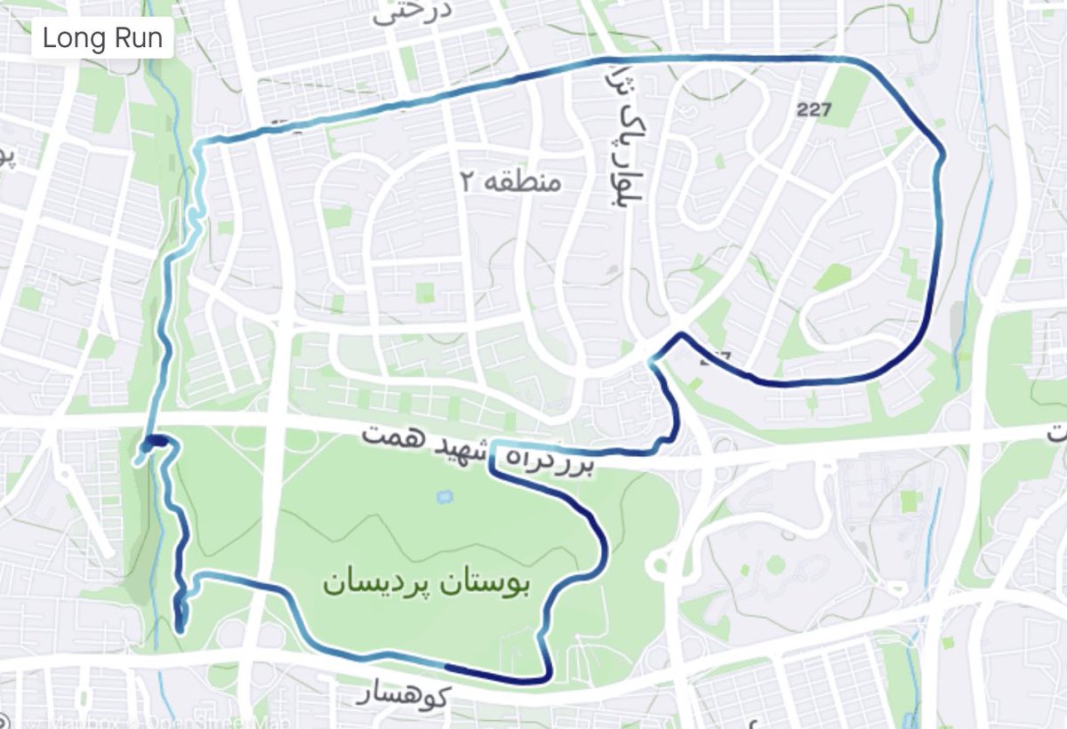
15 Apr 2021
Love the @Strava #elevationmap especially when I get 2k vert in less than 6 miles.
#running #trailrunning #vert

1
2


یه چیز باحال توی #استراوا که از @mehrdad یاد گرفتم، #هشتگ گذاشتن بود که روی مپ مشخص میشه
#PaceMap یا #SpeedMap برای سرعت
#HeartrateMap برای ضربان قلب
#Elevationmap یا #GradientMap تغییر ارتفاع
#PowerMap برای قدرت (دوچرخه سواری)
#TimeMap برای زمان
#TemperatureMap برای تغییر دما
3
10

2 Oct 2020
Strava introduced Statmaps for subscribers today allowing colourful GPS tracks. ✅ from me. Add #speedmap #elevationmap or #gradientmap into your ride's title or description.


1
4

12 Nov 2019
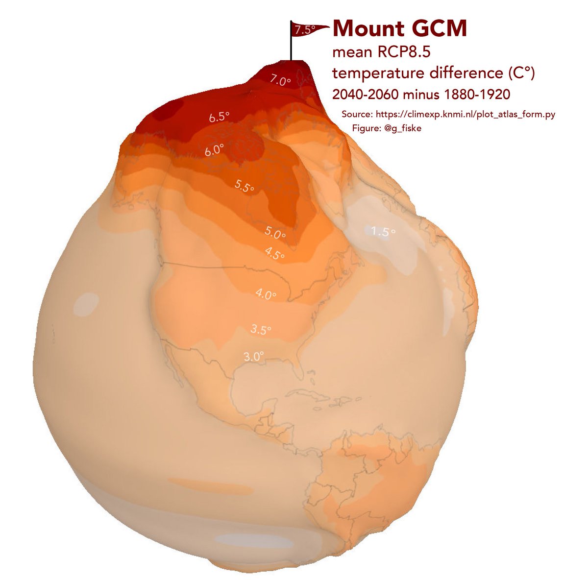
Les T° de surface (c'est le cas de le dire 😑) du scénario RCP8.5 sur une #ElevationMap
On comprend bien, visuellement, les différences entre continents, océans et pôles quant à la #Variabilité.
cc @laydgeur voilà qui devrait te plaire...
11 Nov 2019

An attempt to illustrate the disproportionate heating of the Arctic. #30DayMapChallenge, Day 11 - Elevation. 🏔️ #Map
1
7
9


Seguimos con más trabajos de agricultura de precicisión esta semana.
Si quieres contratar nuestros servicios ponte en contacto con nosotros.
#agricultor #agricultura #equiposagricolas #agribusiness
#agtech #elevationmap #drone
1

10 Jan 2019
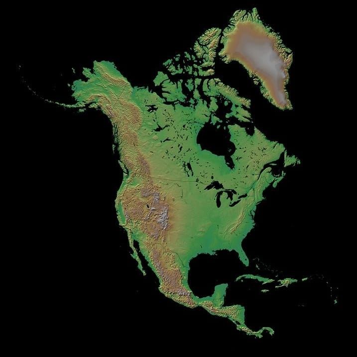
Hill-shaded relief #map of North America. Source: buff.ly/2Fm90Md
#Mexico #Canada #greenland #cuba #elevationmap #cartography #geo #GIS
4
23

6 Nov 2018
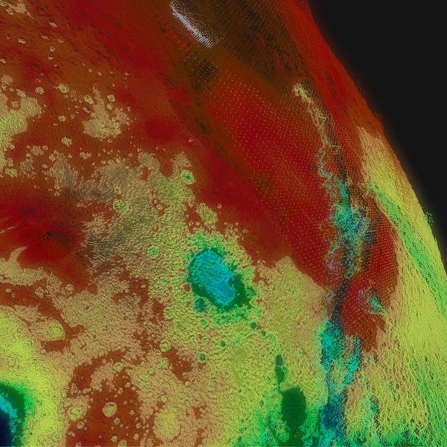
Bennu elevationmap. Made from my shape model. Shows some cratering that is hard to see in the normal pictures. @OSIRISREx
1
1
6