

Jun 2
You mean the global alliances we've been shitting on for the last 16 months?
Also Argo, WAVEWATCH, IOSS, NDBC, and GTMBA are all targeted in these cuts.
revistapesquisa.fapesp.br/en…
3
49

May 19
J'ai testé wavewatch point top, c'est une bonne alternative en terme de contenu mais mon Norton (payant) pop up dans tous les sens, faites juste gaffe.
8
1
33
9,231


May 13
The Diablo Canyon Waverider Buoy data and NOAA/NCEP’s WaveWatch III model display can reveal a great deal about the evolving oceanographic conditions along the Central Coast, and they indicate that it’s time to batten down the hatches!
Northwesterly winds will steadily increase today through Friday, before peaking Saturday afternoon and evening at moderate gale-force to fresh gale-force (32 to 46 mph, with gusts exceeding 55 mph) levels. 🍃
These powerful winds will generate a 7- to 9-foot northwesterly (310-degree deep-water) sea and swell on Friday, building to 12- to 14-feet on Saturday (with a 5- to 11-second period). Note: Wave heights will be even higher offshore. 🌬️🌊
Meanwhile, significant ocean upwelling will drive seawater temperatures down to a frigid 48 to 50 degrees along the immediate coastline this weekend, cold indeed! 🫧🥶
These winds will decrease on Monday and Tuesday.

1
1
3
689


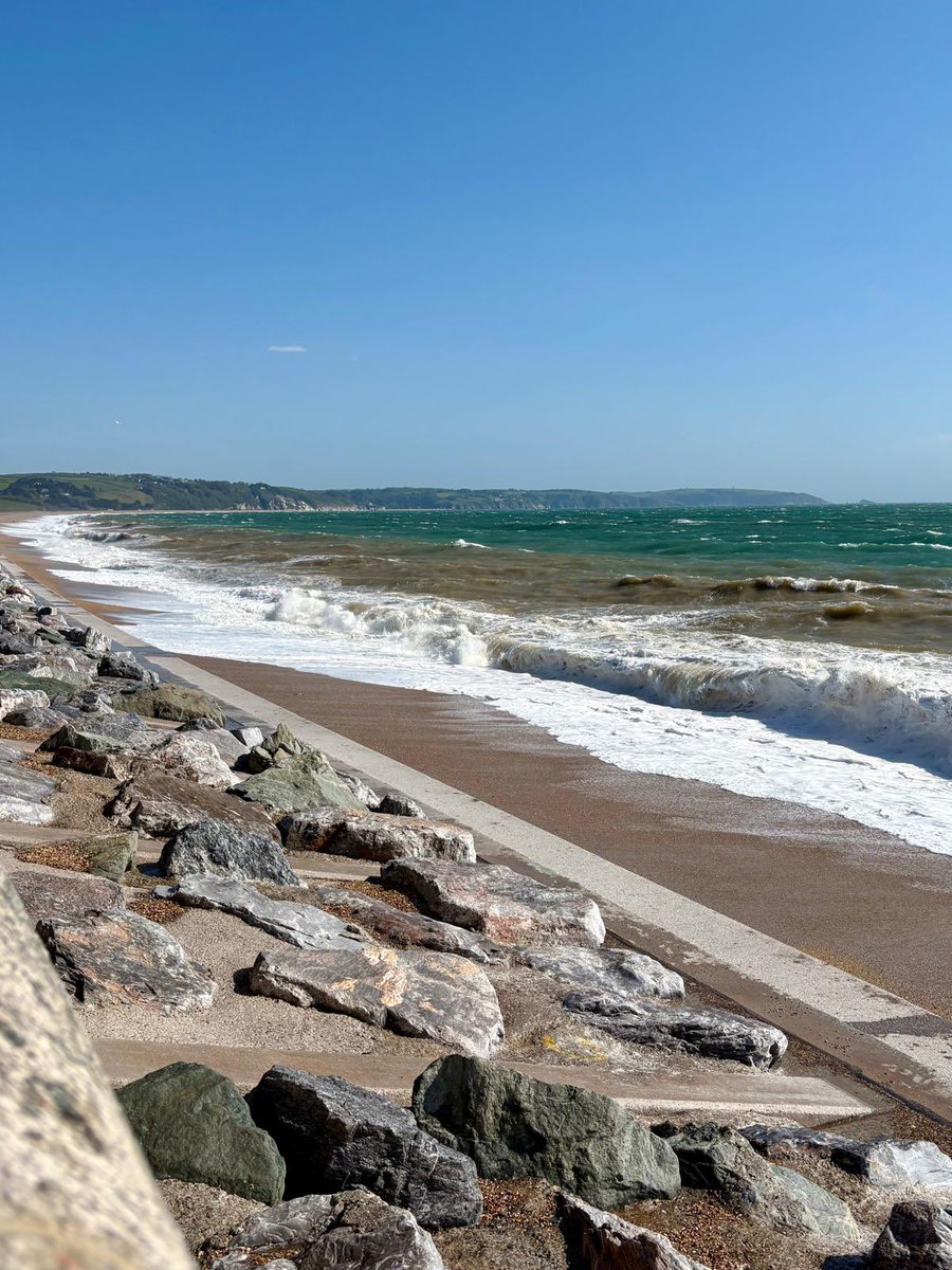
Apr 29
The wind has wiped up again so please take care later today & tomorrow around high tide times 🛟💨
We have a beautiful stormy sea ~ the perfect time to come & wave watch 🌊
bbc.co.uk/weather/coast-and-…
#Windy #Waves #StormySea #WaveWatch #StaySafe
6
333

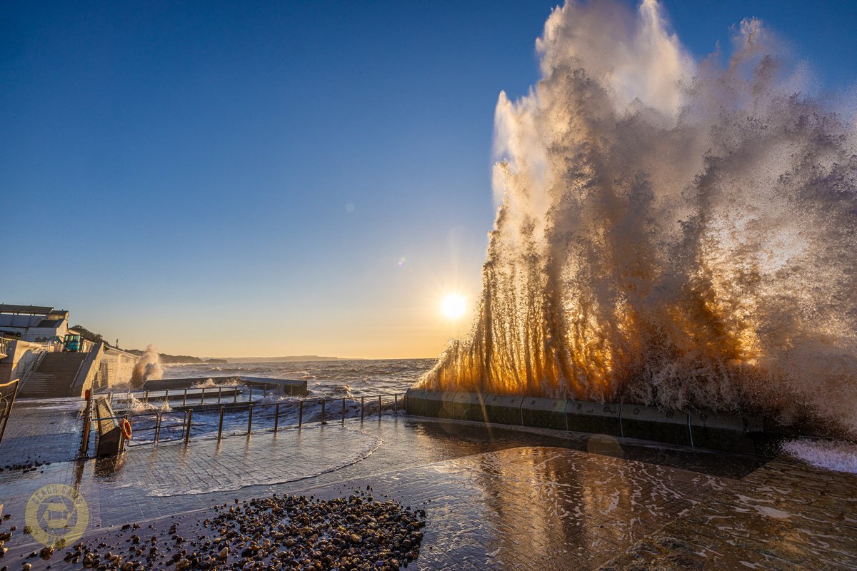
Apr 26
When a wave hits at just the right angle, all that energy has nowhere else to go… so it goes straight up. And when the light catches it like this, it turns into something special.
@BeachCamsMan
#Dawlish #SeaWall #CoastCams #WaveWatch #DevonCoast #SouthDevon #OceanPower
1
23
382

Mar 25
🌊 Helix Pulse: Wave Watch — March 25
Current wave: Defense/Energy War Premium (Hormuz Week 5)
Stage: MID-LATE — 2 late signals detected
⏳ Aging: Oil momentum fading, Saudi alternatives scaling, Goldman sees $67 Q4
🌱 Building: MU confirmed HBM demand, rate-cut expectations rising, PFE catalyst
Transition probability: 30% → AI Infrastructure
Don't buy at the end of a dying wave.
@PulseHelix #WaveWatch #Cycles

2
3
47


Mar 4
#Stormsurf muestra en sus gráficos una animación del modelo Wavewatch III para pronóstico de oleajes.
La costa peruana verá un deterioro de las condiciones del mar, progresivamente, a lo largo del domingo.
El lunes desde la madrugada podrían presentarse maretazos progresivamente de sur a norte. Es el día de mayor oleaje de este evento. A partir del martes empieza a decaer.
Es un evento robusto y debe ser tomado en cuenta por los ciudadanos con actividades cerca de las playas, pescadores y operadores de embarcaciones de todo tipo.
Para los tablistas, las olas significan deporte.
Para seguimiento de temas de oleajes en Instagram recomiendo seguir al Gurú de las Olas @gbarandiarang
9
36
164
143,263

Jan 19
⚡ The Future of Healing Is Here — And It’s Changing Everything
David Meltzer and Michael Jaco go live to break down what’s really happening in the world of health technology — and why the timing of these breakthroughs is no accident.
This conversation dives into how next-generation wellness tech is finally becoming accessible, how frequency-based healing is transforming recovery and performance, and why the global reset is opening the door to innovations that were once kept out of reach.
Michael shares insights from decades of experience in high-level operations and consciousness work, while David explains how emerging technologies are helping people take control of their health in ways never before possible.
This isn’t hype.
This is the next phase of human wellness.
🎥 Watch the full conversation here:
youtube.com/live/ZcNwqugZ45k
🌐 Michael Jaco – Health & Performance Resources:
michaelkjaco.com
🔗 LifeWave with Michael Jaco:
michaelkjaco.com/liveyounger…
⚡ WaveWatch Technology — Get $100 OFF
wavwatch.com
Use code JACOO100 at checkout
If you’re ready to understand where health, technology, and human potential are headed… this one is a must-watch.
3
12
50
2,117


Jan 8
Glad to announce the launch of WaveWatch. A marine weather app. It’s been a long dream to have my own marine app. 💪 for now available just on iOS.
2
1,260

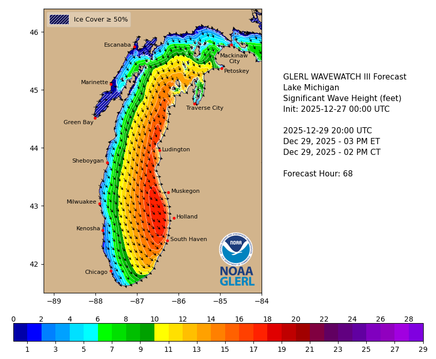
27 Dec 2025
Massive waves will pound the Lake Michigan shoreline in western Michigan Sunday night through all day Monday 🌊💨. Strong winds will drive powerful surf, beach erosion, and dangerous conditions near piers and breakwalls—stay back from the water and avoid walking on icy structures. This will be a wild, hazardous scene along the lakeshore. ⚠️
#LakeMichigan #MIwx #GreatLakes #HugeWaves #LakeshoreFlooding #BeachErosion #GaleForceWinds #StormSurge #WeatherAlert #WestMichigan #StaySafe #WaveWatch
1
7
862

23 Oct 2025
Today’s pair is wavewatch/maritime law [fanon] ♪
- submission by anon 🪖
#fliplinestudios #twteria


2
1
12
731

7 Oct 2025
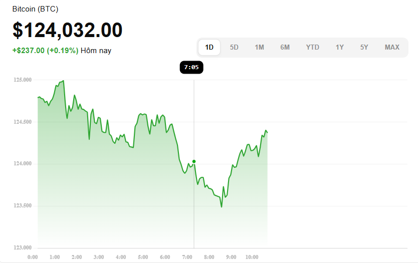
🧠 $BTC MACD Signal (Technicals) @EdgenTech
MACD is a momentum indicator that shows the difference between the 12-period and 26-period EMAs, with a 9-period EMA as the “signal” line. Investopedia 1
When the MACD line crosses above the signal line ⇒ bullish momentum. When it crosses below ⇒ bearish signal.
Recently, analysts have flagged bearish MACD crossovers in Bitcoin as part of cautionary signals.
Combined with other indicators, some analysts see this as a warning of downward pressure, potentially signaling a correction of 20–30% in adverse conditions.
So, the MACD bias is currently cautious / slightly bearish unless the MACD line recovers above its signal line decisively.
“Bitcoin’s $BTC MACD just flicked a red warning — the momentum may be shifting. Watch that crossover closely: is it the start of a climb or the signal of a deeper pullback?
#BTC #Bitcoin #MACD #CryptoAnalysis #MomentumShift #BearishSignal #CryptoTrade #WaveWatch #DeFi #MarketAlert #HODLOrFold
4
2
82

22 Aug 2025
Apresentando Gabrielle Harris, minha mais nova OC. Salva-vidas da Wavewatch, é bonita, forte e também impulsiva.
E uma informação de bastidores: a moça da direita também é ela, só que não quis postar.
Enfim, espero que gostem.
#oc #originalcharacter #digital #clipstudiopaint


1
1
4
226

8 Aug 2025
Rahul Gandhi’s political waves are making everyone grab a surfboard — or maybe a life jacket! 🏄♂️😂
Fans riding high, critics trying to stay afloat — but will these waves crash or carry him to victory? Stay tuned! 🌊🎢
#RahulGandhi #PoliticalSurfing #Election2025 #WaveWatch
1
3
118