
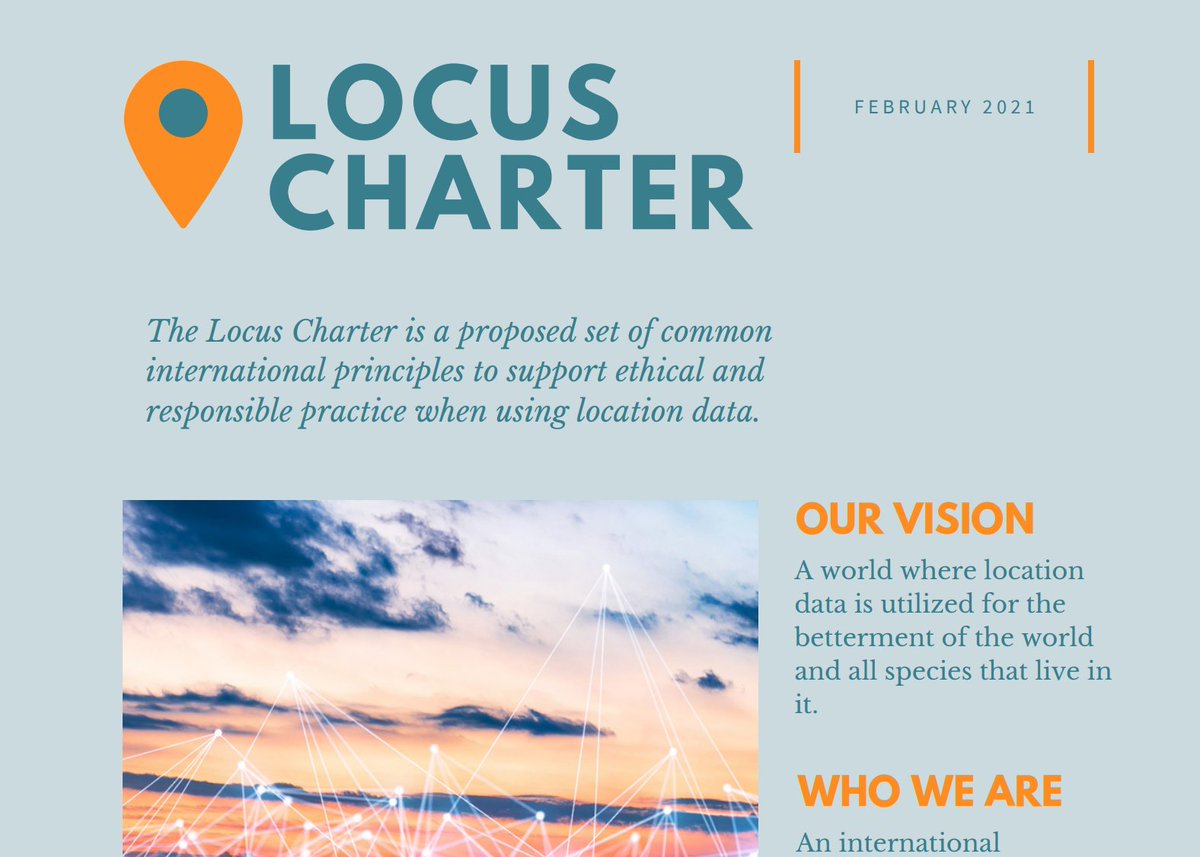
A world where location data is utilized for the betterment of the world and all species that live in it. With thanks to #BenchmarkInitiative & #EthicalGEO
Joined June 2020
- Tweets 255
- Following 234
- Followers 280
- Likes 523
37 Photos and videos

Pinned Tweet

20 Jul 2021
The @LocusCharter has announced initial supporting organizations working to advance the responsible and ethical use of #locationdata. Read more about the Locus Charter and join the community: ethicalgeo.org/locus-charter…

6
17
42
Locus Charter retweeted

23 Oct 2024
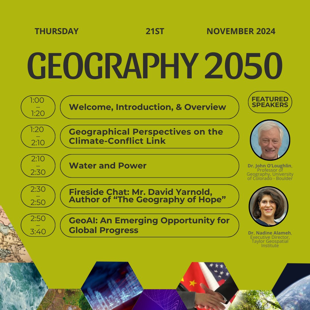
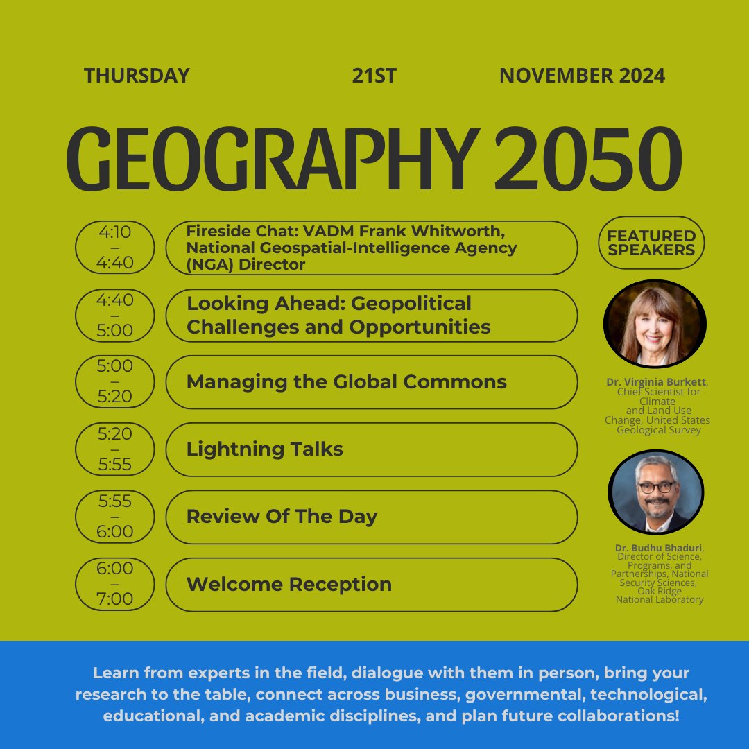
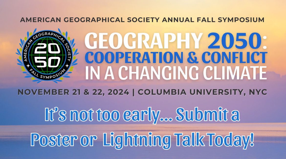
Our 10th Symposium w @columbiaclimate will be held November 21-22 in #NYC! This gathering of #geospatial #gis #geography #geopolitics leadership in #government #tech #academia & #research is a unique opportunity to grow your #geo #network. Register here: geography2050.org/registrati…
5
10
813
Locus Charter retweeted

10 Oct 2024
@geography2050 symposium this Nov. 21-22 w/ @columbiaclimate is on #geographical research & #geospatial #technology for international #cooperation & #conflict resolution in the face of #climatechange. Join our wide geo-community in #research, #tech, #education, & #government!
10 Oct 2024

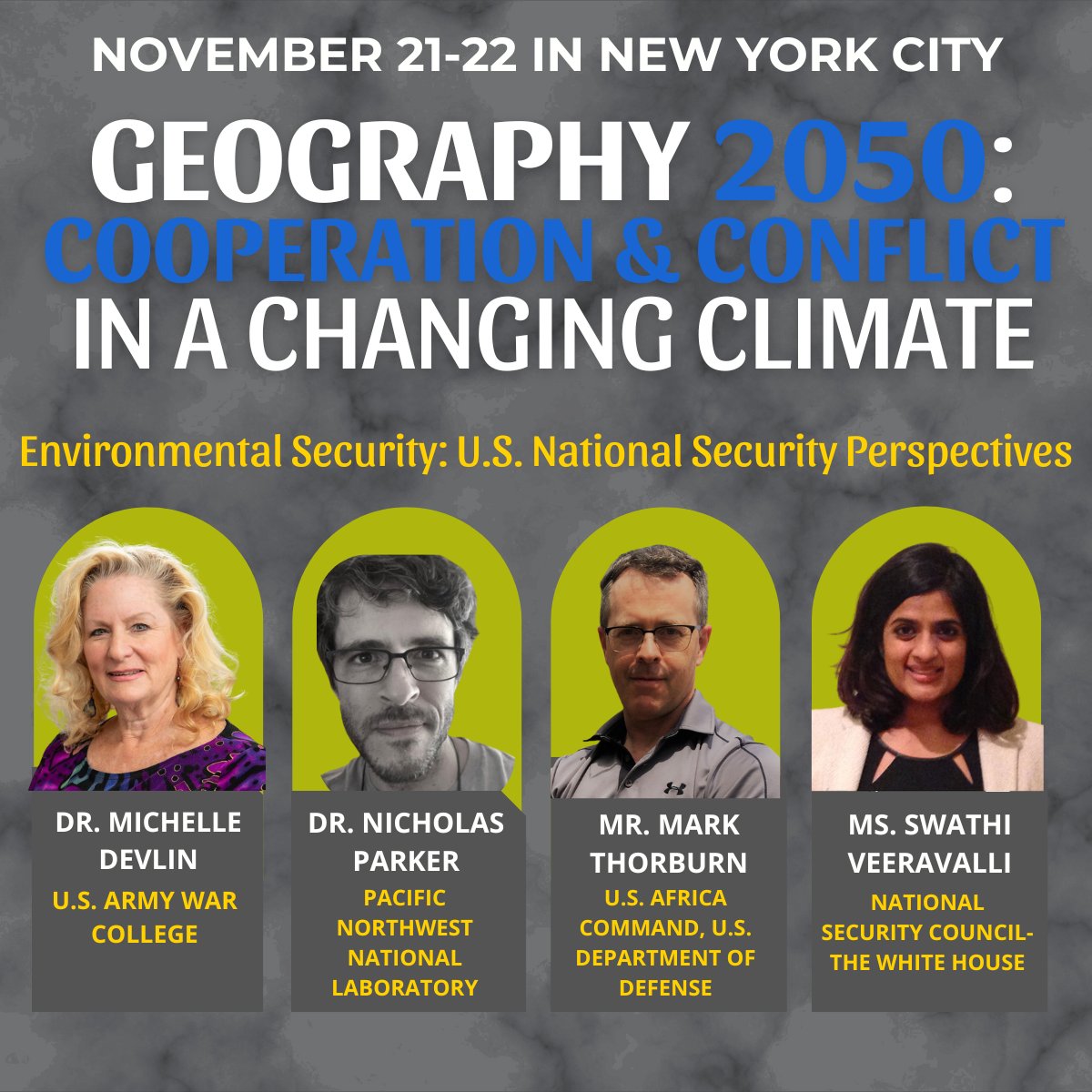
Join us Nov 21-22 in #NYC for #EnvironmentalSecurity #NationalSecurity @WestPoint_USMA @us_awc @PNNLab @USAfricaCommand @DeptofDefense @WhiteHouse leaders! Learn from experts, connect across disciplines, and plan future collaborations! Register today: geography2050.org/registrati…
4
7
682
Locus Charter retweeted
10 Oct 2024
Join us Nov 21-22 in #NYC for #EnvironmentalSecurity #NationalSecurity @WestPoint_USMA @us_awc @PNNLab @USAfricaCommand @DeptofDefense @WhiteHouse leaders! Learn from experts, connect across disciplines, and plan future collaborations! Register today: geography2050.org/registrati…
1
4
787
Locus Charter retweeted
30 Sep 2024
The Speaker lineup for our Symposium with @columbiaclimate Nov. 21-22 is out! Register today to hear from #geography #geospatial experts at @TaylorGeoSTL @USGS @ICRC @MigrationPolicy @UofAlabama @ORNL @PNNLab @NYClimEx @CUBoulder @GCCMobility Go here: geography2050.org/
7
9
850
Locus Charter retweeted
24 Sep 2024
Looking to convene with #geography #geospatial #GIS #geotech educators, researchers, and leaders focused on creating positive change towards a better world? Register today for our fall Symposium, November 21-22 at Columbia University in New York City! geography2050.org/
2
3
293
Locus Charter retweeted
26 Sep 2024
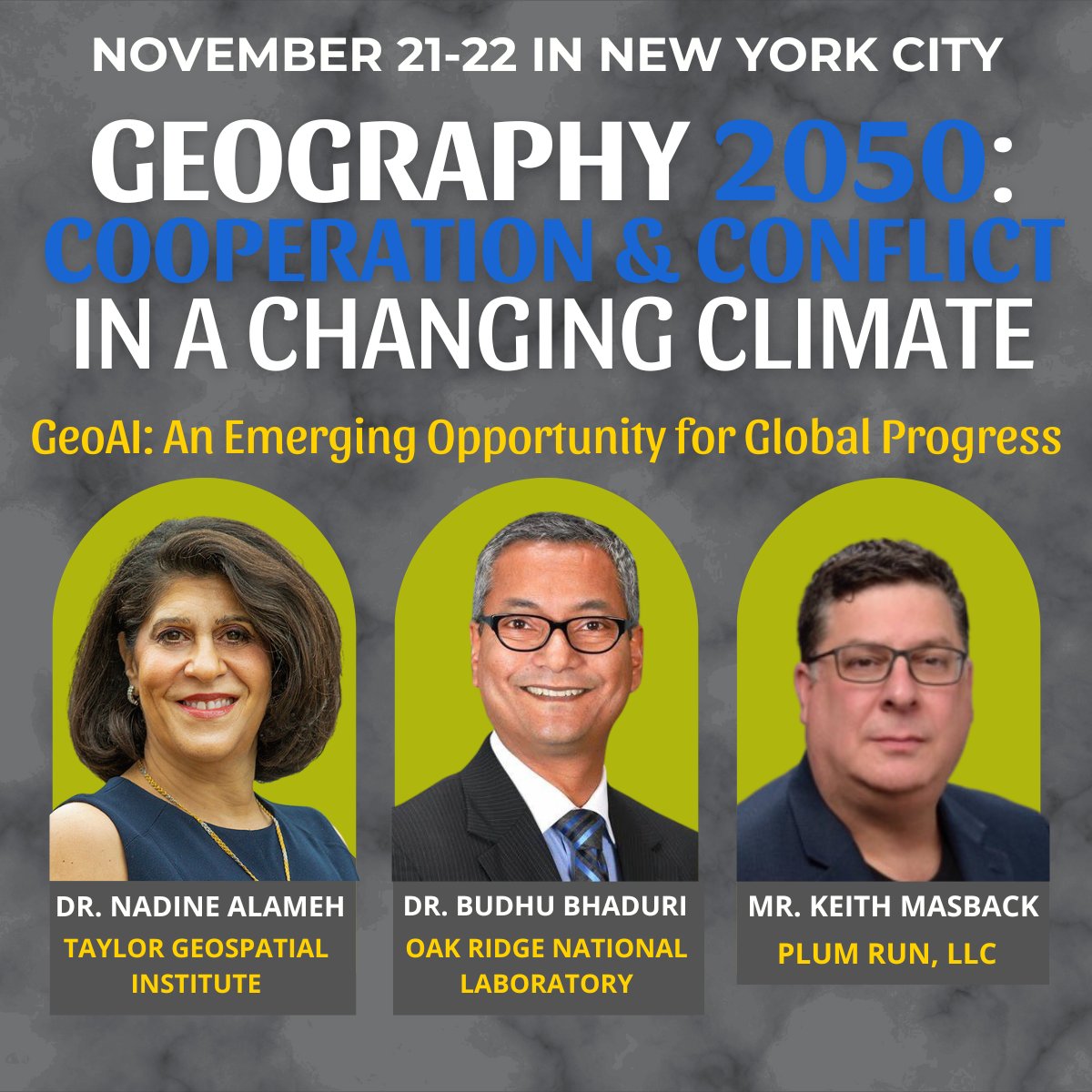
📢Announcing the #GeoAI session! Our symposium this Nov. 21-22 with @columbiaclimate in #NYC is focused on #geography research and #geospatial #GIS #technology #data for international cooperation in the face of #climatechange. Join us: geography2050.org/registrati…
1
4
9
406
Locus Charter retweeted
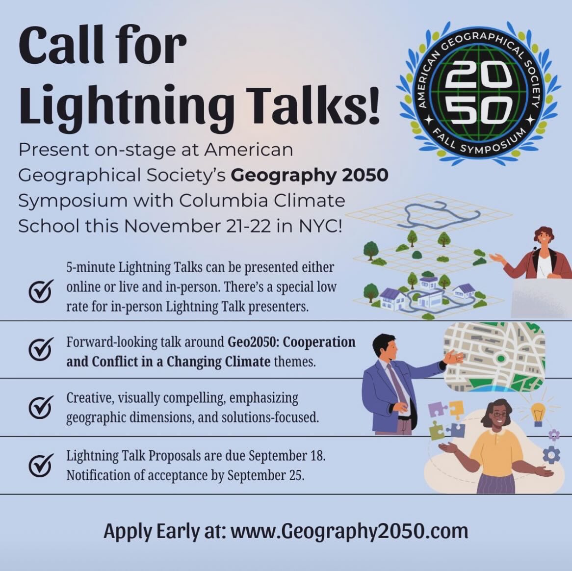
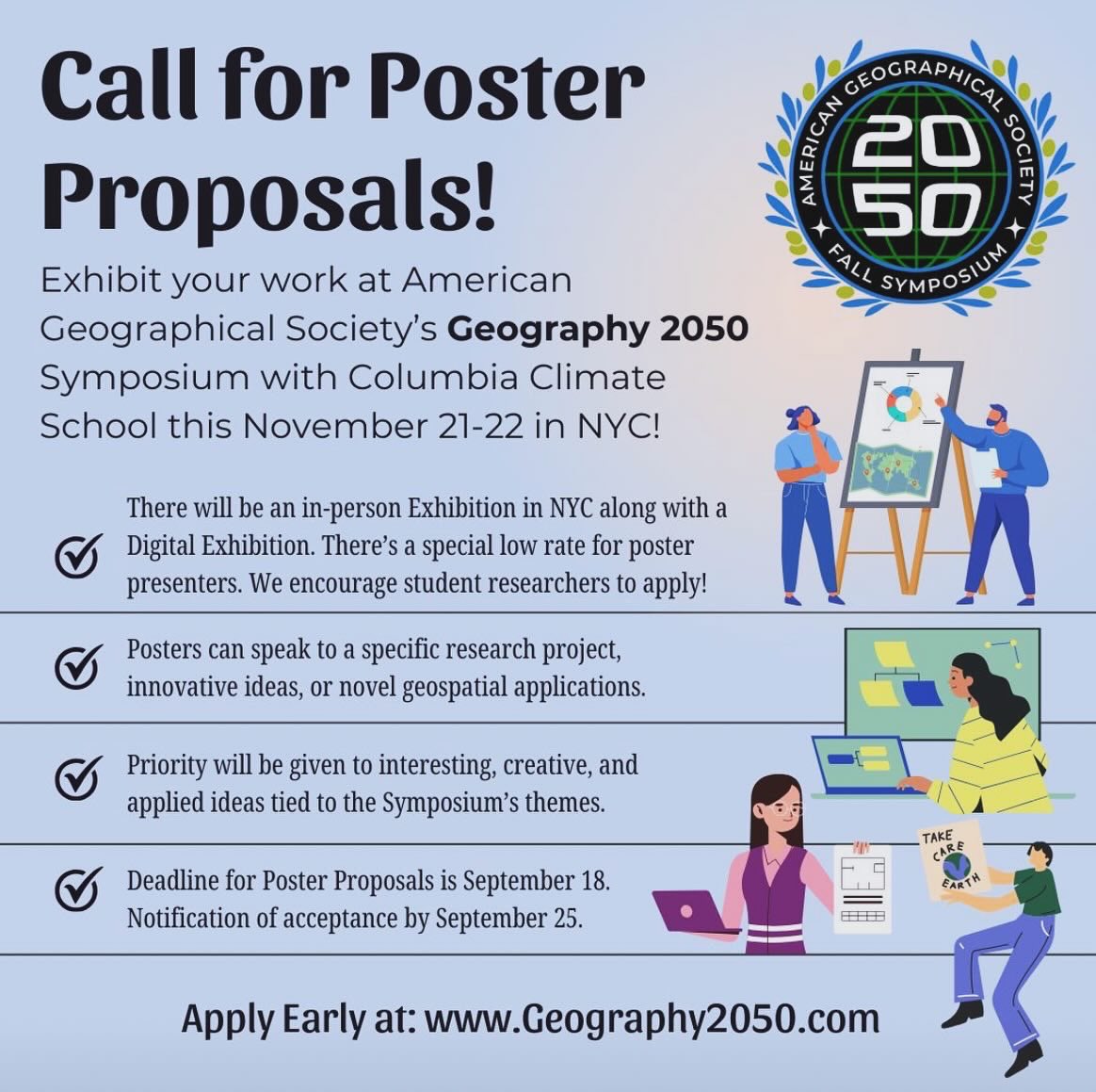
18 Mar 2024
Call for Proposals for the Fall Symposium’s Poster Exhibition and Lightning Talk Sessions! Submit your proposal(s) early and present this November in NYC. geography2050.org/posters-in…
@columbiaclimate
#geography #gis #mapping #geotech #geoscience #remotesensing #satelliteimagery
6
9
1,266
Locus Charter retweeted
13 Mar 2024
What does a planet of 10.3 billion in 2050 mean for our world, especially in the face of climate crisis? Join us in Nov for Geo2050, a critical convening of our wide geo-community. Want to share your work? Submit a poster or lightning talk proposal today! geography2050.org
13 Mar 2024

Mapped: Population Growth by Region (1900-2050F) 🌏️
📲 Want more content like this with daily insights from the world’s top creators? See it first on the @VoronoiApp.
posts.voronoiapp.com/demogra…

2
2
363
Locus Charter retweeted
13 Mar 2024
📣 #GEO-LEADERS! SUBMIT A POSTER OR LIGHTNING TALK PROPOSAL EARLY FOR OUR FALL SYMPOSIUM! 🌎 Posters will be presented in NYC & digitally. 5-min Lightning Talks can be online or in-person. geography2050.org
#geography #geospatial #gis #mapping #maps #climate #climatechange
2
3
288
Locus Charter retweeted

19 Dec 2023
AI can now find your location in photos. “PIGEON system could identify the location of a Google Street view image anywhere on earth. It guesses the correct country 95% of the time and can usually pick a location within about 25 miles of the actual site” npr.org/2023/12/19/121998400…

2
3
198
Locus Charter retweeted

7 Dec 2023
Thanks to @MacPherson_D from @12Geniuses for having me on his podcast to talk about topics from my book @Planet3Billion. It was great fun, and I hope you’ll give it a listen. @StablePlanetAll @PopnBalance @PopnMatters @UNFPA @paragkhanna @VSkirbekk
12geniuses.com/12-geniuses-p…

1
6
14
1,122
Locus Charter retweeted
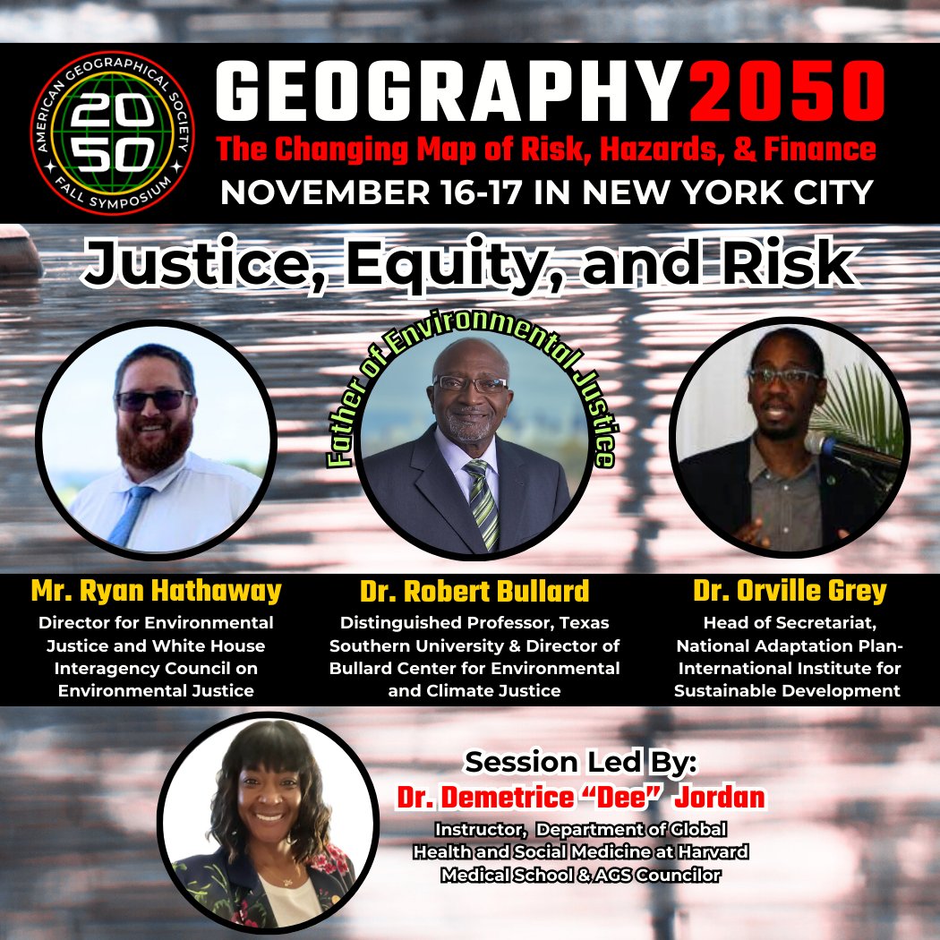
19 Oct 2023
🎉Announcing...our #Justice, #Equity, & #Risk lineup at @Geography2050, Nov 16-17 symposium w @columbiaclimate in NYC! Father of Environmental Justice @DrBobBullard, @IISD_news National Adaptation Plan Network Head, & @WhiteHouse Director for #EJ! Register bit.ly/3YdX6KJ
5
12
2,005
Locus Charter retweeted
15 Oct 2023
In the face of #risks & #hazards due to #climate change, it is more urgent than ever to collaborate across disciplines & sectors. The field of #Geography, in many ways, has always been a gathering place. @Geography2050 is our way of honoring that legacy. bit.ly/3YdX6KJ
5
8
1,544
Locus Charter retweeted
11 Oct 2023
#Geovisualization #Cartography #GIS #Maps #GeospatialTech #SatTech are at the HEART of #ClimateAction! Join our annual symposium on Nov 16-17 in NYC at @Geography2050 with @ColumbiaClimate: bit.ly/3YdX6KJ
11 Oct 2023

Over the past three years, the largest lake in the Middle East, Lake Urmia, transformed from being filled with water into a mostly vast, dry salt flat. Drier conditions over that time led to this change captured by #Landsat 8 and 9 in Sept. 2020 and 2023.
go.nasa.gov/45xnbq1
6
7
1,917
Locus Charter retweeted
30 Sep 2023
16-17 Nov in NYC is @Geography2050, our #climate convening w @columbiaclimate on #risks, #hazards, & #finance & how our geo-community in #research #education #government #geospatial #tech #finance #insurance MUST collaborate to face urgent global issues. Geography2050.org

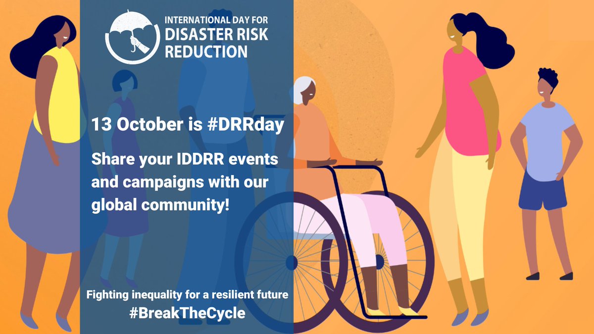
📢 SHARE YOUR EVENTS
13 October is International Day for Disaster Risk Reduction: Join our global community and send us the details of your events, promotions or ideas around #DRRday, so we can fight inequality for a resilient future, together. 👉 ow.ly/GHpq50PR9TH
4
4
1,772
27 Sep 2023
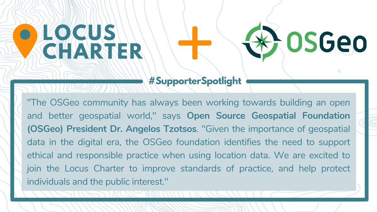
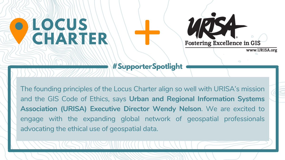
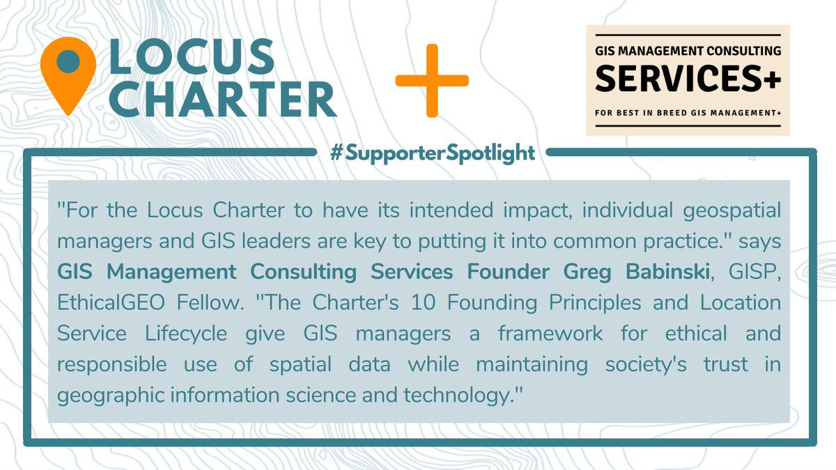
New @geoworldmedia piece highlights the importance of ensuring ETHICAL & RESPONSIBLE use of #geospatial data! our 10 #LocusCharter principles align to “foster innovation, ensure data accessibility, & uphold #ethical standards.” Learn more here: bit.ly/467xcLY
27 Sep 2023

The #geospatial domain operates w/in a framework of policies & regulations that profoundly influence scientific #research & #tech advancements. Understanding this impact is crucial for fostering innovation while ensuring ethical & responsible use of data. bit.ly/3ZBmVW0
1
1
396
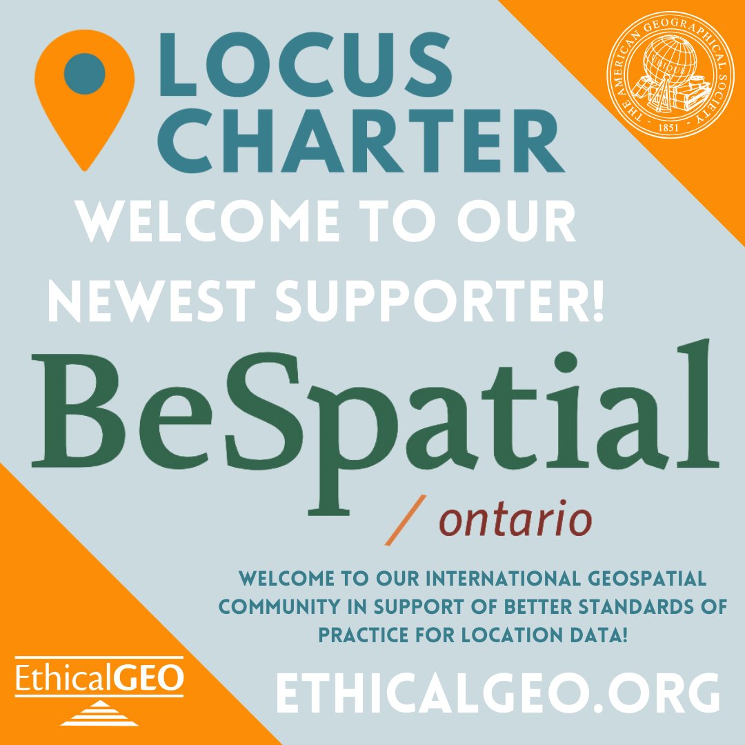
21 Sep 2023
Welcome to our newest @EthicalGEO Locus Charter Supporter, @BeSpatialON ! We're happy to have you as part of our international #geospatial community in support of better standards of practice for location data. Thank you for standing with our 10 founding principles! @PLANETucker
2
6
281
Locus Charter retweeted
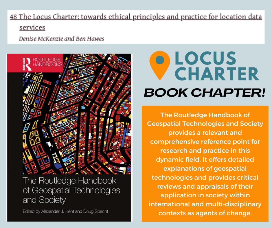
29 Aug 2023
BIG NEWS! @LocusCharter is featured in brand new @routledgebooks Routledge Handbook of #Geospatial Technologies and Society, in a chapter written by Ben Hawes and Denise McKenzie! 🌟 Check it out here: routledge.com/The-Routledge-…
2
3
403
Locus Charter retweeted
11 Jul 2023
The COVID-19 pandemic has brought global efforts together to address its challenges, including the use of open data for research and policy-making.
Read more here: bit.ly/44BJuLl

3
4
465
6 Jul 2023
We need the #LocusCharter now more than ever!
ethicalgeo.org/locus-charter
2 Jul 2023

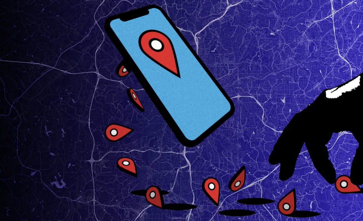
OSINT analyst uses the OpenStreetMap Overpass API to pin down his target’s location to within a meter using only clues spotted in the background of her selfie video
4
7
1,159