
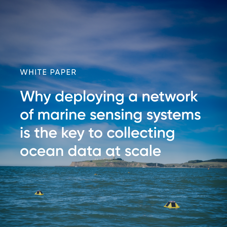
Connecting the world's oceans to power a more sustainable future.
Joined September 2011
- Tweets 3,728
- Following 1,312
- Followers 6,291
- Likes 2,822
913 Photos and videos


4 Dec 2025
Wind-assisted propulsion gets a lot of buzz. What is the technology’s actual fuel and emissions savings potential?
We dug into the interplay between wind-assisted propulsion, voyage optimization, and overall earnings.
Blog: sofarocean.com/posts/wind-as…
Demo: app.howdygo.com/share/6647f9…
173

#30DayMapChallenge Day 20 — Water 🌊
Navigating smarter, not harder.
The @Sofarocean Wayfinder Voyage Simulator, built with Mapbox, lets captains and operators test and compare ocean voyage plans in real time. It runs full-physics simulations in the browser using vessel models and live forecast data — so users can adjust routes, tweak power, and instantly see the impact on ETA, fuel, and weather.
Learn more about how they built it here: sofarocean.com/posts/how-the…
#BuiltWithMapbox #MaritimeTech
5
30
2,265
5 Nov 2025
🌊 Introducing the Spotter Configurator! Design your custom ocean monitoring system from surface to seafloor in minutes with this new tool.
Build your system today: spotter-configurator.sofaroc…
#OceanScience #sofarocean #monitoring
3
183
29 Oct 2025
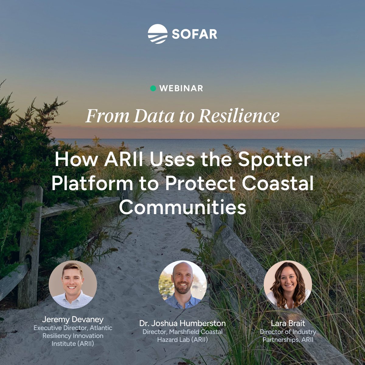
NEW Webinar! From Data to Resilience How @ARII_Institute uses the Spotter Platform to protect coastal communities.
📅 Nov 13 | 11am PT | 2pm EST
🔗 Register here: sofarocean.com/posts/arii-pr…
#SofarOcean #ARII #ClimateResilience #OceanData
1
3
148
22 Oct 2025
Honored to be recognized with collaborators for the 2025 @thenopp Excellence in Partnering Award 🌊🌪️
With @USNavyResearch, we air‑deployed Spotter wave buoys ahead of 6 #hurricanes to deliver real‑time data and improve forecasts.
Read more: sofarocean.com/posts/nopp-ex…
#navy
3
272
16 Oct 2025
ICYMI: @tradewindsnews stopped by our San Francisco office to see how Wayfinder is transforming voyage optimization for the world’s top shipping companies.
Check it out: tradewindsnews.com/technolog…
Article and photo: @EPM_Maritime
#tradewinds
146
2 Oct 2025
⚡️The Wayfinder Voyage Simulator leverages world-class weather forecasts vessel‑specific performance models that are updated daily.
🎥 Join our live webinar to learn why we built it: sofarocean.com/posts/webinar…
#marineshipping #sofarocean
2
139
1 Oct 2025
The future of voyage planning is here 🚢
Wayfinder Voyage Simulator delivers instant scenarios, real‑time intelligence, and transparent fuel/time costs—so operators can save fuel, cut costs, and reduce emissions. Read why we built it: sofarocean.com/posts/introdu…
#shippingindustry
2
125
16 Sep 2025
Honored to be in @ThetiusHQ's Top 150 for maritime innovation 🚀
With the world’s most accurate real-time marine weather, Wayfinder optimizes every voyage for safety and efficiency — delivering an average of 5%- 8% fuel savings per voyage.
#MOL @lloydsregister
3
160
21 Aug 2025
🌊 Tracking Hurricane Erin
Our Spotter buoys and weather model have captured waves over 80 ft. Data from Sofar’s Weather Dashboard is powering forecasts relied on by @NHC_Atlantic @NOAA to protect coastal communities.
Track live 👉 weather.sofarocean.com/
2
6
519
Sofar Ocean retweeted

14 Apr 2025
With low-carbon fuels years away, shipping fleets are turning to high-tech sails, onboard CO2 capture and ocean sensors. bloomberg.com/news/features/…
3
4
1,351
14 Apr 2025
Sofar was featured in Bloomberg!
The article spotlights our Wayfinder platform details how it uses the world’s most accurate marine weather to provide dynamic voyage optimization that significantly cuts vessel emissions.
Read article: bloomberg.com/news/features/…
@business @climate
349
Sofar Ocean retweeted

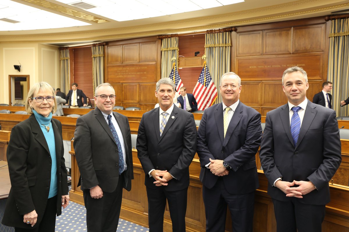
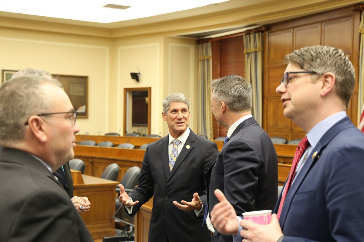
27 Mar 2025
Chairman @RepFranklin thanked the witnesses from @Sofarocean, @Oceaneering, @xoceansocial, and @UCSanDiego after yesterday’s Environment Subcommittee hearing.
Strong public-private partnerships drive innovation in the ocean industry now and in the future.

1
2
592
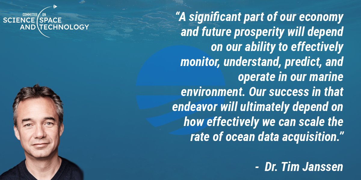
1 Apr 2025
In his testimony before @housescience, Sofar CEO Tim Janssen detailed why the U.S. needs strong public-private partnerships to accelerate the blue economy into an information economy powered by highly accurate marine weather intelligence.
Full hearing: youtube.com/live/VhWIljNUt2M…
26 Mar 2025

During our Environment Subcommittee hearing, Dr. Tim Janssen, CEO of @Sofarocean, emphasized the importance of developing technologies to enhance our understanding of the oceans and their crucial role in our nation's success.
⬇️
1
4
1,125
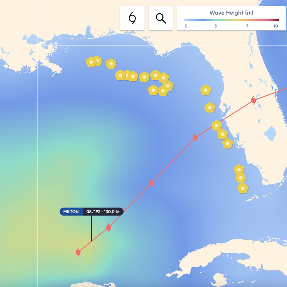
8 Oct 2024
8 Spotter buoys were airdropped ahead of #HurricaneMilton today. The buoys will make real-time observations of extreme conditions generated by the storm before landfall. 12 Spotters deployed ahead of Hurricane Helene remain active to the north.
Updates: sofarocean.com/mx/atlantic-h…
1
3
9
1,026
10 Oct 2024
Spotters airdropped ahead of #HurricaneMilton made real-time observations of the storm's extreme conditions. Here we overlay satellite imagery w/Spotter drift tracks. SPOT-31243C passed close to the eye wall, observing max wave heights of 65 ft.
Updates: sofarocean.com/mx/atlantic-h…
1
591
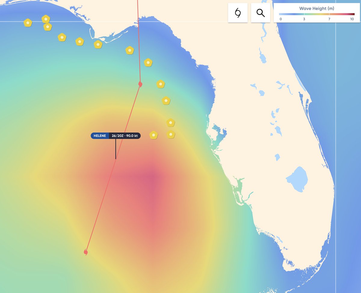
26 Sep 2024
13 Sofar Spotter buoys were airdropped ahead of #HurricaneHelene to make real-time observations of the storm.
The buoys will measure the most extreme conditions generated by Helene later Thu. One buoy has already seen max wave heights of 45 feet.
Updates: sofarocean.com/mx/atlantic-h…
1
3
10
1,216
26 Sep 2024
The @USNRL Scientific Development Squadron VXS-1 deployed the Spotters on Tuesday in the Gulf of Mexico, along with microSWIFTs and A-DWSDs, as part of the @thenopp Hurricane Coastal Impacts Project (NHCI).
Updates: sofarocean.com/mx/atlantic-h…
📹: Sofar Ocean/NOPP
#HurricaneHelene
1
3
826
27 Sep 2024
Spotters airdropped ahead of #HurricaneHelene made real-time observations of extreme conditions in the Cat 4 storm.
Here we overlay satellite imagery w/Spotter drift tracks. SPOT-31995C (southernmost track) observed max wave heights of 70 feet.
Updates: sofarocean.com/mx/atlantic-h…
1
494
27 Sep 2024
Sofar was featured in @nytimes coverage of #HurricaneHelene, which made landfall as a Cat 4 storm in NW Florida. @AustynGaffney details how Spotter buoys were airdropped in the storm’s path to collect real-time data, which is leveraged by @NHC_Atlantic.
nytimes.com/live/2024/09/26/…
3
405