Meteorologist for NBC4 in DC. Oklahoma Alumnus, International Traveler, Marathon Runner. Lover of Dogs, Old Cars, History, Trivia, Cooking and My Husband.
- Tweets 31,101
- Following 1,506
- Followers 33,633
- Likes 10,895


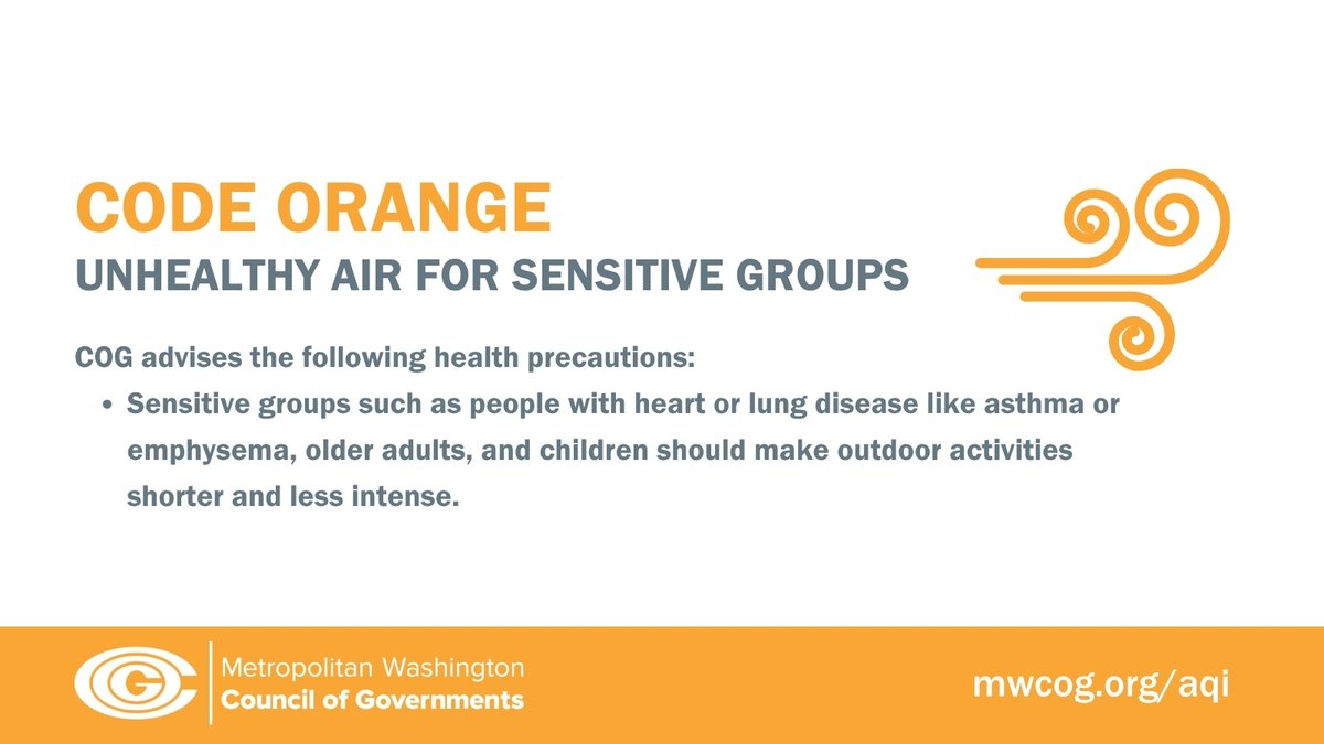
ALT CODE ORANGE means unhealthy air for sensitive groups. COG advises sensitive groups to make outdoor activities shorter and less intense.


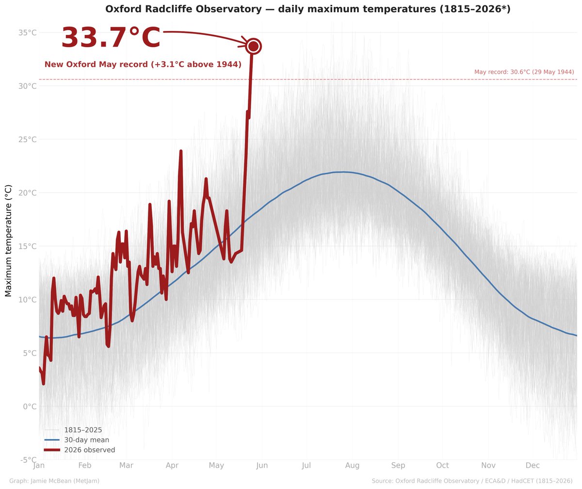
ALT Spaghetti chart showing Oxford Radcliffe Observatory daily maximum temperatures for every day of the year from 1815 to 2026. 211 years of historical data are shown as very faint grey lines tracing a seasonal cycle from around 5°C in winter to a summer peak of roughly 25–30°C in July and August. A blue smoothed 30-day mean line highlights the average annual temperature cycle. The 2026 line is shown in bold red, running from January through to late May before spiking sharply upward to reach 33.7°C on 26 May, well above the entire historical grey envelope for that time of year. A single dashed red reference line marks the previous May record of 30.6°C set on 29 May 1944. The 2026 reading exceeds this by 3.1°C and, in statistical terms, is the 6th most anomalous maximum temperature in Oxford's 211-year record, ranking as the most anomalous May maximum ever observed and coming within 0.6°C of the all-time June record of 34.3°C set in 1976.