Just a casual person using Twitter. Currently a weather enthusiast and working up with studying a bit of space weather as well.
- Tweets 2,394
- Following 4,065
- Followers 953
- Likes 33,550


ALT A full disk image of Earth, as seen from the Orion capsule. The planet is a pale blue, swirling with white clouds and glowing slightly lighter blue in place from reflected light. From about 8 to 9 o'clock, a large brown landmass is Africa, with the Iberian peninsula twinkling with lights just where the planet curves. At the 1 o'clock spot, aurora glow in a thin green glow, just barely separated from the planet's surface. Earth is set against the black of space. Credit: NASA/Reid Wiseman


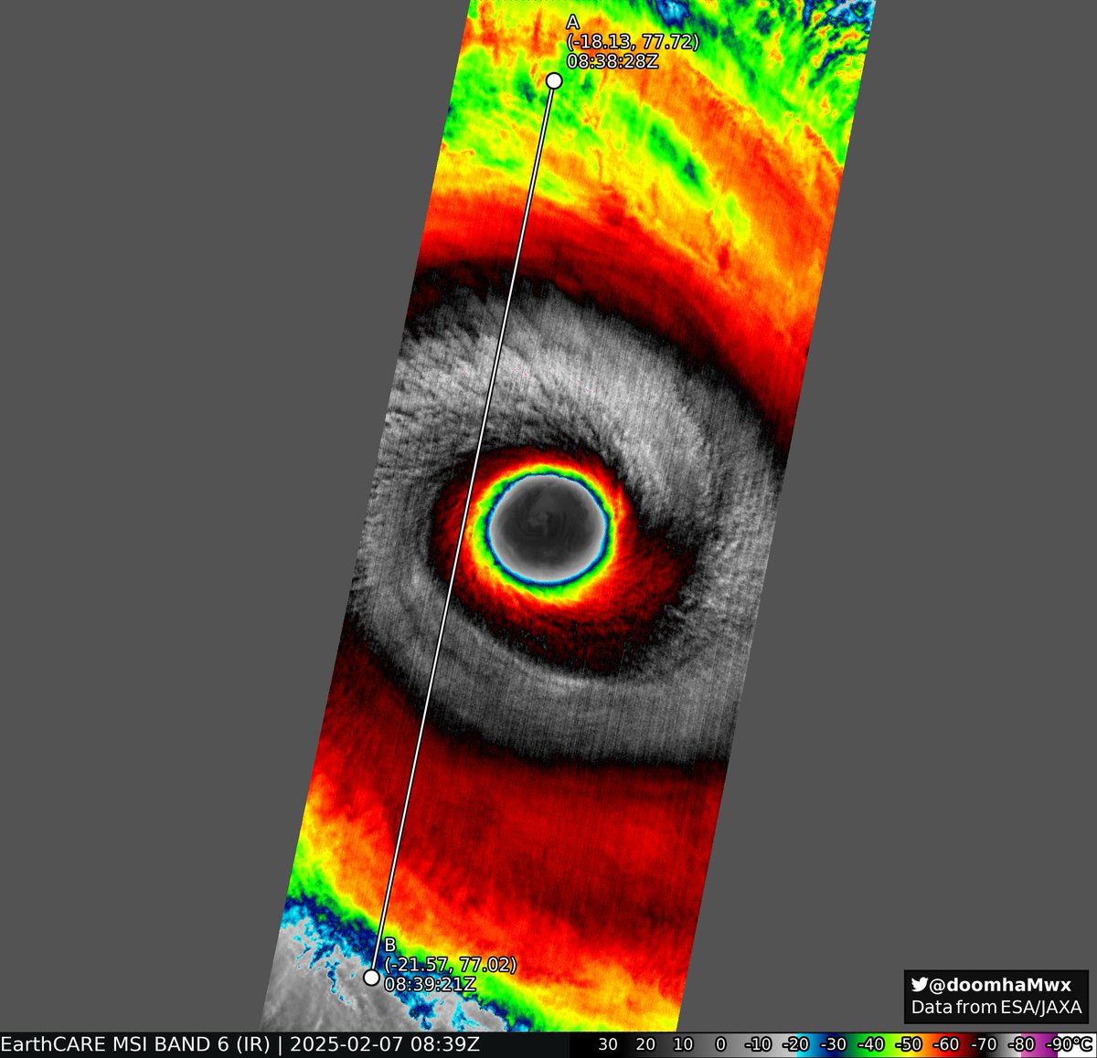
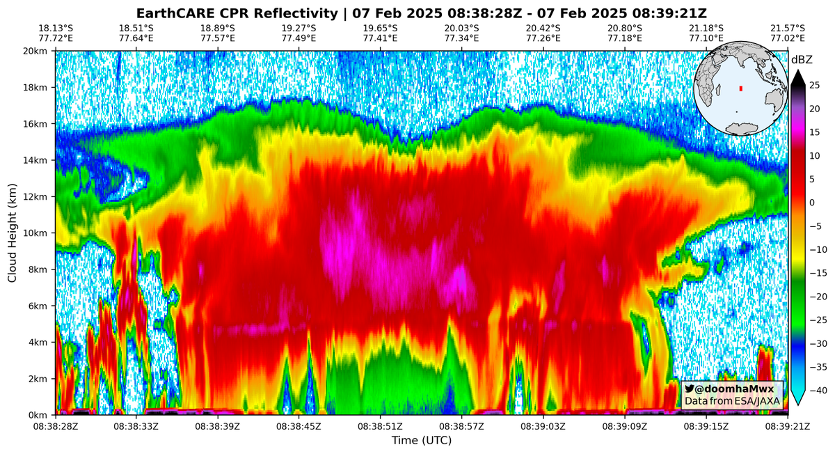
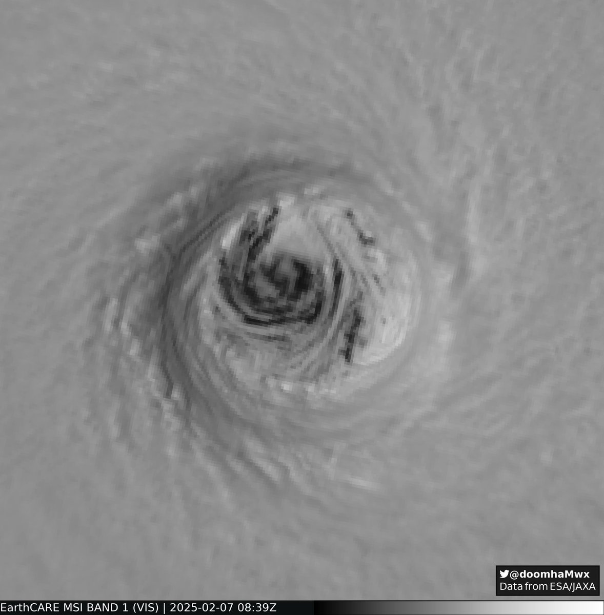


ALT Credit: Sebastian Bley, TROPOS Image: Tropical Cyclone Vince, as seen by EarthCARE The image shows Tropical Cyclone Vince, captured over the South-West Indian Ocean on 7 February 2025 by the multispectral imager (MSI). MSI is one of the four instruments carried by ESA’s EarthCARE satellite, providing images at 500 m ground sampling distance over a 150 km wide swath. MSI provided invaluable insights into Vince’s structure, and the optical and microphysical properties of the associated cumulonimbus cloud. MSI recorded a remarkable cloud top minimum temperature of 192 K (-81oC, (c)). The cloud liquid and ice water path retrieved from the Cloud Optical and Physical Properties products reaches values up to 4000 g m⁻², indicating an extremely high water content (d). Values exceeding 3000 g m⁻² are rare and generally associated only with intense tropical systems, such as Cyclone Vince.