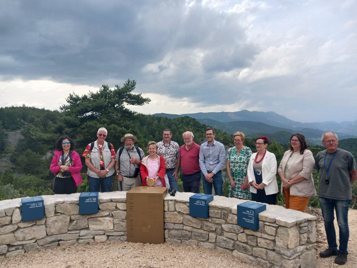
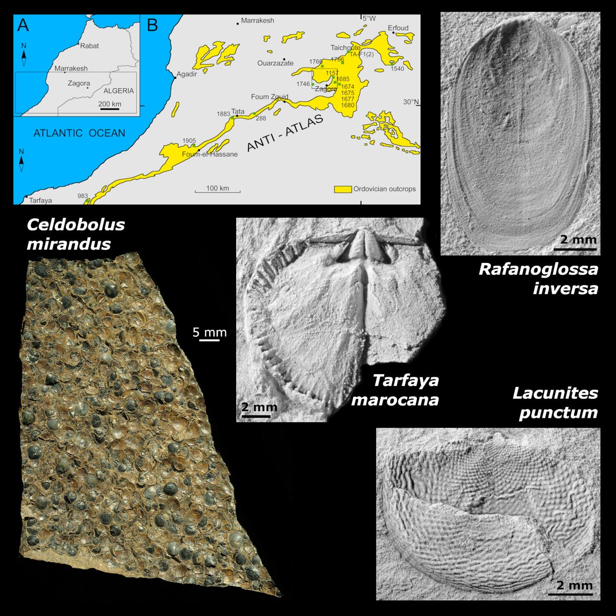
ALT Top left: Maps of Morocco with the Atlantic on the left (in blue) and Ordovician outcrops of the Anti-Atlas in yellow. A rectangle around Zagora in a region towards the upper right shows the study area. The inset at top left shows the location on a more general map.
On the right, three black and white fossil brachiopod images: top is Rafanoglossa inversa (scale bar bottom right of image is 2 mm); middle is Tarfaya marocana (scale bar bottom left is 2 mm); bottom is Lacunites punctum (scale bar bottom right is 2 mm).
Colour photograph at bottom left is a slab containing many specimens of Celdobolus mirandus (horizontal white scale bar to right of image is 5 mm).
15
44
2,380
International Commission on Stratigraphy retweeted
Super few days in beautiful Drôme celebrating @ICS2022@theIUGS@DurUniEarthSci achievements. Not one but two Golden Spike dedications…the Albian and Hauterivian stages of the Cretaceous. Thanks to everyone involve especially the communities of Arnayon and La Charce. /2
3
16
592
International Commission on Stratigraphy retweeted
Almost 50 years to the day I (we) visited Castellane, my undergraduate mapping area of Mesozoic limestones and ‘Tertiary’ molasse. Thank you @imperialcollege for such a great opportunity @ICS2022 @durham_uni
2
3
34
1,356
International Commission on Stratigraphy retweeted
Final result of my geological map. Color palette depicts the geological age of each formation according to the @ICS2022, shaded relief and contour lines created with raster functions on the #NASADEM, paper texture tiles by @John_M_Nelson#cARTography#MakingMapsPretty#ArcGISPro
MNCH director Todd Braje argues the recent failure of the @ICS2022 to formalize the term "Anthropocene" is an opportunity, not a loss.
"Moving forward, [cross-disciplinary approaches] must create bridges between scientists and the public." shorturl.at/cflpG
1
2
204
International Commission on Stratigraphy retweeted
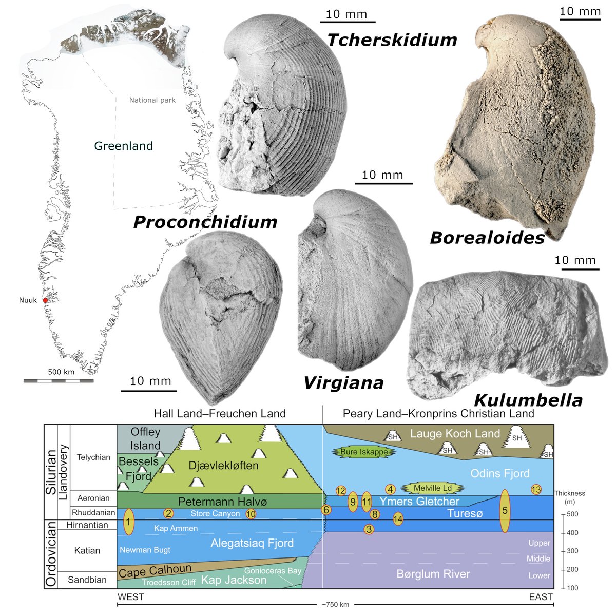
ALT Top left: map of Greenland with the fossil outcrops of Upper Ordovician and lower Silurian strata shaded in the north.
Bottom, schematic of the stratigraphy of the shallow-water sediments showing the the various localities (numbered) placed according to their approximate geographical position along the ~750km transect line, west to east (left to right).
In the upper right quadrant, five examples of significant taxa from this fauna: top row - Tcherskidium tenuicostatum (GGU 254729) and Borealoides balderi (MGUH 34240, holotype); bottom row - Proconchidium schleyi (MGUH 34049), Virgiana hursti (MGUH 34226, holotype) and Kulumbella heimdali (MGUH 34259, holotype). All scale bars represent 10 mm.
8
26
2,574
International Commission on Stratigraphy retweeted
New 315-million-year old fossil found in Co. Clare!
Irish palaeontologist, Dr Eamon Doyle, has discovered a new fossil sponge species in rocks near the Cliffs of Moher. To read about this amazing discovery check out the new Fossil News page on our website.
ucc.ie/en/fossil-heritage/fo…
7
27
948
International Commission on Stratigraphy retweeted
The International Commission on Stratigraphy (ICS) and the IUGS are delighted to see the 2023/06 International Chronostratigraphic chart published. It now includes the Golden Spike for the Langhian Stage and the Middle Miocene at 15.98 Ma.