
Geographic Information Systems lectures & practicals @Macquarie_Uni @MQEarthEnv
Joined April 2020
- Tweets 57
- Following 26
- Followers 17
- Likes 5
9 Photos and videos


25 Apr 2024
I stumbled upon this gem that aligns perfectly with what we'll be covering in our Intro to Remote Sensing Lecture next week! 🌟 Thoughts on how this aligns with our lecture material? Looking forward to discussing it with you all next week! @mqnatsci #RemoteSensing #ENVS2364
23 Apr 2024

The UAE received about 10 in of rain, causing major flooding. This video shows Landsat 8 and 9 images of before and after this event in land/water band combinations, making the water appear purple. Learn about different band combinations with Landsat data: ow.ly/X0Eo50Rmvrg
24
MQ GIS Lectures retweeted

6 Apr 2024
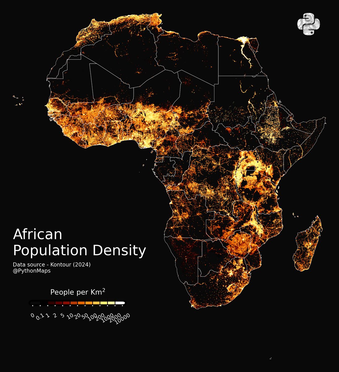
Here is a thread of my favourite maps of Africa. Let me know which you like most and give me your best theories for how thel all fit together.
Starting with population. 1/10
118
1,415
11,193
2,955,556
MQ GIS Lectures retweeted

21 Mar 2024
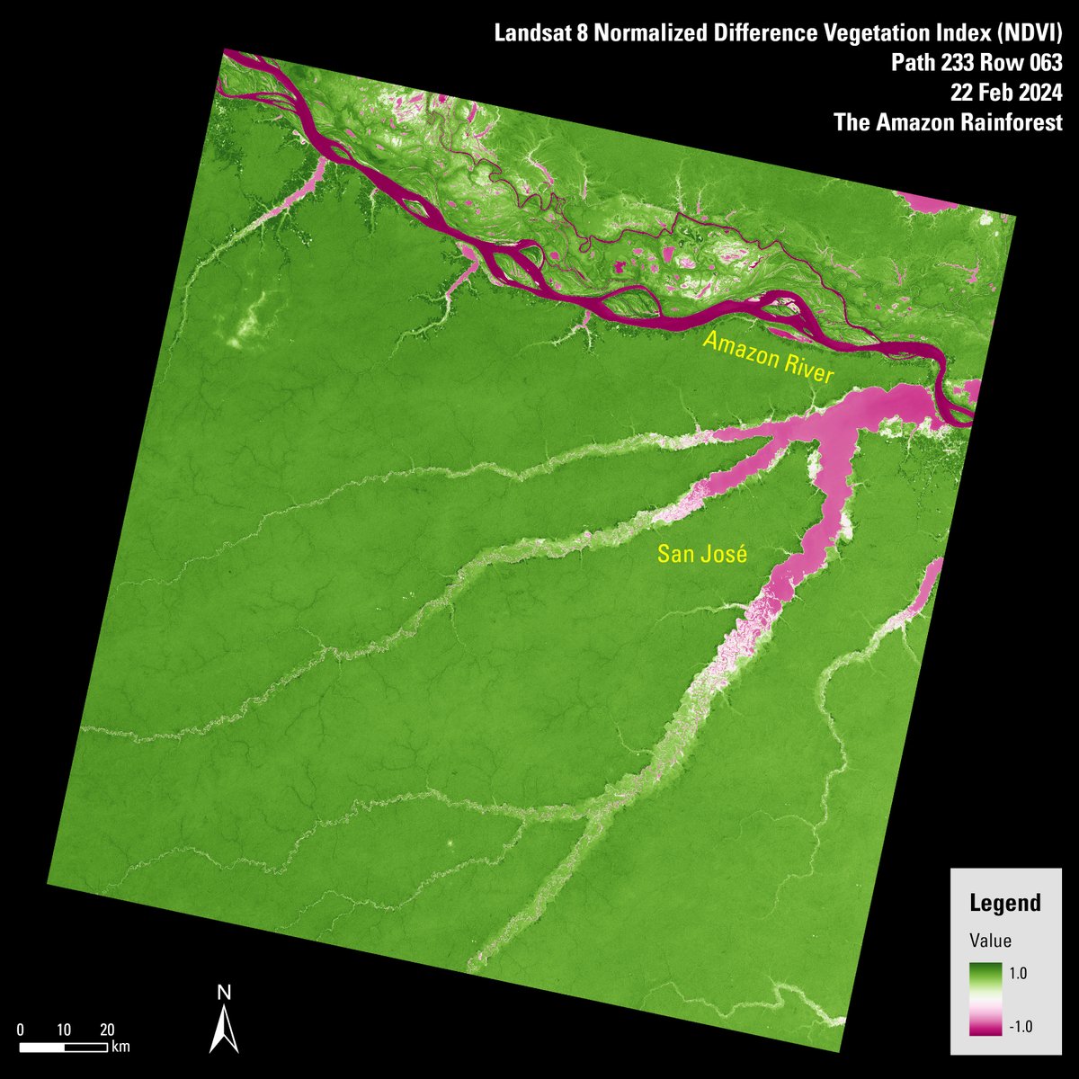
In honor of International Day of Forests, here are two Normalized Difference Vegetation Index (NDVI) Landsat scenes of two different rainforests: The amazon rainforest and the Congo rainforest. Learn more about NDVI Landsat scenes: ow.ly/JYoY50QZ2W0
#ForestDay #Landsat

8
37
2,716
MQ GIS Lectures retweeted

4 Mar 2024
Get ready to meet @CopernicusEU ROSE-L 🛰️
"It's a bit like a car, which at the same time should be small, provide a lot of space and go fast, but with little fuel consumption."
Rose-L, the Copernicus L-band Synthetic Aperture Radar, will help monitor geohazards, flying the same orbit of #Sentinel1.
🎥 Full video premiere this Thursday at 16 CET on @esa YouTube: youtu.be/DqgEYCeXaEI?si=ulhg…
1
36
115
9,620
MQ GIS Lectures retweeted

22 Feb 2024
Evolving barrier islands off the coast of Mississippi and Alabama protect the mainland from the Gulf of Mexico’s waves and weather. 🌊
#Landsat captured these images showing the change in these islands from Nov. 29, 2000 to Dec. 31, 2023.
go.nasa.gov/49jRi7n
9
20
2,139
MQ GIS Lectures retweeted

21 Feb 2024
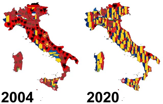
Largest minority group by province in Italy: 2004 vs 2020.
From Albanian predominance to a Romanian one.
8
34
355
84,691
MQ GIS Lectures retweeted
3 Jun 2022
According to the @WMO #StateOfClimate report, in 2021, global mean sea level reached a new record high 🌊
The Maldives are particularly vulnerable to this because most of their land stands less than 1 m above average sea level public.wmo.int/en/our-mandat…
🛰️: @CopernicusEU #Sentinel2
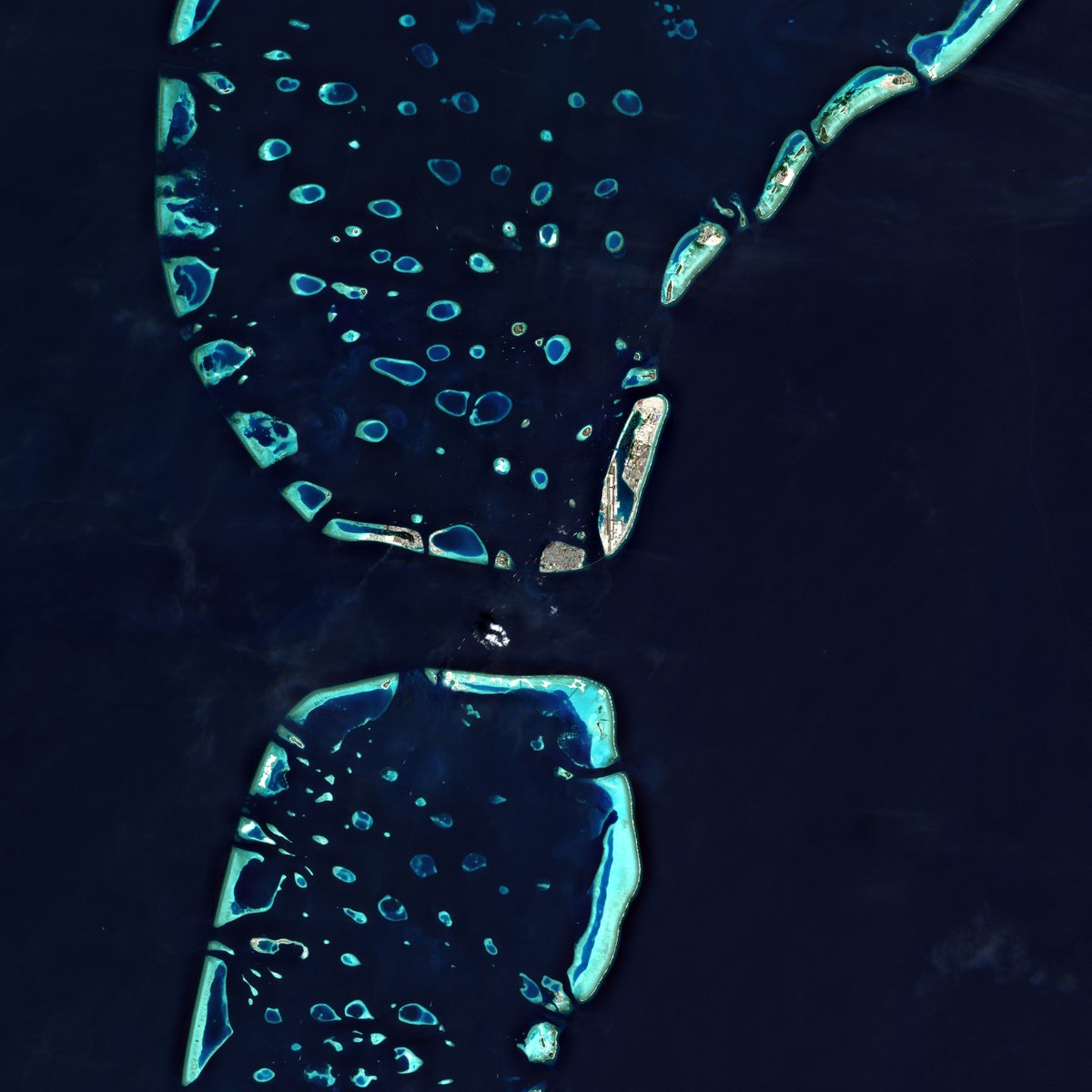
ALT Space image of the Maldives
10
33

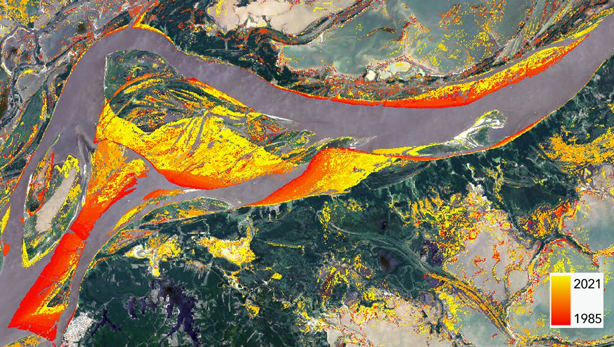
By compiling more than 30 years of Landsat data we can see how the Amazon River continually reshapes the landscape. This map shows where raster pixels changed from land to water between 1985-2021 and when they changed based on the red-yellow color ramp. esri.social/uHCI50JnMrf
1
14
56
MQ GIS Lectures retweeted
2 Jun 2022
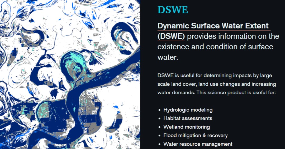
Do you remotely study rivers, lakes, or wetlands? The Dynamic Surface Water Extent (DSWE) product might be perfect for you! DSWE provides information about the existence of surface water in Landsat data. 🛰️🌊
Learn more with this interactive Storymap! ow.ly/TOo250JnEh3
1
25
87
MQ GIS Lectures retweeted
27 May 2022
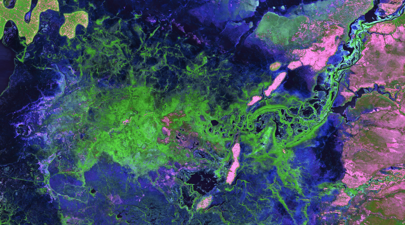
17 rivers flow into the Bangweulu Wetlands in Zambia, but only one drains out. Green tendrils randomly sweep through the image, a landscape dominated by various grasslands, open water, and dense Papyrus grass and Phragmites reeds.
2
9
MQ GIS Lectures retweeted

17 Apr 2022
With this #Easter egg 🐣 🥚, featuring a partial #Copernicus #Sentinel1 🇪🇺🛰️mosaic of the #EU, we wish a Happy #Easter to all our friends, colleagues, partners, users and followers who celebrate!

3
56
209
MQ GIS Lectures retweeted
17 Apr 2022
This beautiful view is brought to you by the @CopernicusEU #Sentinel2 B satellite. This is Alaska’s Columbia Glacier, one of the most rapidly changing glaciers in the world. You can explore the image in more detail: esa.int/ESA_Multimedia/Image…
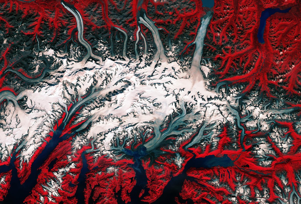
ALT Columbia Glacier
14
72
MQ GIS Lectures retweeted
6 Apr 2022
There are many cool places to learn about #EarthObservation, but the single place where you can learn the most is... the next #LivingPlanet Symposium #LPS22 😉
👉 Register now and secure yourself a seat at the Earth Observation event of the year: lps22.esa.int/frontend/index…
9
24
31 Mar 2022
Webinar on partnerships for Earth Observation - Spatial Source spatialsource.com.au/webinar…
MQ GIS Lectures retweeted
14 Mar 2022
This is #Dubai through the years. By processing 7 million images from the @USGSLandsat satellite, collected between 1985 and 2015, you can see how much this 🏙️has grown.
Read more on how we're mapping the human footprint from space: esa.int/Applications/Observi…
11
34
MQ GIS Lectures retweeted
12 Mar 2022
The @CopernicusEU #Sentinel2 mission takes us to the Atacama desert🏜️
At the top of the image, we can see part of #Chile's largest salt flat, the Salar de Atacama. The bright turquoise rectangles and squares visible along the top part of the image are evaporation ponds.
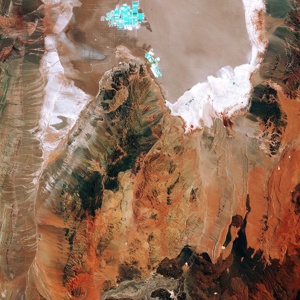
ALT Chile's salt flat
6
36
147
MQ GIS Lectures retweeted
13 Mar 2022
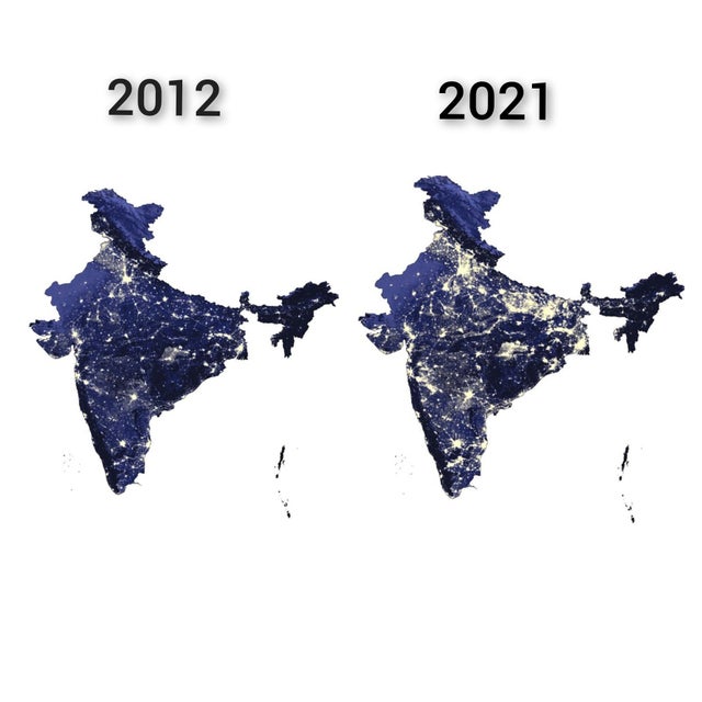
India Nightime Luminosity comparison 2012 vs 2021. Source - Economic Survey of India 2022
72
728
5,487
MQ GIS Lectures retweeted

28 Feb 2022
In-flight, bore-sight, fully-fused visible-shortwave-infrared imaging spectrometer (400-2500 nm) and waveform lidar scan over #Hawaii. #GlobalAirborneObservatory of @asnerlab of @ASU_GDCS of @asuglobalfuture
5
18
117

Did you know? Severe droughts have dramatic consequences on forests.
To better understand the threat, ALAB researchers ventured into the California Sierra Nevada, armed with #remotesensing, to assess the forest’s vulnerability to drought. gdcs.asu.edu/publications

3
16