
Jun 13
Check out the ATE funded GeoTech Center based in Louisville, Kentucky! This center works to develop geospatial curriculum materials and resources to increase the number of geospatial technicians in the field. geotechcenter.org/ #ATE #Geospatialtechnology
8

Measuring an Entire Site by Walking 😎
Site measurement is becoming faster and simpler with digital technologies. Instead of complex equipment and long processes.
#3DScanning #DigitalSurvey #SiteMapping #GeospatialTechnology #ConstructionTech

Registration link: studyhacksgeospatial.com/pro…
For Registration, contact this Email: rmijanur10266@gmail.com
Or WhatsApp 24/7: wa.me/ 8801780942798
#googleearthengine #QGIS #ArcGISPro #remotesensing #GIS #training #GeospatialTechnology

2
88

Jun 11
Mumbai SRA Floats Tender For High-Resolution Satellite Imagery To Strengthen Slum Monitoring And Track Unauthorised Development
#Mumbai #SRA #SatelliteImagery #UrbanPlanning #SlumRehabilitation #GeospatialTechnology #MumbaiDevelopment
freepressjournal.in/mumbai/m…
69

Jun 11
بين الواقع الميداني والبيئة الرقمية، تسهم التقنيات الجيومكانية في إنشاء نماذج ثلاثية الأبعاد دقيقة تعزز كفاءة التخطيط وتدعم إدارة المعلومات العمرانية.
تقدم شركة القطر حلولاً متكاملة تجمع بين الرفع المساحي الأرضي والتصوير الجوي لإنتاج مخرجات رقمية وسحابات نقطية عالية الدقة تعكس المواقع والمرافق بموثوقية عالية، وتوفر للمهندسين والمخططين بيانات مكانية تدعم التحليل والمتابعة والتوثيق الهندسي.
وتسهم هذه الحلول في دعم مستهدفات التحول الرقمي وتطوير منظومات عمل أكثر كفاءة واعتمادًا على البيانات.
Between field reality and the digital environment, geospatial technologies enable the creation of accurate 3D models that enhance planning efficiency and support urban information management.
Alqotr provides integrated solutions that combine terrestrial surveying and aerial imaging to produce high-precision digital outputs and point clouds that accurately represent sites and facilities. These solutions provide engineers and planners with reliable spatial data to support analysis, monitoring, and engineering documentation.
These integrated solutions contribute to achieving digital transformation objectives and developing more efficient, data-driven operational systems.
#Alqotr #GeospatialTechnology #DigitalTransformation #GIS #SmartCities #3DModeling
1
87

Jun 10
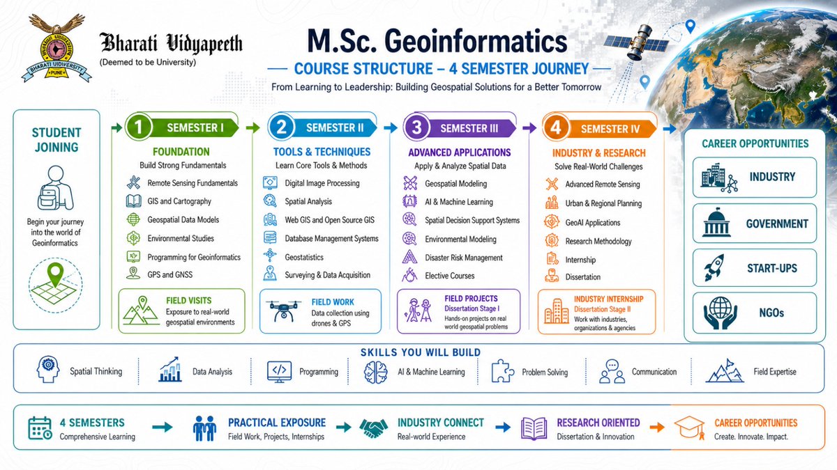
Map the World. Shape the Future.
Turn your passion for technology, data, and innovation into a rewarding career with M.Sc. Geoinformatics at Bharati Vidyapeeth's Institute of Environment Education & Research, Pune
Master GIS, Remote Sensing, GeoAI, and Spatial Analytics through hands-on learning, fieldwork, and industry exposure.
🌍 Learn. Analyze. Innovate. Lead.
📢 Admissions Open Now!
Apply Now - bvducet.bharatividyapeeth.ed…
#MSCGeoinformatics #Geoinformatics #GIS #RemoteSensing #GeoAI #SpatialAnalytics #BVIEER #BharatiVidyapeeth #AdmissionsOpen #GeospatialTechnology #FutureReady
21

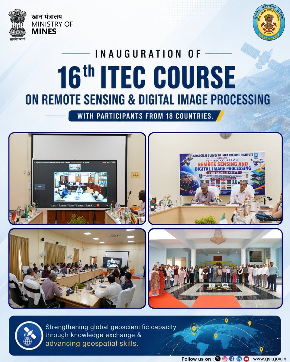
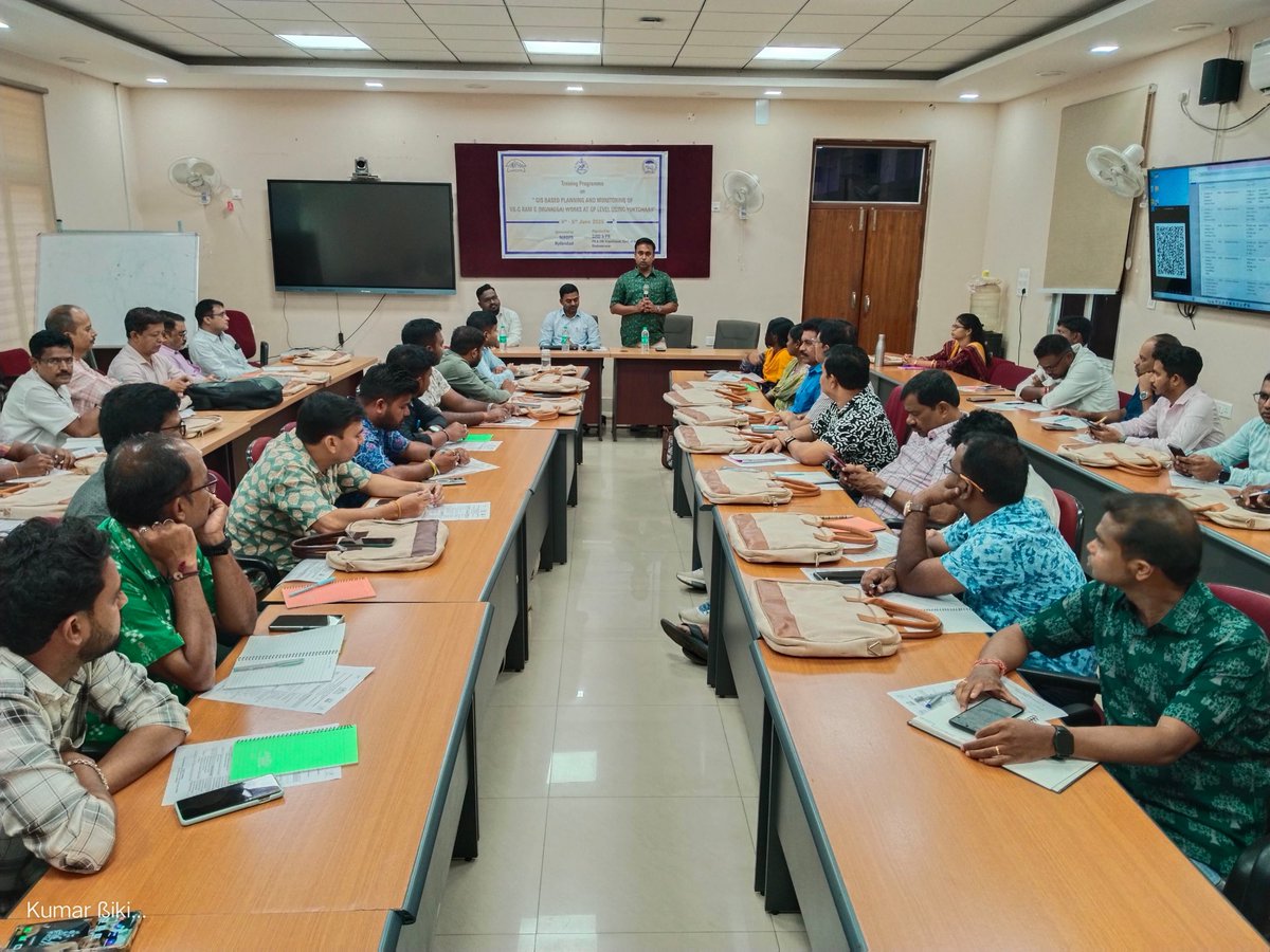
The 16th Course on “Remote Sensing and Digital Image Processing for Geoscientists” under the Indian Technical and Economic Cooperation (ITEC) Programme, was inaugurated at the GSI Training Institute, Hyderabad on 09 June 2026.
The inaugural session was chaired virtually by Shri Asit Saha, Director General, GSI, in the presence of Dr. S. Ravi, Dy DG & Head, Mission-V, Shri R. Balaji, Dy.DG (RTDs & FTCs), and senior officials of GSITI.
Sponsored by the Ministry of External Affairs, the programme brings together 20 geoscientists from 18 countries and aims to strengthen international cooperation, capacity building, and geospacial knowledge exchange across the globe.
#GeologicalSurveyOfIndia #GSI #GSITI #ITEC #MEAIndia #RemoteSensing #DigitalImageProcessing #GeospatialTechnology #CapacityBuilding #InternationalCooperation #Geoscience
@kishanreddybjp @satishdubeyy @MinesMinIndia @MEAIndia @IndianDiplomacy @ITECnetwork @BOIndiaOfficial @HCI_Suva @IndiainZimbabwe @IndiainTanzania @amb_tashkent @india_nigeria @IndEmbDushanbe @IndiainBolivia @EI_Baghdad @IndiainKenya @IndiainLiberia @India_in_Malawi @ihcdhaka @Indiainbhutan @IndiainPanama @eoidamascus @indiainzambia
11
396

Smart Physical Planning Starts with Smart Maps.
At JapakGIS, we leverage GIS and web mapping technologies to support modern estate planning and land development projects. Our interactive planning platform enables planners, developers, and stakeholders to visualize land parcels, infrastructure, road networks, utilities, and development opportunities in a single geospatial environment.
Key Benefits:
✔ Spatially-informed planning decisions
✔ Improved land-use management
✔ Infrastructure and utility planning
✔ Interactive web-based visualization
✔ Enhanced stakeholder engagement
By transforming location data into actionable insights, we help create well-planned, sustainable, and future-ready developments.
Explore the live platform:
japakgis.com/maps/estate-pla…
#GIS #PhysicalPlanning #UrbanPlanning #EstatePlanning #LandDevelopment #SmartCities #WebGIS #SpatialPlanning #DigitalTransformation #GeospatialTechnology #JapakGIS

2
1
12

Land Survey Equipment Market Size, Share & Growth Analysis 2034 | CAGR Outlook, Key Players & Regional Demand
To Know More :linkedin.com/pulse/land-surv…
#landsurveyequipment #geospatialtechnology #surveying #infrastructuredevelopment #mapping
6

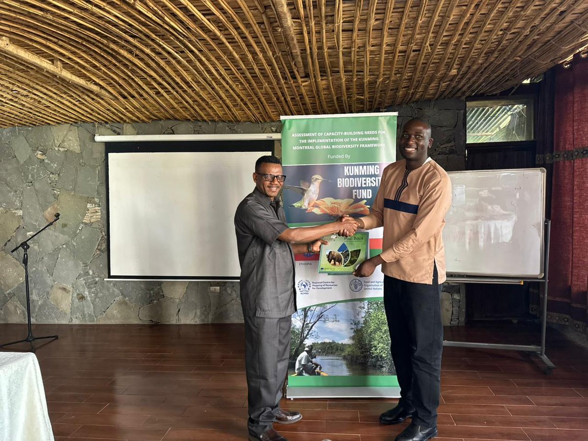
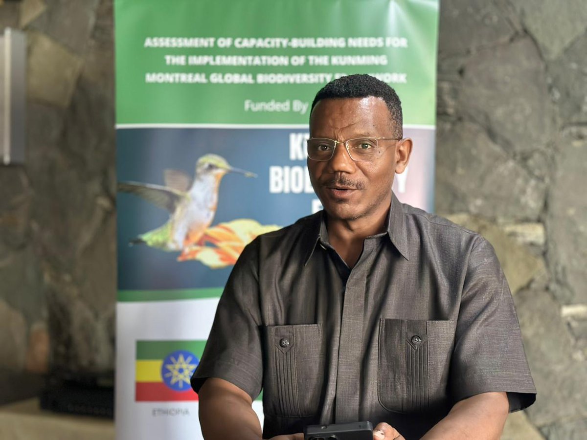
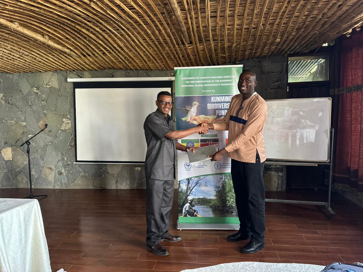
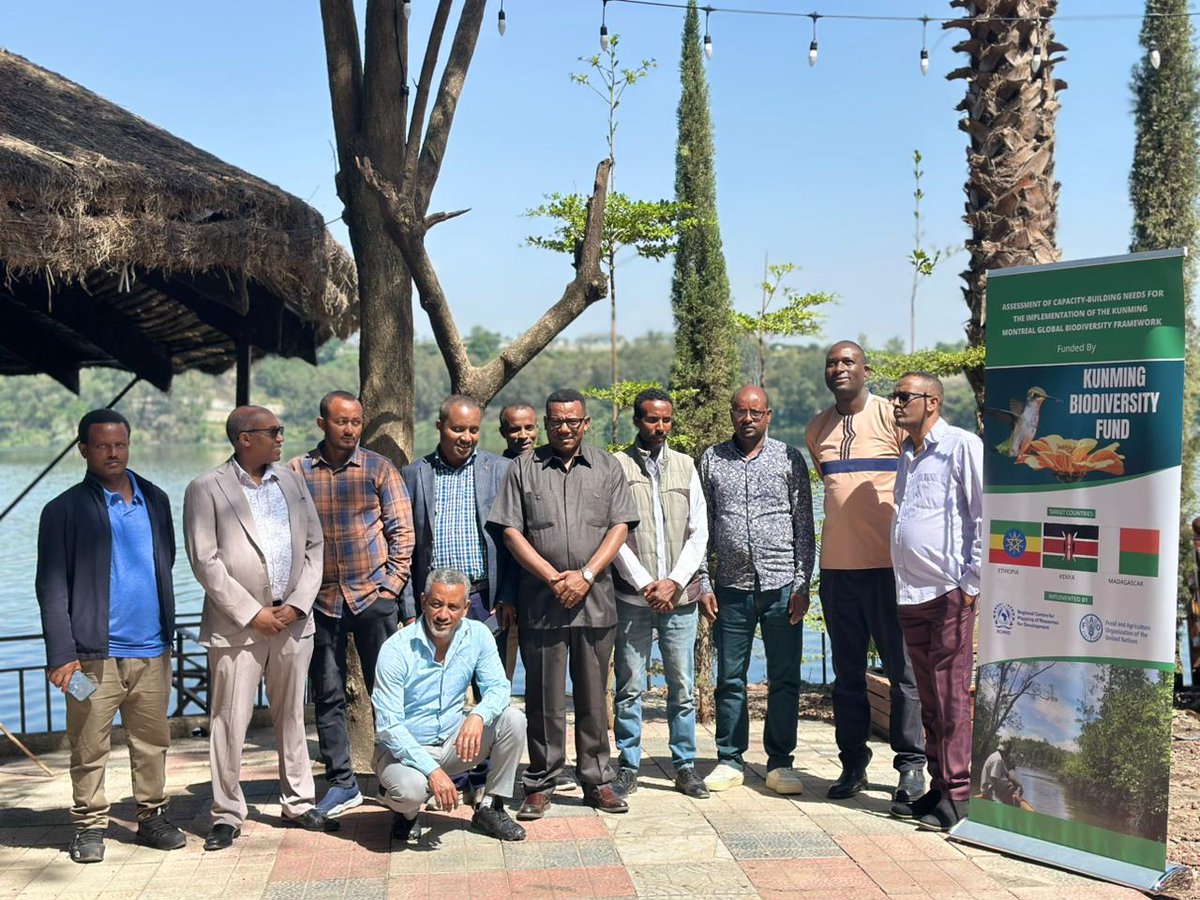
RCMRD is currently in Ethiopia conducting an assessment of capacity-building needs to support implementation of the Kunming-Montreal Global Biodiversity Framework and strengthen national biodiversity action.
The DG of the Ethiopia Biodiversity Institute, Dr. Karta Kaske Kalsa, welcomed the initiative and emphasized the importance of collaboration among RCMRD, the Kunming Biodiversity Fund, and FAO in advancing Ethiopia's NBSAPs and KMGBF targets. He also highlighted the critical role of GIS and geospatial technologies in biodiversity monitoring and reporting.
#Biodiversity #KMGBF #NBSAPs #GIS #GeospatialTechnology #CapacityBuilding #Conservation #Ethiopia #RCMRD #FAO #KunmingBiodiversityFund
1
2
170

June 8 is World Ocean Day, and it's a reminder that the oceans aren't just water. They're the heartbeat of our planet, covering over 70% of Earth's surface, producing half the oxygen we breathe, and regulating the climate we all depend on.
At AI Geo Navigators, our work with geospatial intelligence and AI gives us a front-row seat to how our planet is changing and the oceans tell us a lot. Rising sea levels, shifting currents, and coastal changes are not just environmental data points. They're stories the Earth is telling us, and technology helps us listen.
This World Ocean Day is a reminder of the deeper reason behind every project, every dataset, and every solution we build.
A healthier planet. For everyone. For always.
Because when the ocean is okay, we are okay.
What's one thing YOU are doing to protect our oceans? Drop it in the comments below let's inspire each other, because change starts with a single ripple.
@WorldOceansDay
@AIforGood
@CANIntl
@ZSP_ORG
@RedFoxGIS
@AiGeoNavigators
#WorldOceanDay #AIGeoNavigators #GeospatialTechnology #AIForGood #OceanDay2026 #ClimateAction #Sustainability #GIS #RemoteSensing #TechForEarth
1
37

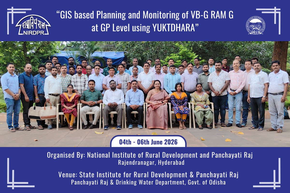
ସ୍ମାର୍ଟ ଡାଟା ସହ ସଶକ୍ତ ଗ୍ରାମୀଣ ଶାସନ!
ଭିବି-ଜି ରାମ ଜି ଯୋଜନାରେ ଅଧିକ ସ୍ୱଚ୍ଛତା ଓ ସ୍ଥାୟୀତ୍ୱ ଆଣିବା ଲକ୍ଷ୍ୟରେ NIRD&PR ଓ SIRD&PR ର ମିଳିତ ପ୍ରୟାସରେ ଆୟୋଜିତ “ଯୁକ୍ତଧାରା (Yuktdhara)” ଆଧାରିତ GIS ପ୍ରଶିକ୍ଷଣ ସଫଳତାର ସହ ସମାପ୍ତ ।
୪୫ ଜଣ PEO, GPDO ଓ JE ସାଟେଲାଇଟ୍ ମ୍ୟାପିଂ, ଜିଓ-ଟ୍ୟାଗିଂ, ରିମୋଟ୍ ସେନ୍ସିଂ ଏବଂ ଡାଟା-ଆଧାରିତ ପ୍ରକଳ୍ପ ପରିଚାଳନାରେ ପ୍ରଶିକ୍ଷିତ ହୋଇଛନ୍ତି। ଏହି ପଦକ୍ଷେପ ସରକାରୀ ପାଣ୍ଠିର ସଦୁପଯୋଗ, ଉନ୍ନତ ଯୋଜନା ପ୍ରସ୍ତୁତି ଓ ସ୍ଥାୟୀ ଗ୍ରାମୀଣ ବିକାଶକୁ ଆହୁରି ଗତିଶୀଳ କରିବ ।
ବିକଶିତ ଗାଁ, ବିକଶିତ ଓଡ଼ିଶା ଦିଗରେ ଆଉ ଏକ ଦୃଢ଼ ପଦକ୍ଷେପ।
#Odisha #GIS #Yuktdhara #GeospatialTechnology #RemoteSensing #RuralDevelopment #GoodGovernance #ViksitGaonViksitOdisha #SIRDPROdisha
@CMO_Odisha @RabiNaikBJP @IPR_Odisha @sird_pr_odisha

2
7
538

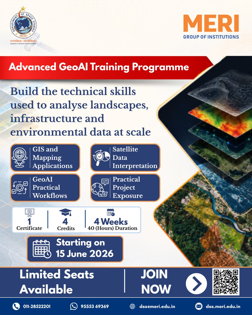
Join the Advanced GeoAI Training Programme and gain hands-on experience in GIS, Mapping Applications, Satellite Data Analysis, GeoAI Workflows, and Practical Projects.📅 Starts: 15 June 2026
Register Now: dss.meri.edu.in/advanced-geo…
#geoai #gismapping #geospatialtechnology @SIA_Ind
17

Jun 3
space ecosystem together.
#IndiaBhutan #SpaceCollaboration #NewSpace #INSPACe #SpaceTech #GeospatialTechnology @MEAIndia @IndianDiplomacy @IndiainBhutanCG @isro
3
340

May 25
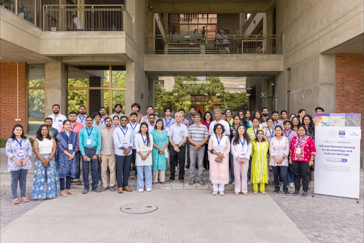
𝗚𝗹𝗶𝗺𝗽𝘀𝗲𝘀 𝗳𝗿𝗼𝗺 𝘁𝗵𝗲 𝟳-𝗗𝗮𝘆 𝗛𝗮𝗻𝗱𝘀-𝗼𝗻 𝗪𝗼𝗿𝗸𝘀𝗵𝗼𝗽 𝗼𝗻 “𝗚𝗜𝗦 𝗮𝗻𝗱 𝗥𝗲𝗺𝗼𝘁𝗲 𝗦𝗲𝗻𝘀𝗶𝗻𝗴 𝗳𝗼𝗿 𝗔𝗿𝗰𝗵𝗮𝗲𝗼𝗹𝗼𝗴𝘆 𝗮𝗻𝗱 𝗖𝘂𝗹𝘁𝘂𝗿𝗮𝗹 𝗛𝗲𝗿𝗶𝘁𝗮𝗴𝗲” at 𝗜𝗜𝗧𝗚𝗡.
The workshop featured hands-on sessions on GIS applications, archaeological mapping, satellite imagery interpretation, spatial analysis, and heritage site documentation, bringing together participants from diverse institutions and disciplines.
#IITGN #IITGNResearch #GIS #RemoteSensing #Archaeology #CulturalHeritage #GeospatialTechnology #Workshop
1
1
8
558
May 22
𝗜𝗜𝗧𝗚𝗡 inaugurated the 𝟳-𝗗𝗮𝘆 𝗛𝗮𝗻𝗱𝘀-𝗼𝗻 𝗪𝗼𝗿𝗸𝘀𝗵𝗼𝗽 𝗼𝗻 “𝗚𝗜𝗦 𝗮𝗻𝗱 𝗥𝗲𝗺𝗼𝘁𝗲 𝗦𝗲𝗻𝘀𝗶𝗻𝗴 𝗳𝗼𝗿 𝗔𝗿𝗰𝗵𝗮𝗲𝗼𝗹𝗼𝗴𝘆 𝗮𝗻𝗱 𝗖𝘂𝗹𝘁𝘂𝗿𝗮𝗹 𝗛𝗲𝗿𝗶𝘁𝗮𝗴𝗲” on May 21, 2026.
The workshop brings together participants from various institutions for hands-on training in GIS and Remote Sensing applications, including spatial analysis, archaeological mapping, satellite imagery interpretation, and heritage site documentation.
The programme aims to strengthen interdisciplinary learning and promote the use of advanced geospatial technologies in archaeology and cultural heritage research.
#IITGN #IITGNResearch #GIS #RemoteSensing #Archaeology #CulturalHeritage #GeospatialTechnology #Workshop


2
209

Working on a Python automated workflow for GeoHydro-AI: Integrated Groundwater Potential Mapping Using Lineament, Drainage, Remote Sensing, Geostatistics, GWR and Machine Learning.
#GeospatialTechnology
#PythonAutomation @GIS


1
1
7
77

May 18
Happy new week!
@gistechke guides you in matters Geospatial Information Systems (GIS),Remote Sensing, Geo-Intelligent Digital Data Solutions!🌍
Contact us!📩
#GIS #RemoteSensing #Geospatialtechnology #EarthObservation #Africa #GeoAI #gistechke

ALT GistechKE new week Post
3
95
Classification of the VHI values in terms of drought Monitoring using Google Earth Engine.Tutorial link: youtube.com/live/1nX4MkrTRj0…
#remotesensing #googleearthengine #GIS #geospatial #geospatialtechnology
1
17
820

May 5
Survey of India enables a deeper understanding of terrain through accurate representation of elevation using contours in topographical maps.
Contours provide valuable insights into landforms, slopes, and surface characteristics, helping users interpret whether the terrain is flat, undulating, or steep.
With consistent contour intervals and well-defined characteristics, these maps support engineering projects, route planning, watershed analysis, and infrastructure development across the nation.
@DrJitendraSingh @karandi65 @IndiaDST
#SurveyOfIndia #GeospatialIndia #ContourMapping #TopographicMapping #TerrainAnalysis
[GeospatialTechnology, SurveyingScience, ContourLines, DigitalCartography, SpatialDataInfrastructure, DroneMapping, GNSSSurvey, RemoteSensingData, InfrastructurePlanning, MappingIndia]
2
8
169