

ALT The map depicts India's claim line (Source: SOI) in red and China's claim area in shaded regions. Satellite observed Infrastructure developments suggests probable access exist to Chinese up to its claimed boundary in this disputed region.

ALT Processed satellite image showcasing the distinct characteristics of land features. Beyond interpretation, such imagery enables meaningful quantitative analysis. 📷 Courtesy: Satellogic via Dhruva Space Imagery Services. Map prepared by Takshashila Institution.

ALT Zone A is the location of the new border settlement


ALT 3D view of the border settlement. Image courtesy - Satellogic, Via Dhruva Space Imagery Services.
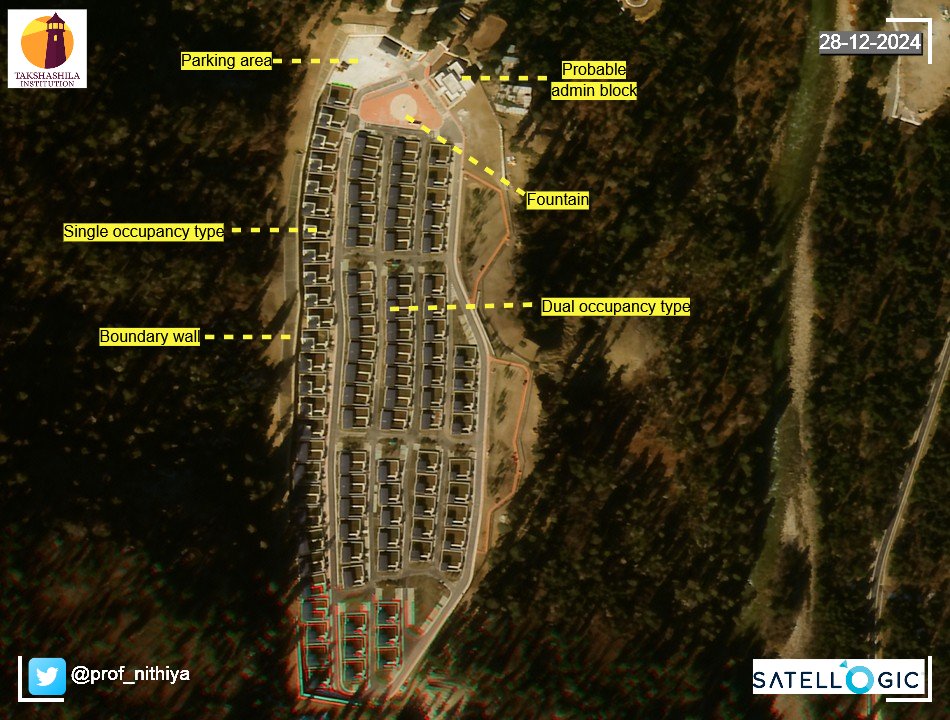
ALT Closer view of the new settlement

ALT November 2023, under construction stage

ALT 3D Closer view of the new unknown settlement; Sites with similar land cover (available for exploitation) and reference to other key features. Image credit : Sentinel, ESA