
4 Feb 2025
The Truth About the Shadow Stick Method for Navigation
#WildernessNavigation #SurvivalSkills #SunPosition #OutdoorEducation #EssentialNavigation #PioneerWisdom #ShadowAnalysis #NatureSkills #LearnWithUs #SurvivalTips
2
86

2 Feb 2025
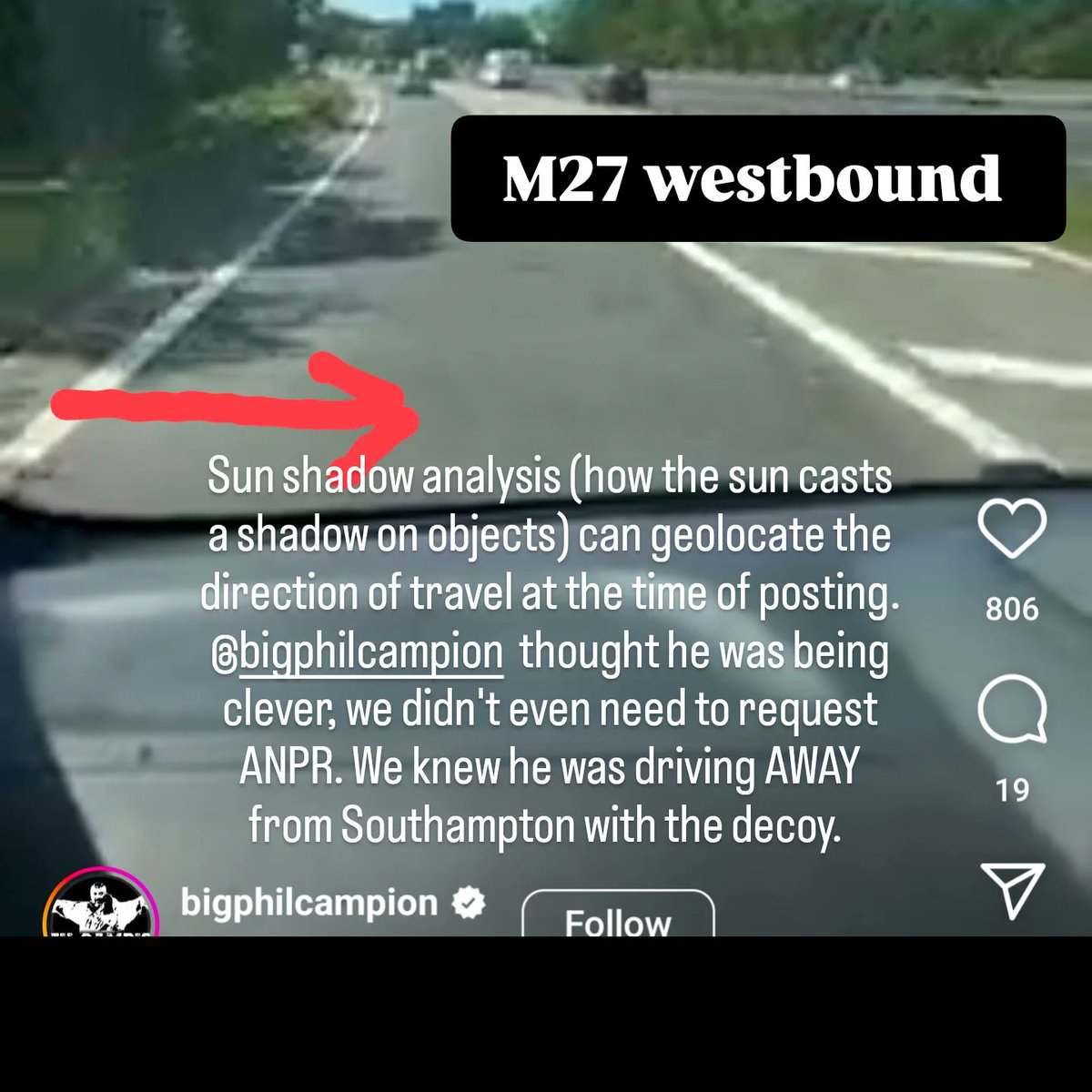
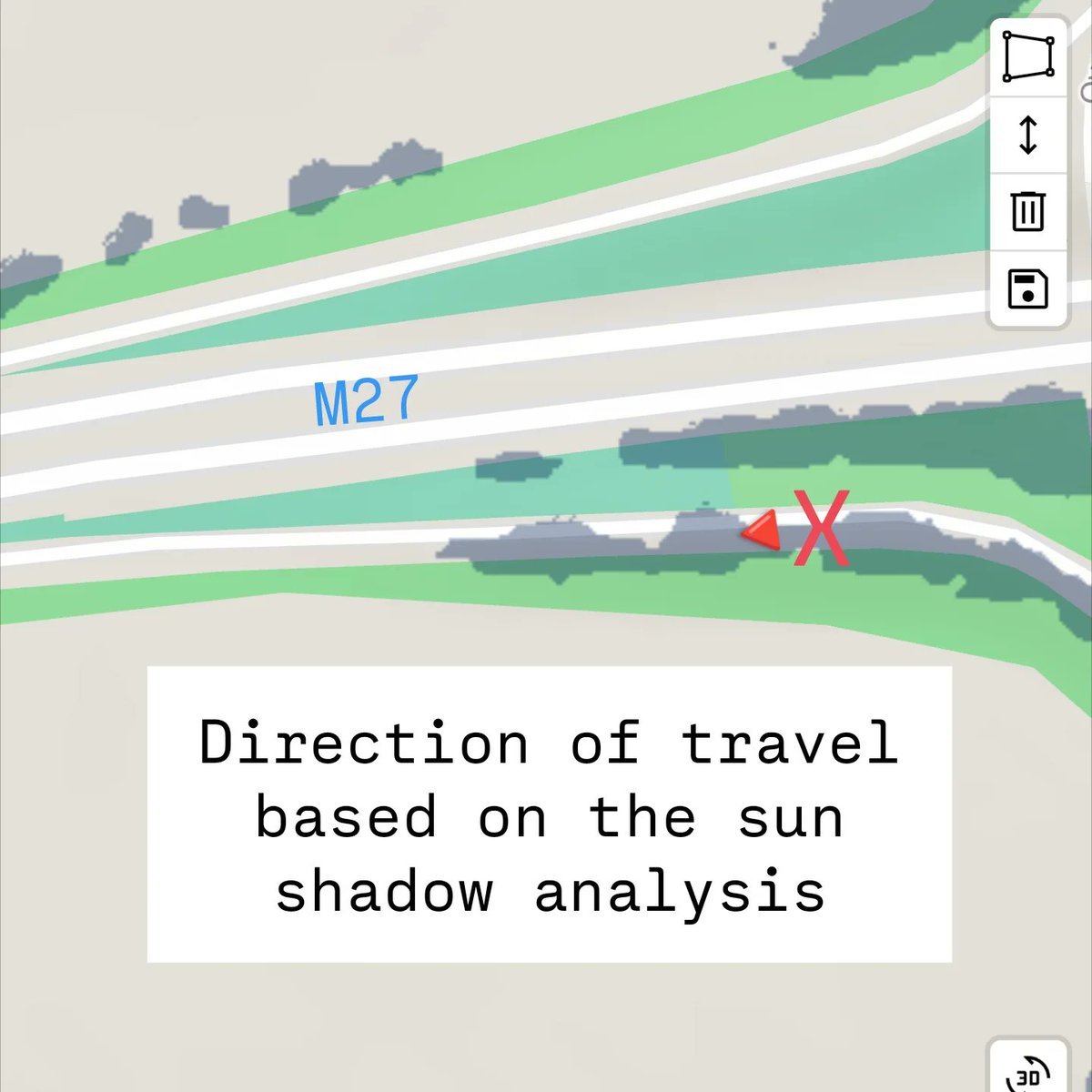
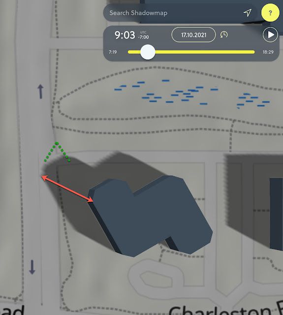
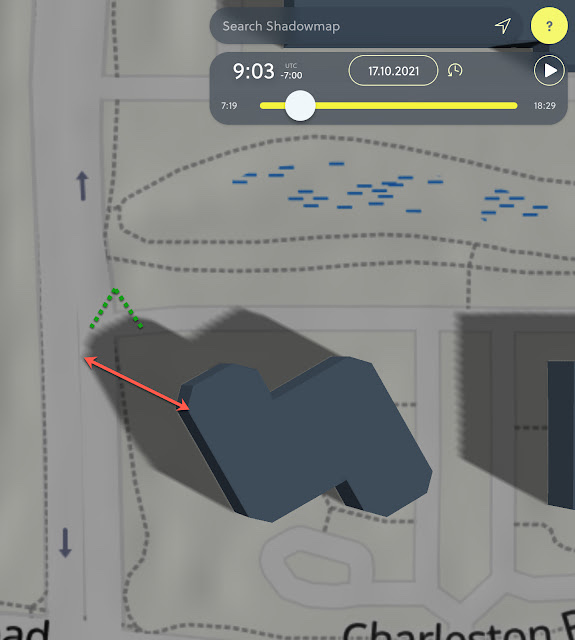
☀️Geolocation is a fundamental component of sun shadow analysis, enabling accurate calculations of the sun's position and realistic simulations of shadows for any given location and time. It can add value to any image, indicating the direction of travel or the time of the image or video. ☀️
One of my favorite shadow analysis tools is Shade Map as it's free @shademap
Sorry @bigphilcampion and @SimonMcCoyTV you didn't fool us this time!
#OSINT
#geolocation
#shadowanalysis
#celebrityhunted
shademap.app/@51.5667,-1.198…
2
3
778

15 Jul 2024
How can you optimize your design for all seasons using Snaptrude?
In part one of this two-part series, we explore Snaptrude's sunpath and shadow analysis tools to ensure your project is comfortable year-round. See how adjusting terraces can improve your building's performance in different conditions.
Stay tuned for the next video where we dive deeper into the sunpath feature on Snaptrude.
#Snaptrude #Architecture #SunpathAnalysis #ShadowAnalysis #DesignOptimization
2
134

20 Mar 2024
We are happy to introduce the improved Shadow Colour area calculator!
It's fast, easy, and produces your report directly onto your sheets.
Try out Shadow Colour:
agileform.ca/products/shadow…
#shadowstudy #siteplanning #shadowanalysis #revit
2
76

22 Dec 2023
Neden ifşa etmiyorsunuz? Sacro,kamanli,london union,shadowanalysis....bunların hepsi ceza aldı sanırım..
5
324

2 Nov 2021
[#OSINT|#SHADOWANALYSIS] SearchReSearch: Answer (3): Can you get the time and date from a shadow? (by Daniel Russell):
searchresearch1.blogspot.com…
#imint #imageanalysis
2
10
20 Oct 2021
[#OSINT|#SHADOWANALYSIS] SearchReSearch: Answer (3): Can you get the time and date from a shadow? (by Daniel Russell):
searchresearch1.blogspot.com…
#imint #imageanalysis
3
8
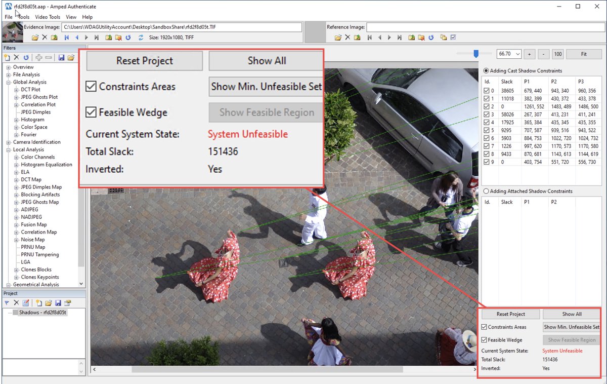
21 Jun 2021
[#OSINT|#SHADOWANALYSIS] How To Detect Tampered Images On Social Media Via Shadows Analysis [with Amped Autheticate] (by @ForensicFocus [note that Amped Software is a partner of Forensic Focus]) :
forensicfocus.com/articles/h…
#imageanalysis #forensics #eforensics
2
2

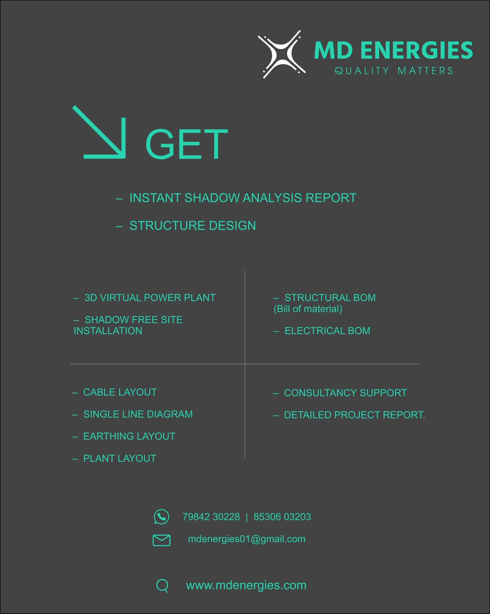
26 May 2020
#solardesigning
#mdenergies provides::
For Residential #suryagujaratyojna
-- Shadow analysis report
-- Structure design
For commercial projects.
-- Complete detailed drawing.
-- EPC work.
#shadowanalysis #structuredesign
Make #greenworld Using #solarenergy
1
2

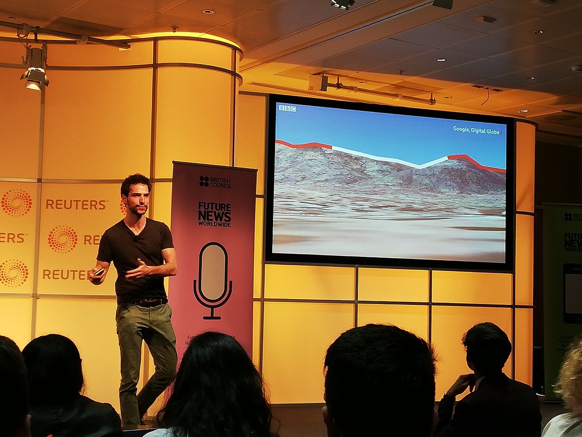
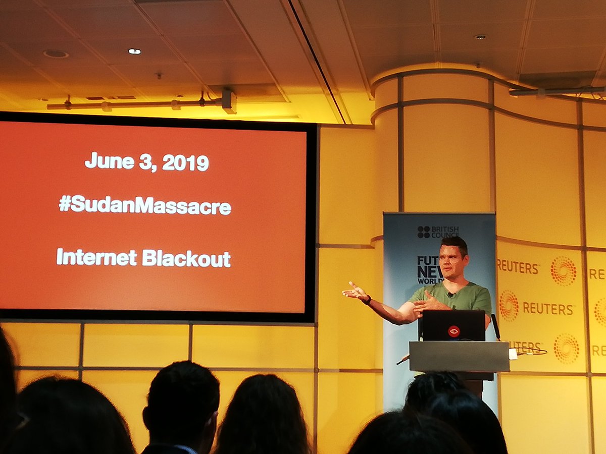
17 Jul 2019
So exciting and fun to hear from the guys from Africa Eye!! 😍😍
Wow #FNW19
#opensourceinvestigations
#Trigonometry
#Shadowanalysis
#geolocation
@BBCAfrica
#AfricaEyeBBC
4

14 Nov 2018
A Game of #Shadows #Supertall towers and their effect on #CentralPark. A bold idea about #solarimpact goo.gl/AtBrMU #solarradiation #GISday @ESRI @Carto #cartography @NYCPlanning #OpenData #shadowanalysis @masnyc @galeabrewer #dataviz #NYCOpenData #GIS
3


10 Aug 2016
ShadowAnalysis: How Being a Woman Can Impact Your Career Success shadowanalysis.blogspot.com/…
