
🇫🇷 Excited to be joining the official Victorian Government delegation at #VivaTech2026 in Paris 17–20 June.
Looking forward to showcasing how SKAND helps organisations unlock value from spatial data.
#Geospatial #SpatialData #DigitalTransformation #GlobalVictoria

7

Precision nutrient management requires precision data. How do we balance crop nutrition with environmental safety in drylands? New high-resolution phosphorus mapping across China’s arid zones provides solutions: ow.ly/bxcj50Z7ims
#SpatialData #SoilMapping

79

Precision nutrient management requires precision data. How do we balance crop nutrition with environmental safety in drylands? New high-resolution phosphorus mapping across China’s arid zones provides solutions: ow.ly/wwWW50Z7ii1
#SpatialData #SoilMapping

4
7
348

Jun 11
His decision to join reflects his commitment to advancing geospatial innovation and data-driven decision-making.
We are delighted to welcome Onyedikachi to our vibrant community of professionals and innovators.
#ProfessionalMembership #GIScience #GeoAI #SpatialData
1
17

Spatial data is no longer a technical add-on. The new @Stantec appointment puts GIS and digital asset intelligence closer to client decisions.
#SpatialData #GeospatialAdvisory #Stantec #DigitalTwins #InfrastructurePlanning #GIS
insidewater.com.au/geospatia…
9

Jun 9
🚶🚗 What if your daily movement could earn rewards?
Commute, Travel, Meet friends.
Go wherever life takes you.
Every movement creates data.
Every place you visit adds value.
TINA transforms real-world movement and place activity into valuable spatial data for the Geo-DePIN ecosystem.
🎁 Move
📍 Contribute
💰 Earn
Curious how it works?🎥
Watch our latest guide and discover how TINA rewards everyday movement 👇
youtube.com/watch?v=DUG7FSkD…
🚶🚗 일상의 이동이 보상이 된다면?
출퇴근, 여행, 친구와의 약속
우리가 매일 하는 이동과 방문이
가치 있는 데이터가 될 수 있습니다.
TINA는 실제 이동과 장소 활동을
Geo-DePIN 생태계의 공간 데이터로 전환하고,
참여자에게 리워드를 제공합니다.
🎁 이동하고
📍 데이터에 기여하고
💰 보상받고
어떻게 가능한지 궁금하신가요?
🎥 최신 가이드 영상에서 TINA의 주행 리워드 기능을 확인해보세요 👇
youtube.com/watch?v=DUG7FSkD…
#TINA #GeoDePIN #DePIN #MoveToEarn #DriveToEarn #Web3 #Solana #SpatialData
1
10
731

Jun 8
البيانات الدقيقة ليست مجرد معلومات، بل هي أساس التخطيط الذكي والتنمية المستدامة.
ومن خلال تقنيات التصوير الجوي المتقدمة، تقدم شركة القطر حلولاً جيومكانية متكاملة توفر رؤية دقيقة وحديثة للمدن والمشروعات، عبر إنتاج بيانات مكانية عالية الاعتمادية تعكس الواقع كما هو، وتدعم عمليات التحليل والتخطيط وصناعة القرار بكفاءة استثنائية.
وتُمكّن هذه الحلول الجهات الحكومية والخاصة من مراقبة التغيرات المكانية، وتعزيز جودة المعلومات الجغرافية، ورفع كفاءة إدارة المشروعات والأصول، بما يسهم في بناء مدن أكثر ذكاءً واستدامة، واتخاذ قرارات قائمة على بيانات دقيقة ورؤية مستقبلية.
Accurate data is not merely information; it is the foundation of smart planning and sustainable development.
Through advanced aerial imaging technologies, Alqotr Company delivers integrated geospatial solutions that provide an accurate and up-to-date view of cities and projects by producing highly reliable spatial data that reflects reality as it is, while supporting analysis, planning, and decision-making processes with exceptional efficiency.
These solutions enable both public and private sector entities to monitor spatial changes, enhance the quality of geographic information, and improve the efficiency of project and asset management. This contributes to building smarter and more sustainable cities while supporting decisions based on accurate data and a forward-looking vision.
#Alqotr_Company #Geospatial #GIS #AerialSurvey #Photogrammetry #RemoteSensing #SmartCities #SpatialData #UrbanPlanning #DigitalTransformation

112
Jun 8
📢 TINA × INAVI SYSYEMS
TINA has signed a POI data supply agreement with INAVI SYSYEMS.
The POI data generated by the TINA network is now moving beyond collection and into real-world industry use.
Together, TINA and INAVI will also collaborate on data verification and quality assurance to build a more reliable spatial data infrastructure.
🌍 Real Users
📍 Real Data
⚡ Real Utility
This is what Geo-DePIN looks like in the real world.
TINA가 아이나비시스템즈와 POI(Point of Interest) 데이터 공급 계약을 체결했습니다.
이번 계약을 통해 TINA 서비스에서 구축된
실제 공간 데이터(POI)가 아이나비에 공급될 예정입니다.
양사는 데이터 검수 및 품질 검증 과정에서도 협업을 진행하며,
보다 정확하고 신뢰도 높은 공간 데이터 구축 체계를 함께 고도화해 나갈 예정입니다.
이는 커뮤니티 기반으로 생성된 공간 데이터가
실제 산업에서 활용되는 Geo-DePIN 생태계 확장의 의미 있는 사례입니다.
Real Users → Real Data → Real Utility
TINA는 앞으로도
실제 활용 가능한 글로벌 공간 데이터 생태계 구축을 지속적으로 확대해 나가겠습니다 🌍
#TINA #INAVY #THINKWARE #INAVISYSTEMS #DataSupplyAgreement #StrategicPartnership #EnterprisePartnership #Commercialization #EnterpriseAdoption #RealWorldUtility #GeoDePIN #DePIN #SpatialData #LocationData #DataInfrastructure #POI #Web3 #Partnership

1
58
112
7,940

Urban Growth Monitoring using Remote Sensing || Urban Expansion Mapping in Google Earth Engine. Full tutorial link: youtu.be/kUHOLFnpMro?si=JrB3…
Registration link: studyhacksgeospatial.com/pro…
#googleearthengine #GIS #Geospatial #GeospatialAnalysis #SpatialData #EarthObservation
1
4
20
810

May 27
Your organisation has years of spatial data work sitting on computers, flash drives, and email attachments that your own team cannot find.
Every GIS team, research organisation, and government department we work with has the same problem: enormous quantities of valuable spatial data — shapefiles, rasters, CSVs, imagery — that should be organisational assets but are effectively inaccessible.
The shapefile from the 2020 household survey: on the project lead's old laptop.
The boundary layers from the infrastructure project: somewhere in a shared drive nobody can navigate.
The satellite imagery from three years ago: on a flash drive, location unknown.
The OrionSpatial Data Hub gives your team's spatial data a proper home.
→ Upload all your spatial files — shapefiles, CSVs, GeoTIFFs, WMS services
→ Organise in a structure your team can actually navigate
→ Share privately within your organisation — role-based access
→ Not everything is public. Private data provisions are fully built in.
→ Analyse, visualise, and create maps and reports directly in the platform
→ Connect to QGIS or ArcGIS via WFS — your team works in the tools they know
→ New field data from mobile apps lands here automatically
All free. Your internal data stays internal. You control who sees what.
How much spatial data does your organisation have that nobody can find?
Start Managing your data digitally today tor free
🔗 orionterrametrics.com
#OrionSDH #SpatialData #DataManagement #GIS #NGO #Research #Kenya #AfricaGIS

1
13
1,321

May 25
‘Spatial data. What is it
and why they are needed
Let's have a chat about spatial data.
Because they are the main product@vangrid_io.
But first we need to figure out what it actually is.
Let me explain using a simple example.
When you take photos of the street, it’s just
A picture. Flat. Lacking depth. Lacking context.
But spatial data is a different matter.
This is an accurate three-dimensional representation of the real world, namely, distances, heights, the movement of objects, terrain, obstacles.
Now try to imagine a sat-nav. Just
not for a car, but for a robot or a drone.
And this sat-nav is updated more than once a month,
every single second.
This is exactly the kind of data we need:
- autonomous vehicles,
- robots in manufacturing and logistics,
- military drones,
- researchers who train AI models.
And it is precisely this kind of data, in real time
collects and delivers in real time@vangrid_io.
This isn’t just a set of abstract figures.
It’s like fuel for physical AI.
Click the link and join us:
🔗 hub.vangrid.io/loyalty?refer…
#Vangrid #PhysicalAI #SpatialData

2
19

May 25
توقف عن إنشاء الخرائط يدويًا.
ابدأ بصناعة الخرائط بذكاء.
للمزيد من المعلومات: esrisaudi-ai.maps.arcgis.com…
#GIS #ArcGIS #ArtificialIntelligence #DeepLearning #MachineLearning #RemoteSensing #Geospatial #SpatialData #SmartCities


2
19
1,204

May 16
Part 2 of 3 in my short reflection series exploring GIS, geography education and modern geographical practice. robgeogchambers.substack.com… More than 25 years after entering teaching, GIS still feels inconsistently embedded within mainstream geography education — despite becoming increasingly central to geographical practice beyond schools.
#GIS #Geography #GeographyTeacher #Education #Curriculum #DigitalLiteracy #SpatialThinking #SpatialData #EdTech #GeographyEducation
5
430

Do you know that every community has spatial stories?
Who gathers the data? Who owns it? Who benefits from it?
GIS Forum II creates a platform for constructive discussions on geospatial data gathering & the role of spatial intelligence in development.
#GISForumII #SpatialData
1
2
52

Our advanced #GIS course will show you how to prepare and conduct spatial analysis on a variety of spatial data in R.
The course will be held online on 19-20 May 2026 with @NickBearmanUK.
Find out more and register: ncrm.ac.uk/training/show.php…
#SpatialData #Statistics

ALT Network of glowing location pins representing spatial data.
3
3
722
May 8
Africa's spatial data infrastructure shouldn't be this hard.
We're fixing it — one dataset at a time.
900 datasets in. Thousands more coming.
Create a free account 👇
orionterrametrics.com
#GIS #Africa #OpenData #Geospatial #AfricaTech #MadeInAfrica #Mapping #SpatialData
3
8
229

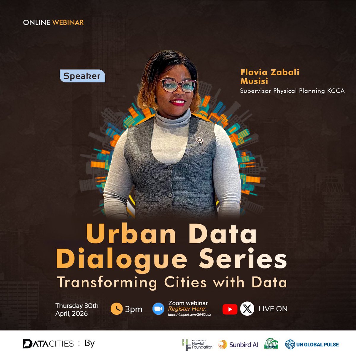
It’s today! 📍
Join us for Episode 2 of the Urban Data Dialogue Series — Boosting City Revenue & Service Delivery with Data.
🗓 30th April 2026
⏲️3:00 PM EAT
If you haven’t registered yet, there is still time. 👇
tinyurl.com/2fv82ydz
#UrbanDataDialogue #DataForGood #GIS #GeospatialData #SpatialData
2
4
138

Apr 30
🚨 Quick Reminder
Today at 3:00 PM, I’ll be joining @DataCitiesUg, @UNGlobalPulseUG, @ChristineKayon2, Prof. @iBaino & @johnstonebk for Episode 2 of the Urban Data Dialogue Series.
We’ll explore how data can transform city revenue collection and improve service delivery.
Bring your questions, experiences & ideas!
Register here 👉 tinyurl.com/2fv82ydz
#UrbanDataDialogue #DataForGood #SmartCities #GIS #GeospatialData #SpatialData
Apr 29

Excited to join @DataCitiesUg @UNGlobalPulseUG @ChristineKayon2, Prof. @iBaino and @johnstonebk as a panelist for Episode 2 of the Urban Data Dialogue Series tomorrow at 3:00 pm.
We’ll be diving deep into how data can transform city revenue collection and improve service delivery.
Special invitation to my social media team and all colleagues grappling with data challenges in revenue mobilization, this is your space!
Come with your questions, experiences, and ideas. Let’s learn together and find practical solutions.
Register now and save your spot 👉 tinyurl.com/2fv82ydz
#UrbanDataDialogue #DataForGood #RevenueCollection #SmartCities #GeospatialData #SpatialData #GIS
3
10
175
🚨Tomorrow is the day!
We are just 1 day away from the Urban Data Dialogue Series.
Be part of the conversation on how data is transforming city revenue & service delivery.
Save your spot 👉tinyurl.com/2fv82ydz
#UrbanDataDialogue #DataForGood #RevenueCollection #GeospatialData #SpatialData #GIS

2
6
110
Apr 29
Excited to join @DataCitiesUg @UNGlobalPulseUG @ChristineKayon2, Prof. @iBaino and @johnstonebk as a panelist for Episode 2 of the Urban Data Dialogue Series tomorrow at 3:00 pm.
We’ll be diving deep into how data can transform city revenue collection and improve service delivery.
Special invitation to my social media team and all colleagues grappling with data challenges in revenue mobilization, this is your space!
Come with your questions, experiences, and ideas. Let’s learn together and find practical solutions.
Register now and save your spot 👉 tinyurl.com/2fv82ydz
#UrbanDataDialogue #DataForGood #RevenueCollection #SmartCities #GeospatialData #SpatialData #GIS
1
5
15
376