
1 Nov 2025
📢 New map alert! ✨
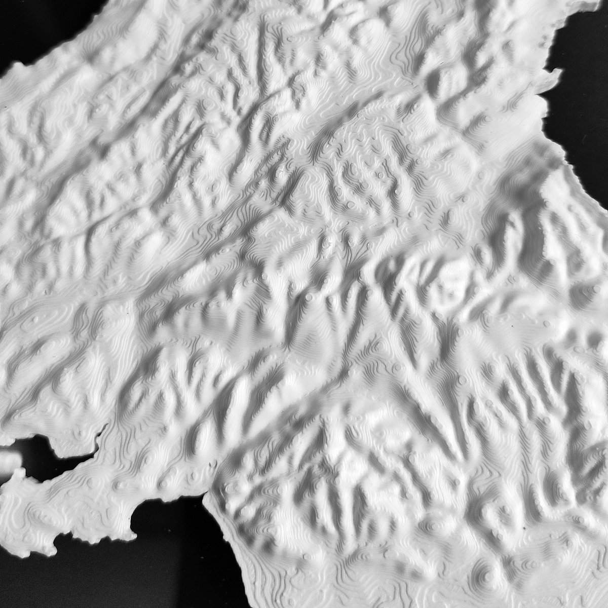
This week’s #1week1project📅💻 is a restored and stitched historical map of northern South America 🇪🇨🇨🇴🇻🇪🇬🇾
I took a scanned vintage map and turned them into a seamless, high-resolution composite with a 3D effect.
Let's open a 🧵👇🏼
#TopographicMap🗺️

2
12
31
8,693

8 Oct 2025
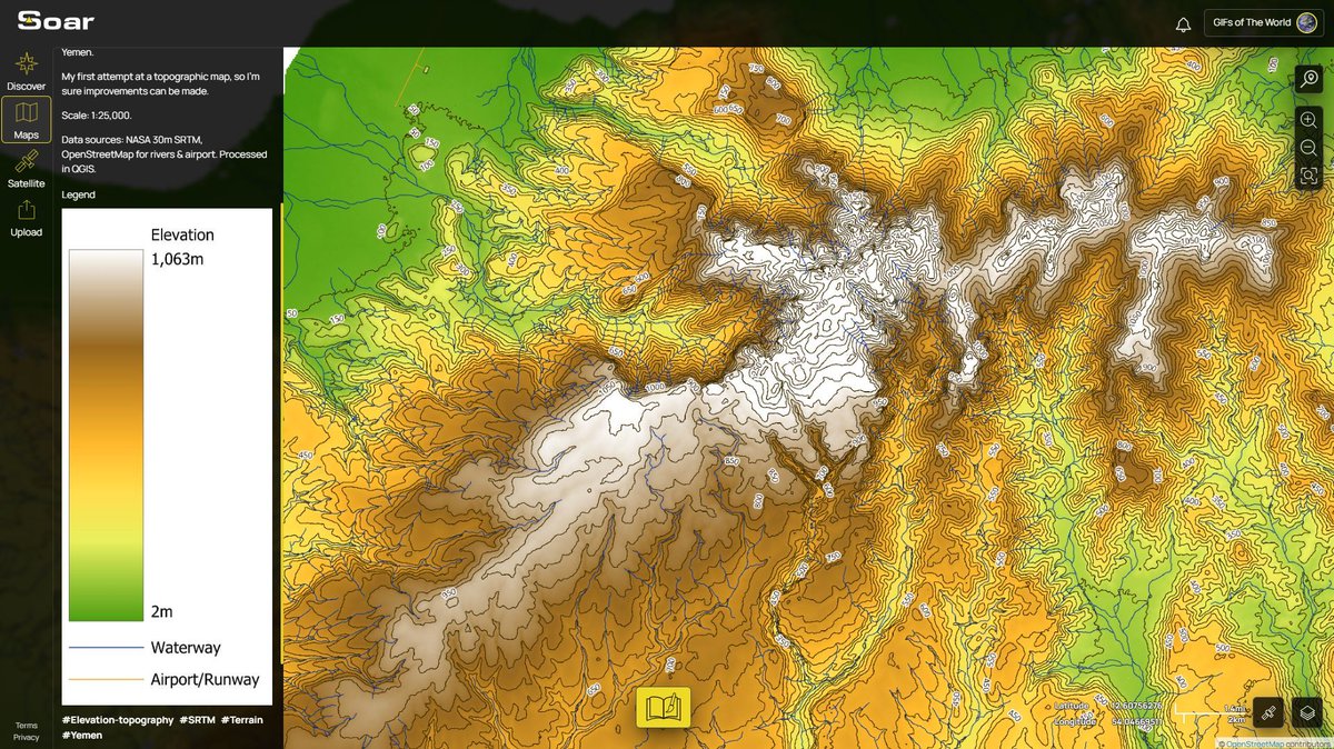
🗺️ Topographic Map of Socotra & Darsah, Yemen
A simple topo map, illustrating the sharp relief and coastal contours of one of the most geologically and biologically distinct islands on Earth.
Pan, zoom, and explore it here: soaratlas.com/maps/asia-topo…
#TopographicMap #Cartography #Socotra #Yemen
5
383

20 Sep 2025
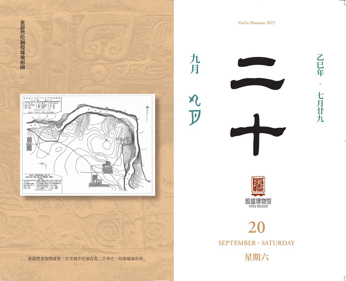
【Yinxu #Calendar】September 20th: 🗺️📐Zhang Weiran participated in the third excavation of Yinxu and drew the first 1:2,000 topographic map of the Yinxu site. 👨🔬
#YinxuMuseum #saturday
#YinxuExcavation
#TopographicMap
#ArchaeologyCartography
#ChineseArchaeology
3
44


5 May 2025
Kim I love you so fucking much you have no idea oh my god they try way too fucking hard its just corny I think I’m gonna consult my occult friend today and make her cast a spell that makes sure they are harmed in multiple ways
2
2
41


1 Mar 2025
Futuristic terrain map background gradient dark blue vector design template fit for cover, banner, header, backdrop
stock.adobe.com/uk/images/fu…
#blue #lineart #linedesign #linebackground #background #wallpaper #design #vector #template #topographic #map #topographicmap

2
293
1 Mar 2025
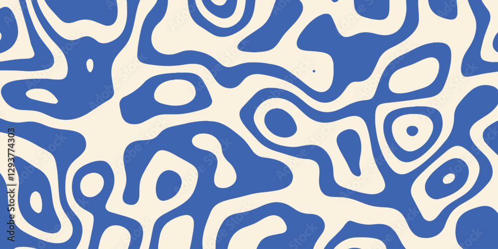
Groovy blue liquid background topographic terrain map vector design illustration seamless pattern
stock.adobe.com/uk/images/gr…
#blue #groovy #background #pattern #seamless #cover #liquid #terrainmap #topographicmap #topographic
2
99

30 Nov 2024
"Sleeping Beauty in Singapore" by Kitsune Kowai
Prints for sale!
kitsune-kowai.pixels.com/fea…
#sleepingbeauty #artforsalebyartist #artforsale #singapore #painting #topography #singaporeisland #pareidolia #topographicmap #map #kitsune #kitsunekowai #antwerpartist #antwerp #belgium
1
100
15 Nov 2024
"Pirate Map" by Kitsune Kowai
Watercolor and ink painting on an Old Topographic map (1958) of Rekem, Belgium
Prints for sale! kitsune-kowai.pixels.com/fea…
#piratemap #topographicmap #artforsale #watercolorpainting #kitsunekowai #antwerpartist #belgium🇧🇪
1
2
28

25 Sep 2024
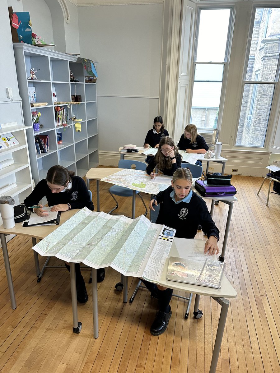
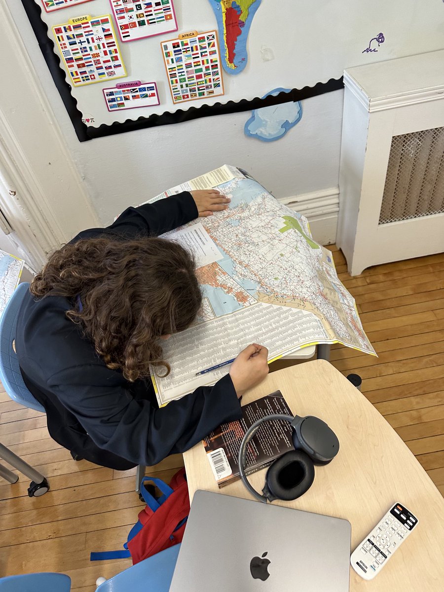
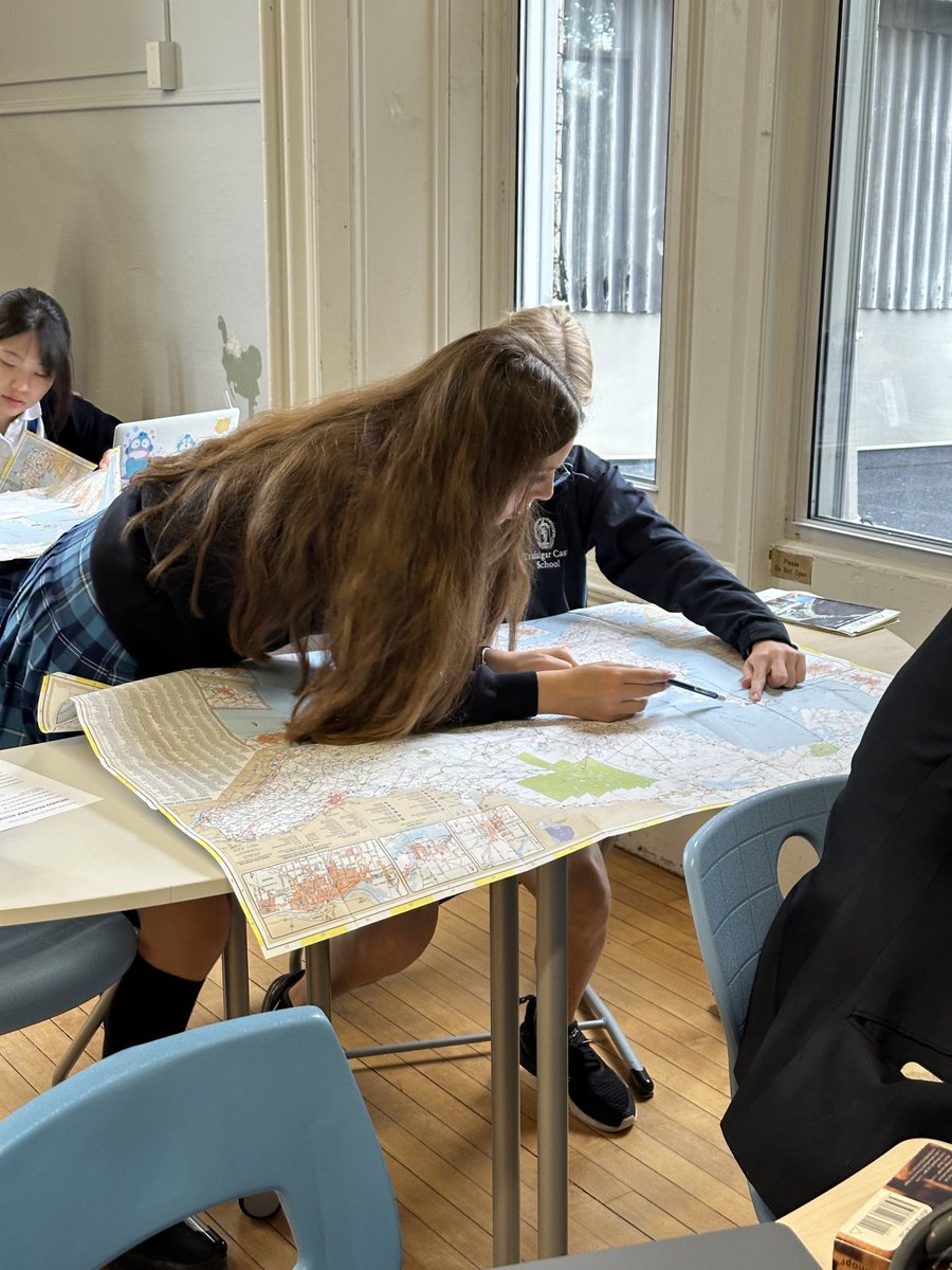
Always one of my favorite geo assignments!! Pulling out paper maps and getting the students to figure out routes, using an index, the legend etc!! #geography #lifeskills @trafalgarcastle #topographicmap #ontarioroadmap

1
2
128

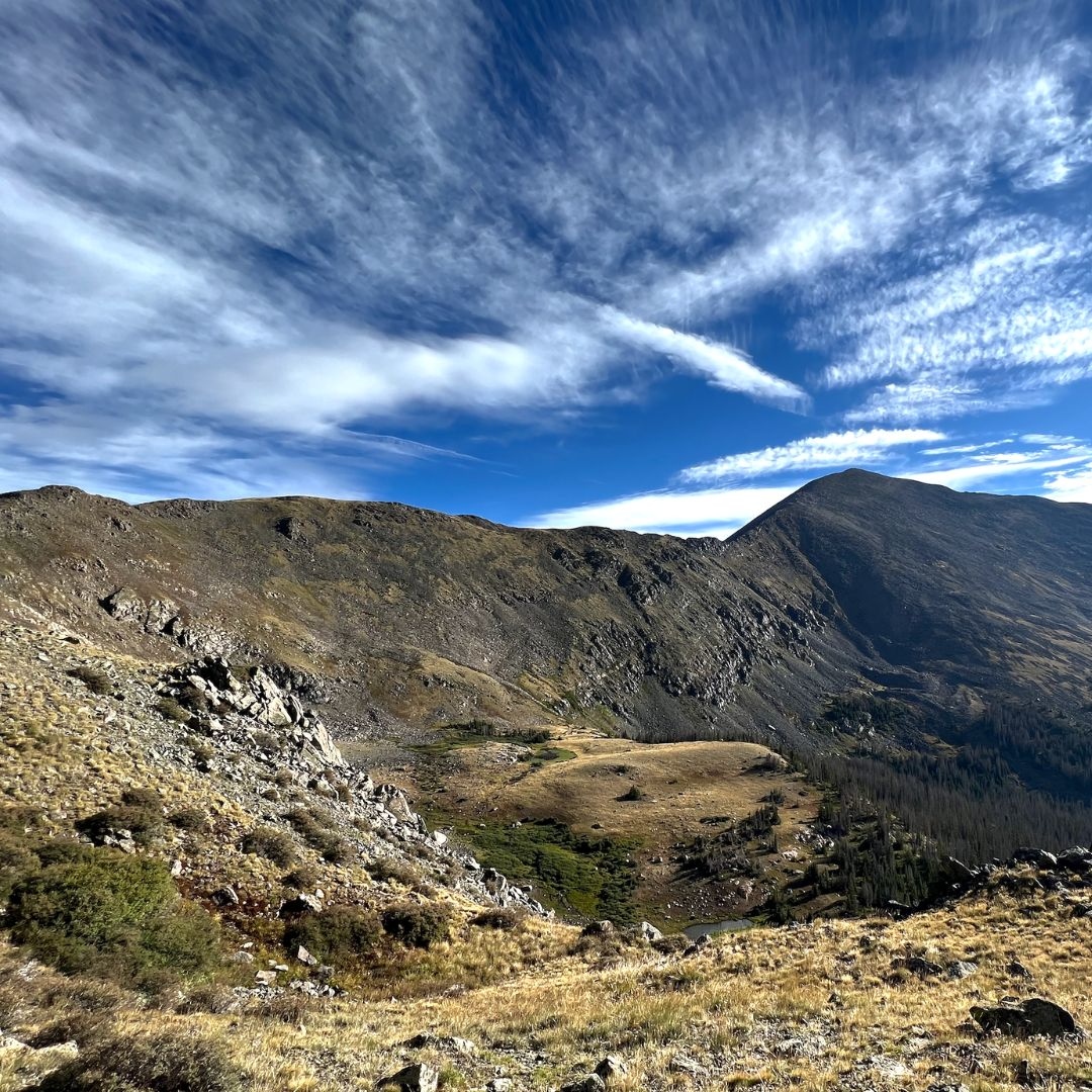
7 Jul 2024
Understanding the contours of the landscape is essential for any hiker or climber. Contour lines on a topographic map connect points that share the same elevation, illustrating the 3D terrain on a 2D surface, like ridges and valleys.
#TopographicMap #ContourLines #MountainSkills
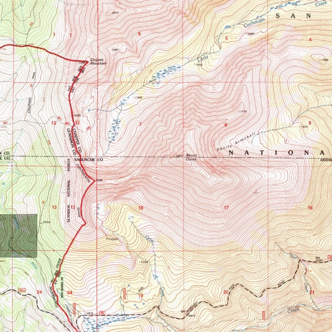
1
9
538

Topo Map Reading pt. 2/10: Overview & Map Collar. Find what’s around the edge of a topographic map: Title, vicinity map, quad index, north arrow, scale, and projection information #mytopo #hiking #usgs #topomap #topographicmap #mapreading #outdoorskills #navigation #cartography
2
85

28 Mar 2024
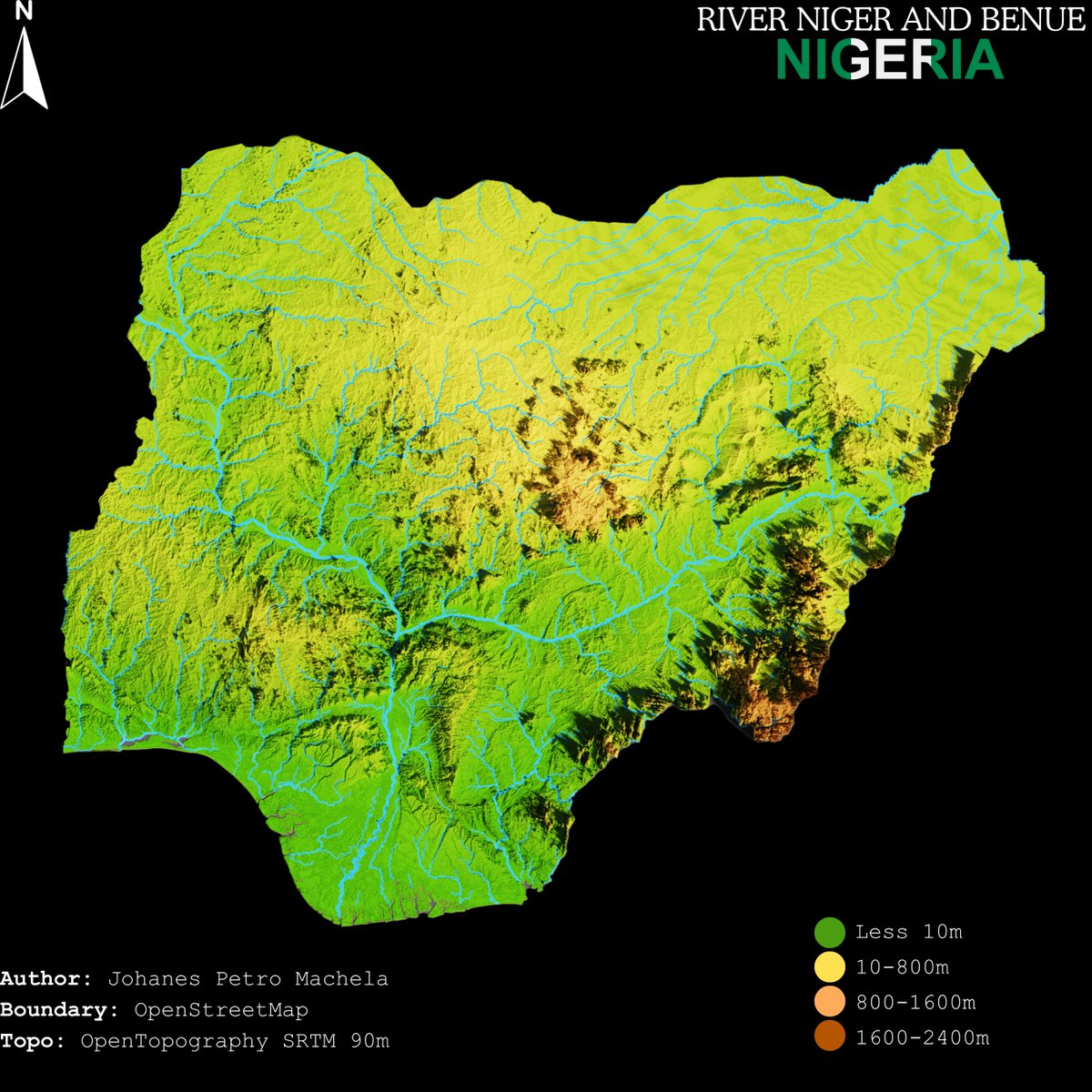
#Nigeria #TopographicMap showing #RiverNiger #RiverBenue, Topography data from @OpenTopography boundary @openstreetmap @uniquemappers #gischat #gis #map #Africa #omdtz
6
174

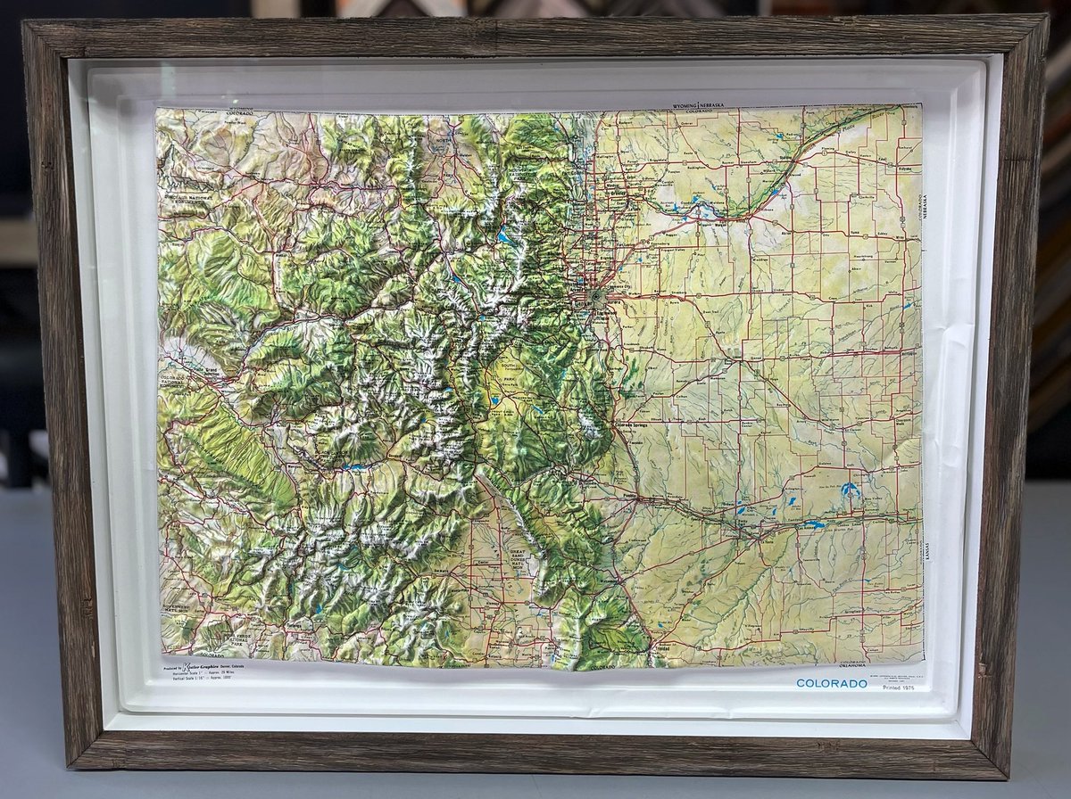
12 Mar 2024
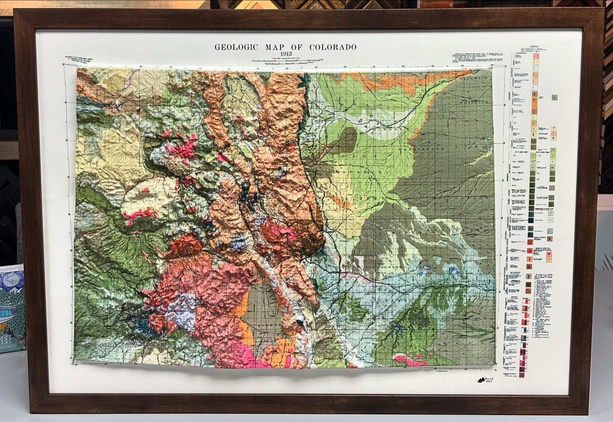
Custom framed Geologic Map of Colorado using acid-free materials and wood frame! #art #denver #colorado #pictureframing #customframing #5280customframing #geologicmap #map #topographicmap
2
87

5 Apr 2023
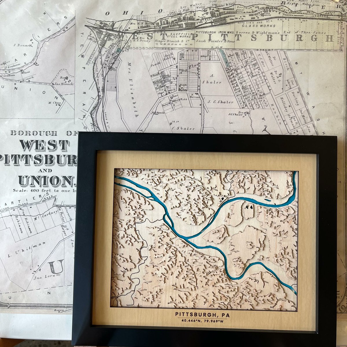
We are thrilled to carry a new artist in our shops, Squirrel Hill Design and Craft @squirrelhill.shop! These wood pieces are a must see like this topographic wood map of Allegheny County. #lovepittsburghshop #championsoflocal
#topography #topographicmap #pittsburghhills
2
174

1 Mar 2023
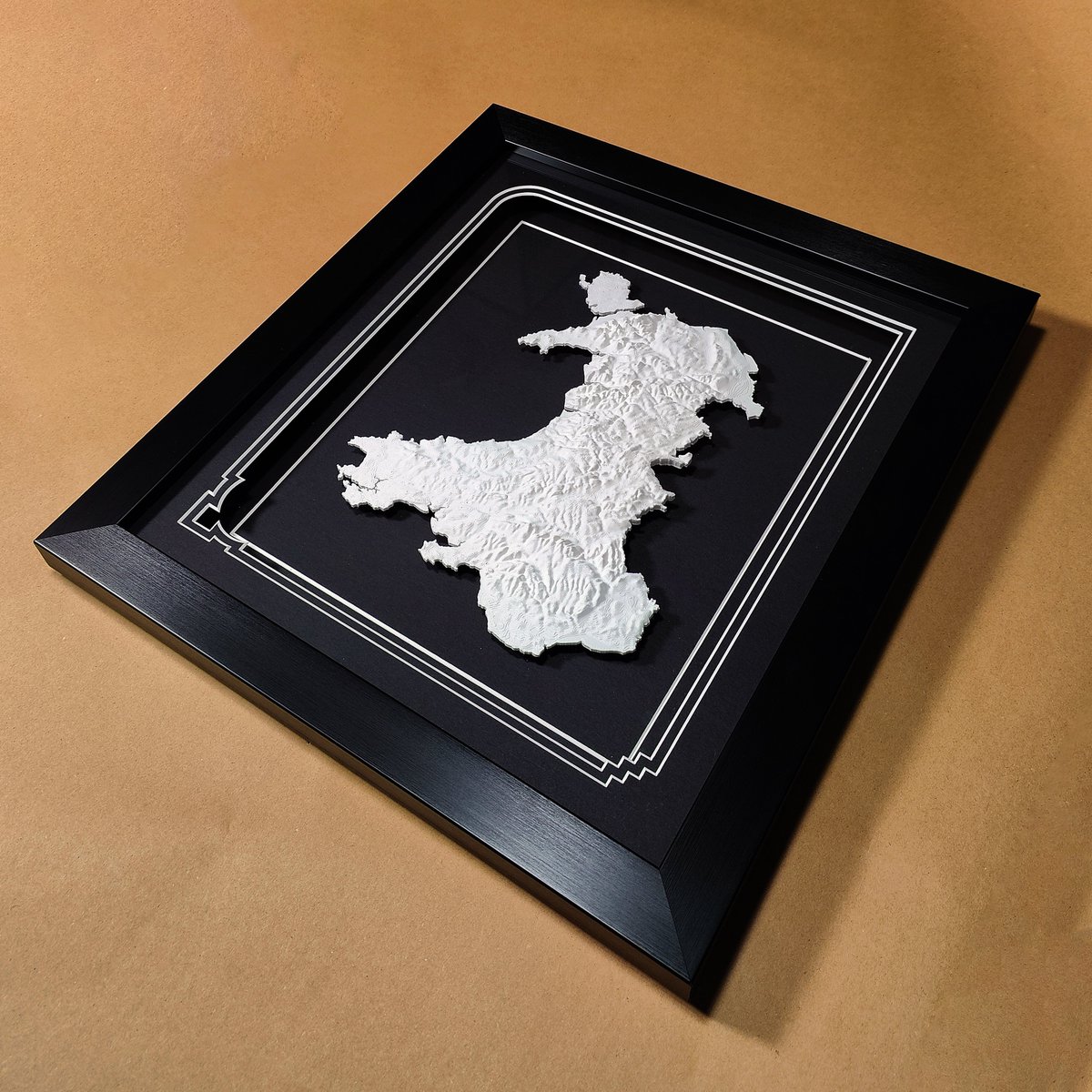
Happy St David's Day! 🏴🎉
Celebrating Wales with our 3D printed topographic map. Each contour and elevation perfectly captured, highlighting the beauty of our stunning country. 🗺️
#StDavidsDay #Wales #3DPrinting #TopographicMap #CelebrateWales #3dprinting

2
3
305

23 Jan 2023
Have you generated a custom #topographicmap yet using @USGS's topoBuilder?
Check it out! 👇
#USGS #TakeAHike

The people have spoken! OnDemand Topo #maps & topoBuilder were so popular that we're ending the pilot phase of the project & making topoBuilder a permanent offering of @USGSTNM. Now you'll always be able to select your own topographic map: ow.ly/wYrO50MxUzm #topomaps #topo

ALT Reston, Virginia 4 US Topo Quadrangles (left) compared to 1 custom centered OnDemand Topo (right)
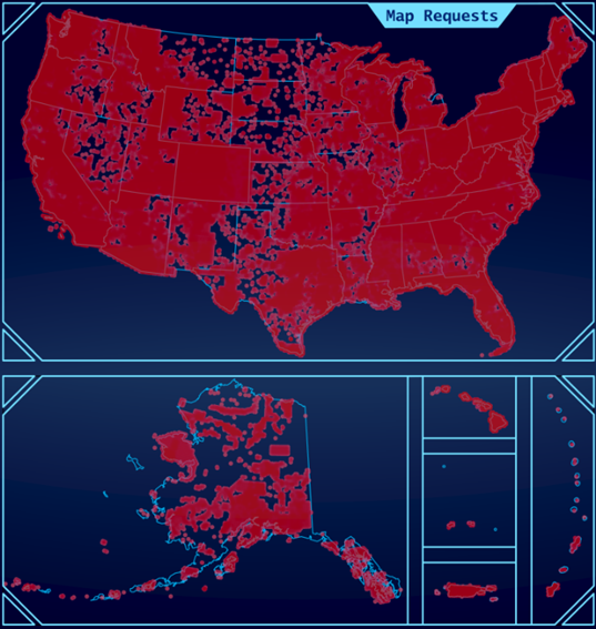
ALT Map view of topoBuilder requests (in red) from February 2022 thru Dec 2022 covering most of the coterminous United States, Alaska, Hawaii, Puerto Rico. the US Virgin Islands, and the Mariana Islands
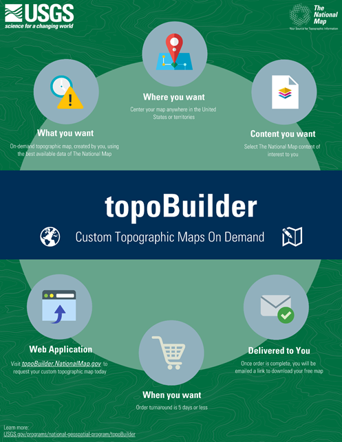
ALT 2 topoBuilder custom topographic maps on demand
3
1,803

8 Dec 2022
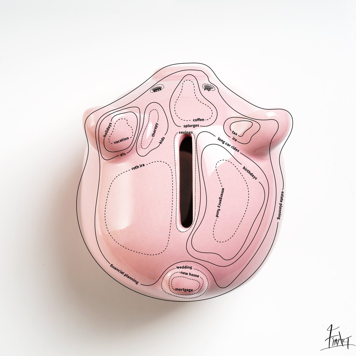
Inspired by a topographic map.
There are many things in life that shapes our future.
Many bumps along the roads.
Many ups and downs.
New heights.
I tried capturing life in a map.
Enjoy.
#topographicmap #financialfreedom #financialplanning #personalfinance
5
11 Oct 2022
🏔 Custom framed topographic map of Colorado using museum glass and frame by @omegamoulding! #art #denver #colorado #pictureframing #customframing #5280customframing #topographicmap @truvueglazing
1
5