
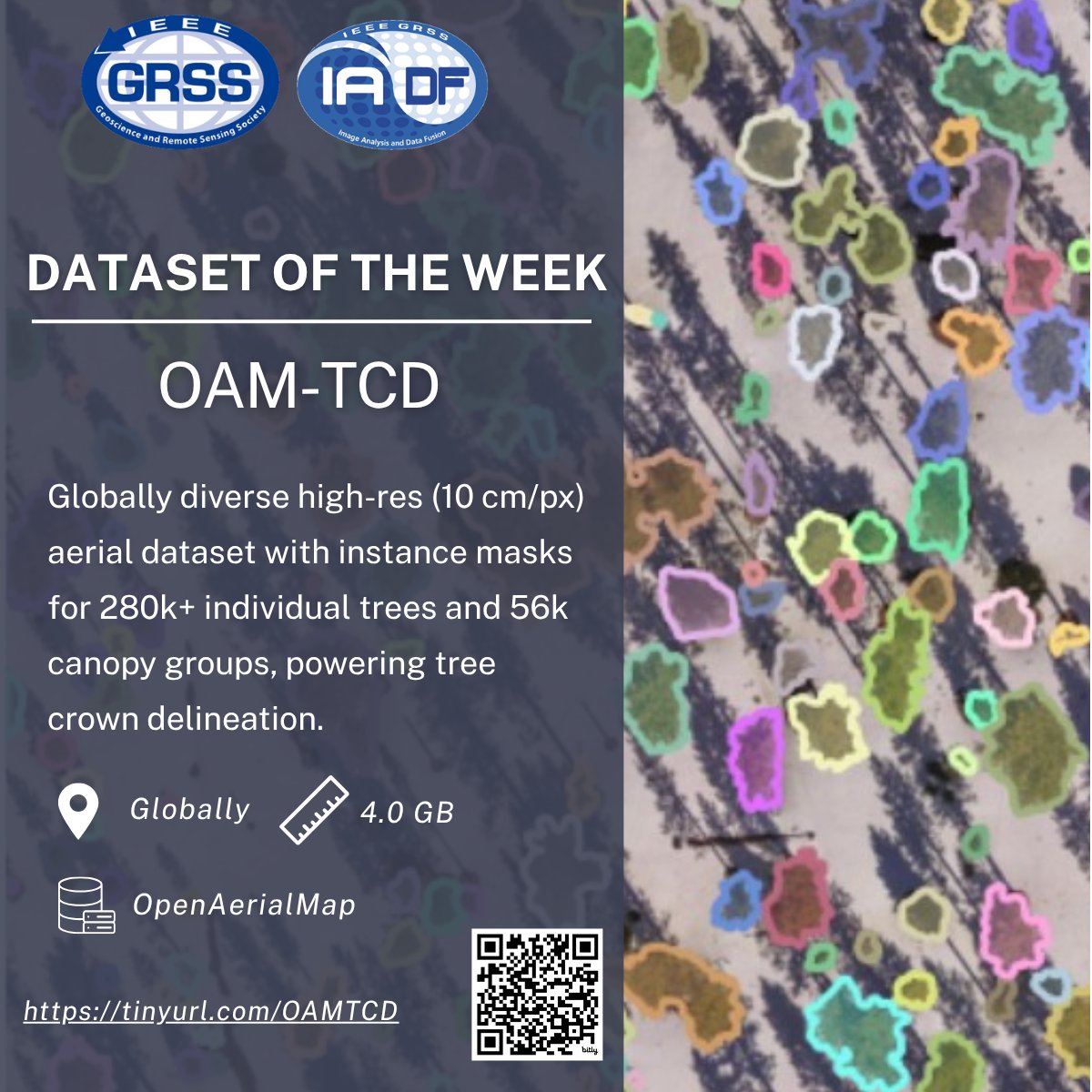
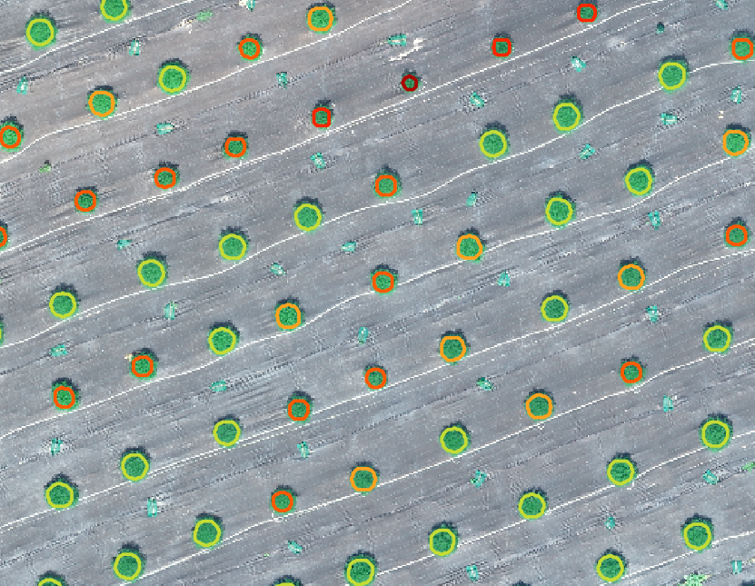
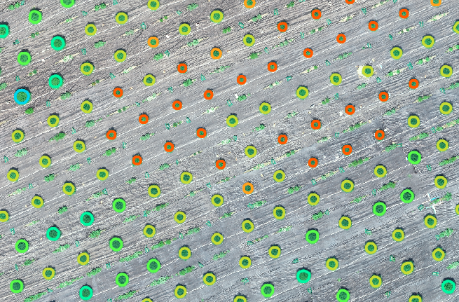
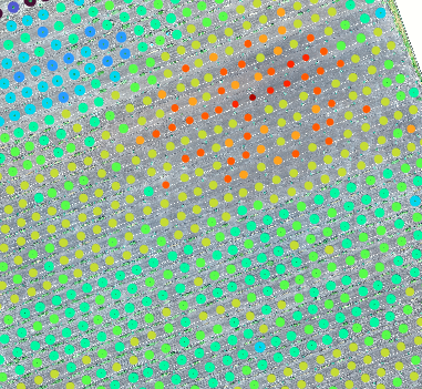
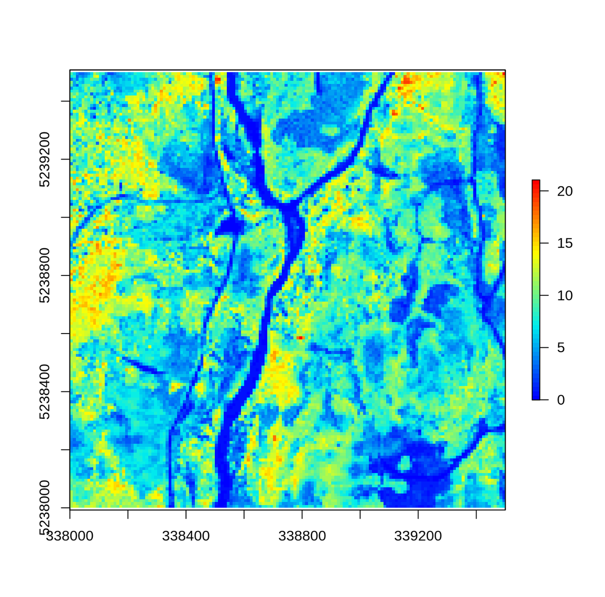
📢 Introducing the OAM-TCD Dataset!
🌎 High-resolution aerial image tiles from around the world, spanning diverse terrestrial biomes, urban, and natural environments.
🛰️ Sourced from OpenAerialMap (OAM) user-contributed UAV and aerial RGB surveys.
📏 10 cm/px resolution with 2048x2048 px GeoTIFF tiles (>20k hectares total).
🧩 Instance-level polygon masks for 280k individual trees and 56k canopy groups.
🔎 Ideal for tree crown delineation, canopy cover mapping, and DL-based ecological monitoring.
📄 Dataset: eod-grss-ieee.com/dataset-de…
#IEEEGRSS #IADF #RemoteSensing #EarthObservation #TreeDetection #TreeCrownDelineation #AerialImagery #ForestRestoration #DeepLearning
12
52
2,603

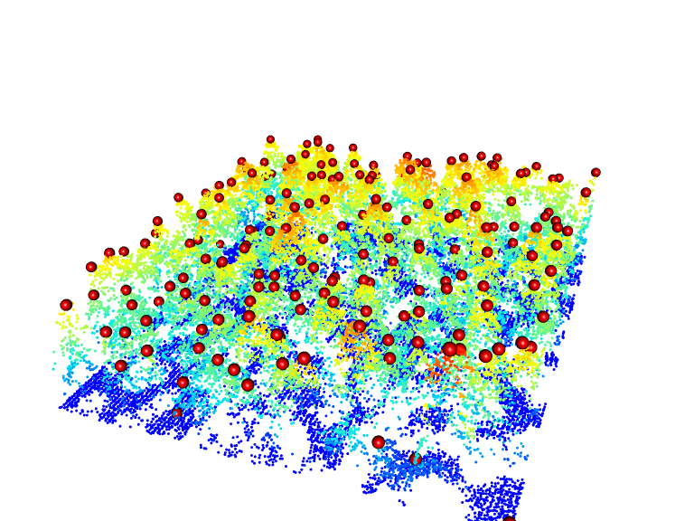
🌳 Interested in AI & Tree Detection? 🌍
Learn how AI detects trees in high-resolution imagery with Esri's Tree Detection Deep Learning Model! Perfect for forestry, urban planning & more.
🔗 Check it out: arcgis.com/home/item.html?id…
#AI #DeepLearning #GIS #TreeDetection 🌱

3
76

13 Mar 2024
#MostDownloaded
🌲Correcting the Results of CHM-Based Individual #TreeDetection Algorithms to Improve Their Accuracy and Reliability by Maciej Lisiewicz, Agnieszka Kamińska, Bartłomiej Kraszewski and Krzysztof Stereńczak
mdpi.com/2072-4292/14/8/1822
#forests
2
8
541
21 Feb 2023
#remotesensing
📢#UAV-Based #LiDAR Scanning for Individual #TreeDetection and Height Measurement in Young Forest Permanent Trials by Francisco Rodríguez-Puerta, Esteban Gómez-García, Saray Martín-García, Fernando Pérez-Rodríguez and Eva Prada
👉 mdpi.com/2072-4292/14/1/170
6
26
2,111
18 Jan 2023
#mostdownloaded #remotesensing
📢Comparison of Classical Methods and Mask R-CNN for Automatic #TreeDetection and #Mapping Using #UAV Imagery by Kunyong Yu, Zhenbang Hao, Christopher J. Post, Elena A. Mikhailova, Lili Lin, et all.
🔗mdpi.com/2072-4292/14/2/295
5
32
2,334

25 Apr 2022
Very excited to share our latest research on UAV based individual tree crown detection, delineation, and parameter estimation. #Drone #TreeDetection #VHROptical #RemoteSensing
Please find more details in our Remote Sensing paper:
mdpi.com/2072-4292/14/9/2044
1
3

13 Aug 2021
computer vision and aerial images give growers detailed info about the entire field and each individual plant/tree
What plants need more attention and where you need to start
#treedetection and recognition
#plantstress #irrigation #agtech @ALCanadaLabs #orchard #cannabis

3
8

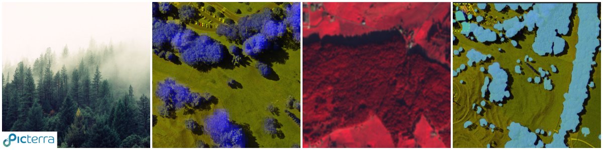
👉 How to work with images that are not simply RGB on Picterra?
👉 Do you need to use a false color image in #QGIS?
This article explains the process in a nutshell 👇
buff.ly/32RKqye
#multispectral #GIS #TreeDetection #UAV #drones #RemoteSensing #forestry #GEOAI
3

20 Jul 2020
The #LidR 📦 has a huge array of tools available to process your #lidar data:
✅Lidar #DataVisualization
✅Individual #TreeDetection
✅Canopy height models
✅#DTMs
✅Classification
✅Normalization
✅Custom metrics
more!
📦: github.com/Jean-Romain/lidR
#rstudio #RStats #ALS
9
14

1 Jul 2020
"A Method for #TreeDetection Based on Similarity with Geometric Shapes of 3D Geospatial Data" by Mihai-Sorin Stupariu, Alin-Ionuț Pleșoianu, Ileana Pătru-Stupariu and Christine Fürst 👉mdpi.com/2220-9964/9/5/298
#digitalsurfacemodel
#wavelets
#canopy3Dmetric
#LiDAR

1
2


3 Dec 2018
Wildfire in Jack Pine Forests: How Drones and Satellites Can Help Recovery #Environment #Forestry #geography #JackPine #LiDAR #Pinusbanksiana #SpatialScience #TreeDetection #Drones #UAV dronebelow.com/2018/12/03/wi…
1
27 Nov 2018
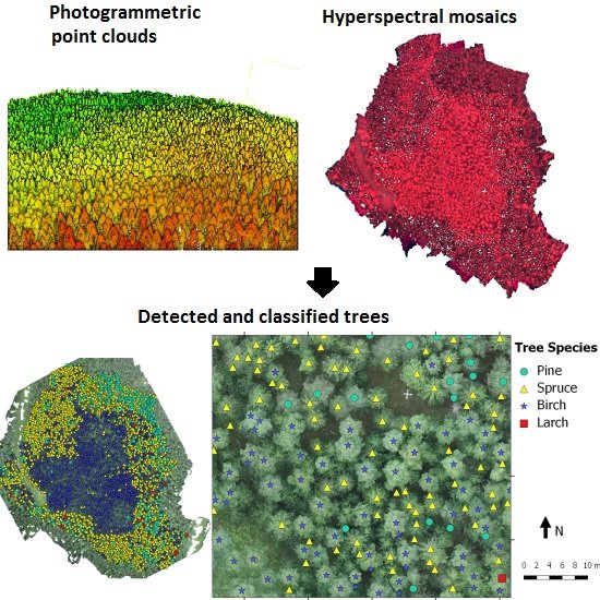
🔥2017 Highly cited paper
Individual #TreeDetection and Classification with #UAV-Based #Photogrammetric Point Clouds and #Hyperspectral Imaging
by Nevalainen, O.; Honkavaara, E.; et al. 2017
👉mdpi.com/182536
#PointClouds
1
5