
🔔 New REVIEW article:
Srivastava et al. present a #LiteratureReview exploring methods for extracting building footprints from #VeryHighResolution remotely sensed imagery, using a variety of #DeepLearning methods.
🔗 doi.org/10.1080/01431161.202…
#IJRS #RemoteSensing

2
153
🔔 New article:
Sánchez et al. present a #CropSegmentation and #CropMaturity #classification for Agave crops which uses #VeryHighResolution 🛰️ imagery and #DeepLearning (with active learning and synthetic image creation).
🔗 doi.org/10.1080/01431161.202…
#IJRS #RemoteSensing

3
4
543

24 May 2023
#mostdownloaded
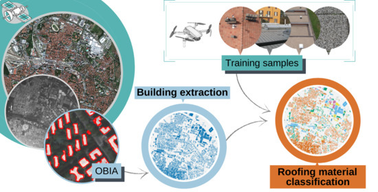
📢 An Object-Oriented Approach to the Classification of Roofing Materials Using #VeryHighResolution #SatelliteStereo-Pairs
by Francesca Trevisiol, Alessandro Lambertini, Francesca Franci and Emanuele Mandanici
🔗 Read the full article: mdpi.com/2072-4292/14/4/849
1
6
716

30 Dec 2022
#latestpaper
📢Improving #MountainSnow and #LandCoverMapping Using #VeryHighResolution (#VHR) #OpticalSatelliteImages and #RandomForest #MachineLearning Models by J. Michelle Hu and
David Shean
🔗Read the full article: lnkd.in/dWaTWfwJ
2
630
SPECIAL ISSUE article:
S. Pang et. al. propose a novel, robust end-to-end Siamese correlation and attention-based #ChangeDetection network (SCA-CDNet) for bitemporal, #VeryHighResolution imagery.
🔗 doi.org/10.1080/01431161.202…
#IJRS #RemoteSensing #ResNet
1
2
6

4 Apr 2022
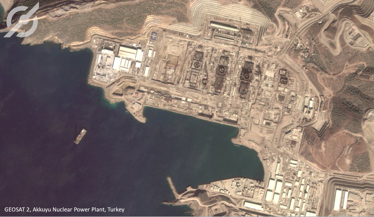
Sharper edges, good calibration and high-quality inputs to ensure good results in automatic #FeatureDetection algorithms, are just some of the great qualities of our #SuperResolution product. #GEOSAT2 #AkkuyuNuclearPowerPlant #Turkey #VeryHighResolution
2
2

16 Nov 2021
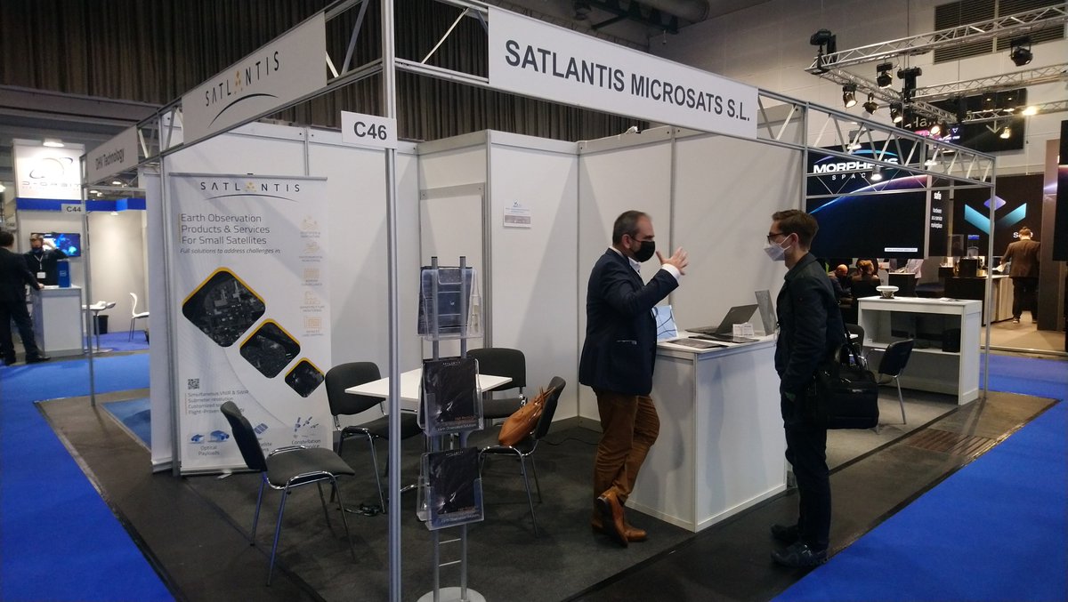
Thrilling first day at #SpaceTechExpoEU in Bremen. Interested in Earth Observation Solutions?
Our team is ready to welcome you at booth C46!
#smallsats #EarthObservation #VeryHighResolution

2
5
12 Nov 2021
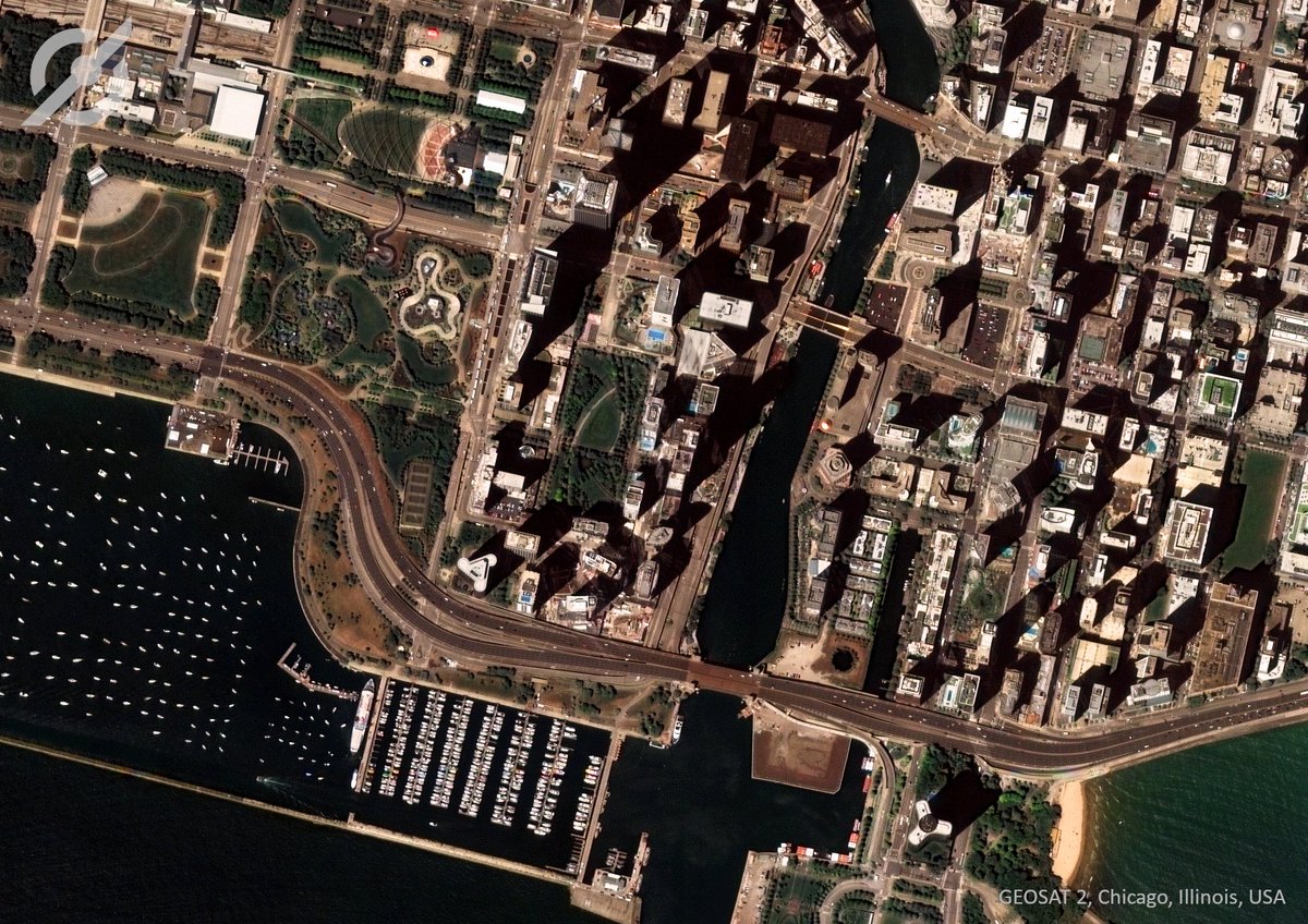
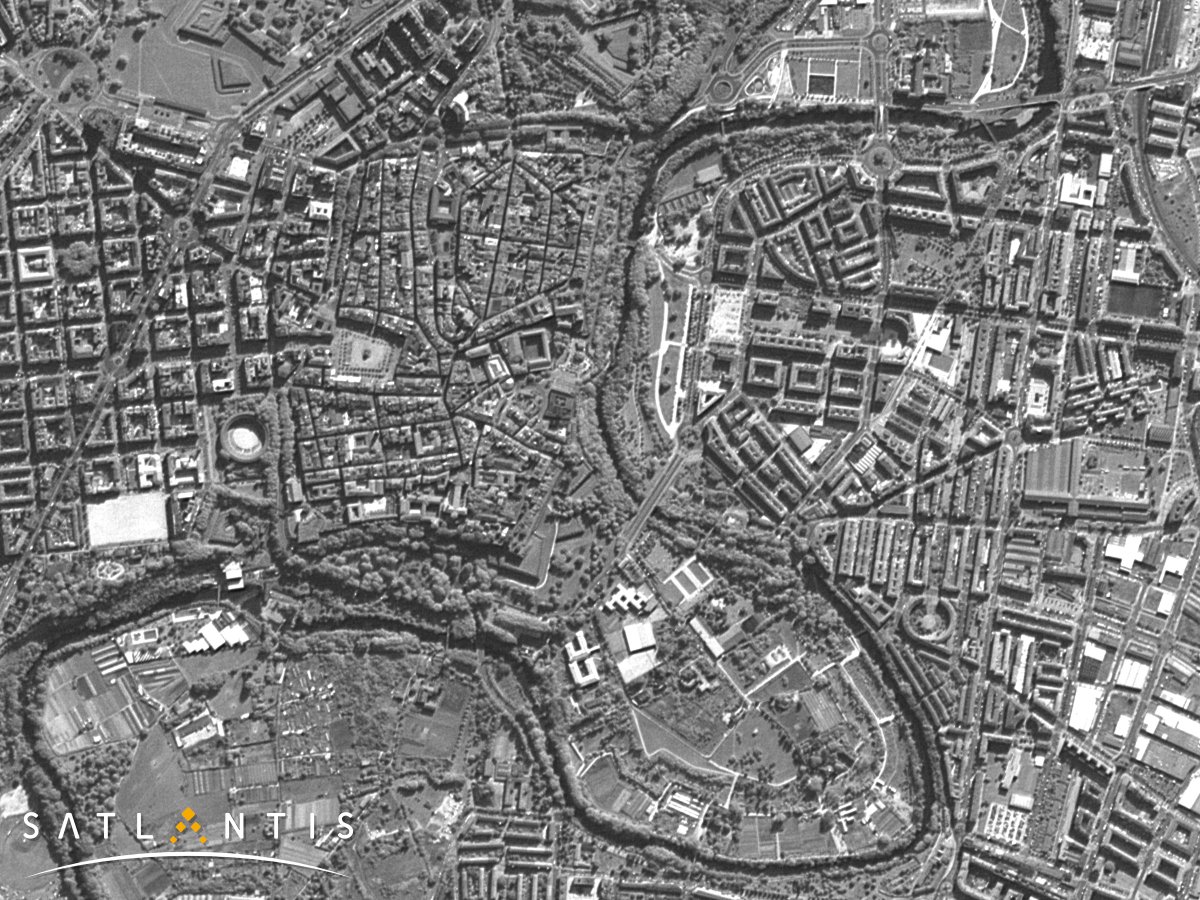
#GEOSAT2 #VeryHighResolution 75cm imagery can be used to identify small-scale changes, enabling a highly detailed analysis of the urban morphology #Chicago #USA #Urbanplanning
3
15 Oct 2021
Check out how #GEOSAT2 is able to show the evolution of #CumbreViejaVolcano over time. Its #VeryHighResolution images enable to visualize the delta growth until its outflow into the sea, as well as the changes in the lava flow in great detail. #ErupcionLaPalma #LaPalmaVolcano
1
4

Yesterday, the Italian #COSMOSkyMed-Second Generation radar satellite (@ASI_spazio/@MinisteroDifesa) captured for @CopernicusEMS #EMSR546 #VeryHighResolution #DualPol image of the #ErupciónLaPalma, showing how the lava front has advanced by 330 metres in just a few hours.
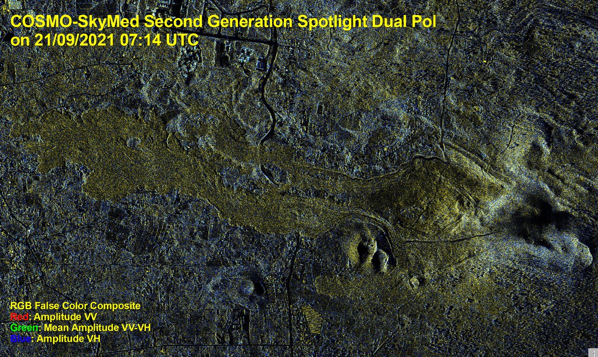
ALT https://emergency.copernicus.eu/mapping/list-of-components/EMSR546
1
14
41
13 Apr 2021
Well-known for its bull run and its old city, Pamplona is also renowned for its #urbandevelopment and #sustainability. Discover how iSIM #technology can help you achieve sustainable goals in #urbanplanning and monitoring.
#SatelliteImagery #EarthObservation #VeryHighResolution

ALT Pamplona (Spain) seen by iSIM IOD 2020. SATLANTIS
ALT Pamplona (Spain) seen by iSIM IOD 2020. SATLANTIS
5
5

18 Sep 2020
Video of 3D wind speed evolution of #Medicane #Ianos for the next 36 hours...
#AgoApps #WeatherIntelligenceEngine #veryhighresolution
1
2
17 Sep 2020
A #DeepLearning-Based Robust #ChangeDetection Approach for #VeryHighResolution Remotely Sensed #Images with Multiple Features
by Lijun Huang, Ru An, et al.
👉mdpi.com/2072-4292/12/9/1441…
#remotesensing

3
8

7 Aug 2020
High-Resolution Satellite images captured the damage of the surrounding blast site only hours after the massive explosion in Beirut.
#Beirut #EuropeanSpaceImaging #WorldView-2 #VeryHighResolution #Satellite #Lebanon spacewatch.global/2020/08/sa…

6
3
30 Jun 2020
Automatic Windthrow Detection Using #VeryHighResolution #Satellite #Imagery and #DeepLearning
by Dmitry E. Kislov and Kirill A. Korznikov
👉mdpi.com/2072-4292/12/7/1145…
#CNN
#machinelearning
#forestdisturbance
#remotesensing
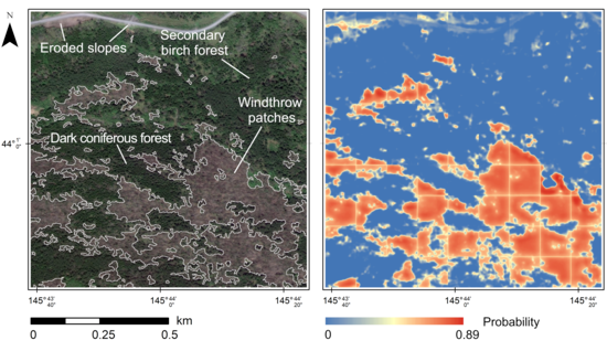
3

13 Mar 2020
Looking for very high resolution satellite imagery (VHR)? We are proud to include them in our offer on CREODIAS.eu platform!🛰️🪐🛰️🪐🛰️
ℹ️: bit.ly/2TOzPzv
#EOData #EarthObservationData #VHR #VeryHighResolution #ITForAirLandSpace #CloudComputing
1
1
4

📢 Announcing our new partnership with @Maxar Technologies!
ONDA now offers #VeryHighResolution 𝗼𝗽𝘁𝗶𝗰𝗮𝗹 satellite imagery - 𝘂𝗽 𝘁𝗼 𝟯𝟬 𝗰𝗺- from Quickbird, IKONOS, GeoEye-1 and WorldView-1, -2, -3 & -4.
More info: bit.ly/2TclFGV
#VHR #peopleONDAta

1
2
5
25 Dec 2019
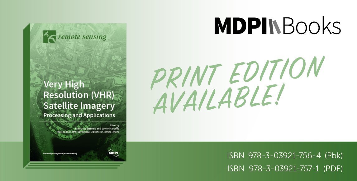
📢New BOOK #VeryHighResolution (#VHR) #SatelliteImagery: Processing and Applications
Francisco Eugenio and Javier Marcello (Eds.)
👉Book link: mdpi.com/books/pdfview/book/…
👉Special Issue link: mdpi.com/journal/remotesensi…
4
13
Very pleased to announce our recent partnership with @deimosimaging for the provision of images acquired by #DEIMOS2, a #VeryHighResolution (75 cm) #multispectral optical satellite.
🖥️ Request VHR data: bit.ly/2kOwd1B
ℹ️ Read more: bit.ly/2kmGhyG
2
4