⚡🌪️️ INSANE chase moment today in northern Missouri! Came dangerously close to getting struck by lightning while tracking a tornadic supercell across the area. The storm was producing intense lightning, powerful inflow, torrential rain, and rotation as it moved through the region. One lightning bolt hit extremely close during the intercept — a reminder how dangerous severe weather and storm chasing can become in seconds. ⚡🚗🌩️🌪️
These supercells across northern Missouri and southern Iowa had an environment capable of tornadoes, large hail, damaging winds, and constant cloud-to-ground lightning as instability and shear increased along the boundary. Definitely one of the more intense lightning situations of the season so far. 👀📡
#StormChasing #Lightning #MissouriWeather #TornadicSupercell #SevereWeather #StormChaser #Missouri #Weather #Supercell #Tornado #ExtremeWeather #Nature #MidwestWeather #LightningStrike #ChasingStorms #LiveStormChasing #NorthernMissouri #WeatherAlert #ChicagoMidwestStormChasers 🌪️⚡

1
9
731

Apr 29
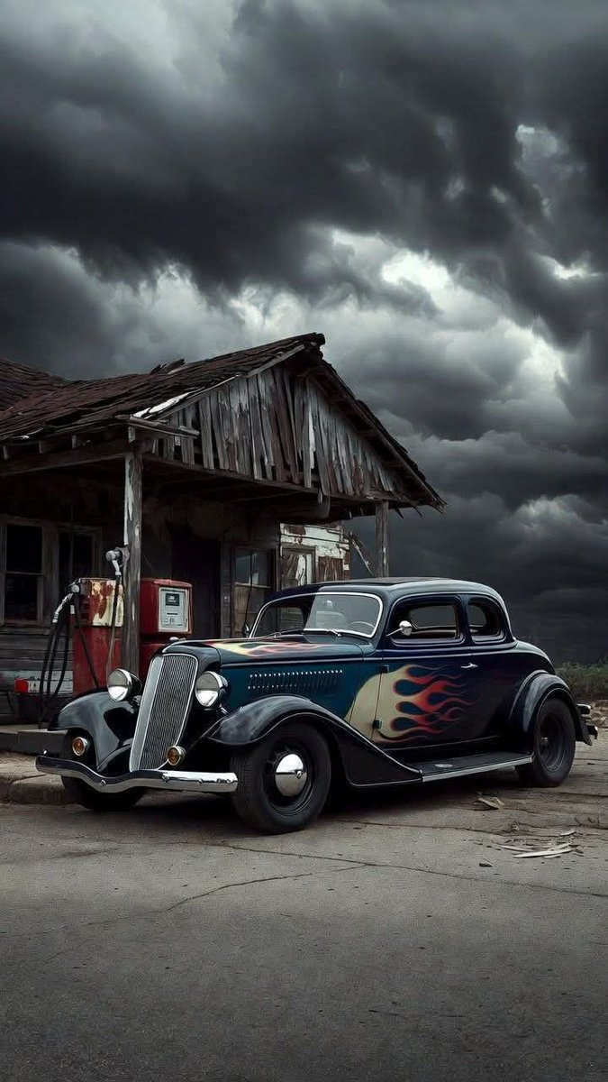
Drawn to the Storm #StormyWeather #MoodyVibes #RainyDays #ChasingStorms ... youtube.com/shorts/ADJX0aO1Y… via @YouTube
1
5
115

Drove up to I-35 in North Fort Worth to see what @Fox4Weather was talking about. The shelf over downtown was impressive as well as the movement of the clouds. As the heavy rains fell, I drove a little further out to see it from a neighborhood equally impressive. #chasingstorms


2
5
175

🌪️ Back at it again — heading to Iowa for another round of tornado chasing! 🚗💨
Conditions are primed, and we’ll be tracking storms closely as they fire.
📡 Catch me LIVE later on YouTube & Twitter as we intercept these storms in real time!
#StormChasing #TornadoChase #IowaWeather #LiveStream #SevereWeather #MidwestWeather #WX #ChasingStorms
1
1
5
1,644
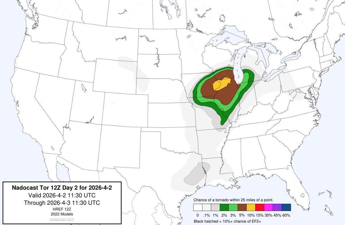
Nadocast is lighting things up for Thursday… and it’s no joke ⚠️🌪️
High-end strong tornado potential is on the table, signaling a potentially dangerous setup with favorable ingredients coming together. This could turn into a long, intense chase day with serious severe weather risks.
🌪️ Summary:
High-end tornado signals are increasing for Thursday — including the potential for strong, possibly long-track tornadoes. This is a setup you need to take seriously.
🔥 Buckle up… it’s gonna be a long one.
#tornado #severeweather #stormchasing #midwestwx #ilwx #inwx #iawx #weatheralert #nadocast #wxnerd #chasingstorms #tornadooutbreak
3
41
5,250
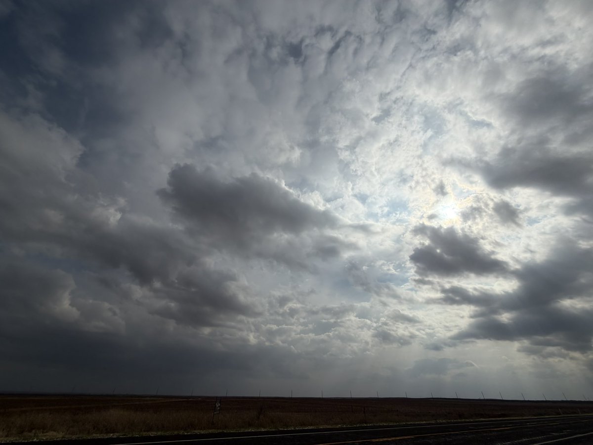
Watching closely for supercell development near or SW of Matador & Paducah, TX as the atmosphere continues to destabilize. Storms could begin firing soon across the region. 🌩️🌪️📡
#TXwx #StormChasing #SevereWeather #Supercell #TexasWeather #StormTracker #WeatherUpdate #ChasingStorms
9
657
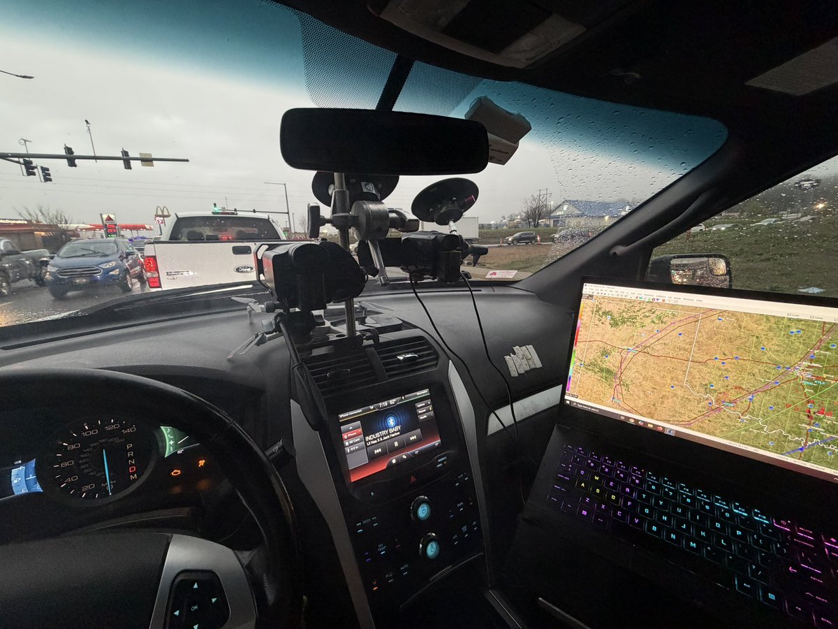
Back on the road for Day 2 of storm chasing 🚗🌩️ — heading toward SW Oklahoma near the TX/OK border to track potential severe storms and tornadoes. I’ll be going LIVE later on YouTube, Twitter, and Facebook, so stay tuned for real-time updates and storm coverage! 🌪️📡
#StormChasing #SevereWeather #OklahomaWeather #TexasWeather #StormChaser #TornadoWatch #LiveStormChase #WeatherLive #ExtremeWeather #ChasingStorms
1
530
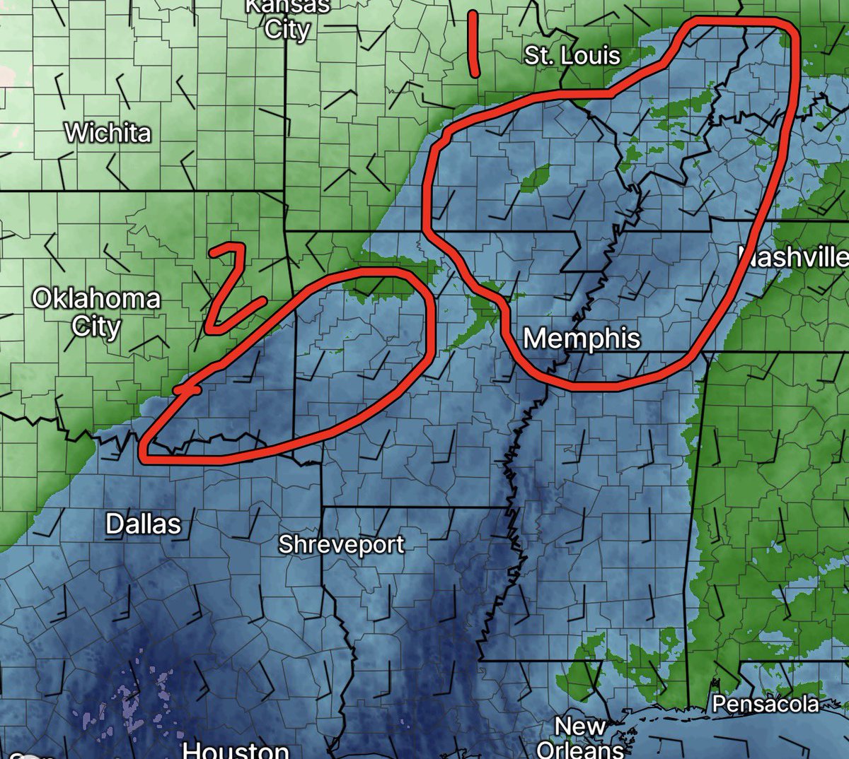
🌩️ Severe Weather Outlook for Today 🌪️
There are two primary areas to watch for severe weather today across the Midwest and southern Plains.
1️⃣ Primary Area: Southern Illinois • SE Missouri • SW Indiana • NW Kentucky (near the warm front)
This area has the best combination of ingredients for organized severe storms. Strong 925–700 mb winds, increasing 0–3 km CAPE, and enhanced low-level helicity along the warm front will support rotating storms. With dewpoints near 60°F and southeast surface winds feeding moisture into the boundary, the environment will be favorable for multicells and supercells capable of all hazards.
⚠️ Main threats:
🌪️ Tornadoes
🧊 Large hail
💨 Damaging winds
Storms that interact directly with the warm front could become particularly intense, as low-level shear and storm-relative helicity will be maximized there.
2️⃣ Secondary Area: NW Arkansas • ESE Oklahoma
This region will also need monitoring. Strong daytime heating and good instability (CAPE) are expected, along with ample moisture. However, the strongest wind shear may remain slightly north of the area or tied closer to the warm front, and 925–700 mb winds appear weaker compared to the Midwest target.
Another uncertainty is how far south the front pushes, which will determine how favorable the shear profile becomes. If storms can form in the right environment, supercells capable of all hazards are still possible, but confidence is a bit lower than the northern target.
📡 Bottom line: Two potential severe weather zones today with supercells possible in both regions. The warm front across southern IL/SE MO appears to be the higher-end setup, especially for tornado potential.
🎥 Stay tuned for updates — I’ll be out chasing and streaming live today!
#SevereWeather #StormChasing #TornadoRisk #Supercells #StormSeason #ILwx #MOwx #INwx #KYwx #ARwx #OKwx #MidwestWeather #WeatherAlert #ChasingStorms #StormForecast #WeatherUpdate #Meteorology #LiveStormChasing 🌩️🌪️
3
666

22 Nov 2025
March 14th 2025 #Tornadoutbreak.
I had the incredible opportunity to chase one of the top 10 tornado outbreaks, capturing an astonishing video of a nighttime tornado! 🌪️ However, this powerful storm wreaked havoc in Villa Ridge, MO, leaving a trail of devastating destruction in its wake.
#TornadoChase #SevereWeather #VillaRidge #NaturePower #StormChaser #TornadoOutbreak #NighttimeTornado #WeatherPhotography #DisasterRelief #CommunitySupport #ExtremeWeather #ChasingStorms
21 May 2025

The tornado that struck Villa Ridge, MO, near St. Louis, was very frightening. I witnessed the tornado touching down in town, and I was only about a mile away. Instantly, I rushed back up the ramp to help with the victims. This happened a month or two ago.
3
1,563

25 Jul 2025
Testing My New @insta360 X5 BMW Motorrad Edition!
After months of entering Insta360's giveaways on X, I was lucky enough to win the brand new Insta360 X5 BMW Motorrad Edition, and wow! it's a total game changer. This is my first test run with the camera, and I’m already blown away by the quality, features, and freedom it offers.
As a storm chaser, capturing the perfect shot can mean everything and now, with the power of 360° footage, I’ll never miss that moment again. From wide-angle skies to up-close storm detail, this camera is going to elevate my footage like never before.
🌪️ Stay tuned — my storm chasing footage will never be the same.
#Insta360 #BMWMotorradEdition #StormChasing #Insta360X5 #ExtremeWeather #ChasingStorms #StormChaser #WeatherPhotography
1
10
494

14 Jul 2025
The Alberta Badlands, Where the road runs out, the chase begins
#badlands #albertabadlands #travelalberta #ruggedlandscapes #chasingstorms #abstorms #stormchaser #badlandsviews #explorealberta #visitalberta

1
10
336

19 May 2025
Beautiful Tornado Warned Storm Near Archer City Texas 5/19/25 #WeatherWatch #SkyPorn #ChasingStorms #NatureLovers #ExtremeWeather
2
143

25 Apr 2025
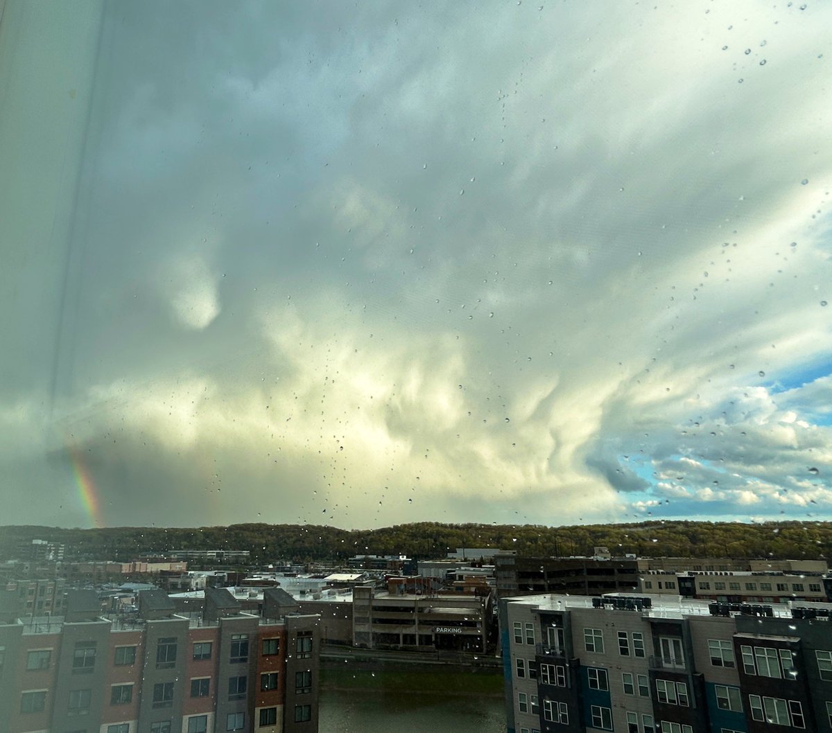
A lot has happened in the past month but during all the chaos I had an incredible experience. Out the window of Hadley’s 4th floor hospital room during sunset after her emergency appendectomy on Tuesday 4/15 in King of Prussia, PA, I had an absolutely amazing view of this beautiful storm which had a double rainbow 🌈🌈on the back side of the storm. I didn’t even have to chase down the storm, it came right to me. It was a religious experience after everything we had been through & I’m so thankful for it 🙏🏼and that my daughter is recovering ❤️🩹 @ZieglerFrank @JasonGlaus @ryanhallyall #supercell #stormcloud #thunderstorm #rainbow #chasingstorms #stormchase #severeweather #clouds #Storm


2
3
181
26 Oct 2024
🌪️My Wildest Storm Adventures Of 2024!** 🌪️
2024 has been a whirlwind! 🌩️ From the heart-pounding thrill of standing beside towering tornadoes to witnessing nature’s raw power, every chase brings a rush like no other. 🚀💨 There are moments that leave you breathless and a little shaken, but the beauty of these storms is truly mesmerizing.
🌟 Love amazing video content about weather and storms? You're in the right place! 📹✨ Follow my socials to stay updated and experience the thrill of nature like never before!
👉 Facebook: Chicago & Midwest Storm Chasers
👉 Facebook: Chicago & Midwest Weather Channel
👉 Instagram: ChicagoMWeather
👉 Twitter: ChicagoMWeather
👉 TikTok: ChicagoMWeatherr
Join our community and never miss out on incredible weather updates and videos. Can't wait to see you there! 💨🌧️
#StormChasing #TornadoAdventures #NatureLovers #ExtremeWeather #ChasingStorms #AdrenalineJunkie #WeatherWarriors #StormHunters #TornadoWatch #AdventureAwaits #WildWeather #MotherNaturePower #VortexView #ThrillSeeker
8
982

23 Oct 2024
Hurricane Emergency Assistance. #MKB #Milton #CateringLife #ChasingStorms #PrettySky #FloridaStrong 💪☮️💪
2
97

10 Oct 2024
🚨BREAKING: Storm chasers in Sarasota, Florida are left disappointed and are packing up to head to Tampa! 🌪️ Fingers crossed @StormhunterTWN check in with #LieutenantDan for some real adventure! #ChasingStorms #OnTheMove 🌧️ #miltonhurricane
3
9
6,080
18 Sep 2024
🌩️✨ Check out this breathtaking timelapse of a supercell thunderstorm and sunset captured a few months ago in Nebraska! The sheer power of nature is on full display, and it’s a sight you won’t want to miss. 🌅
Witnessing these storms reminds us of the beauty and chaos of our environment. If you had the chance, would you be here to experience it? 🤔
What are your favorite types of storms? Whether it's the rumble of thunder or the dance of lightning, we’d love to hear your thoughts! Share in the comments below! 💬
#SupercellThunderstorm #NebraskaTimelapse #StormChasers #NaturePhotography #WeatherPhenomena #ThunderstormWatch #SunsetLovers #TimelapseVideo #StormySkies #WeatherEnthusiast #NatureLovers #ChasingStorms #AtmosphericWonder #CloudFormation #EpicSunsets #SevereWeather #StormyWeather #NatureScience #SkyGazing #WeatherArt #NebraskaNature #TimelapseMagic #StormWatching #BeautifulSkies #WeatherCommunity #NatureInMotion #OutdoorAdventures #ExploreNebraska #FavoriteStorms #NatureCaptures
2
768
27 Aug 2024
🌪️ Just dropped a wild video capturing the raw power of hurricanes! 🌊 The calm before the storm and the chaos that follows—it's a force like no other. 🌪️🏚️
#HurricaneChase #StormWatch #ExtremeWeather #NaturePower #Destruction #AdrenalineJunkie #ChasingStorms #WeatherPhotography #EpicMoments
1
3
846
22 Aug 2024
🌪️ **2024 Storm chasing highlights " Major Stories "**
This year has been nothing short of extraordinary in the world of severe weather. I’ve traveled over 60,000 miles across the Midwest and Southern states, capturing the raw power of tornadoes, hurricanes, floods, and various disaster events.
📹 I’m excited to share a highlight video showcasing the major weather stories I’ve documented this year. Each journey has not only been about witnessing nature’s fury but also about bringing you live coverage and real-time updates. Your support on my social media platforms has been invaluable in making this possible, and I can't thank you enough!
🌊 As we gear up for the remainder of hurricane season, I’m eager to continue this journey. There are still many storms left to chase, and I invite you to join me! Follow all my socials to stay updated with live reports and insights as we navigate through this dynamic weather landscape together.
🚀 Let’s keep pushing the boundaries of weather coverage. Together, we can turn challenges into opportunities for learning and growth. Who's ready to ride along for the rest of this year's adventure?
#WeatherChaser #StormTracking #TornadoSeason #HurricaneCoverage #MidwestWeather #SouthernStorms #DisasterReporting #LiveWeatherUpdates #ExtremeWeather #ChasingStorms #TravelingWeather #WeatherJourney #NaturePhotography #StormWatch #FloodCoverage #MeteorologyLife #OnTheRoadAgain #WeatherCommunity #SupportLocalJournalism #AdventureAwaits #HurricaneSeason2024 #NatureLovers #WeatherEnthusiast #FollowMyJourney #ChaseTheStorms #SevereWeatherAlert #TornadoChasing #WeatherHighlights #CapturingNature #BehindTheScenesWeather
1
487