
Jan 27
Didn't have a free moment for our @Reactive_Tech-sponsored webinar? Not to worry! It's free to watch on-demand.
Power grids used to change very slowly, but with the increasing rate of technological change, integration of large load users, renewables, and other factors, it's critical that grid operators have reliable measurement tools that produce accurate data. Bridging the gap between measurement and modeling by developing new techniques for managing large amounts of data, and wielding them to improve outcomes, are just a few of the ways grid operators must adjust headed into the second half of the decade.
These insider perspectives from experts Reactive Technologies' Duncan Burt and @insideFPL's Dr. Andrew Arana are our gift to you to clue you in and help keep you up.
Register to watch for free: 🔗ow.ly/G4No50Y4i0I
#GridAnalytics #UtilityInnovation #HighResolutionData #GridModernization #FactorThis
371
Jan 23
High-resolution data about grid dynamics can be gleaned with more accuracy and less effort than ever, but the true value of this data can only be realized with judicious planning, and canny use of operational models.
In this free @Reactive_Tech-sponsored Factor This webinar, moderator Paul Gerke shares the digital stage with Reactive Technologies' Chief Strategic Growth Officer, Duncan Burt, and @flpowerandlight's Director of Real Zero Transmission Planning, Dr. Andrew Arana, covering how to turn the growing suite of high-resolution measurement tools into actionable best practices to improve grid operation and resilience.
Join us Monday, January 26, at 12:00 p.m. EST!
Register for free today: 🔗ow.ly/5Xnu50Y1ory
#GridAnalytics #HighResolutionData #UtilityOperations #ReactiveTechnologies #FactorThis

282

3 Dec 2024
#GeoSmartIndia | 𝐃𝐞𝐞𝐩 𝐃𝐢𝐯𝐞 𝐢𝐧𝐭𝐨 𝐭𝐡𝐞 𝐅𝐢𝐧𝐚𝐥 𝐏𝐥𝐞𝐧𝐚𝐫𝐲 𝐒𝐞𝐬𝐬𝐢𝐨𝐧: 𝐈𝐧𝐭𝐞𝐠𝐫𝐚𝐭𝐞𝐝 𝐕𝐢𝐞𝐰 𝐨𝐟 𝐆𝐥𝐨𝐛𝐚𝐥 𝐭𝐨 𝐋𝐨𝐜𝐚𝐥 𝐃𝐚𝐭𝐚 𝐏𝐥𝐚𝐭𝐟𝐨𝐫𝐦𝐬 𝐚𝐧𝐝 𝐏𝐫𝐚𝐜𝐭𝐢𝐜𝐞𝐬 – 𝐀𝐝𝐝𝐫𝐞𝐬𝐬𝐢𝐧𝐠 𝐂𝐥𝐢𝐦𝐚𝐭𝐞 𝐂𝐡𝐚𝐧𝐠𝐞 𝐚𝐧𝐝 𝐃𝐢𝐬𝐚𝐬𝐭𝐞𝐫 𝐌𝐚𝐧𝐚𝐠𝐞𝐦𝐞𝐧𝐭 𝐇𝐨𝐥𝐢𝐬𝐭𝐢𝐜𝐚𝐥𝐥𝐲
Moderated by 𝐀𝐬𝐢𝐭 𝐒𝐚𝐡𝐚, Director General, Geological Survey of India (GoI), the session delved into the pressing challenges of climate change and disaster management, emphasizing the role of integrated data platforms and practices:
@agendra, Managing Director, @EsriIndia, highlighted the shared global challenges of pollution, population growth, and resource scarcity compounded by climate change. He emphasized the role of geography as a scientific framework for organizing and integrating data to uncover patterns, relationships, and the complexities of our world.
𝐀.𝐕. 𝐑𝐚𝐧𝐠𝐚𝐧𝐚𝐭𝐡, IPS, Commissioner, 𝐇𝐲𝐝𝐞𝐫𝐚𝐛𝐚𝐝 𝐃𝐢𝐬𝐚𝐬𝐭𝐞𝐫 𝐑𝐞𝐬𝐩𝐨𝐧𝐬𝐞 𝐚𝐧𝐝 𝐀𝐬𝐬𝐞𝐭 𝐏𝐫𝐨𝐭𝐞𝐜𝐭𝐢𝐨𝐧 𝐀𝐠𝐞𝐧𝐜𝐲 (𝐇𝐘𝐃𝐑𝐀𝐀), and 𝐂𝐡𝐚𝐢𝐫𝐦𝐚𝐧, 𝐋𝐚𝐤𝐞 𝐏𝐫𝐨𝐭𝐞𝐜𝐭𝐢𝐨𝐧 𝐂𝐨𝐦𝐦𝐢𝐭𝐭𝐞𝐞, 𝐓𝐞𝐥𝐚𝐧𝐠𝐚𝐧𝐚, addressed the alarming disappearance of water bodies. He shared proactive measures, including tough decisions like demolishing nalas, to tackle water logging and interconnected lake systems. With Hyderabad experiencing over 144 waterlogging points, he stressed the urgent need for managing rainfall-induced chaos.
Vishnu Chandra, Senior Advisor, 𝐍𝐈𝐂, GoI, shared the government’s focus on reducing data errors and improving efficiency. He emphasized that Earth Observation (EO) Data as a Service is transforming infrastructure projects, driving policy reforms, and fueling digital transformation. He also mentioned that while the creation of value-added use cases across sectors is ongoing, the lack of large-scale data and the challenge of obtaining high-resolution data remain significant hurdles.
This session provided crucial insights into leveraging geospatial data and local practices to build resilience against climate challenges.
#ClimateChange #DisasterManagement #Sustainability #GeospatialTechnology #IntegratedData #EnvironmentalProtection #WaterConservation #SmartCities #ClimateResilience #GlobalToLocal #DisasterResponse #SustainableDevelopment #GeographyForGood #DigitalTransformation #EOData #PolicyReform #GISInnovation #HighResolutionData

1
310

22 Aug 2023
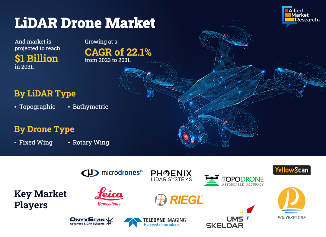
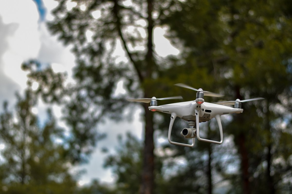
LiDAR Drones: The Next Big Thing in Technology Innovation.
Factors such as the rise in the adoption of LiDAR drones for mining applications, growth in investments in smart city projects, and expansion in applications in civil and defense engineering are the major drivers for the market. Moreover, the factors such as stringent restrictions and regulations related to the use of drones in various countries, lack of trained personnel to operate LiDAR drones, and high operational and purchasing costs restrain the growth of these drones.
Furthermore, factors such as the rise in the adoption of aerial data collection tools for environmental purposes and higher investments in the drone industry create lucrative opportunities for leading players of LiDAR drone products operating in the market.
📈Explore the market overview: tinyurl.com/3rdxskew
#AMR #alliedmarketresearach #alliedmarketresearchinsight #LiDAR #DroneTech #3DMapping #HighResolutionData #LaserMapping #RemoteSensing #GeospatialTech #TerrainMapping #LiDARMapping #AerialSurvey #PrecisionMapping #DataVisualization #GISMapping #LiDARScanning #Geomatics #EnvironmentalMonitoring #LiDARTechnology #DroneMapping #LiDARDrones #GISData
2
64

1 Apr 2022
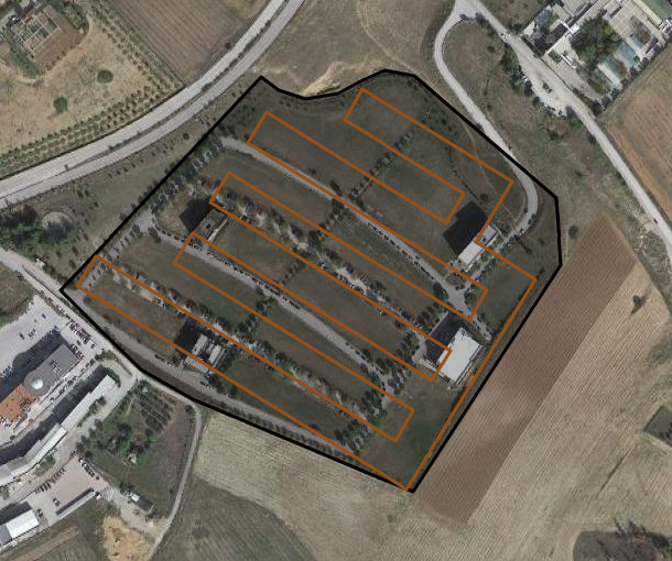
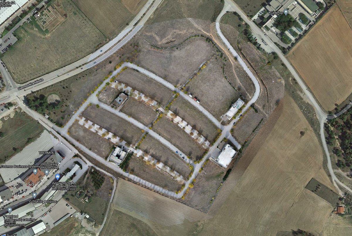
🆕In @CALLISTO_H2020 we developed #pathplanning solutions for #UAVs, covering regions of #highinterest & collect #highresolutiondata, tools useful in cases the resolution of #satellite imagery available is not sufficient in terms of #accuracy to acquire the demanded information.

3
6

8 Dec 2020
TONIGHT! We will take a deep dive into the world of WebSocket with the help of Casne Engineer, Carl. He will explain a case study using #WebSocket as the fastest method for collecting #HighResolutionData for #analytics. It's not too late to RSVP 😀⬇️
hubs.ly/H0CclQ80

1
2
5 Dec 2020
We have one last event to finish out 2020! We will take a deep dive into the world of WebSocket with the help of Casne Engineer, Carl. He will explain a case study using #WebSocket as the fastest method for collecting #HighResolutionData for #analytics.
hubs.ly/H0C3Dl90

3

13 Oct 2020
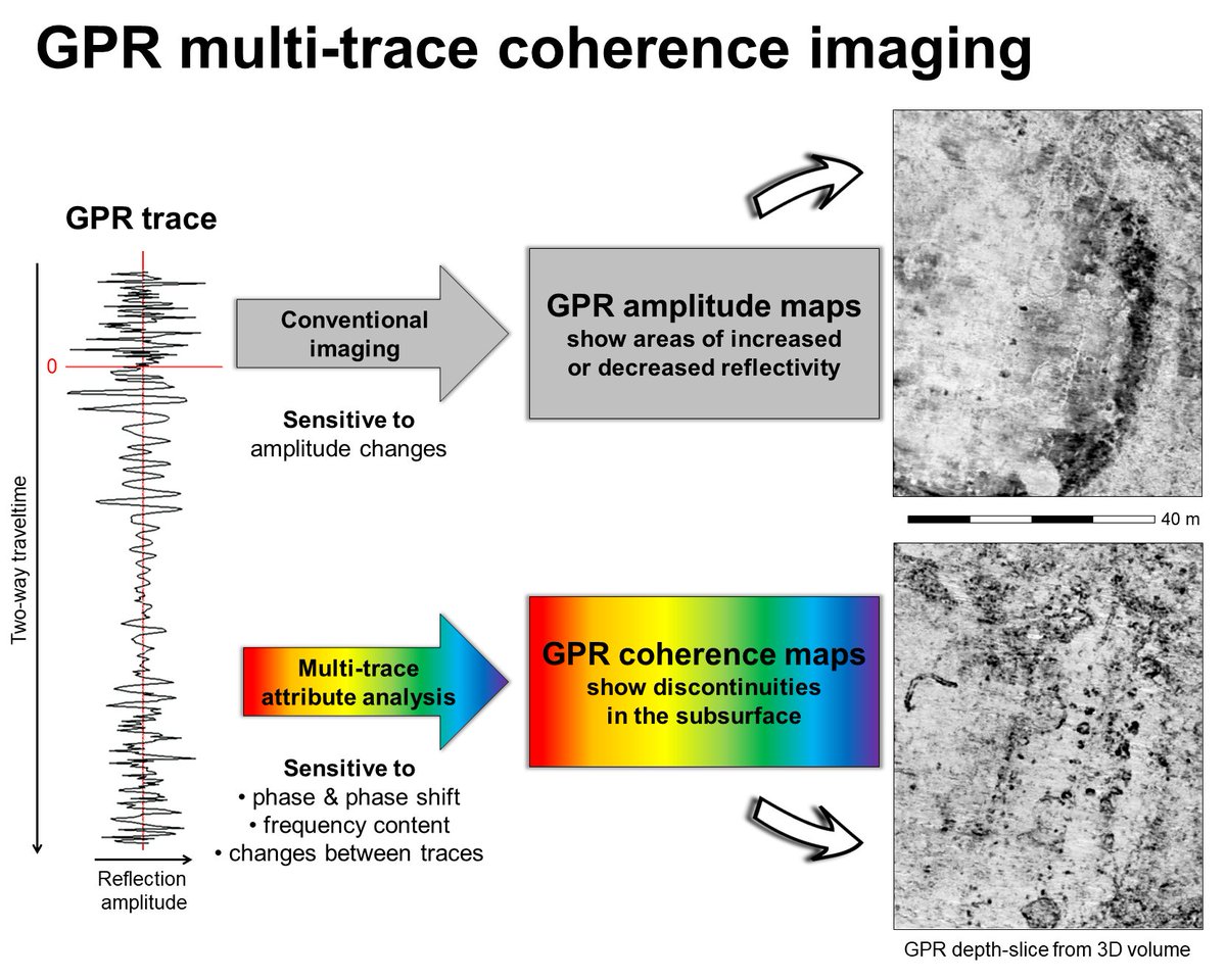
Beyond Amplitudes: Multi-Trace #Coherence Analysis for #GroundPenetratingRadar Data #Imaging
by Immo Trinks and Alois Hinterleitner
👉mdpi.com/2072-4292/12/10/158…
#GPR
#highresolutiondata
#imaging
#remotesensing
3

15 May 2019
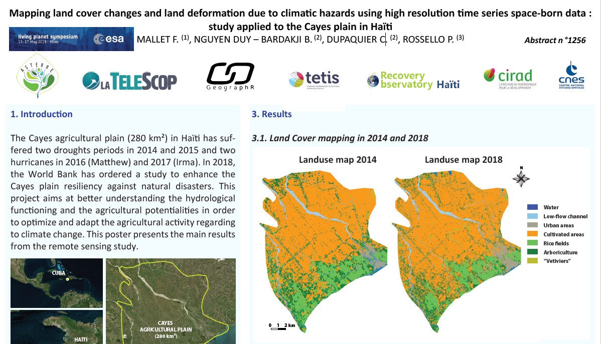
Interested by #climatichazard, #landcover, #highresolutiondata, #timeseries, #Haïti ? Meet @LaTeleScop at #LPS19 #Milano today from 5:30 to 7 pm Area A P140. @ESA_EO @Cnes @Cirad @GeographrR
3