
Computer Geoscientist • Love to work w/ #OpenData • My opinions are my own
Joined May 2009
- Tweets 4,029
- Following 36
- Followers 1,725
- Likes 218
369 Photos and videos


Pascal Neis retweeted

Mar 11
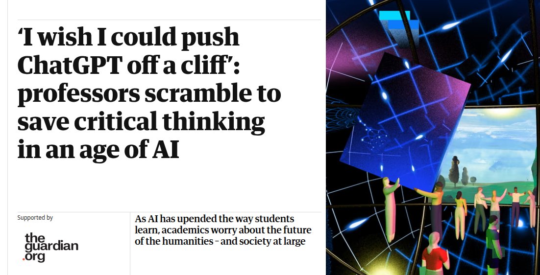
Professors are sounding the alarm as students increasingly offload complex cognitive processing to language models.
The Guardian published a piece.
Literature professors are now hiding invisible trap words inside digital assignments just to catch students who blindly feed prompts into.
While science departments welcome these tools, literature teachers realize students are bypassing independent thought entirely.
The widespread adoption of prompt-based text generation in universities is causing a measurable collapse in students' ability to synthesize raw information.
Surveys show 92% of students use generative software for assignments.
---
theguardian .com/technology/ng-interactive/2026/mar/10/ai-impact-professors-students-learning
71
131
398
25,081
Pascal Neis retweeted

Feb 28
Everybody I know using AI is working more hours not less.
Feb 28

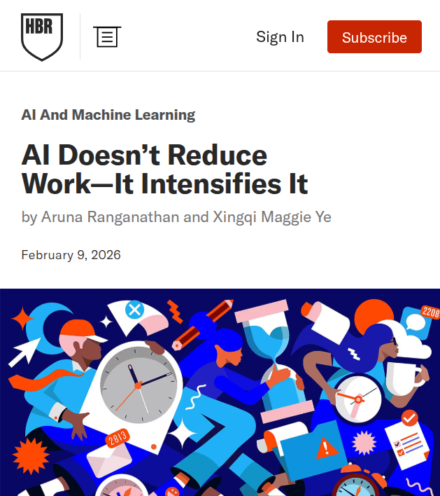
Powerful new Harvard Business Review study.
"AI does not reduce work. It intensifies it. "
A 8-month field study at a US tech company with about 200 employees found that AI use did not shrink work, it intensified it, and made employees busier.
Task expansion happened because AI filled in gaps in knowledge, so people started doing work that used to belong to other roles or would have been outsourced or deferred.
That shift created extra coordination and review work for specialists, including fixing AI-assisted drafts and coaching colleagues whose work was only partly correct or complete.
Boundaries blurred because starting became as easy as writing a prompt, so work slipped into lunch, meetings, and the minutes right before stepping away.
Multitasking rose because people ran multiple AI threads at once and kept checking outputs, which increased attention switching and mental load.
Over time, this faster rhythm raised expectations for speed through what became visible and normal, even without explicit pressure from managers.
297
619
6,394
760,433

Pascal Neis retweeted

Have you been to one of the @PLATIAL_X symposiums and loved it? Do you work with place or platial information and want to connect with a community? Come to the 5th edition of the symposium!
16–18 September, Salzburg, submission of short papers and workshop proposals are welcome
Feb 5

We are thrilled to announce #PLATIAL26 to take place in beautiful Salzburg from 16 to 18 September.
We are seeking short papers and mini workshop proposals on place and platial information from both applied and theoretical perspectives.
platial26.platialscience.net

2
3
190
Pascal Neis retweeted
16 Nov 2025
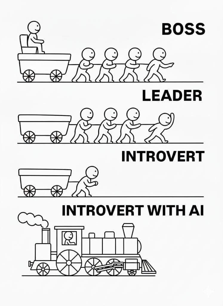
The new steam age.
This has fully arrived, and we are lucky to experience this turning point.
It's possible to do so much more on your own now.
10
18
115
7,164

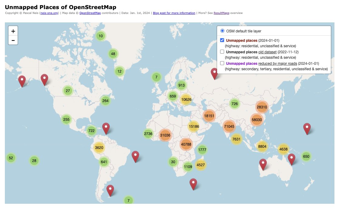
13 Nov 2025
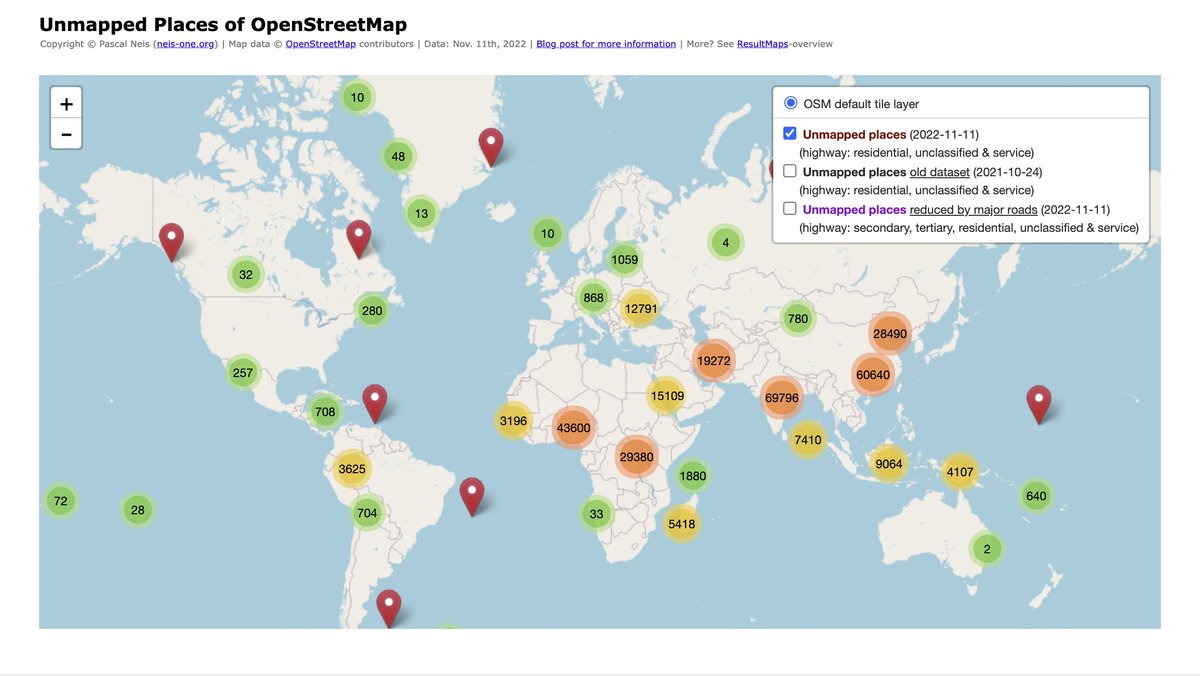
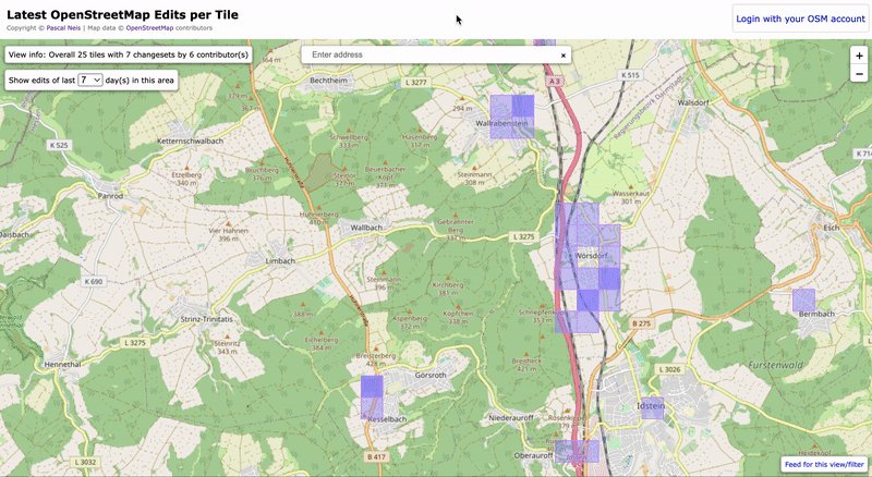
Just updated my "Unmapped Places of @OpenStreetMap" world.
It highlights settlements that still lack proper mapping, showing where the #OpenStreetMap is still blank or missing information. 🌍
👉 resultmaps.neis-one.org/unma…
#30DayMapChallenge #OpenStreetMap #Mapping #OSM
1
2
9
263
Pascal Neis retweeted
20 Oct 2025
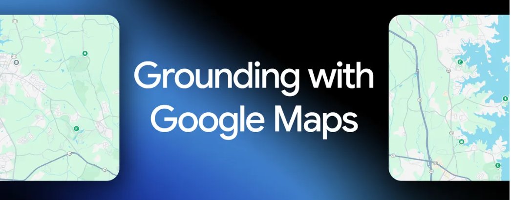
🧭 Google is rolling out a new feature for developers using its Gemini AI models—grounding with Google Maps, so apps answer location questions using live Maps data.
Competing platforms like ChatGPT, Claude, or various Chinese open source models probably won’t have this anytime soon.
This update lets developers link Gemini’s reasoning skills with real-time Google Maps data, so apps can respond with accurate, location-based info like business hours, reviews, or what a place feels like.
This ties Gemini’s reasoning to 250M places, routes, hours, ratings, photos, and reviews for location aware responses.
Grounding means the model calls a trusted tool, pulls factual records, and uses those facts while generating the answer.
Developers enable the Google Maps tool in a request and can pass lat_lng to anchor results to a specific spot.
The response can include grounding metadata plus a context token that lets the app render an interactive Maps widget in the app interface.
The widget shows place details like photos, open hours, ratings, and directions so users can quickly verify and act.
Typical asks include full day itineraries with distance and travel time, hyper local picks for housing or retail, and precise place answers.
Combining Maps Search grounding lets the model use Maps for structured facts and Search for timely schedules or event info, which boosts quality.
The feature is generally available on the latest Gemini models with tool pricing and can be mixed with other tools as needed.
This closes a common gap where language models guessed local facts and now they can base replies on a maintained location database.
8
4
20
4,135
Pascal Neis retweeted

11 Oct 2025
AI product adoption is fast.


262
326
4,081
523,702
Pascal Neis retweeted
24 Aug 2025
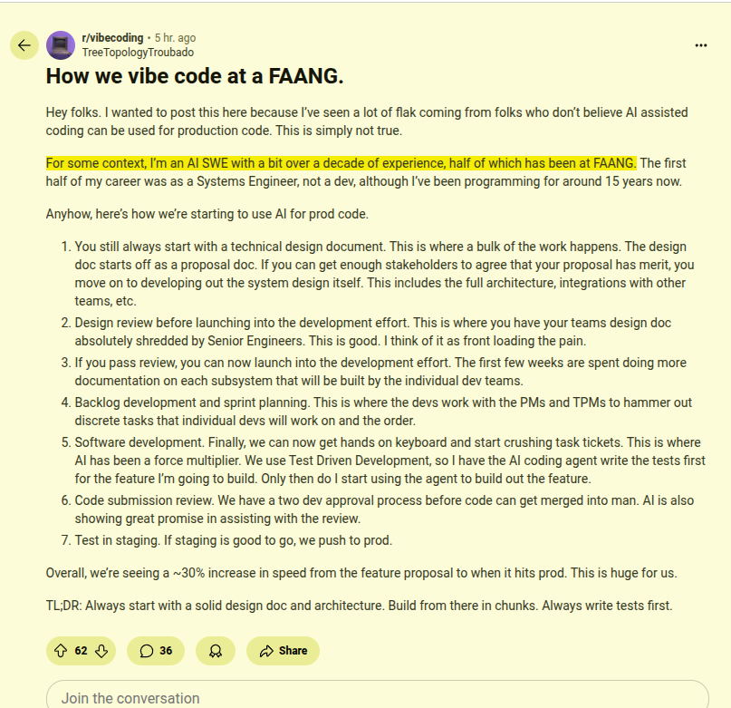
FAANG software engineer tells how they vibe code at FAANG
---
reddit. com/r/vibecoding/comments/1myakhd/how_we_vibe_code_at_a_faang/
161
584
7,803
1,077,133
Pascal Neis retweeted
31 Jul 2025
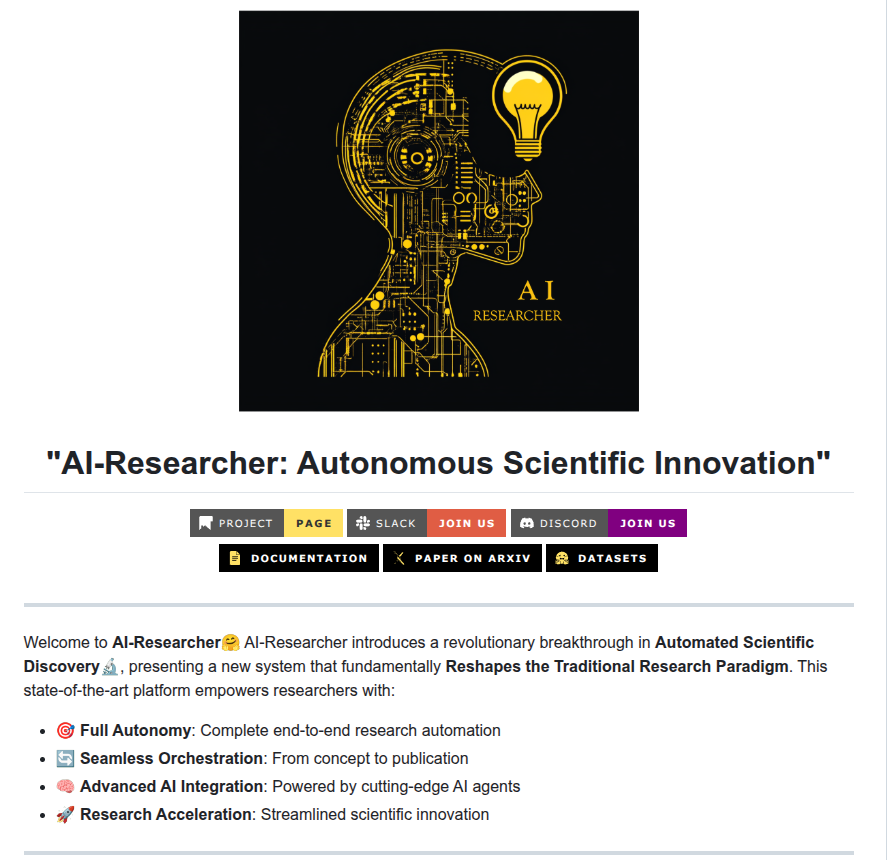
Github: "AI-Researcher: Autonomous Scientific Innovation"
Helps you propose research ideas and autonomously handles literature review, ideation, algorithm implementation, experimentation and manuscript drafting via containerized multi-agent LLM pipelines.
Benchmarked on 4 domains across 2 task levels: reaches 81 % novelty and 0.92 F1 versus human papers while emitting codebases, GUI and Docker stacks in <3 h per project.
11
103
515
41,004


Pascal Neis retweeted

23 Jul 2025
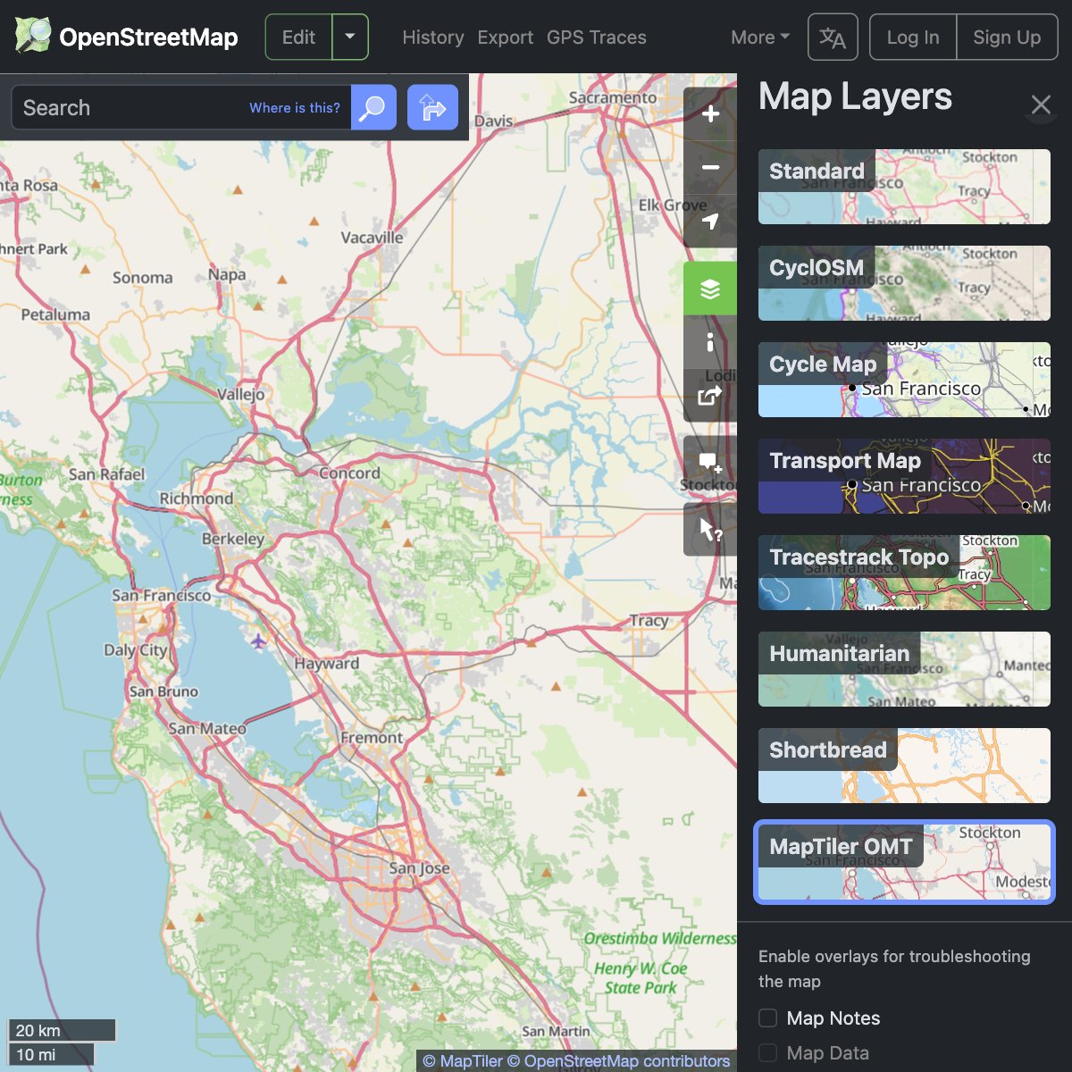
We are happy to announce the deployment of #VectorTiles on OSM Foundation servers & the publication of the layer on the OSM website. We have been working hard to bring you a fresh look to OSM data, paired with exciting technological upgrades.
For details: blog.openstreetmap.org/2025/…

7
71
267
14,676

We're supporting the @openstreetmap community by providing a new map layer for their website.
Thanks to #VectorTiles technology, you can now read map labels in your own language, no matter what part of the world you are looking at! maptiler.link/452oQ8W
#WebMaps #OpenStreetMap

4
31
86
4,735
ollama run gemma3n
26 Jun 2025

Announcing the full release of Gemma 3n, bringing powerful multimodal capabilities to edge devices for developers 🙌 ↓
developers.googleblog.com/en…
21
98
675
59,585
24 Jun 2025
New Blog Post: "From Sky to Trail - Testing GPS Accuracy with Drones, Action Cam and Smartwatch"
👉 neis-one.org/2025/06/from-sk…
1
6
164
Pascal Neis retweeted
22 Jun 2025
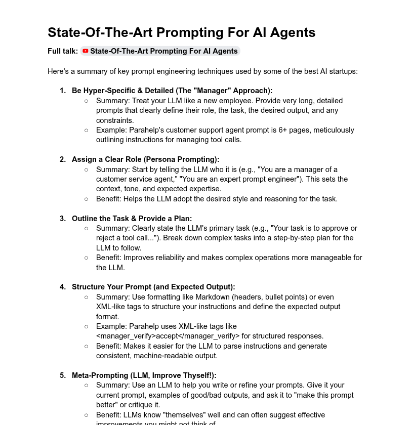
🔥 YC outlines how top AI startups prompt LLMs: prompts exceeding six pages, XML tags, meta-prompts and evaluations as their core IP.
They found meta-prompting and role assignment drive consistent, agent-like behavior.
⚙️ Key Learning
→ Top AI startups use "manager-style" hyper-specific prompts—6 pages detailing task, role, and constraints. These aren't quick hacks; they’re structured like onboarding docs for new hires.
→ Role prompting anchors the LLM’s tone and behavior. Clear persona = better alignment with task. Example: telling the LLM it's a customer support manager calibrates its output expectations.
→ Defining a task and laying out a plan helps break complex workflows into predictable steps. LLMs handle reasoning better when guided through each sub-task explicitly.
→ Structuring output using markdown or XML-style tags improves consistency. Parahelp, for instance, uses tags like <manager_verify> to enforce response format.
→ Meta-prompting means using LLMs to refine your own prompts. Feed it your prompt, outputs, and ask it to debug or improve—LLMs self-optimize well if given context.
→ Few-shot prompting with real examples boosts accuracy. Startups like Jazzberry feed challenging bug examples to shape LLM behavior.
→ Prompt folding lets one prompt trigger generation of deeper, more specific prompts. Helps manage workflows in multi-step AI agents.
→ Escape hatches instruct LLMs to admit uncertainty. Prevents hallucination and improves trust.
→ Thinking traces (model reasoning logs) and debug info expose the model’s internal logic. Essential for troubleshooting and iteration.
→ Evals (prompt test cases) are more valuable than prompts themselves. They help benchmark prompt reliability across edge cases.
→ Use big models for prompt crafting, then distill for production on smaller, cheaper models. Matches quality with efficiency.
27
200
1,716
253,442
Pascal Neis retweeted

18 Jun 2025
Tonight is #geomob, with a talk about @osmuk from director @stevekennedyuk. Get signed up to attend here: thegeomob.com/post/june-18th…
Geobeers afterwards, but if that's not enough...
We'll follow up with a social OpenStreetMap pub meet-up *next* Wednesday: wiki.openstreetmap.org/wiki/…
2
3
162