
pastor. Storm spotter for @nwsjacksonms & @nmscas. Reports not pictures may be use. often rely info for @wtvaweather Views not NMSCAS or others
Joined May 2013
- Tweets 1,872
- Following 219
- Followers 235
- Likes 76
214 Photos and videos


Michael Bishop retweeted

28 Dec 2024
4
7
841
Michael Bishop retweeted

28 Dec 2024
Holy…
#MSwx
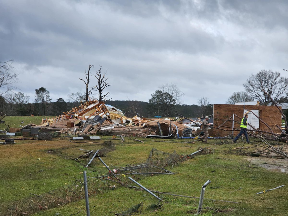
28 Dec 2024

Big time tornado damage near Bude, Mississippi!
@Brandonbirdwx
@ReedTimmerUSA
@BrandonCopicWx
@ChasingWConnor


2
1
370
Michael Bishop retweeted

9 Sep 2024
Tropical Storm #Francine Advisory 4A: Francine Stronger and Becoming Better Organized. Preparations Along the Louisiana Coast Should Be Underway. hurricanes.gov
5
143
397
95,297
Michael Bishop retweeted

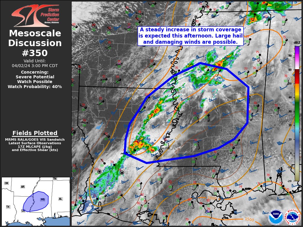
2 Apr 2024
A watch could be issued across central MS as storms flare up to the west. Large hail and damaging wind gusts would be the main threats with any strong storms this afternoon. #mswx
2 Apr 2024

4
2
962
Michael Bishop retweeted

25 Mar 2024
3.25.24 NMSCAS Weather Radar Only Stream (No Audio) x.com/i/broadcasts/1yoJMwBvv…
2
1
262
Michael Bishop retweeted
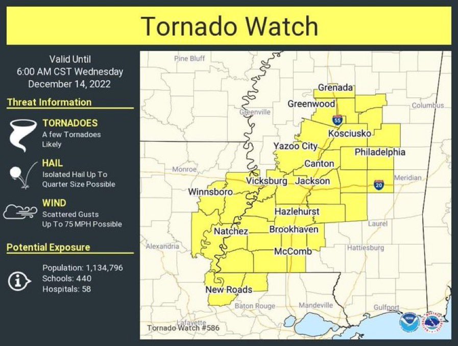
25 Mar 2024
Tornado Watch for Attala, Carroll, Choctaw, Clay, Holmes, Humphreys, Leflore, Lowndes, Montgomery, Noxubee, Oktibbeha, Webster and Winston County in MS until 2:00am. NMSCAS Online: nmscas.org/ #mswx
2
6
397
Michael Bishop retweeted

11 Mar 2024
HEADS UP: The Gulf Coast gasoline spec shifts to full summer gasoline today and there could be a slight impact to #gasprices in some areas of the Gulf and SE US in the days ahead.
2
19
5,499

15 Jan 2024
RT @NMSCAS: From NMSCAS Adrian Ronca-Hohn (@RoncaHohn) in Corinth. He says about an inch and a half of snow in that area. Areas south have…
1
1
Michael Bishop retweeted
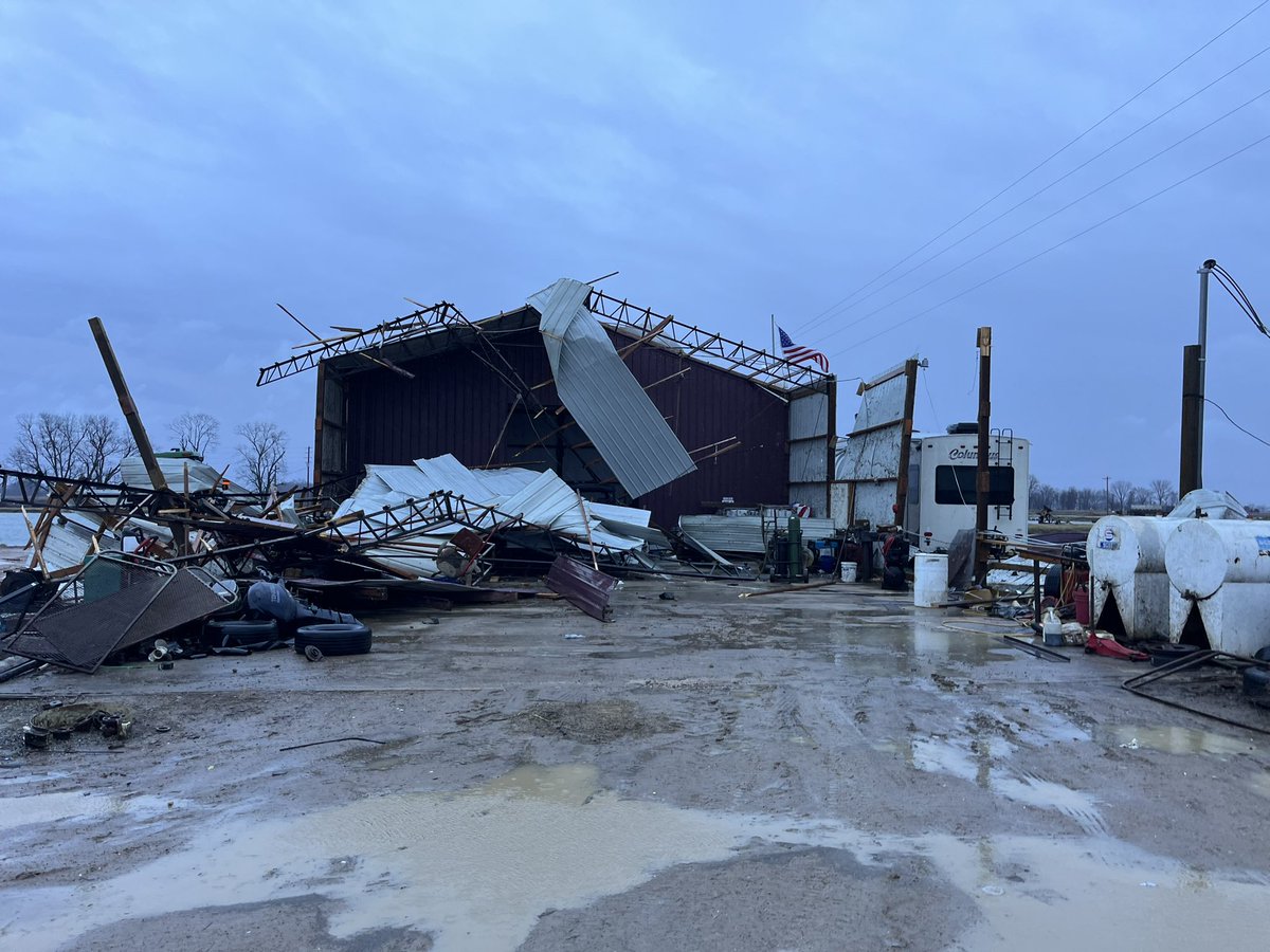
12 Jan 2024
Damage in Humphreys County. @NWSJacksonMS #mswx
12 Jan 2024

3
6
3,176
Michael Bishop retweeted

9 Jan 2024
➡️ Did you see severe weather from storms earlier this evening? Hail? Storm damage? Flooding? Feel free to text us reports or pictures and in case you encounter any additional severe weather overnight, send us reports! #lawx #mswx

ALT Text us severe weather and flooding reports at 504-527-8678
3
4
15
7,840
Michael Bishop retweeted

10 Dec 2023
We have teams assessing damage and looking for patients. Unfortunately, we can confirm there are 3 Fatalities as a result of the severe weather on Nesbitt Lane.
19
174
357
180,946
Michael Bishop retweeted

9 Dec 2023
Distant shots of two golf ball sized ones in senatobia.


5
5
972
5 Dec 2023
Come on down and help us Pack the Trailer. Can’t make it tonight? Still plenty of ways to donate. Visit: .facebook.com/choctawcountyfoodministry 4 more info. @wtva9news @WCBINEWS @MSFoodNet #food4familes


2
1
281
Michael Bishop retweeted

8 Nov 2023
MISSISSIPPI RACE CALLED: Incumbent GOP Gov. @tatereeves is projected to win his reelection bid over Democrat challenger Brandon Presley, according to @NewsNation / @DecisionDeskHQ. #Elections2023 #Mississippi trib.al/m5DpRWg

3
6
21
6,485
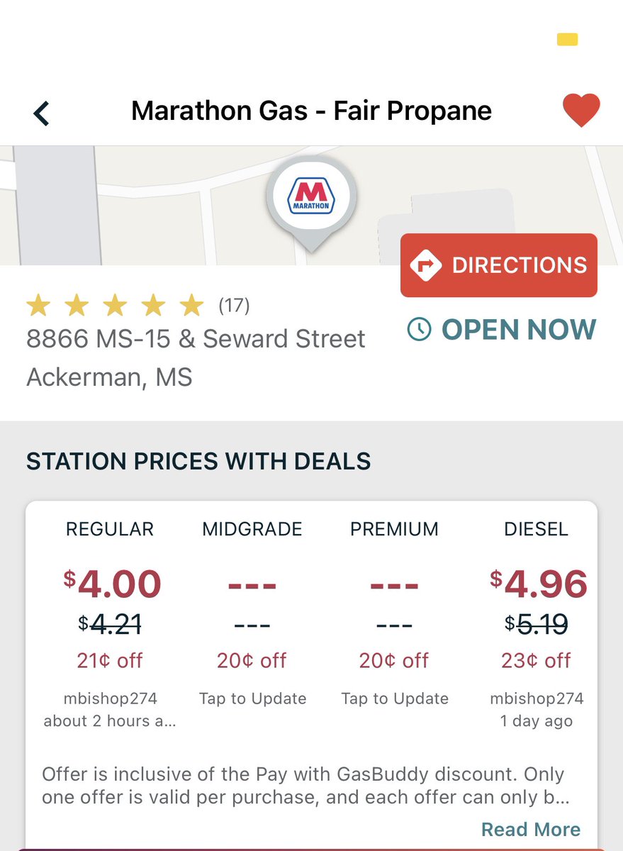
Michael Bishop retweeted
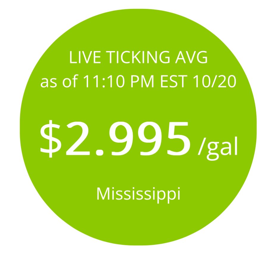
21 Oct 2023
BREAKING: According to GasBuddy data, Mississippi is now the third state with average #gasprices falling to $2.99/gal.
3
7
38
11,066
29 Sep 2023
. @MattWTVA @matt_laubhan @WTVAWeather 3.5 miles west of De Kalb MS on the way home from the Mountains.
2
6
1,060
Michael Bishop retweeted
7 Sep 2023
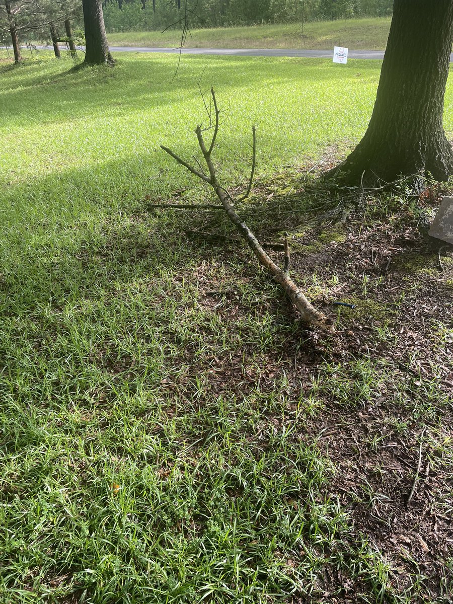
From @NMSCASMike: Tree down on bridge Hwy 9 at Webster/Choctaw County line. Appears to be some power outages also just across the Webster line. #mswx @NWSJacksonMS
2
233
7 Sep 2023
. @GabeWTVA @JohnWTVA @NWSJacksonMS Tree down on bridge Hwy 9 at Webster/Choctaw County line. Appears to be some power outages also just across the Webster line
62