
A Twitter bot that automatically retweets everything about #geospatial #python stuff. #geopython #GIS #RemoteSensing #Jupyter.
Joined May 2020
- Tweets 29,673
- Following 0
- Followers 4,094
- Likes 0
1 Photos and videos

Geospatial Python retweeted

12 Jul 2023
🎥 Watch our new video, revealing how LuxGeospatial revolutionizes geospatial monitoring! Experience monitoring, precision, and sustainability like never before. Join us on this transformative journey! #Geospatial #Innovation #Safety #Sustainability #Luxembourg
4
4
1,659
Geospatial Python retweeted

12 Jul 2023
"[We] decided that animation was the best method to explain the theory, approach and challenges inherent in Sky River," said Blauvelt. "We reached out to an animator and began the process of storyboarding to determine what #geospatial data would be required."
1
2
3
1,780
Geospatial Python retweeted

12 Jul 2023
Piplup Habitat (2014):
Another old (contest) map. This one is supposed to be a habitat for the piplup line. It's also one of my early experiments with tileset spriting lol.
#pokemon #pokemonFanArt #mapping #pokemonMap #pixelart #gameArt

1
1
4
728
Geospatial Python retweeted

12 Jul 2023
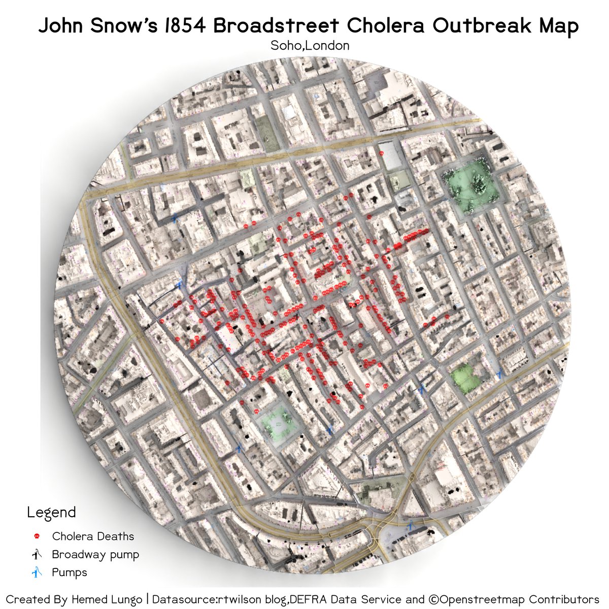
My Version 3 Of A Map🗺️ of 1854 Cholera Outbreak in Soho, London 🇬🇧(A tribute to John Snow) data is from @sciremotesense's blog and @openstreetmap
@OSMLondon And DSM From DEFRA #gischat #QGIS #Blender3d #Remotesensing #cartography #dataviz #mapping #b3d (1/5)
1
13
83
5,406
Geospatial Python retweeted

12 Jul 2023
I wanted to duplicate @kylebarron2 effort using only @flatgeobuf & @cogeotiff without extra processing of @RustGeo #GeoArrow & @WasmWeekly. Use @turfjs if needed.
The result: postholer.com/devmap/John-Mu…
Uses COG at zoom level 1-14, FGB at >14. Click poly for area.
#geospatial
1
2
5
1,265
Geospatial Python retweeted

12 Jul 2023
Spatial Analysis: The Importance of Coordinate Systems w/ Melita Kennedy, @ProjectionWizz & @DrewsAtWork in SDCC Room 30A @ 1pm. #EsriUC #EsriUC2023 @EsriUC @ArcGISanalysis #ArcGIS #GIS #SpatialModels #GIS_algorithms #mapprojections #DataScience #mapping #geostatistics

1
2
618
Geospatial Python retweeted

12 Jul 2023
#NJGF Utilities/Public Works Task Force meeting scheduled for Thu 7/13 is CANCELED. #gis #geospatial #technj
30 Jun 2023

#NJGF Utilities/Public Works Task Force meeting on Thu 7/13 10a-noon. Learn more & RSVP: bit.ly/3HsN2Wp #gis #geospatial #technj
1
399
Geospatial Python retweeted

12 Jul 2023
We have made more progress on @mindat API for #opendata and #opensciecne See how to start at here and links to #jupyter notebooks here mindat.org/a/how_to_get_my_m… @gene21d4 #mineralogy @EarthCube @NSF @EarthDataHelp We will present at @ESIPfed summer mtg next week.
3
5
608
Geospatial Python retweeted

12 Jul 2023
Why can't utilities place all their geospatial data in a single central warehouse? Fabian Mäsch explains. hxgn.biz/3qtXrfH #geospatial #utilities #data hxgn.biz/3ObxVVO
1
1
270
Geospatial Python retweeted

12 Jul 2023
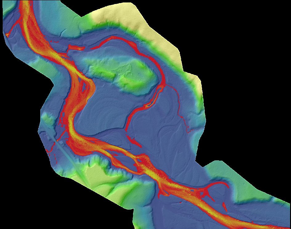
Data Dive: This image shows the Yellowstone River near the confluence of Elk Antler Creek in Wyoming. The image was made using the topobathymetric lidar-derived bare earth model and colored by elevation and water depth.
#Yellowstone #Wyoming #Lidar #GIS #Geospatial
1
4
653
Geospatial Python retweeted

12 Jul 2023
Instead of building your own #API capabilities, work with Precisely and leverage our #addressvalidation, #geocoding, #geospatial, and #dataenrichment APIs. Register for our #webinar on July 19 to learn more: okt.to/7dpyBL

2
3
327
Geospatial Python retweeted

12 Jul 2023
Another cool river basin map by @Steve_Tornes 🇨🇦
Follow my latest tutorial to create your own river basin maps of any country in the world 🏞️
🔗youtu.be/HugGwjogPv0
#RStats #DataScience #tutorial #coding #geospatial #maps #dataviz

4
8
2,265
Geospatial Python retweeted

12 Jul 2023
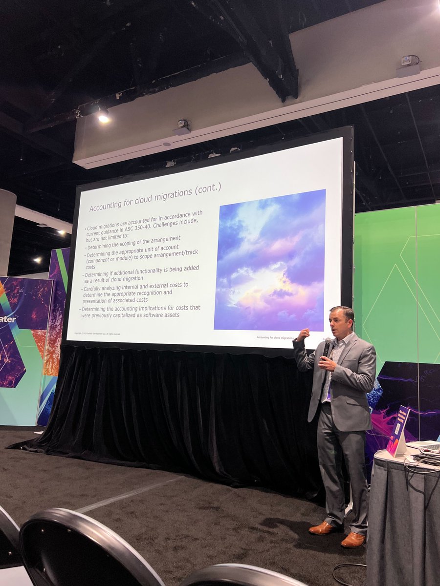
A big thank you to Chris Chiriattii from @DeloitteUS for being the keynote speaker for our #esriuc session: CapEx vs. OpEx: How to Account for Your Cloud Spend ☁️ @EsriUC @EsriPartners #gis #geospatial
3
2
518
Geospatial Python retweeted

12 Jul 2023
📍Big news everyone! The Flex Mini just released and I could not be more excited to be able to talk about it now. Ask me anything ! 📍
Link: einpresswire.com/article/643…
#gischat #geospatial #atxgis
1
186
Geospatial Python retweeted

12 Jul 2023
Here was an interesting #Python / #Pandas challenge, to find the most common languages spoken in Niagara Falls, where I live.
Can you adapt this for your own location? How does it compare with my results?
#Jupyter #JupyterNotebook #GitHub
github.com/pbeens/Data-Analy…
2
1
645
Geospatial Python retweeted

12 Jul 2023
2
3
429