
Mar 20
How it's made:
1. WA DNR LiDAR portal → 1m hillshade
lidarportal.dnr.wa.gov
2. USGS 3DEP WCS → elevation colour
nationalmap.gov
3. Blend in Python with forge3d matplotlib
Full notebook 👇
github.com/milos-agathon/for…
#GeoPython #Cartography #RemoteSensing
2
92

4 Nov 2025
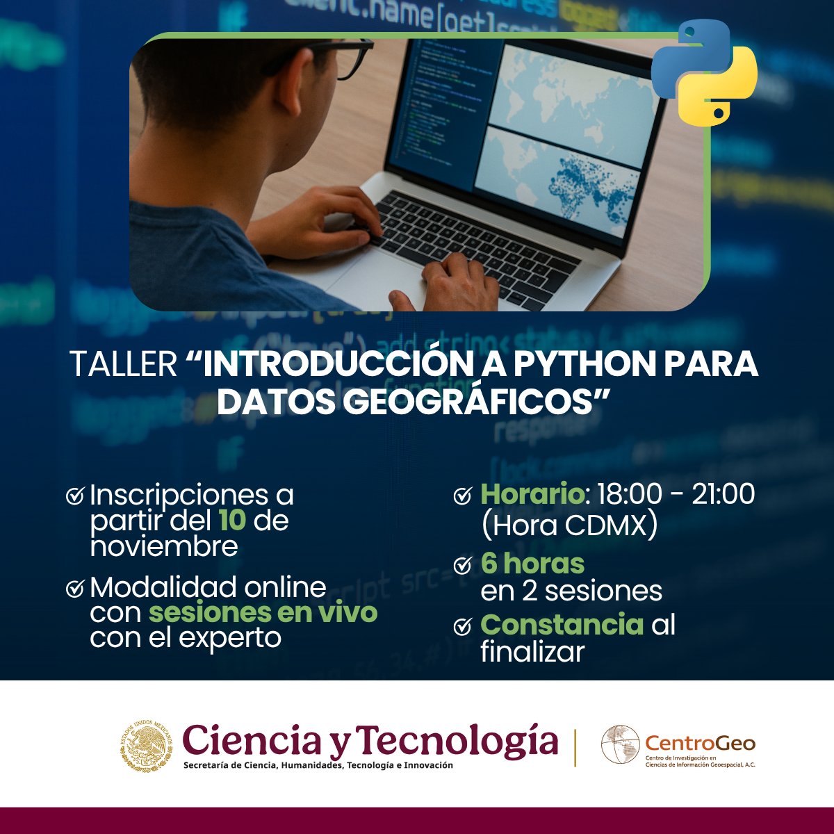
No necesitas experiencia previa. Este taller te guía desde lo más básico hasta crear tus propias visualizaciones con Python y GeoPandas.
Puedes revisar más detalles del taller aquí: linktr.ee/cgeo
#tallerpython #cursoonlinepython #geopython #pythonparadatosgeográficos
40
218
8,351

22 Oct 2025
🚀 Visualize Big Vector Data in Python—FAST!
Tired of slow and clunky tools for visualizing big vector dataset in Python? Discover this one-line Python trick using Leafmap DuckDB to instantly render huge vector datasets—even gigabytes in size—right in your Jupyter notebook. In this video, you'll learn how to:
✅ Visualize millions of vector features with ease
✅ Use Leafmap DuckDB to serve vector tiles dynamically
✅ Handle GeoParquet, GeoPackage, cloud-hosted data & more
✅ Create fully interactive maps—without crashing your browser!
📌 Watch the full video tutorial on YouTube: youtube.com/@giswqs/videos
👉 Notebook example: leafmap.org/maplibre/duckdb_…
#Visualization #Leafmap #BigData #DuckDB #GeoPython #GIS #OpenSource
33
257
13,112

19 Jun 2025
Day 62
✨ Took a short break to reset and recharge — and it worked!
Today I explored file handling in Python 🔍
✅ Learned to read, filter & write .csv files
📂 Now one step closer to working with real GIS datasets using code!
#Python #GISDeveloper #LearnInPublic #GeoPython
3
25
13 Jun 2025
Day 61
Diving deeper into #Python today:
✅ Mastered *args & **kwargs
✅ Understood variable scope (local vs global)
✅ Created sleek lambda functions 💡
Challenging but rewarding—one step closer to becoming a #GISDeveloper! 🌍🧠
#GeoPython #LearningByDoing
3
34
5 Jun 2025
Day 54
Just explored how #Python powers real-world GIS!
From land use change detection to disaster mapping, Python GIS = smart spatial solutions
Libraries used: geopandas, rasterio, numpy, matplotlib
#GIS #GeoPython #SpatialAnalysis #Geoinformatics #RemoteSensing #QGIS #ArcGIS
2
53

25 Feb 2025
Are you attending GeoPython 2025?
GeoPython 2025, scheduled for February 24–26, 2025, in Basel, Switzerland, is set to offer a range of engaging sessions and activities for attendees. Here are some anticipated highlights:
Keynote Speakers
The conference will feature renowned experts in geospatial data science and Python programming, sharing insights into the latest trends and developments in the field.
Workshops and Tutorials
Hands-on workshops and tutorials will provide participants with practical experience in cutting-edge geospatial tools and technologies, catering to both beginners and seasoned professionals.
Paper Presentations
Researchers and practitioners will present their latest findings and projects, offering attendees a glimpse into innovative applications and methodologies in geospatial analysis.
Networking Opportunities
GeoPython 2025 will facilitate numerous networking sessions, allowing participants to connect with peers, share ideas, and explore potential collaborations.
Exhibition Area
An exhibition space will showcase the latest products, services, and solutions from leading companies and organizations in the geospatial industry.
clcoding.com/2025/02/geopyth…
1
5
35
7,321

24 Feb 2025

23
135
5,397
5 Feb 2025
GeoPython 2025 detailed schedule is now available 2025.geopython.net/schedule
#GeoPython #geospatial #geo #conference
1
19
75
4,174

2 Feb 2025
All roads lead to Rome. This map highlights the vast infrastructure of the Roman Empire, showcasing how far their famous roads extended. #Python #DataScience #Geopython #DataVisualization #Rome #Maps

2
1
20
2,168

3 Jan 2025
pygeoapi 0.19.0 released!
github.com/geopython/pygeoap…
#foss4g @osgeo @opengeospatial #geopython #ogcapi
2
3
153
19 Dec 2024
🎉 Exciting news! The talk list for #GeoPython2025 is now available. Check out the amazing lineup of talks and workshops at 2025.geopython.net/talks. See you in Basel!
#Python #GeoSpatial #GIS #RemoteSensing #DataScience #GeoPython
18
44
2,625

8 Dec 2024
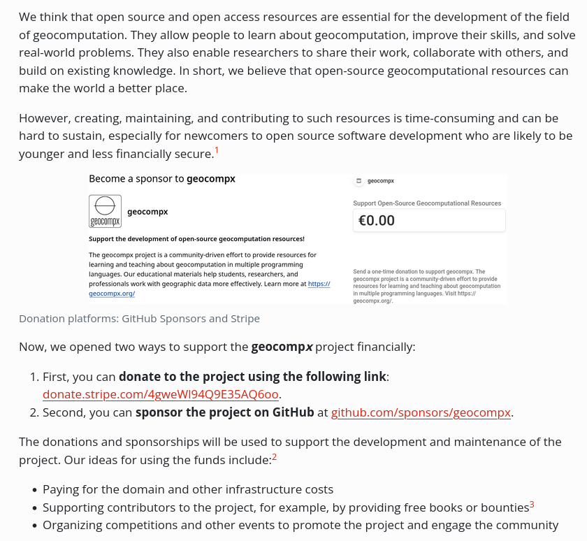
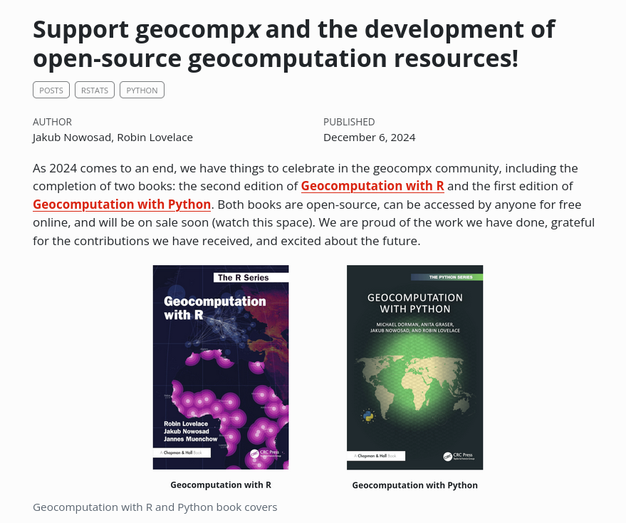
Advancing geocomputation through open-source software! 🗺️
Consider supporting our continued development of free, powerful spatial analysis resources, such as Geocomputation with R.
Learn how to contribute at buff.ly/3OMFPUU
#rstats #rspatial #geopython #gecompx
27
126
8,959

7 Dec 2024
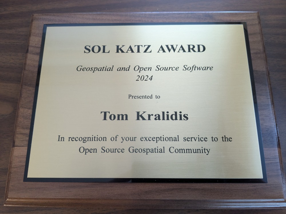
Huge congratulations to Tom Kralidis as the recipient of the 2024 Sol Katz Award (the 20th year of the award!) yesterday in Belém, Brazil. So very well deserved, for the GeoPython and #foss4g community. "we could be heroes, just for one day". cc drshannak.bsky.social
1
5
231

19 Nov 2024
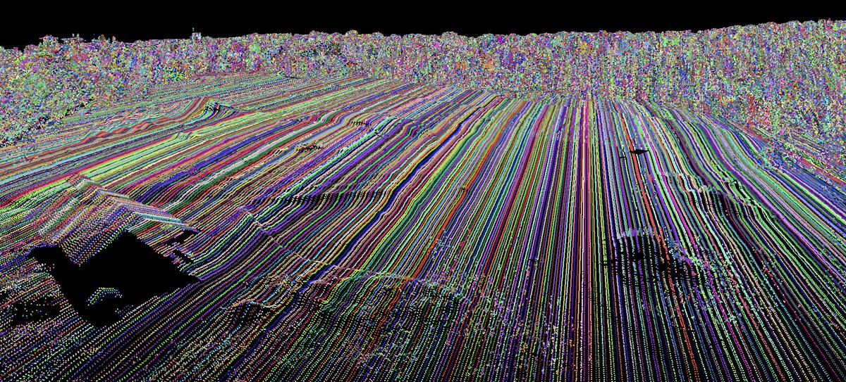
Having fun painting individual #lidar scanlines using #Whitebox Workflows for #Python (WbW). #gis #geomatics #geopython #geospatial #remotesensing
1
8
917
19 Nov 2024
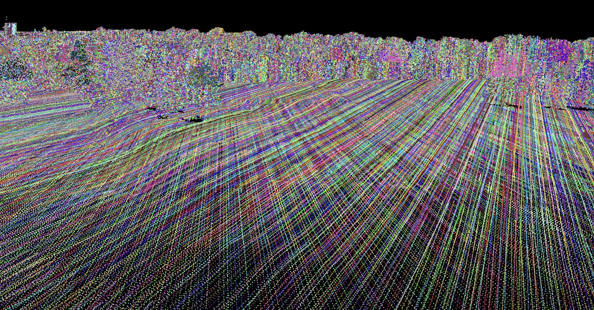
Painting individual #lidar scanlines using #Whitebox Workflows for Python. #geospatial #geopython #geoprocessing #gis #gischat #geomatics
1
7
836
19 Nov 2024
We extended the GeoPython 2025 submission deadline for talks/workshops to November 24 for those who missed the deadline. There will be no further extension.
2025.geopython.net/callforsp…
#geopython #geospatial #geo
3
13
1,673
17 Nov 2024
🌍✨ Leafmap now supports adding directional symbols to the map with only one line of code! 🚦 These icons can be useful for visualizing stream flow, vehicle movement, and more.
Check out the demo here: maps.gishub.org/maplibre/add…
Explore the notebook: leafmap.org/maplibre/add_ico…
#geospatial #dataviz #geopython
23
159
9,237

13 Nov 2024
Image credit: Stolen from Max Gabrielsson's excellent talk at GeoPython : youtube.com/watch?v=hoyQnP8C…

5
265
12 Nov 2024
📢 GeoPython 2025: Call for Speakers closes soon! 📢
Share your knowledge and insights in Python and Geospatial tech with a passionate community. The deadline is approaching on November 15, 2024
Submit here: 2025.geopython.net/callforsp…
#GeoPython #Python #Geospatial
1
3
12
1,057