
Jun 3
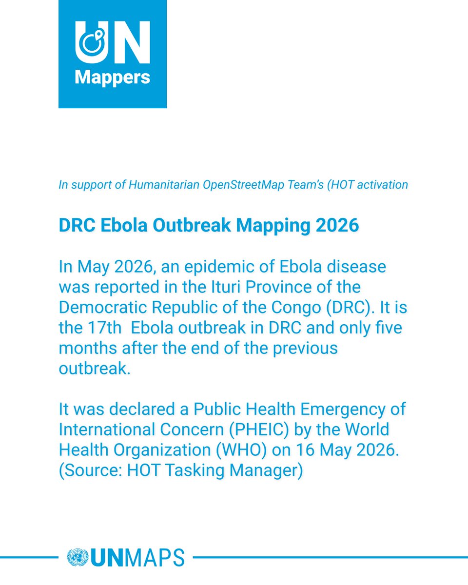
📢 Calling UN Mappers 📢
We are supporting the response activation to map buildings in DRC.
🗺 Features to map: buildings 🏘
🌐 Open to all
📍 Map: tasks.hotosm.org/explore?cam…
More info: wiki.openstreetmap.org/wiki/…
#UNMaps #UNMappers #OpenStreetMap #disastermapping #volunteering
1
7
11
671

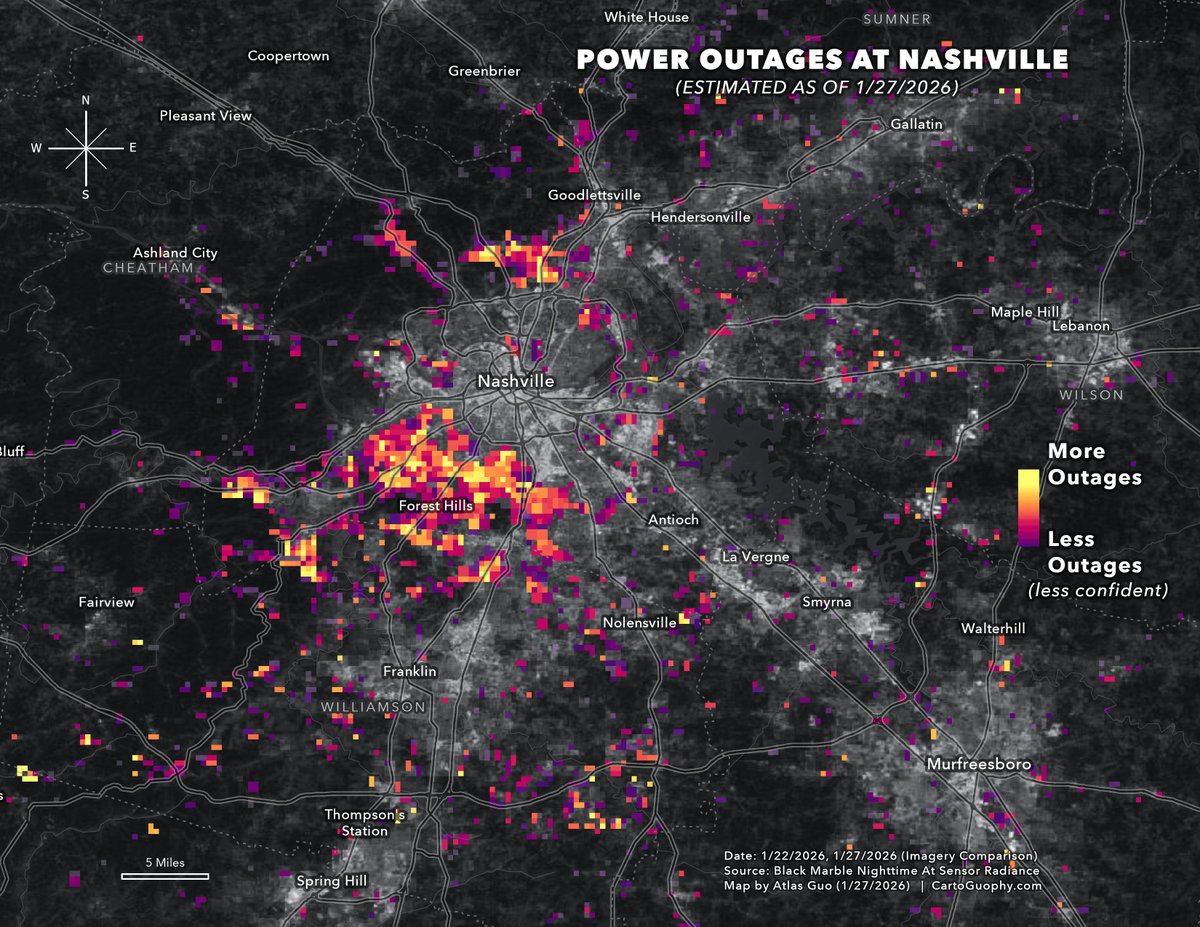
I used satellite imagery over #Nashville from before (1/22) and after (1/27) the recent #WinterStorm to estimate #PowerOutage at a finer spatial scale, based on changes in nighttime radiance. 🛰️❄️🪫🗺️
#WinterStormFern #DisasterMapping #DataVisualization
1
11
46
2,307
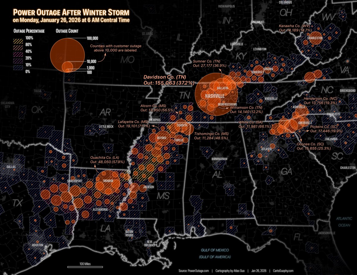
I made a map visualizing the customer count and percentage of #PowerOutage as of 6 AM CT on Jan 26, following the severe #WinterStorm over the weekend. #Nashville stands out as the hardest hit area in terms of outage numbers. #WinterStormFern #DisasterMapping #DataVisualization
1
5
15
1,026

11 Nov 2025
🚨 The latest imagery of Typhoon Kalmaegi captured on the 9th of Nov.
Interactive map 👉: soaratlas.com/maps/139809?po…
Major flooding is visible across the coastal region, with a distinct brown plume stretching from river to ocean.
#TyphoonKalmaegi #DisasterMapping #RemoteSensing
2
235

26 Jan 2025
@FireInsuranceCA @HUDgov @Teamsters @recycle_now @greencity_sol out of power by natures @disastermapping @H2OROI the next town city or worldwide Land need to plan for a very 3way hit, COLD HEATdomes- mid-state hail-tornados-floods-bigwaves fires and earthquakes with allinply
1
25


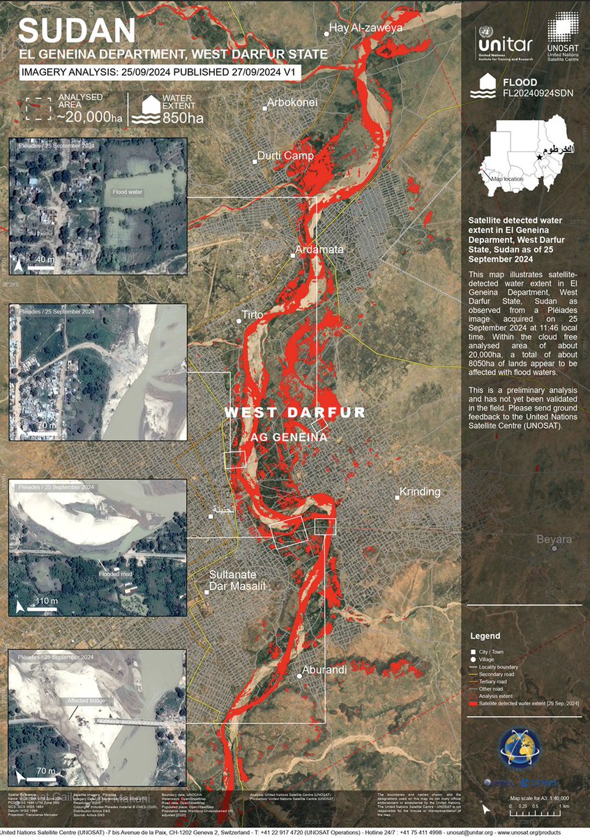
🇸🇩 El Geneina, West Darfur, Sudan (25 Sept 2024): Satellite data shows ~850 ha of land affected by floods in a 20,000 ha analysed area.
📸unosat.org/products/3982
#Sudan #FloodMonitoring #UNOSAT #DisasterMapping #Geospatial #WestDarfur #EMS
2
2
364

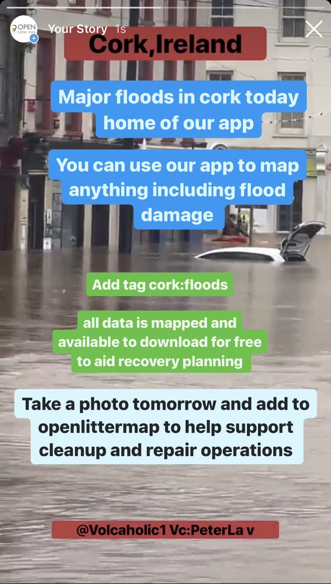
18 Oct 2023
Help collect data on flood damage to support improved disaster recovery support planning
You can use our app for anything, not just litter
All data is mapped and available for free download to allow society to find equitable evidence-based solutions
#openlittermap #corkfloods #StormBabet #citizenscience #disastermapping #stormrelief #peoplepower #opensource #opentags #opendata #cleantheplanet #MMORPG #SDGs
3
2
3,354

28 Sep 2023
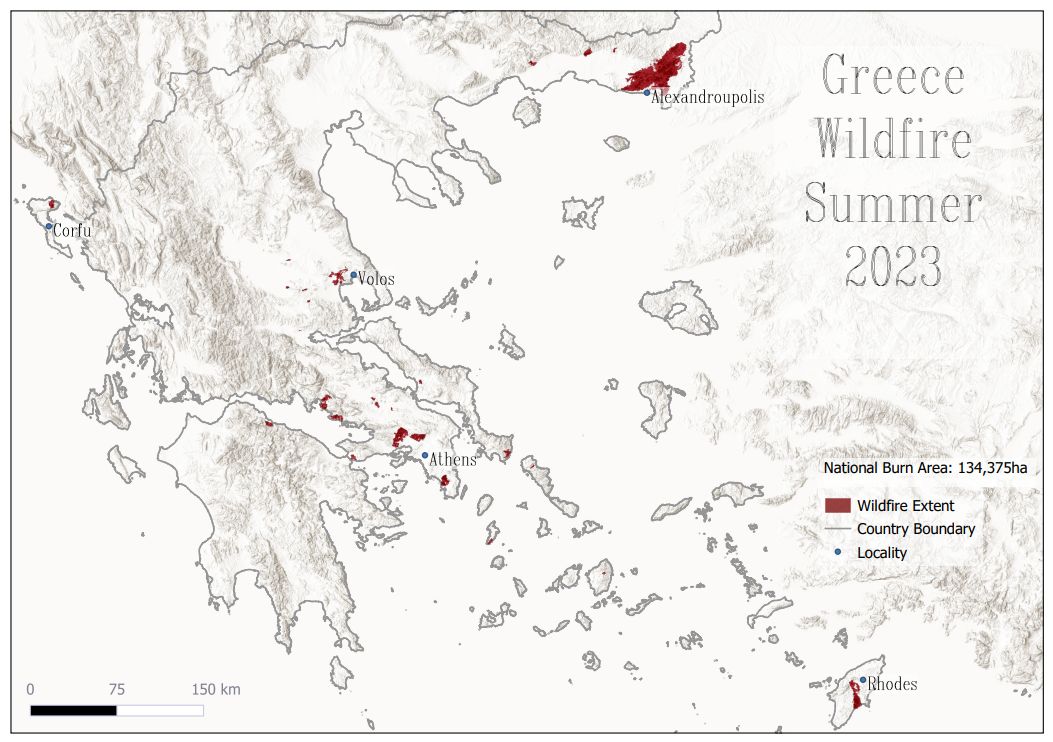
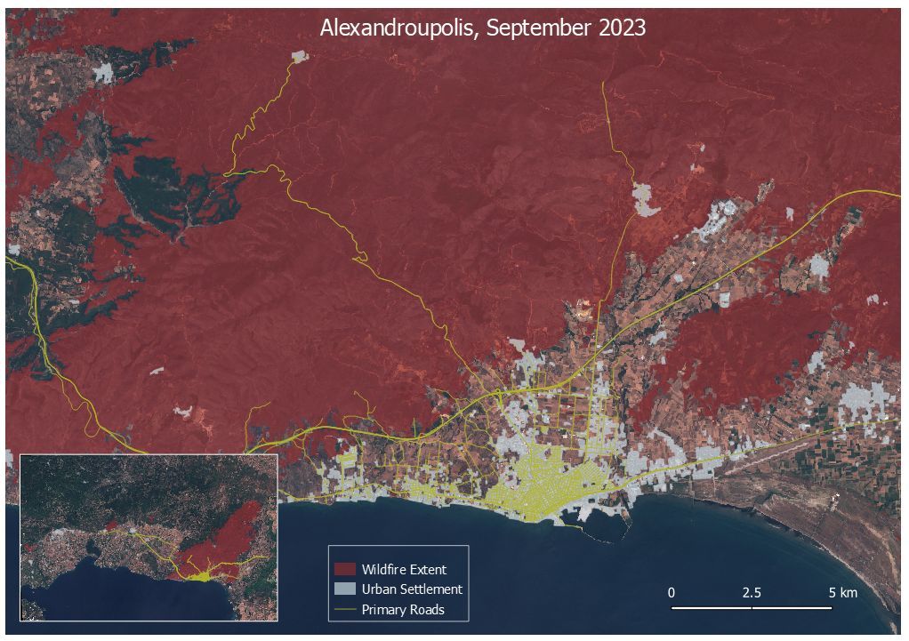
🌍 Explore our latest #EO blog in which we look back at the unprecedented Greek wildfires through satellite imagery and reveal their impact on some major population centres ➡️ buff.ly/3PSCe9f #wildfires #EarthObservation #DisasterResponse #DisasterMapping #WildfireMapping

5
91

12 Sep 2023
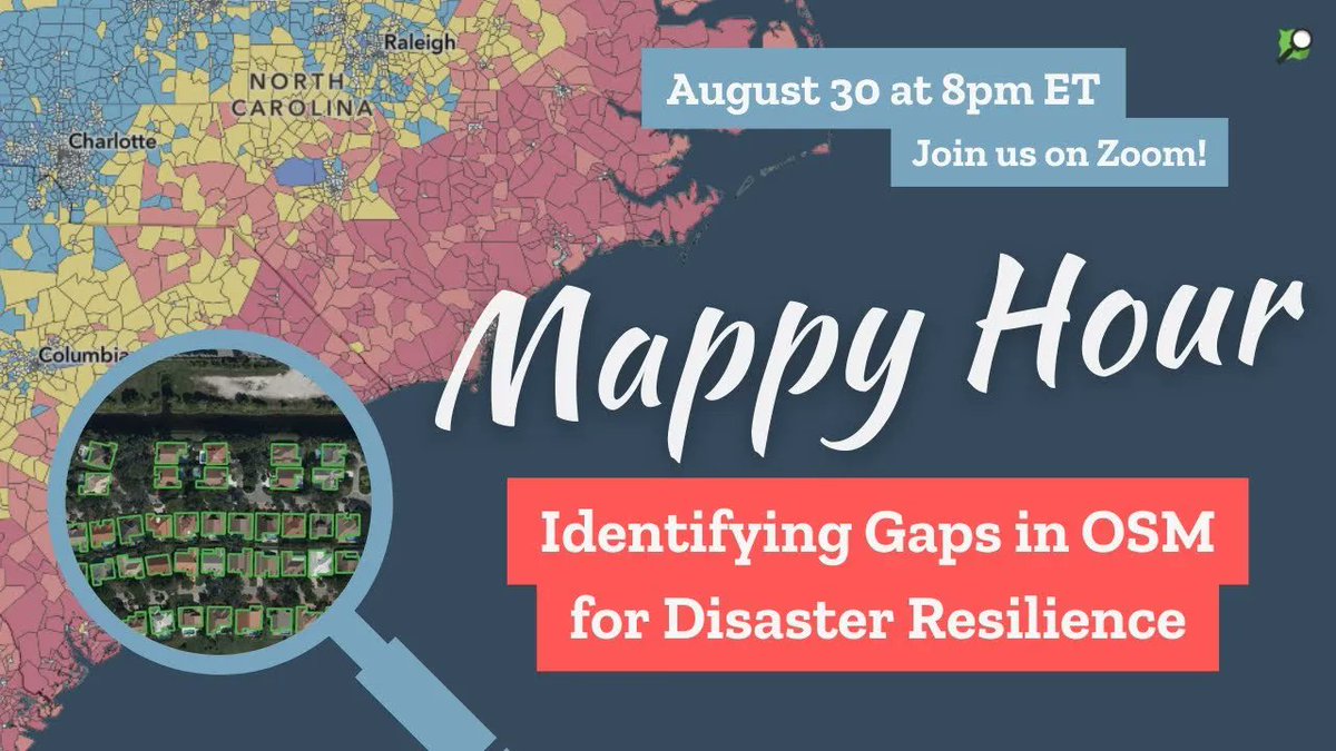
📣 August's Mappy Hour presentation is available here: buff.ly/3sS7w7n
#MappyHour #disasterresilience #disastermapping #OpenStreetMap #OpenStreetMapUS
2
160

9 Sep 2023
No prior experience is required. Here are some resources that you can use to start:
1️⃣ Basic video on how to map: youtube.com/watch?v=Ir-3K0pj…
2️⃣ Review Learn OSM: learnosm.org/en/
3️⃣ Join HOT's slack channels for #disastermapping and #mappersupport: slack.hotosm.org/
1
10
12
1,205
20 Jul 2023
Thanks to all the volunteers who have helped us map flooded areas in Vermont. There is still work to do: tasks.openstreetmap.us/proje… #Vermontflood #Vermontflooding #OpenStreetMap #volunteer #disastermapping
3
6
577
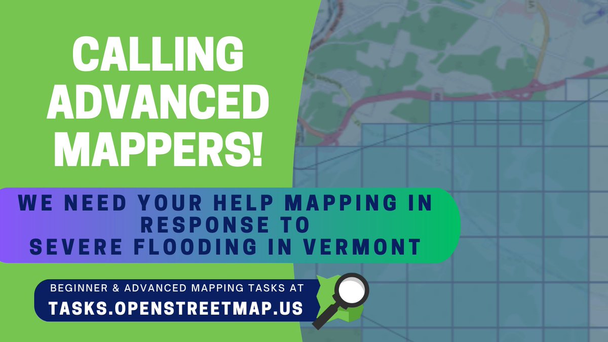
19 Jul 2023
Calling advanced mappers! Help us map Vermont roads and waterways affected by severe flooding: tasks.openstreetmap.us/proje…
#OpenStreetMap #volunteers #disastermapping #Vermontflooding #Vermontfloods
2
3
516

Our #UAS team met crisis response experts to discuss UAS technology for rapid #disastermapping. Our colleagues collected some drone based data for outlining its potential. Excited for future collaborations in disaster mapping and emergency response efforts
remote-sensing.org/uas-mappi…
6
693

11 Jun 2023
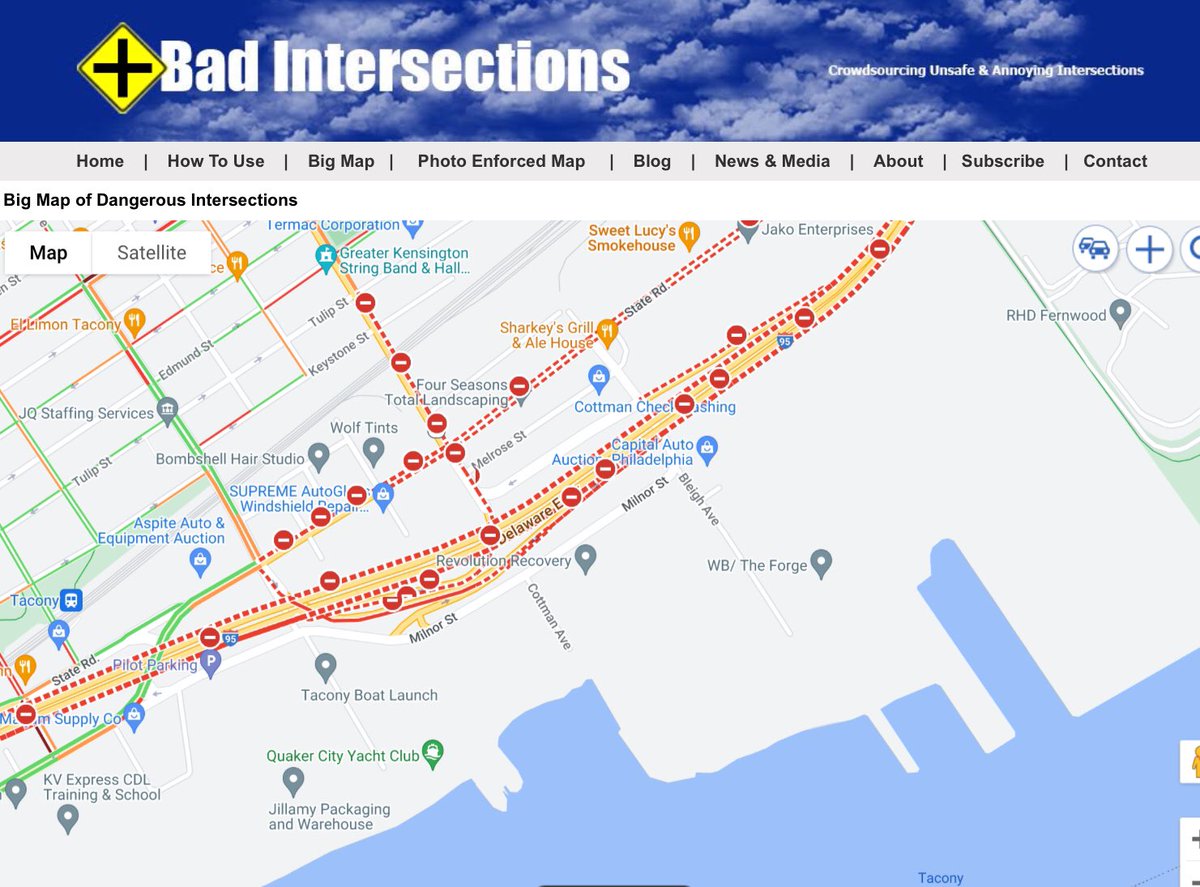
Looks like the underpass has a curve and likely has lots of accidents
1
3
28

17 Mar 2023
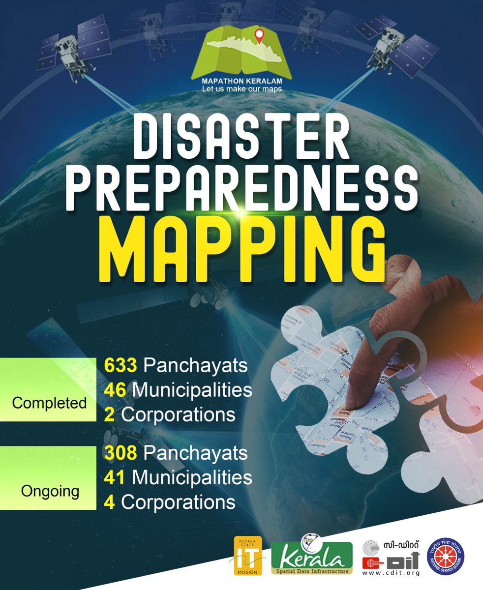
Mapathon Disaster Preparedness Mapping Statistics 🙂
#mapathon #mapathonkerala #disastermapping
@_DigitalIndia @CMOKerala @kerala_it @cditofficial @HQ_DG_NCC
2
77

10 Feb 2023
Another Alice G that maps - #Geography #disastermapping Really good interview on @bbcworldservice with another Alice G from @mapaction regarding how they’re helping on the ground in Turkey. mapaction.org/live-mapaction… #geographyteacher
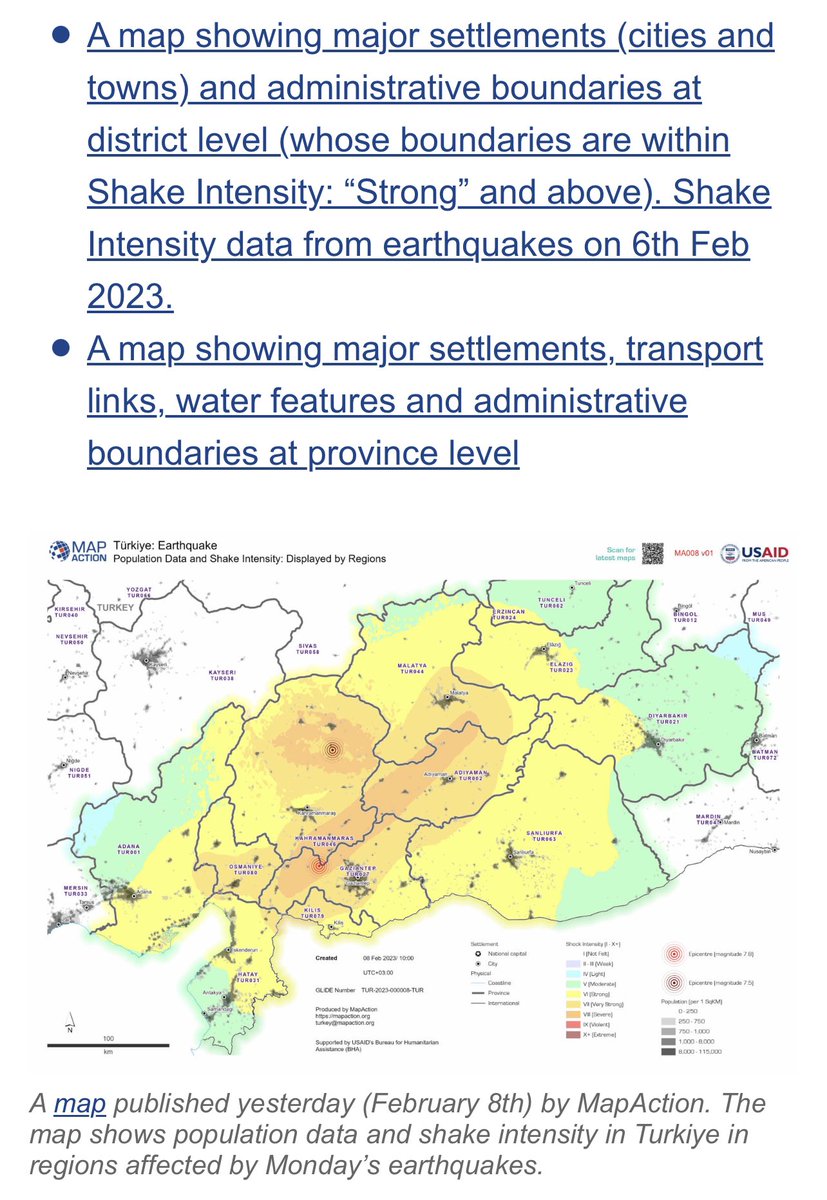
1
3
3
388

14 Nov 2022
We have partnered with @akdn & #Esri for #GISDay 2022! Join us to hear from the keynote speakers & our Disaster Services Manager @harrymahar discuss 'Emergency mapping through volunteers'.
16 Nov I 14:00 to 17:30 (IST)
Registration 👉attendee.gotowebinar.com/reg…
#OSM #disastermapping
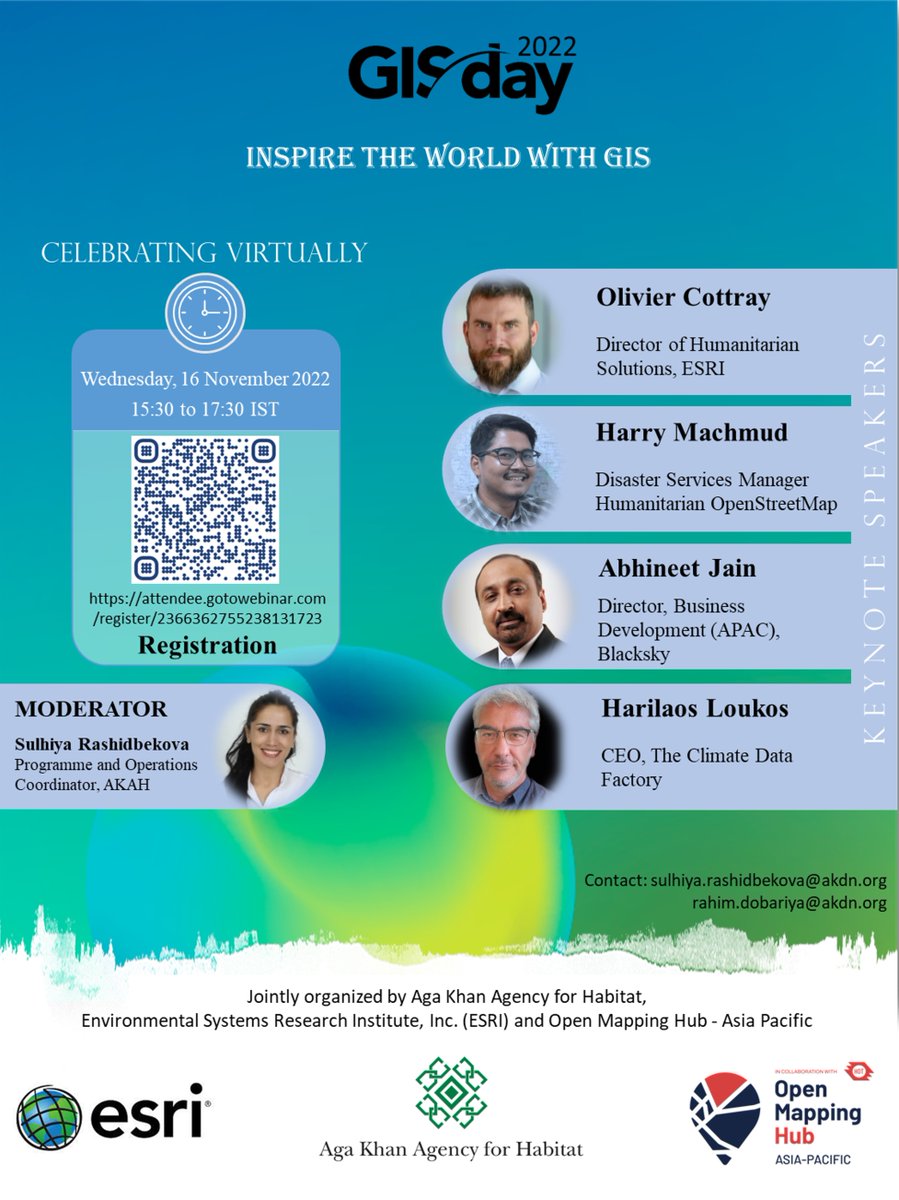
2
14
28 Oct 2022
#Bhola is one of the most vulnerable coastal regions in #Bangladesh & is adversely affected by massive and heavy flooding. Please support this task on the Tasking Manager👉 tasks.hotosm.org/projects/11…
#OSMBangladesh #disastermapping #OSM
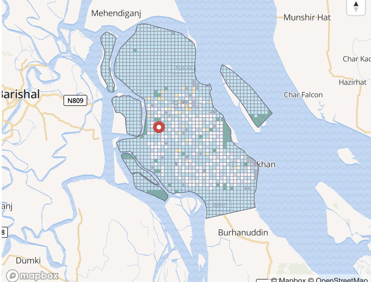
5
8