
Jun 9
🎤 Speaker announcement!
Join us 17 June for "Decision-Maker Perspectives on the Evolving Demand for EO Capacity Building."
Contributors: NASA Earth Action, Paraguay space agency (AEP), GeoDEV Intl. South Africa space agency (SANSA)
Info/register: bit.ly/4fU84QH

1
27

Thank you GeoDev...There are currently 6 imposter accounts trying to clone my original account. Be assured I only have one account and this is 100% real.
11
340

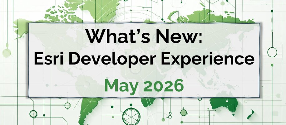
May 7
In 1 week, @EsriDevs webinar, What's New: #Esri #Developer Experience (May 2026) tinyurl.com/y8dc4nxx
#geodev #esridev #location #platform #GIS #arcgis #MapLibre #mapping @EsriDevEvents @Esri @URISA
1
3
99
Apr 27
What is #ArcGIS #Maps #SDK for #JavaScript? tinyurl.com/mvwns5x7
#geodev #esridev #esrijs #GIS #developers #esri #mapping #webapps #GISchat #geospatial @esri @EsriDevs @EsriPartners @EsriStartups @URISA
3
3
159

Mar 27
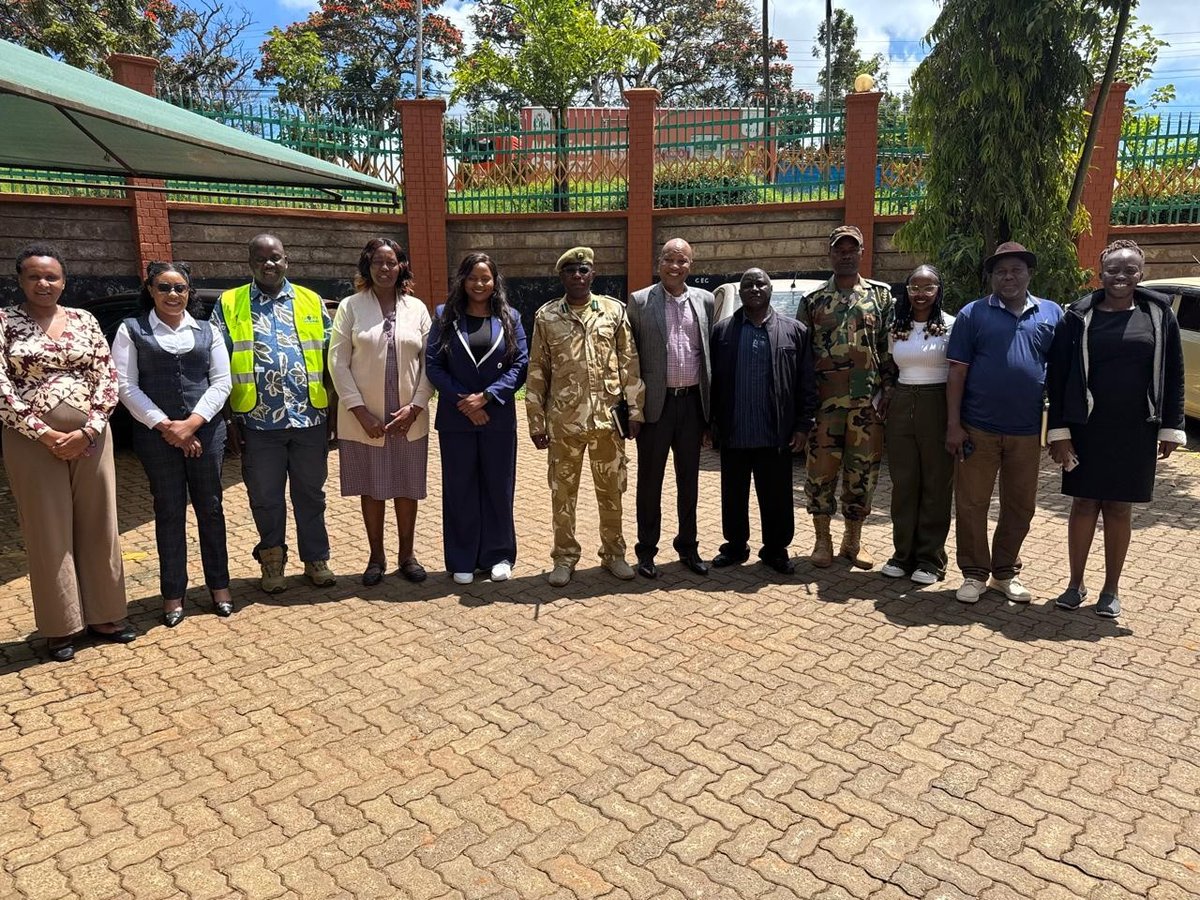
Trade, Tourism and Cooperatives Ag. Chief Officer Sandi Mugambi convened an inception meeting with representatives from the State Department for Tourism, GEODEV, Kenya Wildlife Service (KWS), and Kenya Forest Service (KFS) today.
#BuildingMeruTogether
#TujengeMeruPamoja


3
128

16 Nov 2025
Elevate Your GIS Skills with PostgreSQL #PostGIS: The Professional’s Vector Data Backbone
If you’re still managing your vector GIS data through scattered shapefiles, ad-hoc folders, or aging file geodatabases… it’s time for a serious upgrade.
Modern GIS work demands structure, integrity, performance, and scalability — and that means committing your points, lines, polygons, and attributes to a relational geospatial database.
Enter PostgreSQL PostGIS: the open-source geospatial power duo that transforms chaotic data storage into clean, query-driven, enterprise-grade intelligence.
Why Your Vector Data Belongs in a Relational Geospatial Database
Vector #data thrives when attributes, geometries, classifications, timestamps, and metadata are stored in a system designed for relationships. A standard RDBMS handles the tabular side… but without spatial intelligence, your geometry is just a sad binary object.
PostGIS changes everything. It supercharges PostgreSQL with:
🔹 Native Spatial Data Types
Store GEOMETRY and GEOGRAPHY with full SRID awareness (e.g., EPSG:4326) — plus topology and raster support.
🔹 Spatial Indexing for Massive Scale
Harness GiST or BRIN indexes to run spatial queries on millions of features in milliseconds.
🔹 300 Spatial Functions
From ST_Intersects() to ST_Buffer() to ST_Union() — everything you need for real spatial analysis.
Need overlapping flood zones? One SQL query.
🛠 Why PostgreSQL?
PostgreSQL is free, stable, secure, and trusted by the biggest names in geospatial and data engineering.
It powers everything from NASA missions to Uber’s mapping platforms — and scales effortlessly from a laptop to cloud-managed databases like AWS RDS or Google Cloud SQL.
In 2025, with AI, IoT sensors, drones, and real-time GIS workflows exploding, PostGIS remains the gold standard, backed by Esri, OGC, OpenStreetMap, and the global geodev community.
Stop Limiting Yourself
If you want to grow in GIS — truly grow — you must move beyond shapefiles and flat files.
PostgreSQL with PostGIS isn’t a “nice-to-have.”
It’s the skill upgrade that separates technicians from GIS engineers.
It’s what modern organizations expect.
It’s what future roles will require.
This stack will open doors —
🔸 better jobs
🔸 higher-level responsibilities
🔸 more complex projects
🔸 and a stronger technical portfolio.
💡 Ready to take your GIS to the next level?
Partner with @OrionTerrametrics for expert GIS solutions, PostGIS database setup, and spatial data management that scales. Let’s transform your geospatial data into actionable intelligence today!

2
27
121
4,889

13 Sep 2025
If you haven't checked out the awesome-geojson repo yet, you really should and give @tmcw a shout. Every type of tool/cli/visualizer for working with geojson data you could imagine, great for #geodev #geodata - github.com/tmcw/awesome-geoj…
3
191
21 Aug 2025
🌍✨ Must-Have QGIS Plugins to Elevate Your Mapping Projects 🚀
One of the biggest strengths of QGIS is its vibrant plugin ecosystem. These plugins are built by the community to extend QGIS far beyond its default capabilities — making mapping faster, analysis smarter, and outputs more creative. Whether you’re just starting with GIS or managing complex geospatial workflows, the right plugins can completely transform your projects.
Here are 11 QGIS plugins you should know — and how they can help you:
🔹 1. QuickMapServices – Add basemaps (Google, Bing, OSM, etc.) instantly for quick context layers.
🔹 2. Aino – AI-powered OSM access. Just type “parks in Barcelona” and it fetches the data. No coding needed.
🔹 3. MMQGIS – Bulk data processing: merge layers, geocode addresses, run joins, and clean attributes with ease.
🔹 4. Data Plotly – Create interactive charts (scatter, bar, histograms) linked to your map canvas. Great for storytelling.
🔹 5. TimeManager – Animate temporal changes (urban growth, climate change, land use) directly in QGIS.
🔹 6. Profile Tool – Draw a line across your DEM and get an instant elevation profile. Essential for terrain analysis.
🔹 7. OSMDownloader – Select an AOI on your map, download OSM data (roads, buildings, POIs) in seconds.
🔹 8. QGIS2ThreeJS – Build stunning 3D maps with WebGL and share them in any browser.
🔹 9. SRTM Downloader – Quickly grab elevation data from Shuttle Radar Topography Mission without external tools.
🔹 10. LAS Tools – Process LiDAR data (classify, filter, thin, generate DEMs/DTMs) directly inside QGIS.
🔹 11. Value Tool – Compare raster values in real time by hovering your cursor over the map.
✨ From basemap integration to 3D modeling, LiDAR processing, and time-series animations — these plugins showcase the full power of QGIS
#GeoDev #QGIS #GIS #Mapping #OpenSource
6
49
239
9,179
21 Aug 2025
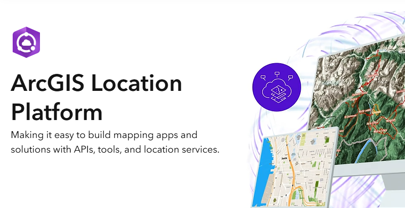
Introducing #ArcGIS #Location Platform shorturl.at/IqVO1
#geodev #esridev #location #spatial #business #intelligence #GIS #esri #mapping #GISchat #geospatial @Esri @EsriDevs @EsriFederalGovt @EsriSLGov @URISA
3
167

Just a few steps with the new Geobase blueprint, and I've got detailed shipping data up and running. Even surprised myself with the speed! awesome narration by @tim_waters code at github.com/decision-labs/geo… #gischat #javascript #reactjs #geodev
1
2
192

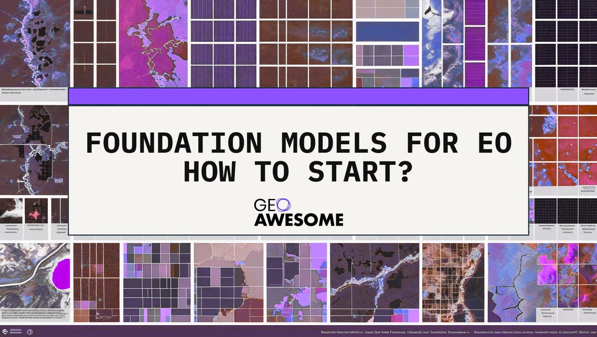
地球観測分野における基盤モデルの始め方の記事
自分がキャッチアップ出来ていないだけだけど、知らない基盤モデルもあったりして勉強になった
/ Foundation Models for EO: How to Start? geoawesome.com/foundation-mo… #GeoDev
9
77
3,864

31 Jul 2025
📡 Want to use foundation models for Earth observation?
Start here → A step-by-step guide to tools, models & platforms like #TerraMind, #Presto, and more.
Read on geoawesome.com/foundation-mo…
#GeoDev #RemoteSensing #AIforEO #FoundationModels #EarthObservation #GeospatialAI
1
2
8
547

26 Jul 2025
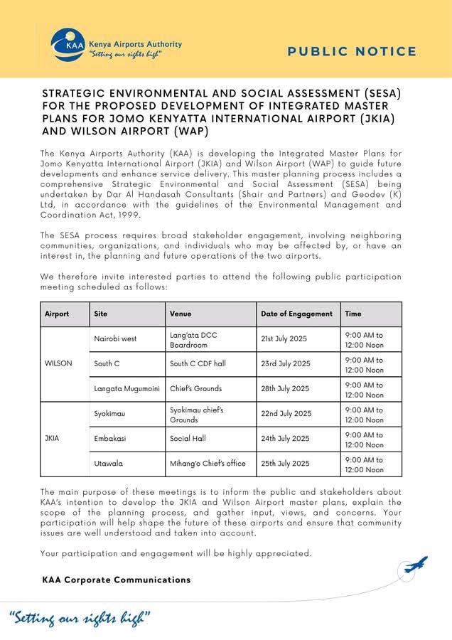
2/4: In collaboration with the expert consultancy teams from Dar Al Handasah (Shair & Partners) & Geodev (K) Ltd, KAA demonstrated its commitment to transparency & inclusivity by actively involving communities from Nairobi West, South C, Langata, Syokimau, Embakasi & Utawala.


1
1
296

22 Jul 2025
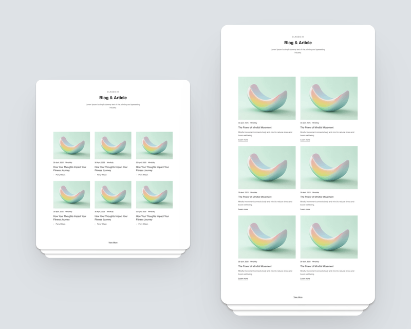
new day, new products.
Pages: Blog & More - makes adding essential pages to your website a breeze! You’ll be able to add a blog, privacy policy, and other key content with just a few clicks.
templays.com/p/pages/
#website #webdesign #design #ux #geodev
1
2
228

20 Jul 2025
Maajabu @KenyaAirports has branded this notice as public but it is yet to publish it on all their social media handles. Apparently, it's a social assessment notice and an invitation to a public participation exercise over some development of JKIA and Wilson Airports.
The process is being done by two companies, an Engineering company called Dar Al Handasah (founded in Beirut, Lebanon) and a surveying company called Geodev.
The public which is being invited for the public participation exercise beginning tomorrow, doesn't' know about it. What is Kasongo planning?
3
11
11
2,304

7 Jul 2025
Hahaha huko nimepiga sana Doria. Ewaya pale unachepuka kushoto ukiwa umetokea kisongo. Unapita makorongo ya zege alafu unaingia looping lukuny. Lemugur kule, piga duka bovu kote huko nimezunguka. Mimi home ni Pale anakoishi Geodev Nabii mkuu, ni jirani angu
1
1
2
18

.@GoogleMaps - I don't think we'll ever be there! 😆
Give this awesome group roadtrip game a try!
➡️ neal.fun/internet-roadtrip/
Everyone votes on the direction the car takes, if the horn honks and what to listen to on the radio!
Built with @GMapsPlatform and other geodev tools!
17 May 2025

Are we there yet?
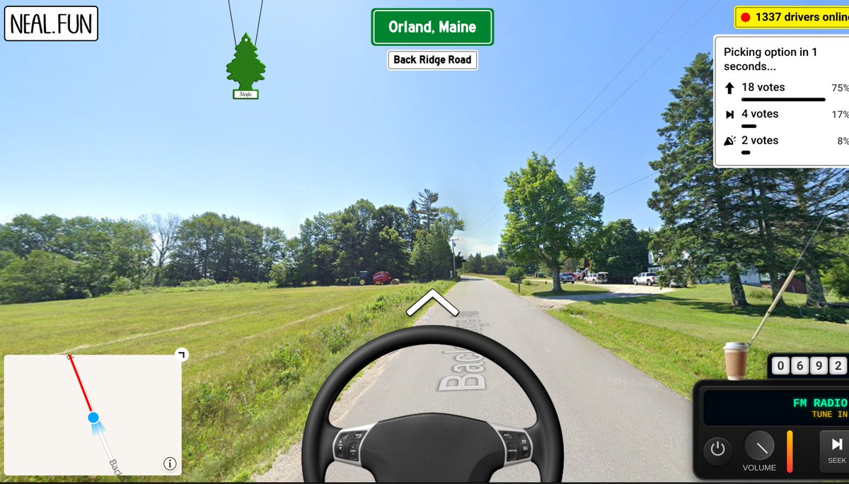
ALT This image is a screen capture from the Internet Road Trip game, showing a driver's-seat view from a Street View car traveling down a road in Orland, Maine.
4
241
1 May 2025
In 1 week, @Esri webinar: What's New: #Esri #Developer Experience (May 2025) tinyurl.com/3s2d8utp
#geodev #esridev #GIS #arcgis #GISChat #geospatial #mapping @EsriDevs @EsriDevEvents @EsriPartners @EsriStartups
2
8
224
18 Apr 2025
What's New in #ArcGIS API for #Python 2.4.1 tinyurl.com/mu8wyykh
#geodev #esridev #GIS #esri #mapping #analysis #GISchat #geospatial @Esri @EsriDevs @EsriFederalGovt @EsriSLGov @URISA
7
241

27 Feb 2025
🚨 New ep of #TheBoundingBox 🚨
💬 Raul @hhkaos shares his work with developers and #geodev community outreach!
🎥 Watch now: youtu.be/00mmW0gBgWg
#esridev #devrel #webdev
1
5
477