

13 Dec 2025
Holiday seasons are coming! Again, remember Geospatial data is more than lines on a map; it’s access to hospitals, safe roads, climate resilience, and opportunities for youth. This holiday season, let’s celebrate by mapping our communities!
#GeospatialForGood #OSMRwanda
2
6
9
328

1 Dec 2025
🌿 BIG NEWS FROM KAMPALA! 🌿
On Friday, 28th November 2025, on Kampala City GIS Day at Imperial Royale Hotel, @KCCAUG proudly launched the Kampala City Wetland Management Strategy🎉🎉
After an indepth spatio temporal analysis of our wetlands from 1994 – 2024 using GIS, the findings are sobering:❗ Over 50% of Kampala’s wetlands have been lost, mainly to high density residential settlements.
But there’s hope!
This Strategy puts Nature Based Solutions at its core, restoring and conserving our vital green lungs for flood control, biodiversity, and a healthier city for everyone. Together as stakeholders @KCCAUG @nemaug @MLHUD @MWE civil society, the community et. al need to jointly work together to implement the strategy.
Watch the official countdown launch video below download the report and join us in protecting Kampala’s wetlands for today and tomorrow 💚
#KampalaWetlandsStrategy #GISDay2025 #NatureBasedSolutions #KampalaCity #UrbanEcology #GeospatialForGood
5
5
29
904

25 Nov 2025
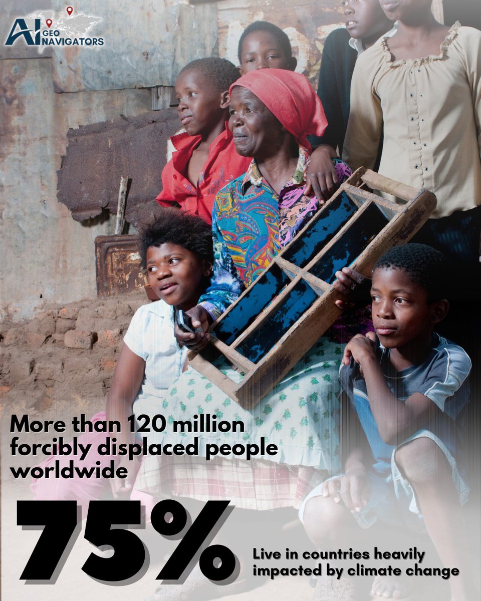
#Climate change is not just an environmental issue, it's a human crisis.
Today, more than 120 million people around the world have been forcibly displaced from their homes due to conflict, disasters, and instability.
What makes this even more alarming is that 75% of these displaced individuals live in #countries that are already heavily impacted by climate change.
Droughts, floods, heatwaves, storms, and environmental degradation are pushing families to leave the places they’ve lived in for generations.
At AI Geo Navigators, we use geospatial analysis and Early Warning system to help governments, institutions, and humanitarian organizations understand risk patterns, plan better, and protect vulnerable populations.
No one deserves to lose their home because of a changing climate. This is our shared responsibility, and the time to act together is now.
#climatecrisis #forcedmigration #climatemigration #displacement #humanrights #climatejustice #vulnerablecommunities #globalwarming #climateemergency #sustainablefuture #resilientcommunities #aigeonavigators #geospatialforgood #climateawareness #aigeonavigatorsforsustainability #aigeonavigatorsforclimateaction #aigeonavigatorsforbuildingresilience
2
20

19 Nov 2025
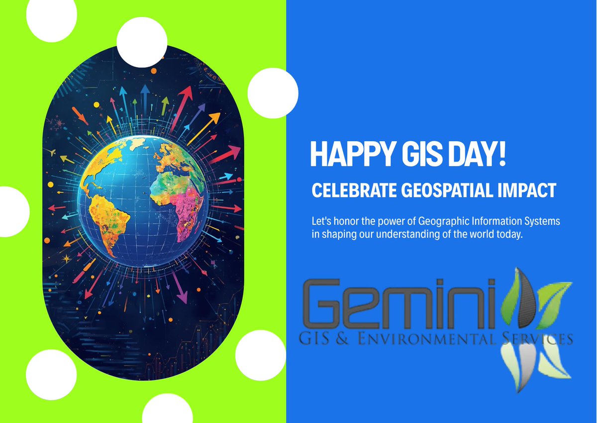
🎉 Happy GIS Day!
Celebrating the power of geospatial technology to shape a better world.
GGES is proud to be part of the movement.
#GISDay #GGES #GeospatialForGood
24

26 Sep 2025
🌍 #WorldEnvironmentalHealthDay 2025 🌍
99% of people breathe unsafe air (WHO).
With geospatial intelligence UAV monitoring, we track key indicators for cleaner cities, disaster risk reduction & a healthier future.
#CleanAir #GeospatialForGood #TechForSustainability

53

8 Sep 2025
Stay tuned as we contribute to this global impact, one map edit at a time! 💡
Together, we map for change. 💪
#YouthMappers #UNILAG #MapAndClean #GeospatialForGood #AfricaYouth
1
3
106

24 Jul 2025
Fun Fact Friday 🐨
GIS helps protect endangered species by mapping habitats and tracking changes over time. At NGIS, we support conservation efforts through spatial analysis and satellite insights.
#Conservation #GIS #ProtectWildlife #GeospatialForGood

184

19 Jul 2025
🚰 Rainwater Harvesting (RWH) in Machakos: A Lifeline in Drylands 🌧️🌾
Machakos County, located in Kenya’s semi-arid zone, faces chronic water scarcity due to erratic rainfall and extended dry spells. RWH systems have emerged as game-changers. They provide households and smallholder farmers with a reliable water source for domestic use, livestock, and irrigation. This has led to improved food security, reduced time spent collecting water (especially for women and children), and greater climate resilience.
Yet, while the impact is promising, more research is urgently needed. 📊🔍 We need to understand:
The long-term efficiency of different RWH technologies in varied microclimates.
The socio-economic impacts on marginalized groups, especially women and youth.
The integration of RWH with digital tools for monitoring, forecasting, and optimizing water use.
Policy and governance frameworks that support scaling of RWH innovations.
Despite community-driven success stories, gaps remain in data, maintenance practices, and equitable access. Deepening research in these areas can unlock new innovations and ensure RWH isn’t just a short-term fix but a pillar of sustainable development in water-scarce regions like Machakos.
🌍 Let’s invest in local water solutions backed by science and community wisdom. #RWH #WaterSecurity #ClimateResilience #Machakos #SustainableFutures #ResearchMatters #GeospatialForGood


1
1
4

17 Jul 2025
Discover how Germany’s national-scale digital twin—built with 10 cm horizontal resolution—is revolutionizing climate response, airspace safety, and insurance risk assessment.
In this keynote by Paul Becker, President of the Federal Agency for Cartography and Geodesy (@BKG_Bund), Germany, at the Geospatial World Forum 2025, learn how the digital twin is being used to monitor forest carbon storage, assess storm and fire damage, and manage aerodrome obstacle risks.
Despite technical and licensing challenges, the digital twin is emerging as a powerful tool for decision-makers in government, industry, and environmental planning.
#GermanyDigitalTwin #ClimateRiskManagement #GeospatialInnovation #DigitalTwinTechnology #BKGGermany #PaulBecker #GeospatialWorldForum #GWF2025 #ClimateAction #SmartMapping #ForestMonitoring #DisasterResponseTech #DigitalGeography #GeospatialForGood #SustainableDevelopmentTools #NationalDigitalTwin #SpatialIntelligence #InsuranceRiskModeling #AerodromeSafety #FutureOfMapping
4
503
11 Jul 2025
At GWF 2025, Geert De Coensel, CEO of Merkator shares the inspiring journey of how a young geospatial company is transforming infrastructure, connectivity, and sustainability across Europe and beyond.
With operations spanning Belgium, Spain, France, the UAE, and more, Merkator Group combines software, data, and services to power smart infrastructure through products like Marlin Digital Twin, Eaglebe, and Belmap.
Greet emphasizes how replacing copper with fiber not only increases internet speed but significantly reduces energy consumption—showing how geospatial intelligence directly supports ESG goals.
“Every location has a story. We bring it to life.”
This keynote showcases how geodata, when merged with purpose and people, becomes a tool for lasting global impact. @MerkatorGIS
#GWF2025 #Merkator #SmartInfrastructure #GeospatialIntelligence #digitaltwin #fiberoptics #Sustainability #ESGgoals #geospatialforgood #InfrastructureInnovation #SmartCities #LocationIntelligence #TechWithPurpose, #marlindigitaltwin
2
367

10 Jul 2025
Let’s stay safe, be proactive, and protect lives and property.
📍 Source @nimetnigeria
#NiMet #SDSSN #FloodAlert #DisasterPreparedness #ClimateRisk #EmergencyAwareness #EnvironmentalSafety #Nigeria #FlashFlood #GeospatialForGood
9

27 Jun 2025
We turned 14 🎉 and we’re launching the Geospatial for Good report!📍 Maps & satellite data are driving real impact worldwide, from disaster relief to SDGs.
More info: geoawesome.com/geospatial-fo…
#Geoawesome14 #GeospatialForGood #SDGs
2
292
24 Jun 2025
From #EarthObservation to #EconomicEmpowerment!
Prateep Basu, CEO of SatSure shared at #GWF2025 how geospatial intelligence is revolutionizing credit access, farming, & deep learning-powered insights.
AI Space Finance = Real-world impact.
#GeospatialAI #FinancialInclusion #SpatialComputing #AgenticAI #SatSure #GeospatialForGood
2
3
518

16 Jun 2025
🌍✨ Mission Monday: Empowering Girls in Geospatial Science ✨🌍
Spatial Girls Network is equipping young women with geospatial skills to drive change in their communities and lead in STEM.
#MissionMonday #SpatialGirlsNetwork #GeospatialForGood #GirlsInSTEM #TechThatEmpowers

1
5
80

26 May 2025
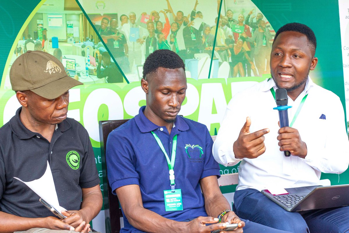
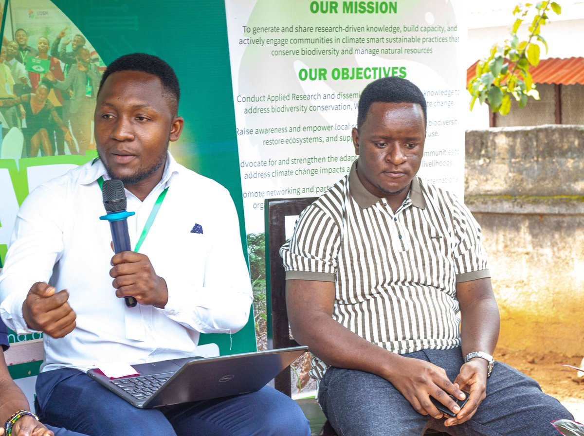
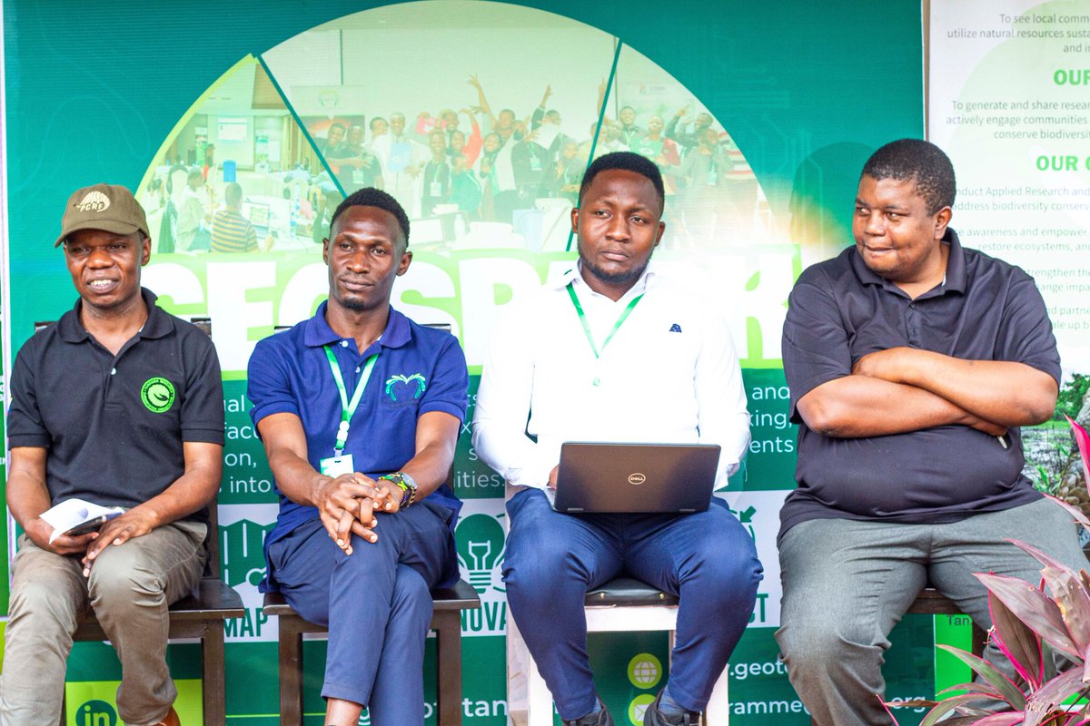
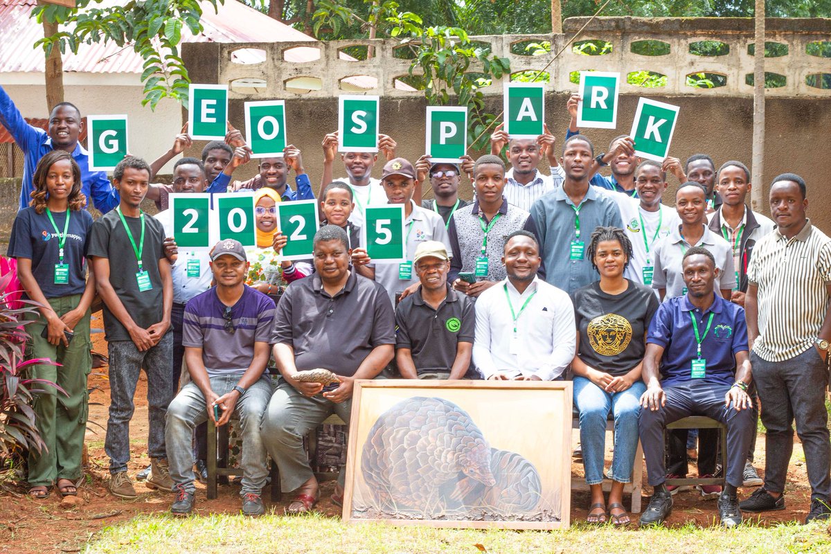
Excited for #GeoSpark2025 with @geotetanzania, @trco_tanzania & @youthmappers.
@makero24 highlighted #mbto conservation efforts using geospatial technology Planting for sustainability 🌎🌳 #PangolinConservation #GeospatialForGood
1
5
53
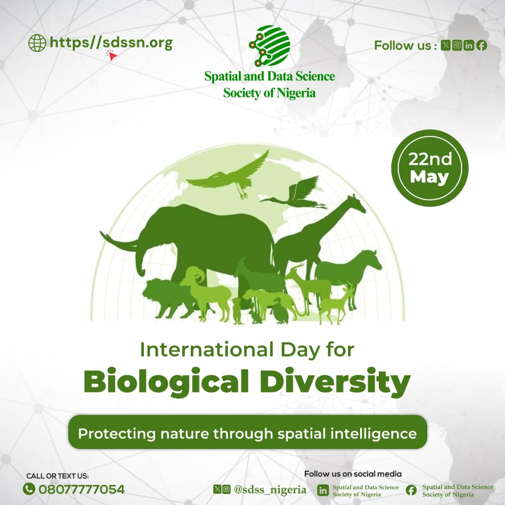
22 May 2025
On this Biodiversity Day, we celebrate Earth's rich life forms and commit to protecting nature. At the Spatial and Data Science Society of Nigeria, we use SpatialIntelligence to support biodiversity conservation.
Let’s map a sustainable future.
#GeospatialForGood #DataForNature
2
2
42

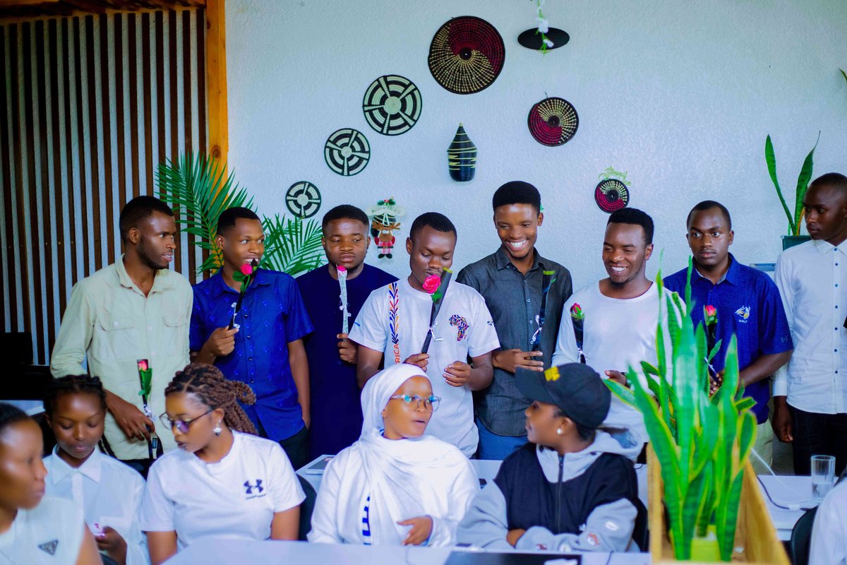
14 Feb 2025
💡 Let’s keep mapping with love! Share your mapping stories, tag us, and let’s inspire more people to make a difference.
#MappingWithLove #ValentinesDay #GeospatialForGood #UniqueMappersNetwork
11
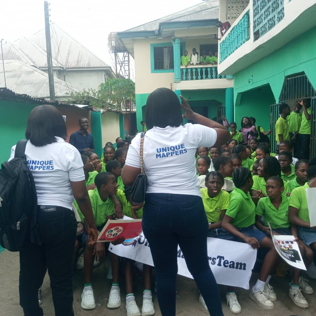
10 Feb 2025
Introducing Students to the World of Digital Mapping with OpenStreetMap!
(Discussion in Thread)
#OpenStreetMap #DigitalMapping #GeospatialForGood #YouthEmpowerment #STEMEducation #UniqueMappersNetwork

1
1
3
34
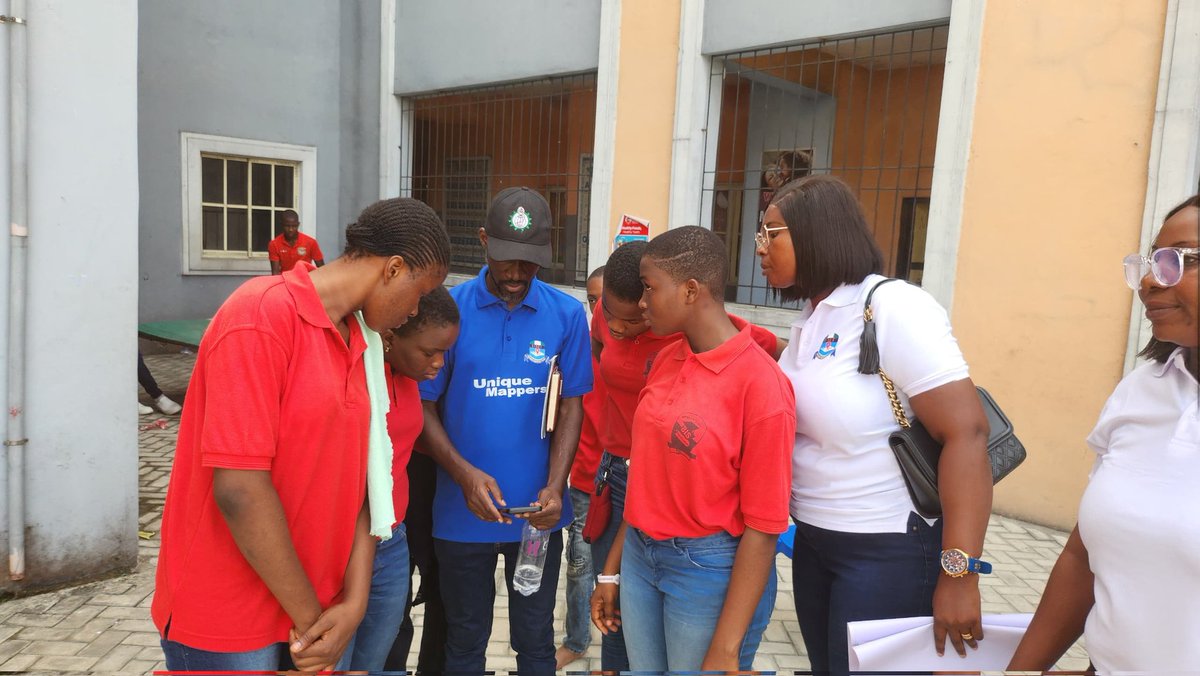
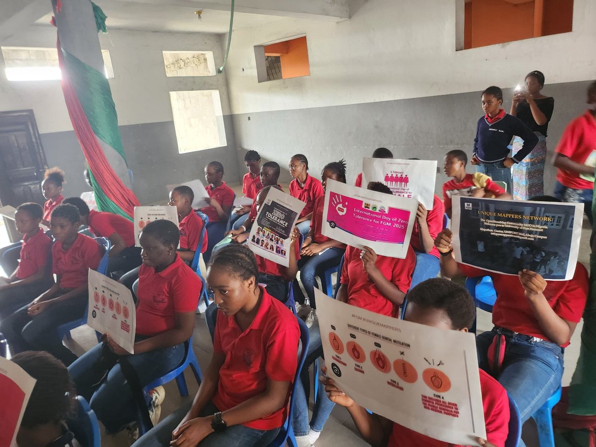
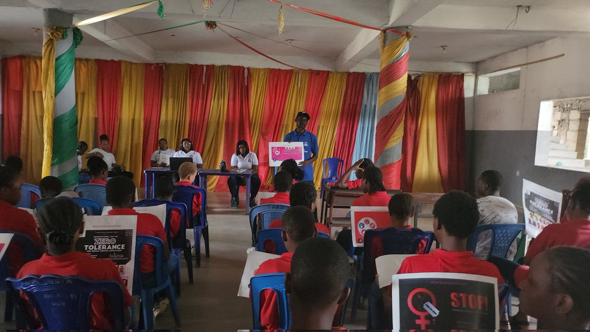
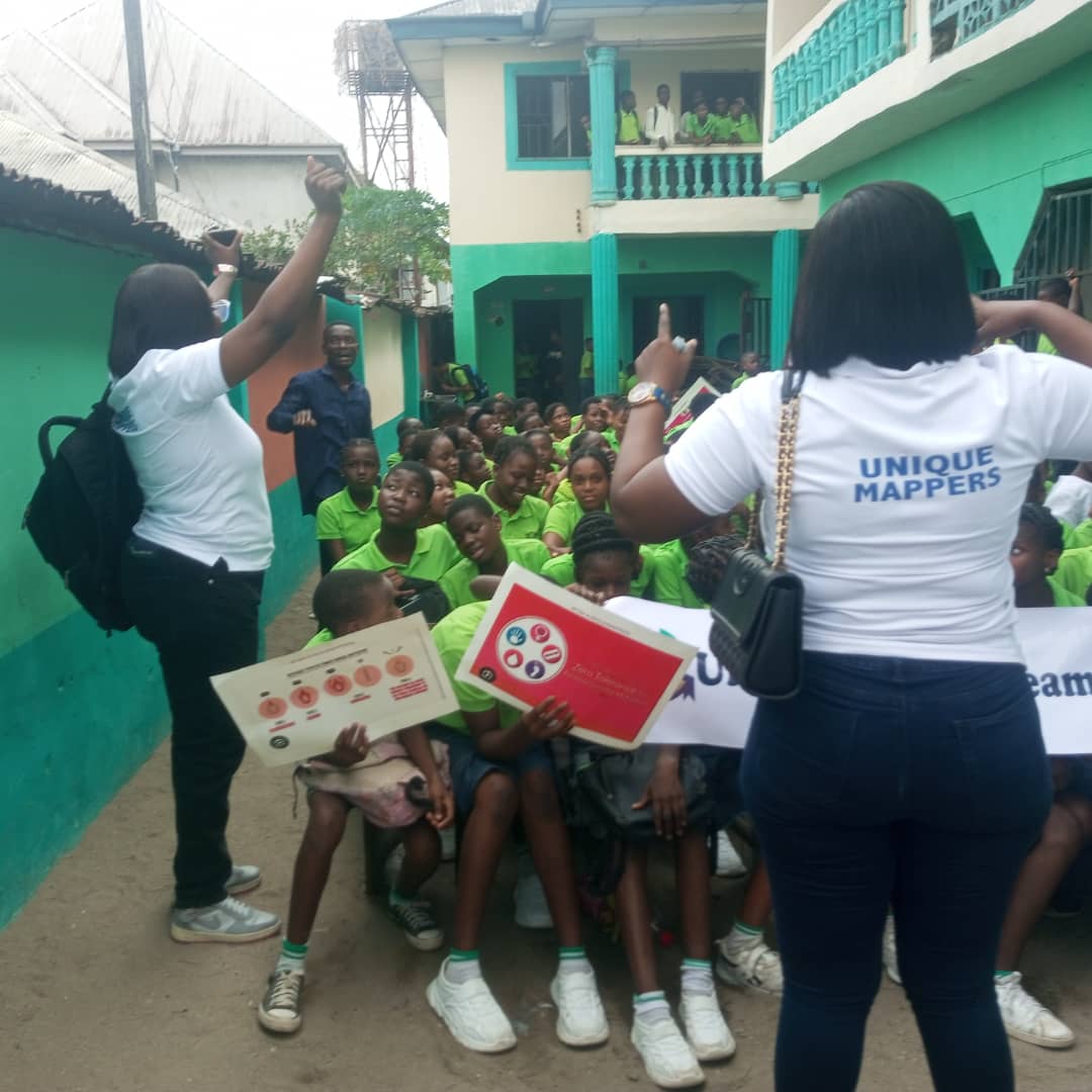
10 Feb 2025
Empowering the Next Generation: School Outreach at Orbit Montessori, Port Harcourt
(Discussion in thread)
#EndFGM #GirlsRights #SDG5 #CommunityEngagement #UniqueMappersNetwork #GeospatialForGood
1
1
1
38