
Jun 12
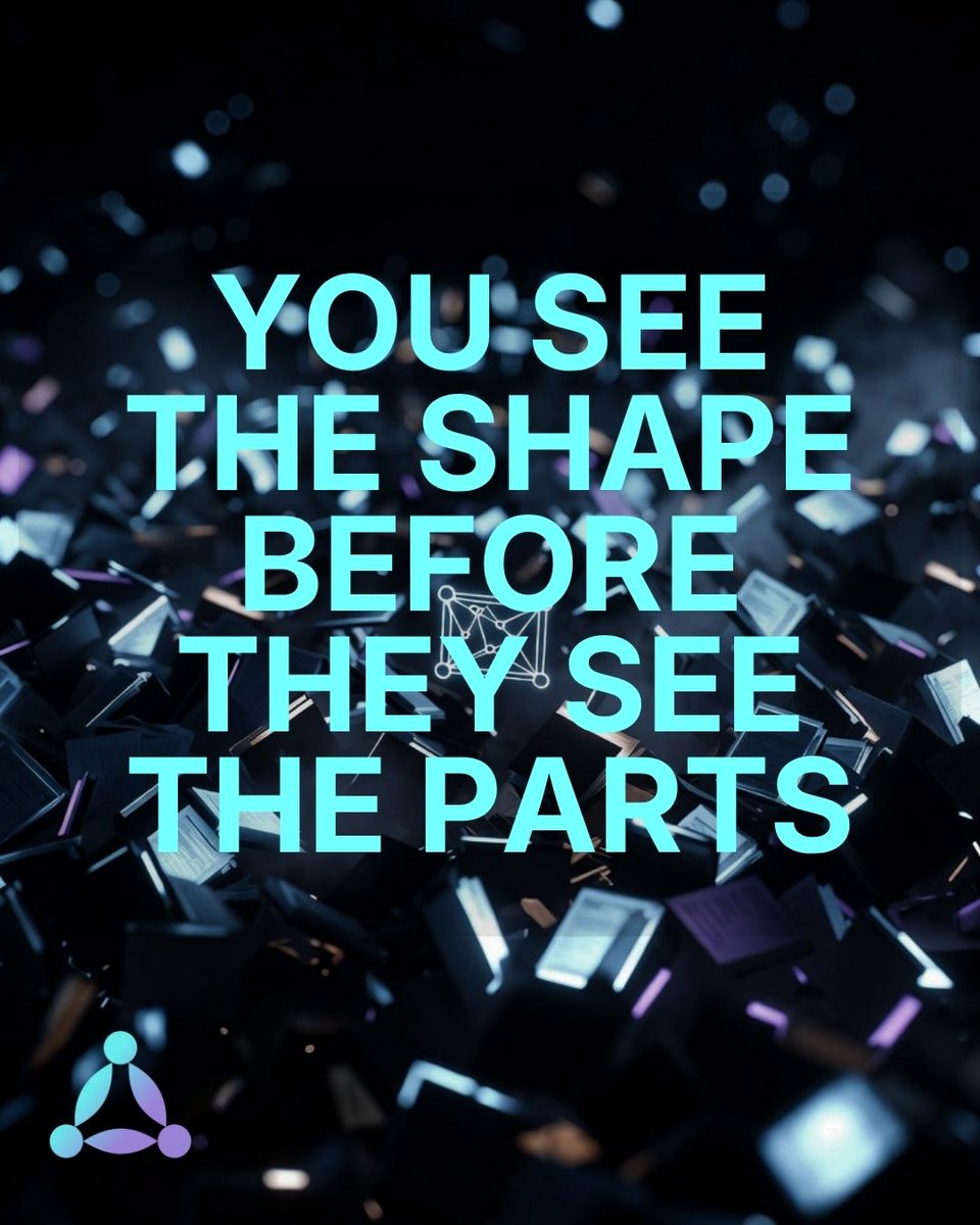
Before anyone else has finished reading the brief, you have already mapped the dependencies.
You know which risks are coupled, which variables interact, which assumption the whole thing rests on.
That is not intuition. It is a structural way of thinking that most tools were never designed to support.
Try it for free at filamental.space
#SpatialThinking #KnowledgeGraph #Research
1
2

May 21
Geography, GIS and the Question of Progression (The GIS Disconnect Part 3) open.substack.com/pub/robgeo… The final piece in my GIS Disconnect series is now published. This article explores GIS entitlement, spatial literacy and curriculum progression, asking what meaningful GIS capability might look like across a seven-year geography curriculum if we are serious about preparing students for the modern world. #GIS #Geography #SpatialThinking #GeographyEducation #geography #geographyteacher

3
407
May 16
Part 2 of 3 in my short reflection series exploring GIS, geography education and modern geographical practice. robgeogchambers.substack.com… More than 25 years after entering teaching, GIS still feels inconsistently embedded within mainstream geography education — despite becoming increasingly central to geographical practice beyond schools.
#GIS #Geography #GeographyTeacher #Education #Curriculum #DigitalLiteracy #SpatialThinking #SpatialData #EdTech #GeographyEducation
5
430

May 16
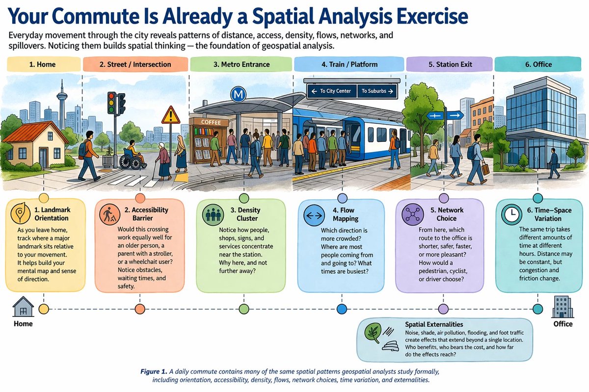
The World Bank shares 10 everyday observations that build geospatial intuition for economists, planners, and anyone working with location data.
Read more: blogs.worldbank.org/en/opend…
#Geoawesome #GIS #SpatialThinking #Geospatial #WorldBank
2
26
1,970

The IIHS Skills Bootcamp on GIS & Remote Sensing (9–11 January 2026) provided an immersive learning experience for undergraduate students from diverse disciplines and institutions and across India, building both skills and confidence to apply spatial thinking across disciplines.
From learning the fundamentals of QGIS and Google Earth Pro to understanding remote sensing and spatial analysis, the bootcamp offered a deep dive into how spatial data can be mapped, layered, analysed, and translated into meaningful insights.
Hear from participants as they reflect on their experience.
#IIHS #SkillsBootcamp #GIS #RemoteSensing #SpatialThinking #LearningInAction
2
140

🗺️ Mapping & Spatial Thinking is one of the e-modules.
Learn how to read and create maps while developing essential spatial thinking skills for education and real-world problem solving.
Discover the module here: portal.geoacademy.eu/e-modul…
#Cartography #SpatialThinking #GeoEducation
3
3
40

30 Nov 2025
Great conversations yesterday on what we often miss in the spatial domain: open data, true open-source, and geospatial portals that should enable research, not just visualise it. A deep dive into our research “Status of Geospatial Portals in India” - shorturl.at/bacIQ
Thanks to @LetsTalkSpatially, @takshashilaInst, @Vonterinon, and everyone who contributed sharp insights. More spatial thinking ahead!
#Geospatial #OpenData #OpenSource #GIS #SpatialThinking #TechPolicy #GeospatialPortals #BangaloreCommunity
1
2
4
1,058

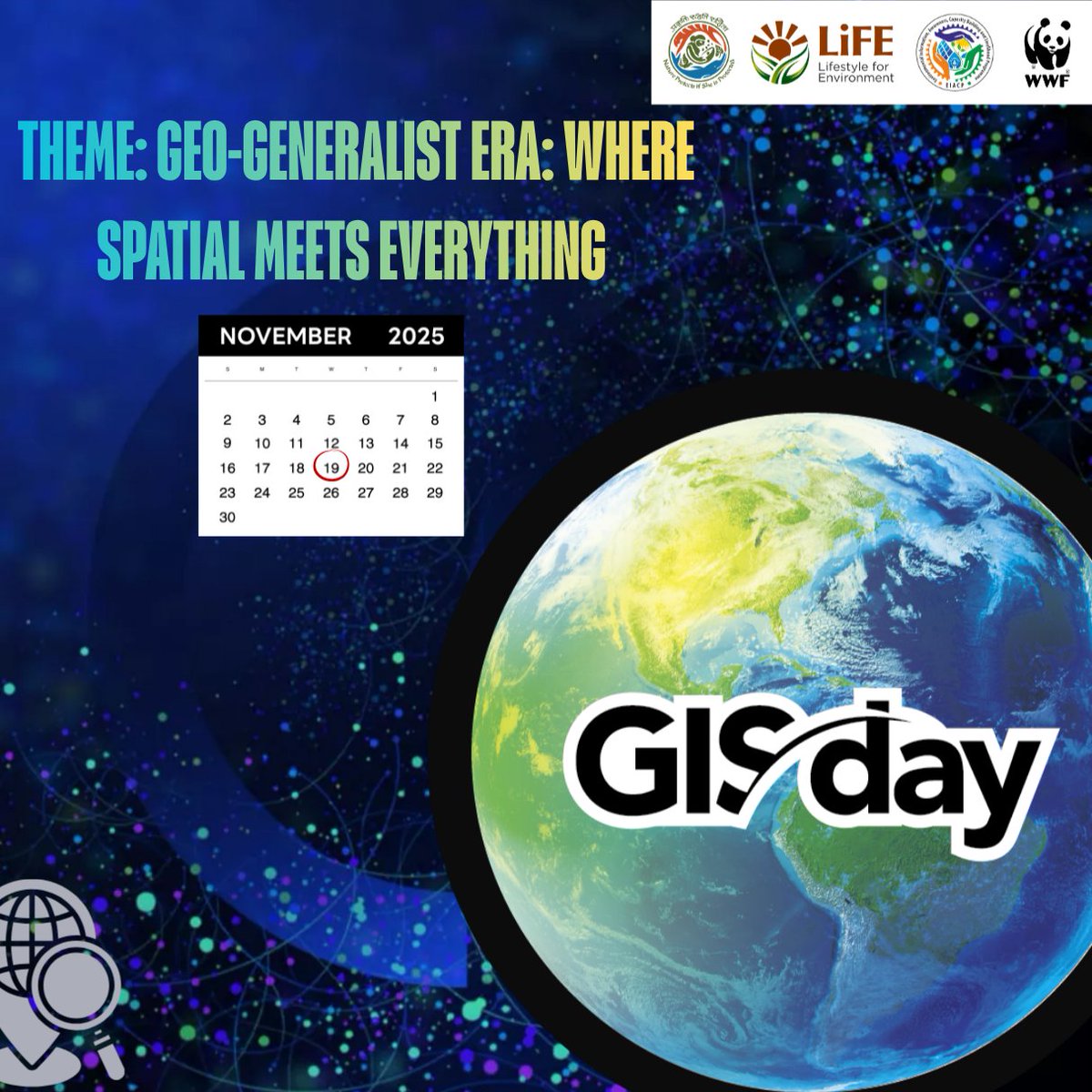
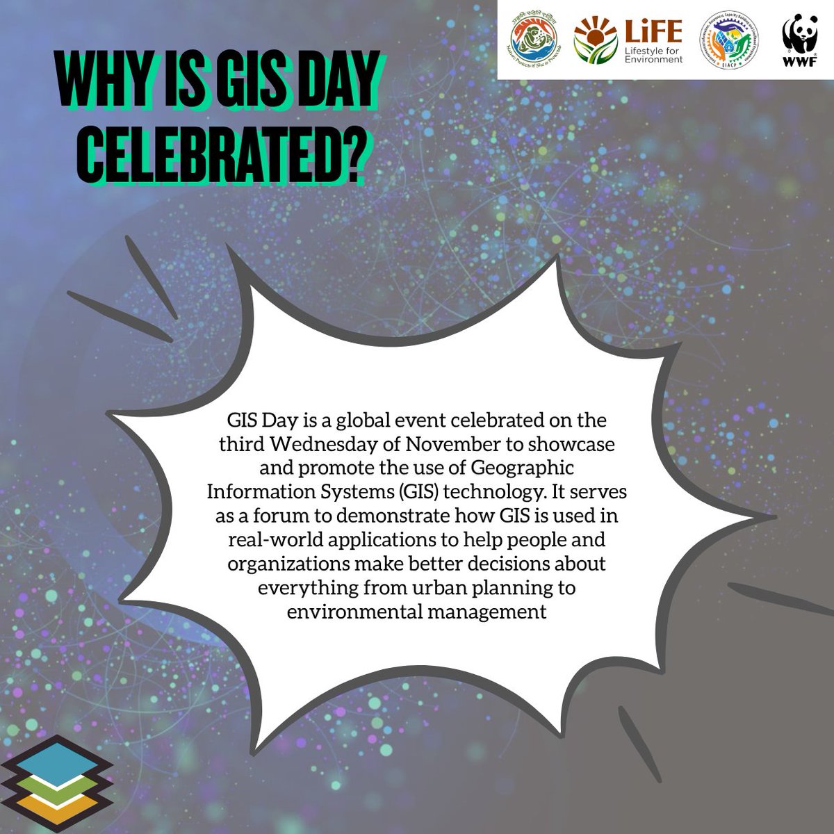
19 Nov 2025
🌍 Happy #GISDay2025!
Celebrating the Geo-Generalist Era—where spatial meets everything. From climate action to smart cities, GIS helps us understand and shape a better world. ✨🗺️
#GISDay #Geospatial #MappingTheFuture #SpatialThinking #FutureOfGIS
1
3
114

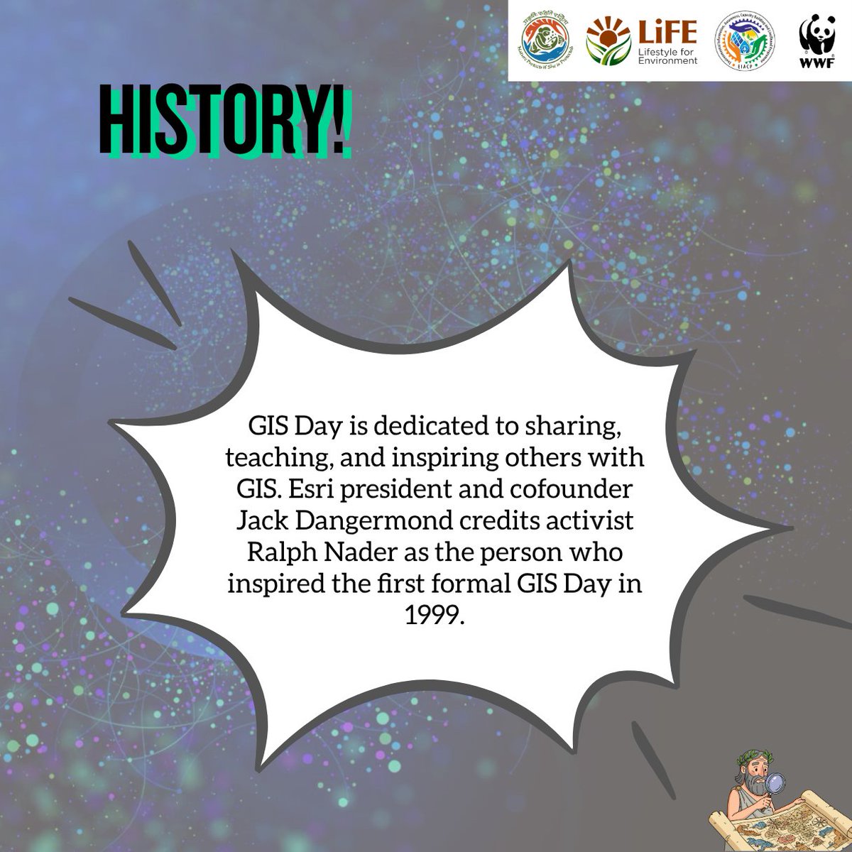
19 Nov 2025
🌍 Happy GIS Day 2025 🌍
This year's theme, "The Geo-Generalist Era: Where Spatial Meets Everything," spotlights how GIS pros are breaking silos, blending spatial smarts with fields like climate action, urban planning, and beyond to tackle real world puzzles. From mapping disaster relief to optimizing supply chains, your work is reshaping our world.
#GISDay2025 #GeoGeneralistEra #SpatialThinking #GIS #ProudGeoGeneralist
3
13
199

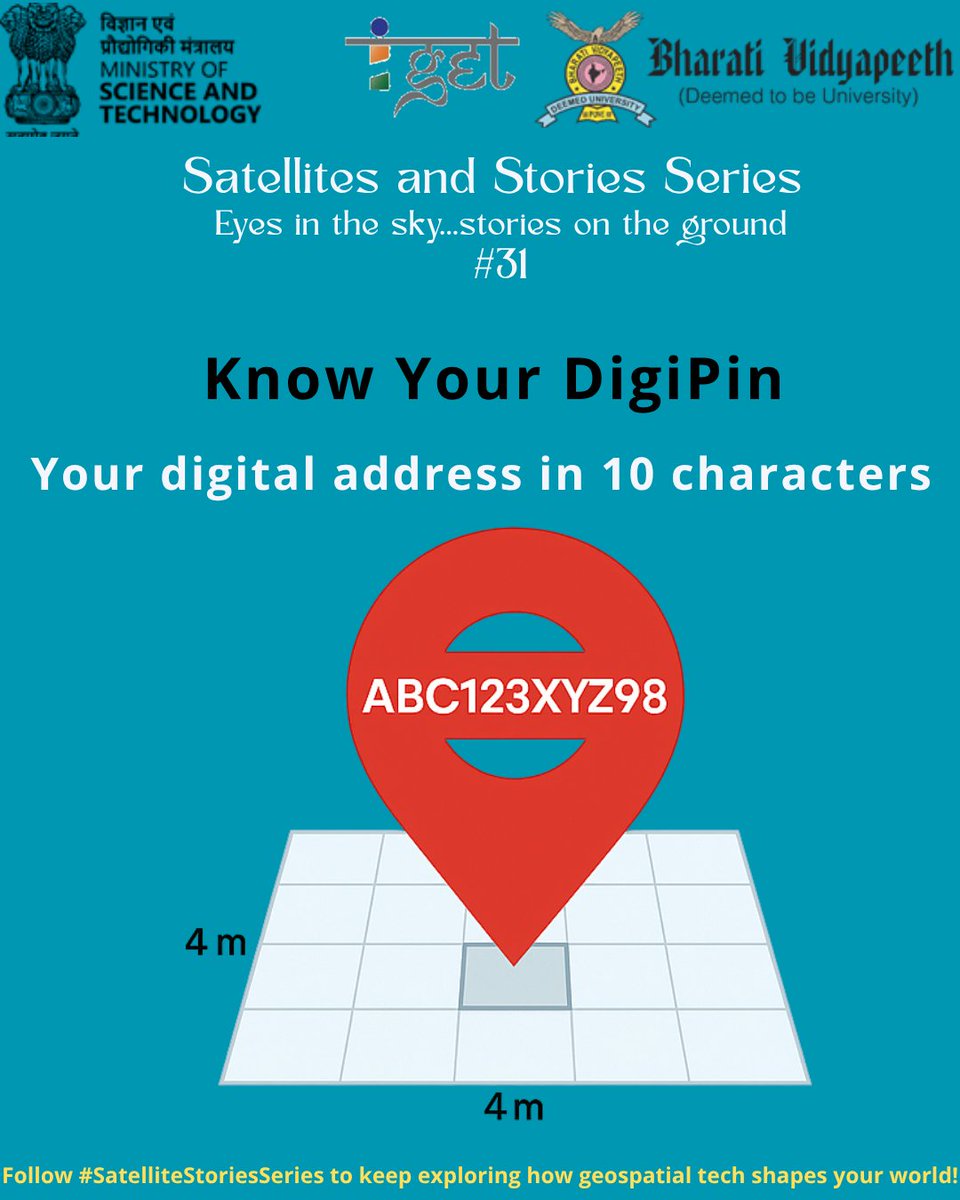
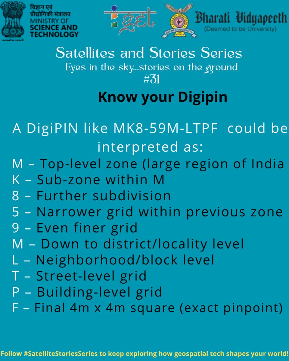
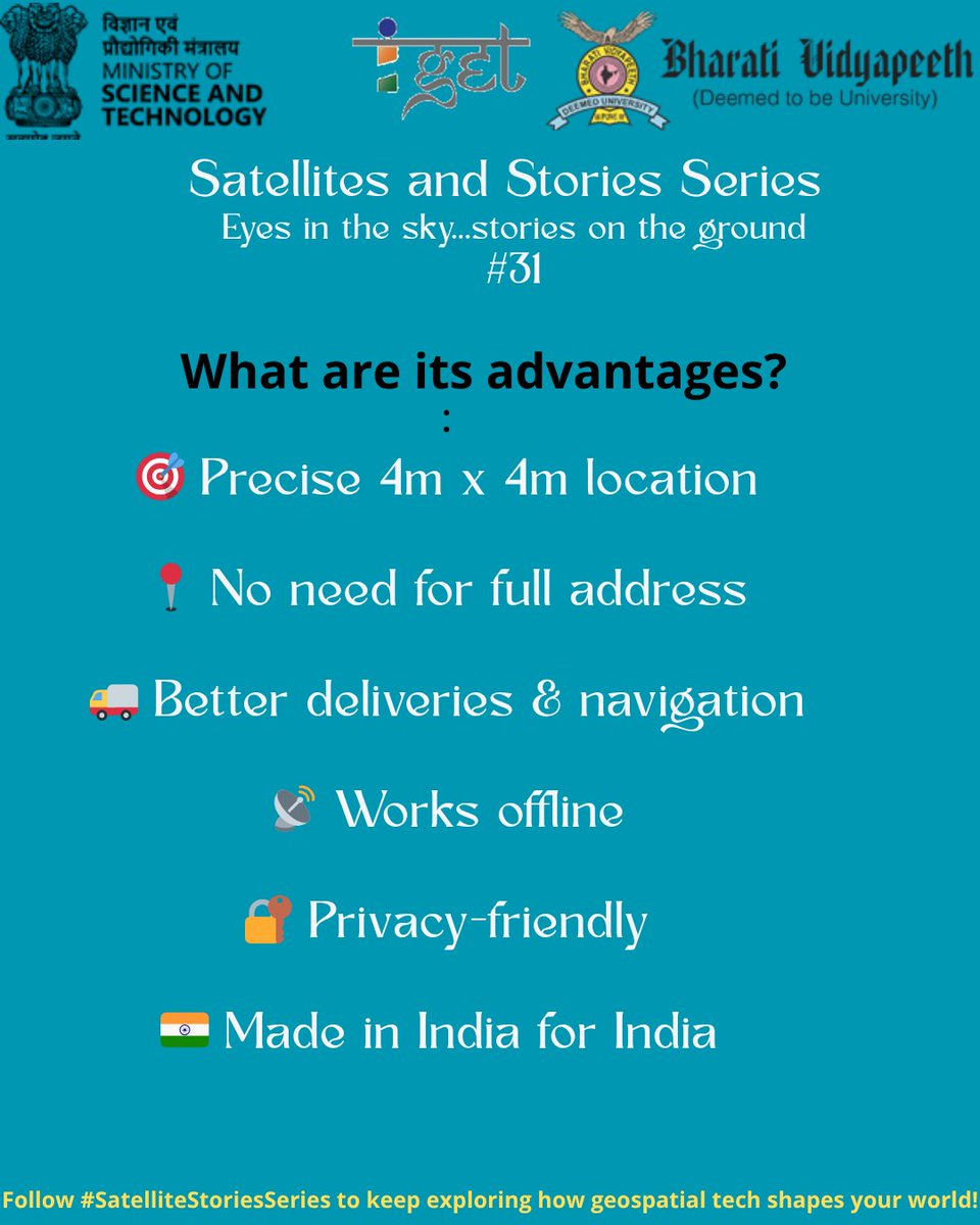
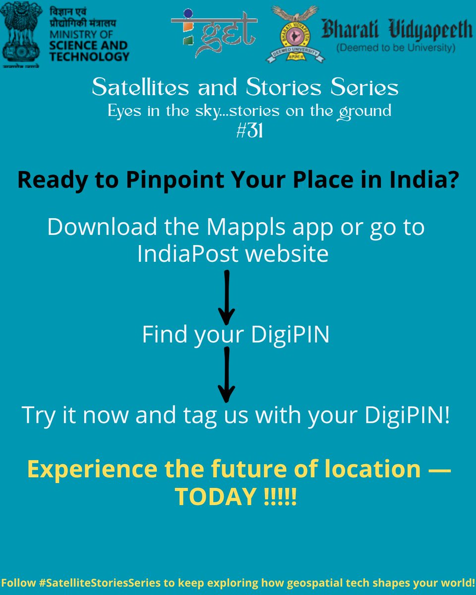
Stop relying on vague addresses and start using DigiPIN — your 10-character digital location code that’s accurate, private, and made for India! Experience the future of location — today! #DigiPIN #Mappls #DigitalIndia #SpatialThinking #DSTIGET #SwadeshiTech #IndiaPost
2
84

24 Sep 2025
youtu.be/fcx5fr9obZU?si=yEgb… What I *REALLY* want students to learn #education #geography #gis #spatialthinking

1
2
322

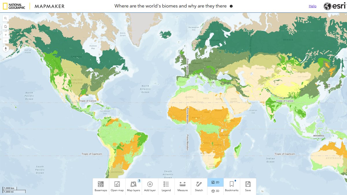
5 Sep 2025
Explore Earth's biomes with this interactive classroom activity. Students investigate patterns, analyze data, and build their own hypotheses about the role of precipitation in shaping ecosystems.
Try it here: ow.ly/xPrp50WSfNE
#GIS #Biomes #EarthScience #SpatialThinking
1
5
13
874
4 Sep 2025
Want to take your #GIS skills to the next level? The Modern GIS Hub is your gateway to hands-on learning, interactive tutorials, and real-world projects.
Check it out: ow.ly/FvoL50WRfBU
#ModernGIS #LearnGIS #SpatialThinking
1
6
228
Google’s AlphaEarth – a game-changer for geospatial thinking!
Imagine a virtual satellite that maps Earth in 10x10m blocks updating data to bear real-time.
#AlphaEarth #Geospatial #AI #Sustainability #EarthObservation #DSTIGET #spatialthinking #bvieerpune #satellite #googleai

3
2,350

17 Jun 2025
Understanding geospatial data requires more than just maps — it requires context. The ecological fallacy is a common pitfall that can distort insights and lead to inaccurate conclusions.
Thank you for the valuable perspective, @yohaniddawela.
#GeospatialAnalysis #DataLiteracy #MapDesign #SpatialThinking
16 Jun 2025

One of the biggest traps in geospatial analysis?
Ecological Fallacy.
It can turn a map into a misleading story.
Here's what you need to know about it:
9
1,183

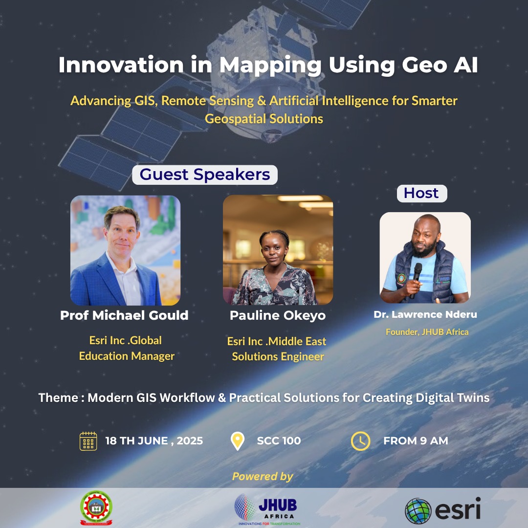
15 Jun 2025
Building Geospatial Skills for the Future
Kenya is steadily becoming a hub of geospatial innovation—and @JHUBAfrica is contributing to this momentum by linking education with real-world application.
This Wednesday, June 18, we’ll host a focused GIS workshop at @DiscoverJKUAT, featuring two expert guests from @Esri, the global leader in GIS technology.
🎓 Tailored for students and early-career professionals in GIS-related fields, the workshop offers hands-on experience, career insights, and a window into the global geospatial community.
Meet our speakers:
1. Michael Gould – Global Education Manager, Esri. With 25 years in GIS education, he has led international academic collaborations.
2. Pauline Okeyo – Senior Solution Engineer,@Esri. A specialist in building GIS solutions across Africa and beyond.
What to expect:
📌 Practical ArcGIS sessions
📌 Industry exposure and mentorship
📌 Insights into GIS for sustainable development
📌 Career pathways in geospatial tech
As Dr. Lawrence Nderu, Founder of JHUB Africa, puts it:
"Data isn’t just numbers. It’s how we map the future."
👉 Be part of this learning experience. Equip yourself with skills that matter.
Venue: SCC100, @DiscoverJKUAT
- Date: Wednesday, June 18
- Time: 9:00 AM
#JHUBAfrica #GISWorkshop #GeospatialInnovation #Esri #JKUAT #SDGs #YouthInTech #SpatialThinking
1
5
122

15 Jun 2025
Hear It from Our Students!
Our student , Ms. Shweta Tambe, M.Sc. Environment Science and Technology,
Batch 2024-26, shares highlights from her first year's journey.
“Village surveys changed my perspective towards understanding environmental issues”
From field visits to group assignments, from classroom discussions to real-world challenges — Shweta reflects on how the first year shaped their perspective, built key skills, and prepared them for the future.
#MScEVST #MScGeoinformatics #SpatialThinking #EnvironmentalLeadership #SDG4.7 #sustainabledevelopment
2
33

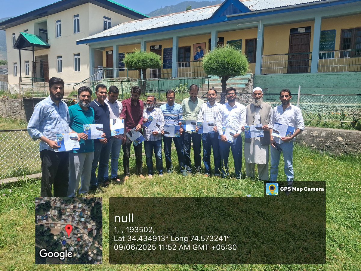
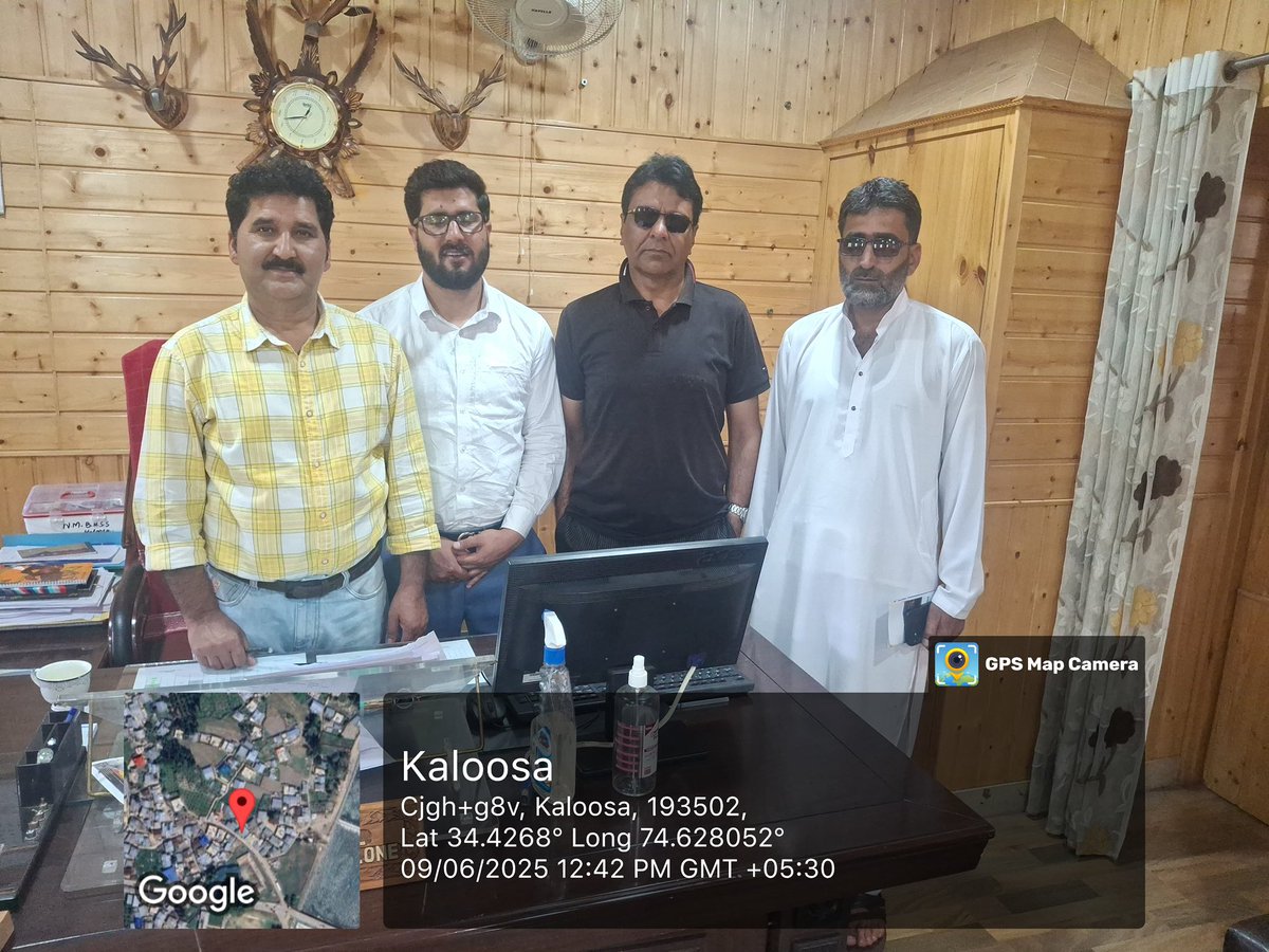
9 Jun 2025
Dept. of Geomatics Outreach Drive
Bringing geospatial awareness to young minds!
Outreach programs successfully conducted at Govt. HSS Quil Bandipora and NM Govt. Boys HSS Kaloosa Bandipora, inspiring the next generation of geo-learners. @iustjk #GeomaticsOutreach #SpatialThinking


2
5
185
23 May 2025
As #GIS technology has evolved, so must GIS curricula!
UCSB's Center for Spatial Studies shares a vision for teaching #modernGIS that emphasizes #spatialthinking and real-world problem-solving ➡️ ow.ly/3bmU50VXbok

1
2
14
553
13 May 2025
From water security to national security — geospatial skills give you the edge.
Join our 4-weekend Expert Capsule Course and build a solid foundation in Geospatial Science & Technology without disrupting your workweek.
📅 Starts June 14 | Online | Apply by June 7
🔗 school.takshashila.org.in/ec…
#Geospatial #SpatialThinking #Takshashila #LearnGeospatial #DataDrivenDecisions #WaterSecurity #NationalSecurity
13 May 2025

From mapping the Jhelum’s surface water to debunking disinformation, geospatial intelligence reveals the real story behind water flows, which is vital for security and sustainable management.
Want to learn how to read the map behind the moves? Join our 4-weekend expert capsule course starting June 14: Introduction to Geospatial Science & Technology.
Designed for busy professionals—gain a solid foundation without disrupting your weekdays. Learn from top-notch experts and explore how geospatial tech drives innovation across disciplines.
REGISTRATION OPEN Apply by June 7! school.takshashila.org.in/ec…
2
344