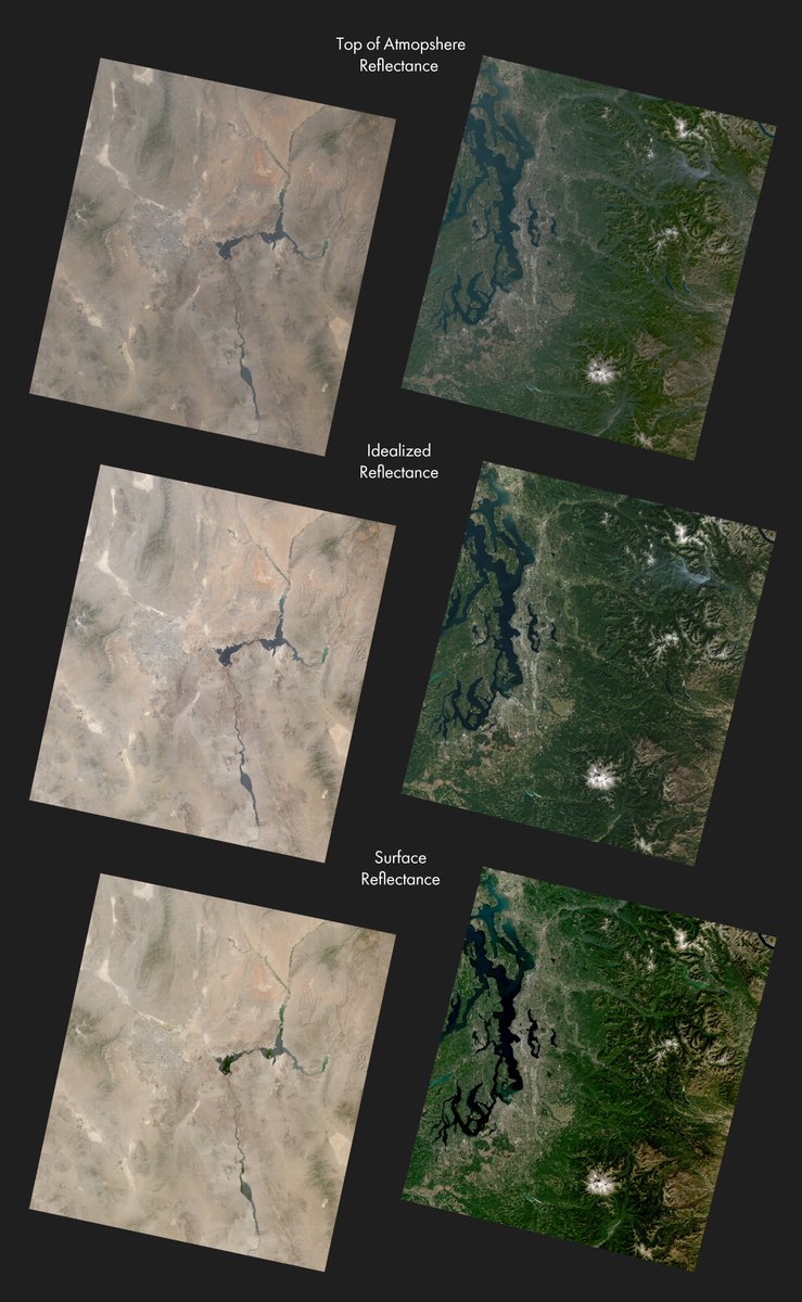
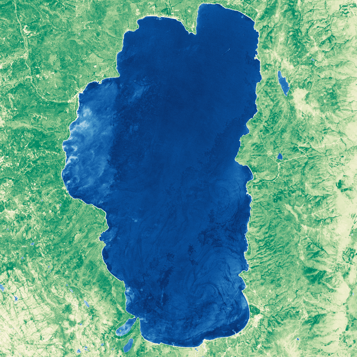
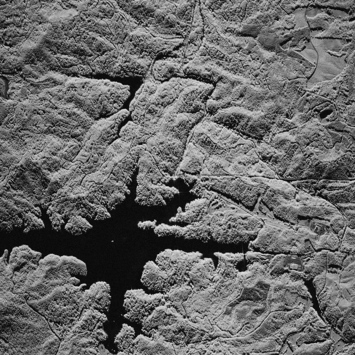
ALT Water quality index and normalized difference vegetation index map of Lake Tahoe. Data from Landsat 8 collected on September 22, 2021. Created entirely with GDAL.
This map is not upside down.
Why do we expect north to be on top? What happens when it's not? And has north always been 'up?'
This beautiful map from @rsimmon provides some cartographic food for thought: maps.com/this-map-is-not-ups…
Ever wondered what the world looks like upside-down*? Now you know! You can even grab a poster-sized copy from the Map Center: mapcenter.com/store/p/upside…#maps#cartography#dataviz
*Not really, north-up is arbitrary.
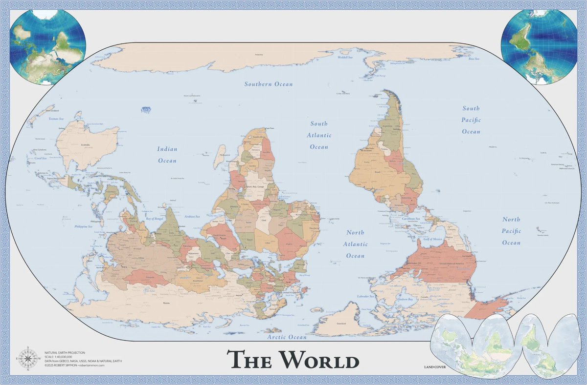
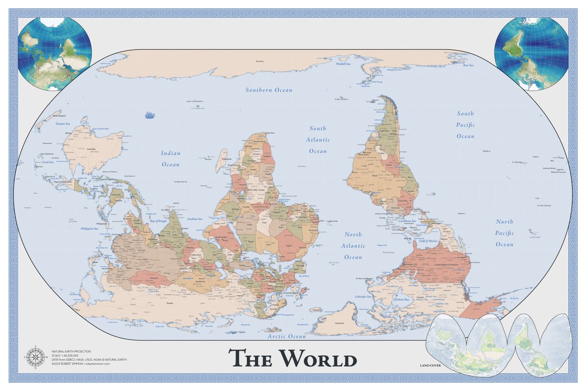
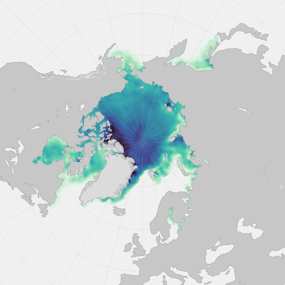
ALT South-up political map of the world. Natural Earth projection centered at 0˚. The political map is accompanied by a land cover map in the interrupted Goode homolosine projection, and biosphere maps of the Eastern and Western Hemispheres. These are also all south-up.
Just about every hurricane forecast map shows you where the storm might go.
Imagine a map that could also forecast who and how many people might be affected, including the portion of those with disabilities, or who lack cell phone or internet access.
That's the goal of Hurricane Aware from @Esri.
maps.com/who-is-threatened-b…
Satellite imagery from @planet shows Biltmore Village, North Carolina before and after Hurricane Helene came through. The image on the left was taken on 09/28/2024 and the image on the right was taken 09/23/2024.
#HurricaneHelene#Asheville
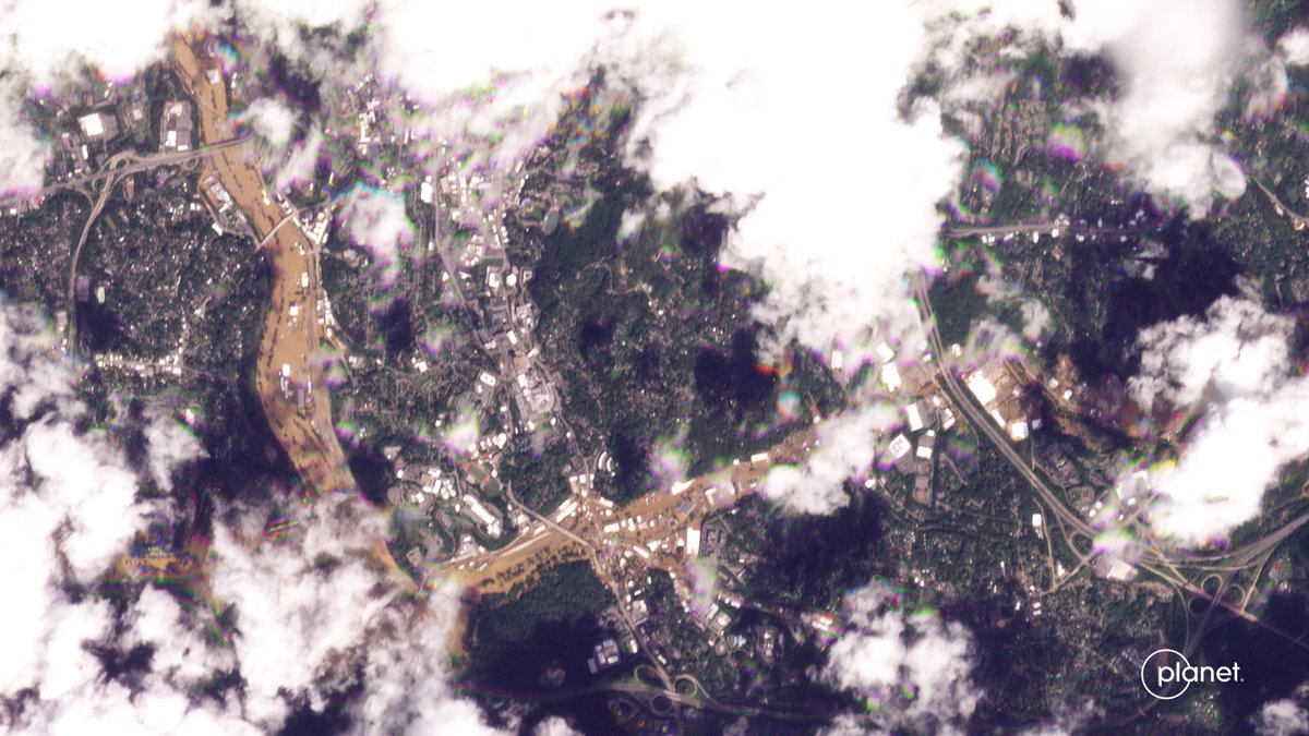
ALT Satellite imagery of Biltmore Village, Asheville North Carolina 09/28/2024 after Hurricane Helene flooding
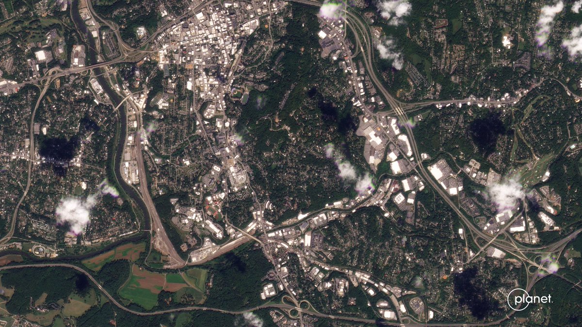
ALT Satellite imagery of Biltmore Village, Asheville North Carolina 09/23/2024 before Hurricane Helene flooding
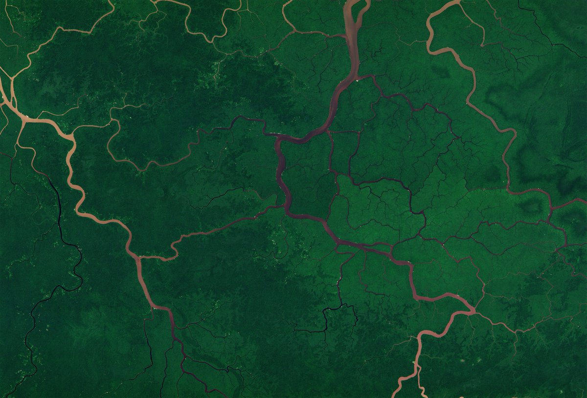
We had collected an image of the dam in question about 3.5 hours after he tweeted at me - we have two in our open data bucket now if anyone wants to try their hand at change detection. Two 50cm shots taken about 12 hours apart (link in next tweet)
First Light from our first hyperspectral satellite, Tanager-1!
This image is of Karachi, Pakistan on Sept 19th. The image has 420 spectral bands, and here we’re showing one in visible-wavelength, one near-infrared image, and one shortwave infrared image of the same site the entire ‘datacube.’
An AI field day!!
So pleased with how this instrument is working!
🛰️🧑💻
More details: planet.com/pulse/first-light…
If you’ve ever seen RJ speak, you know how much his enthusiasm for visualization shines through. If you haven’t, this is a great opportunity to find out.
Next week I begin teaching PERSUASIVE DATA GRAPHICS in-person at San Francisco’s fabulous @Lett_Arc using original historic data graphics (and lots of modern digital ones too). There is one seat remaining. Learn more and sign-up here. letterformarchive.org/shop/p…
New post! I’ve long felt that finding and using satellite data was harder than it should be. Why? And how can we make it easier? My thoughts:
medium.com/@robsimmon/making…
Interested in preforming analysis on NICFI mosaic data without GEE or needing to download? You can use full-bit-depth streaming to treat each dataset like it's one giant local file and easily access what you need at multiple scales. See github.com/planetlabs/notebo… as an example.
In 1984, Aviation Week published a LANDSAT image showing a Soviet SSBN practicing how to break through ice prior to launching its missiles. I thought it would be neat to download the original image and process it with modern software.
Exciting news! It's been fully-usable in production for many years, but we finally received approval to publicly document the full-bit-depth streaming capabilities of Planet's Basemaps product: developers.planet.com/docs/b…
Did take a look at the lights of Kyiv🇺🇦 back in 2022, always amazed at what remote sensing can show, but at the same time a bit concerned of the distance these images create from the true horrors of war. x.com/Pierre_Markuse/status/…
Finally sharing my website with the world!
Please, come in, take a seat, look around, and let me know if you need anything (preferably about maps).
jjserrano.me
New @maxar imagery of the Soumion oil tanker also shows ongoing fires, and rear slick of oil, rather than smoke, as well spills from oil coming from the decks. Via @trbrtc
New @planet high-res image shows ongoing fires at the SOUNION oil tanker targeted by Houthis. Negotiations over tug boats heading to salvage the ship continue. Time is ticking, as fires increase likelihood of deterioration of the structure and cause an environmental disaster