
Joined June 2016
- Tweets 44
- Following 125
- Followers 40
- Likes 102
Photos and videos
TangWei retweeted

18 Sep 2024
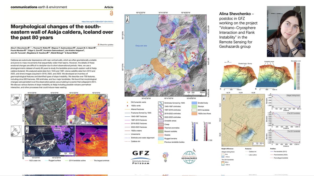
New paper alert!
#Photogrammetry meets #Volcanology
See the new paper by our posdoc, Alina, published at @CommsEarth.
@VOLCAPSE
Link to the paper-->
nature.com/articles/s43247-0…
1
2
11
406
TangWei retweeted
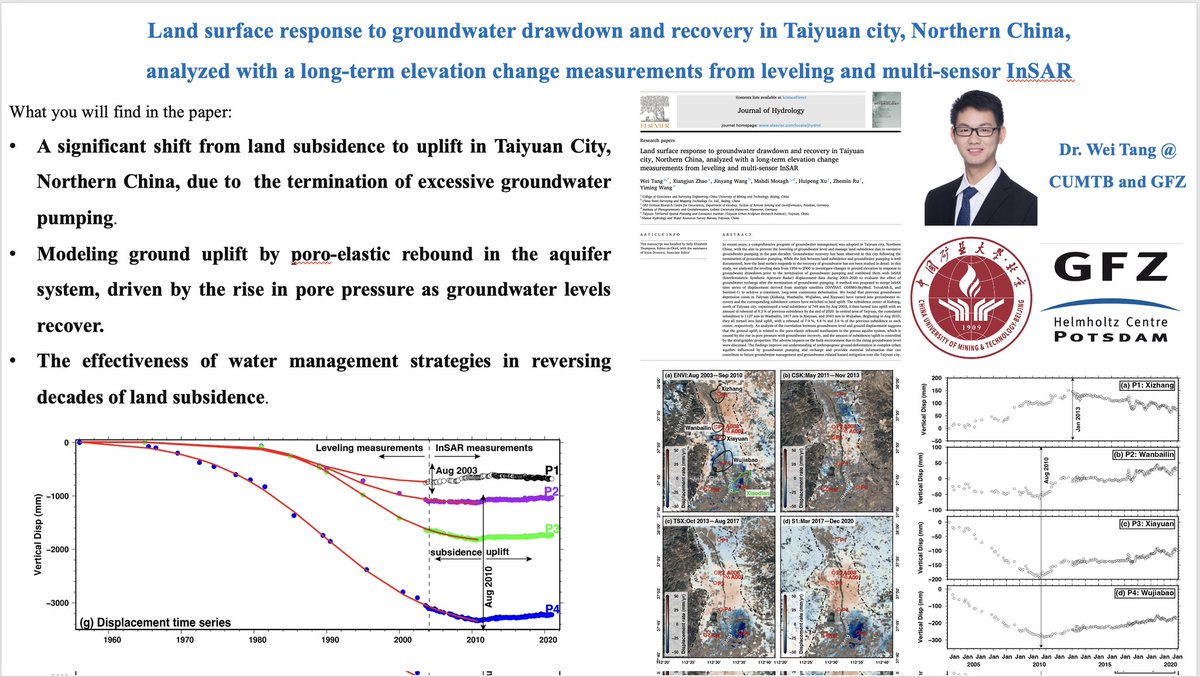
31 Aug 2024
New Paper Alert!
In this publication at the #Journal of #Hydrology, led by @SwiftTang, we have shown how decades of effective #water management stategies in northern #China led to reversal of land #subsidence
@Land_Subsidence
@MahdiMotagh
Link-->
authors.elsevier.com/c/1jZqg…
2
4
428
TangWei retweeted
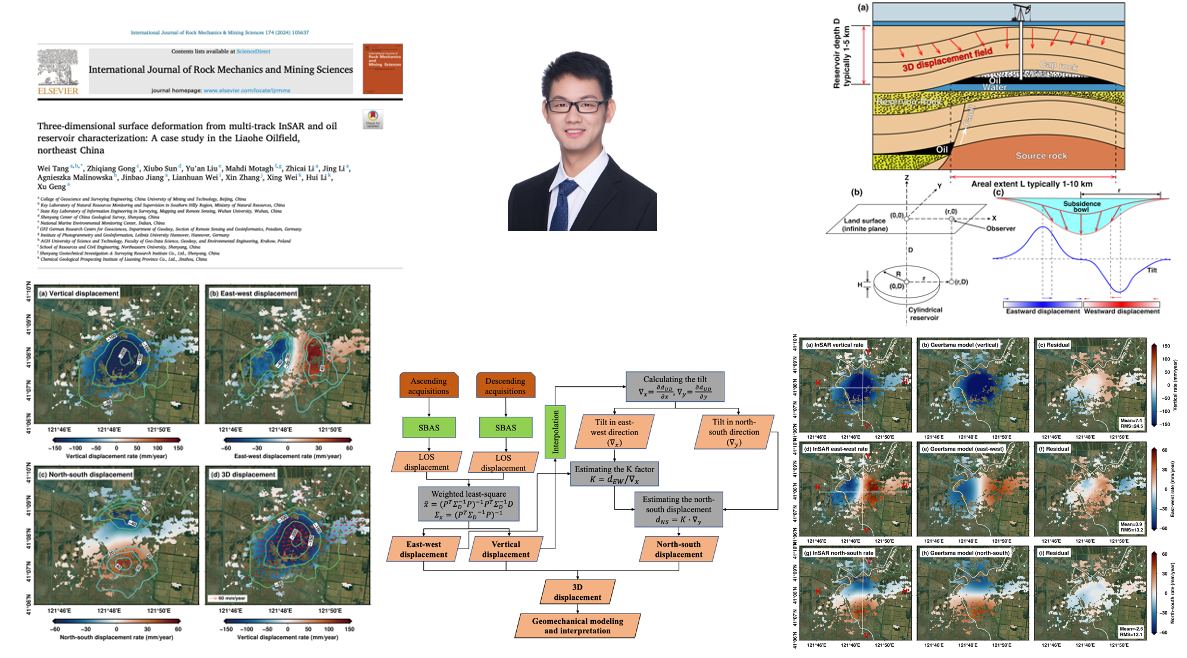
28 Jan 2024
New paper out! Tang Wei's article on analyzing 3D #groundmotion at #Liaohe oilfield in #China using multi-track #InSAR & #geomechanical modeling, published at International Journal of Rock Mechanics and Mining Sciences.
@SwiftTang
@Land_Subsidence
authors.elsevier.com/c/1iRt~…
5
17
823
TangWei retweeted
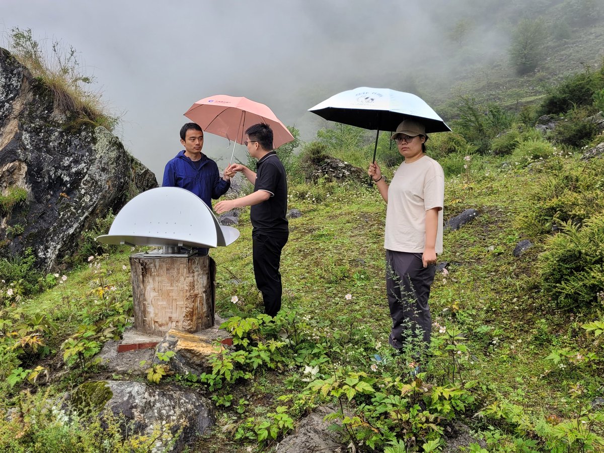
29 Aug 2023
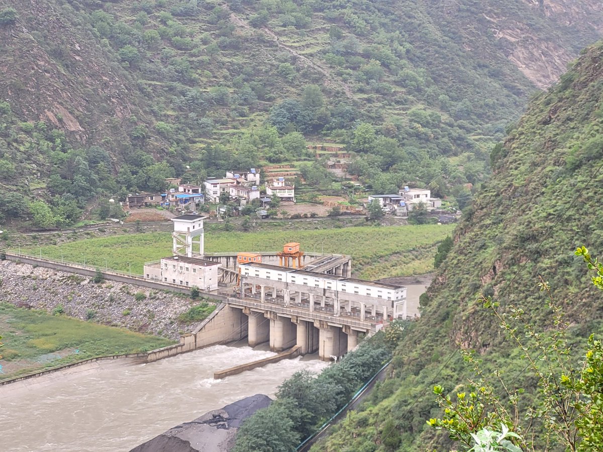
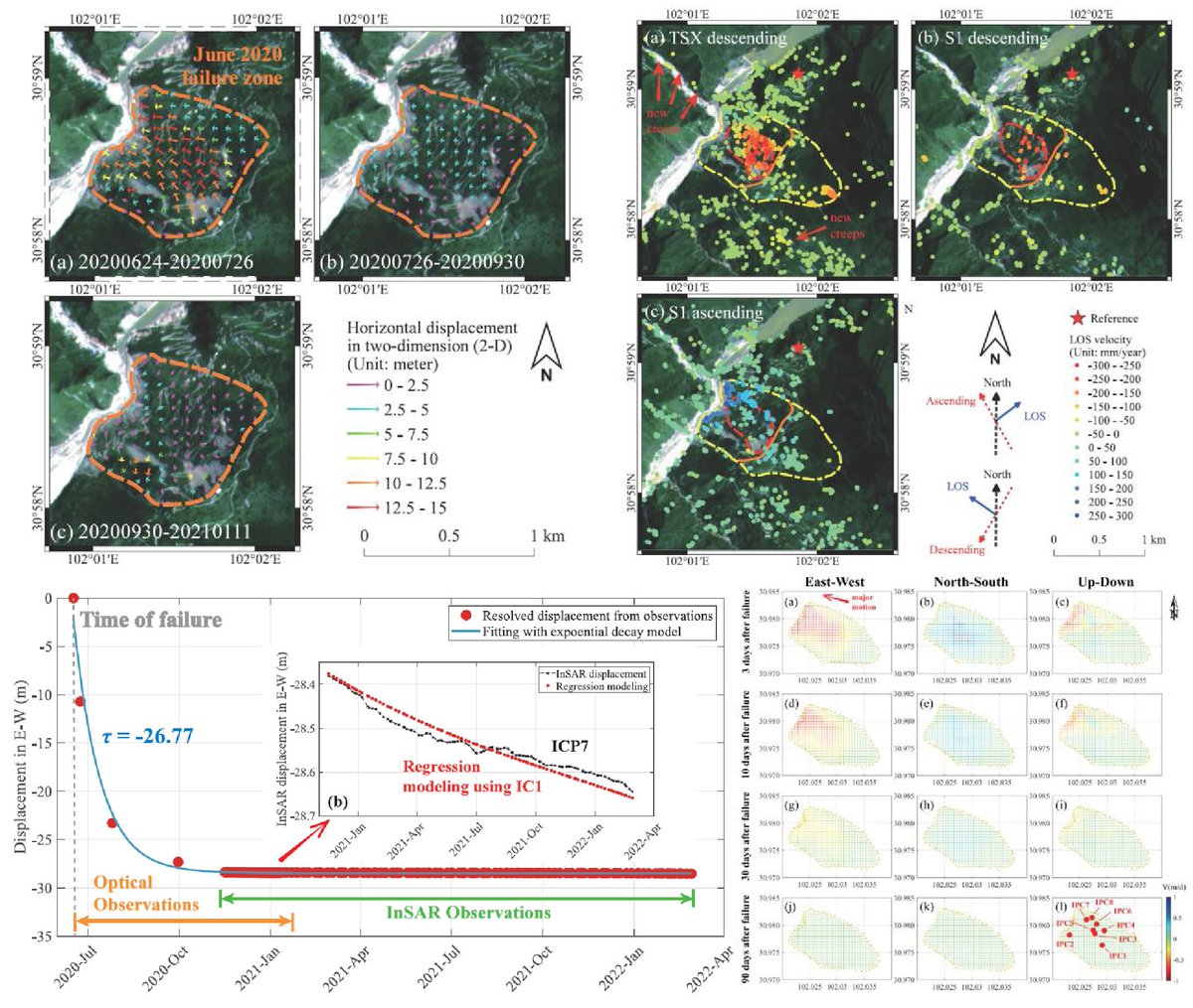
Visiting our CR-based monitoring system at #Aniangzhai landslide, a large, deep-seated ancient #landslide that was partially reactivated in June 2020 in #China after a chain of other hazards nearby. For more details see
ieeexplore.ieee.org/document…
link.springer.com/article/10…

4
16
674
TangWei retweeted
26 Aug 2023
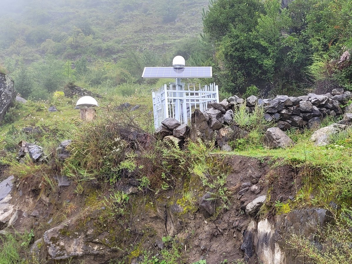
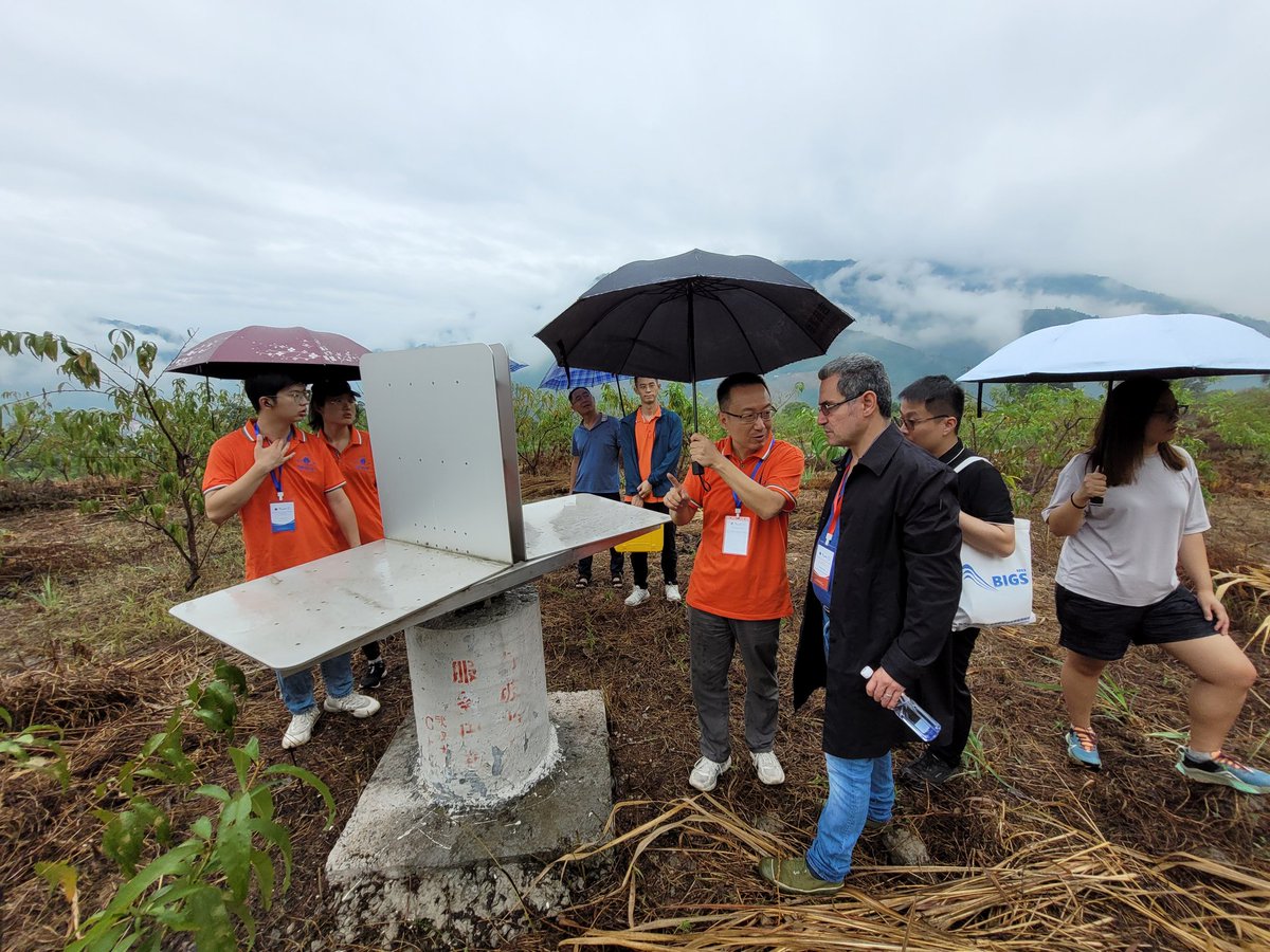
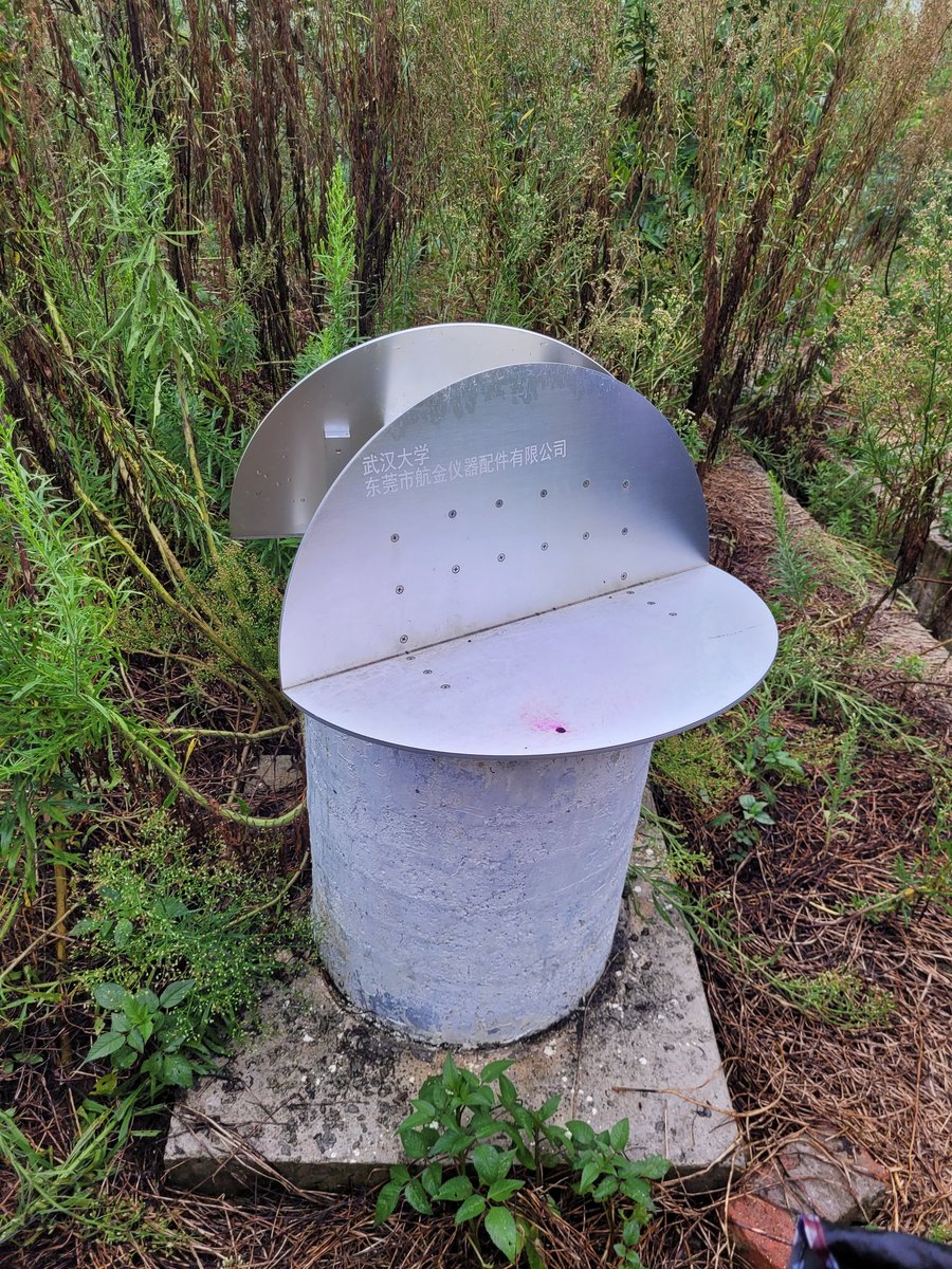
Our team from @GFZ_Potsdam visited today the natural laboratory that we have made at #Huangtupo #landslide in #China in cooperation with @WuHanUniv to evaluate the performance of various types of #CornerReflectors (CR) to assess surface deformation using #CR #InSAR

3
25
793
TangWei retweeted
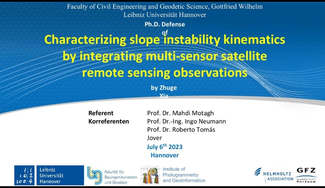
6 Jul 2023
Congratulations to Zhuge Xia for a successful defense of his PhD dissertation entitled 'Characterizing #slope #instability #kinematics by integrating multi-sensor #satellite #remotesensing observations
4
25
1,004
TangWei retweeted
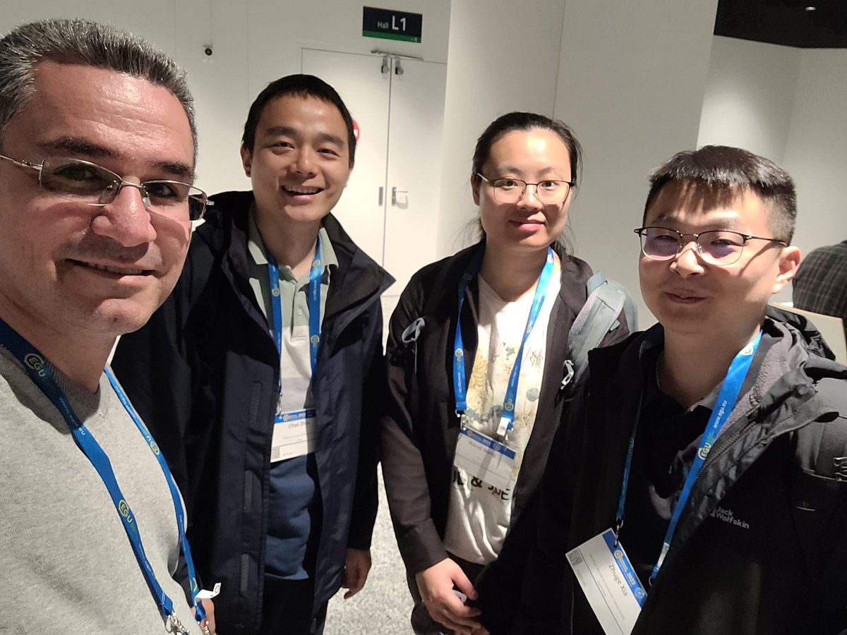
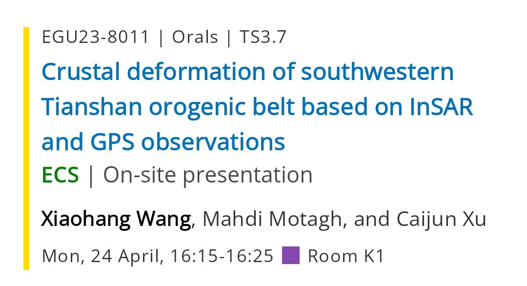
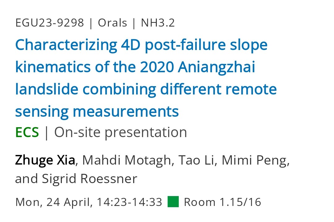
24 Apr 2023
First day of @EuroGeosciences General Assembly #EGU23 conference!
Our group will be presenting two talks today about #Aniangzhai #landslide & tectonics of the #Tianshan orogenic belt
Zhuge Xia, April 24, NH3.2, 14:23-14:33
Xiaohang Wang, April 24, TS3.7, 16:15-16:25
3
17
2,090
TangWei retweeted

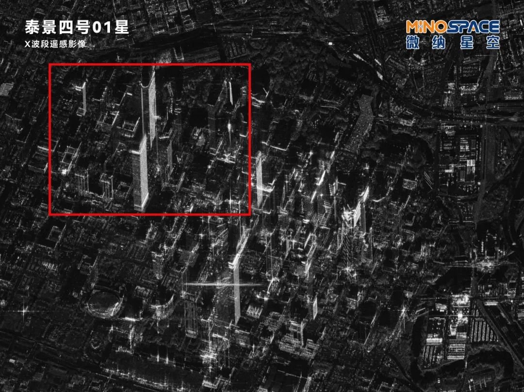
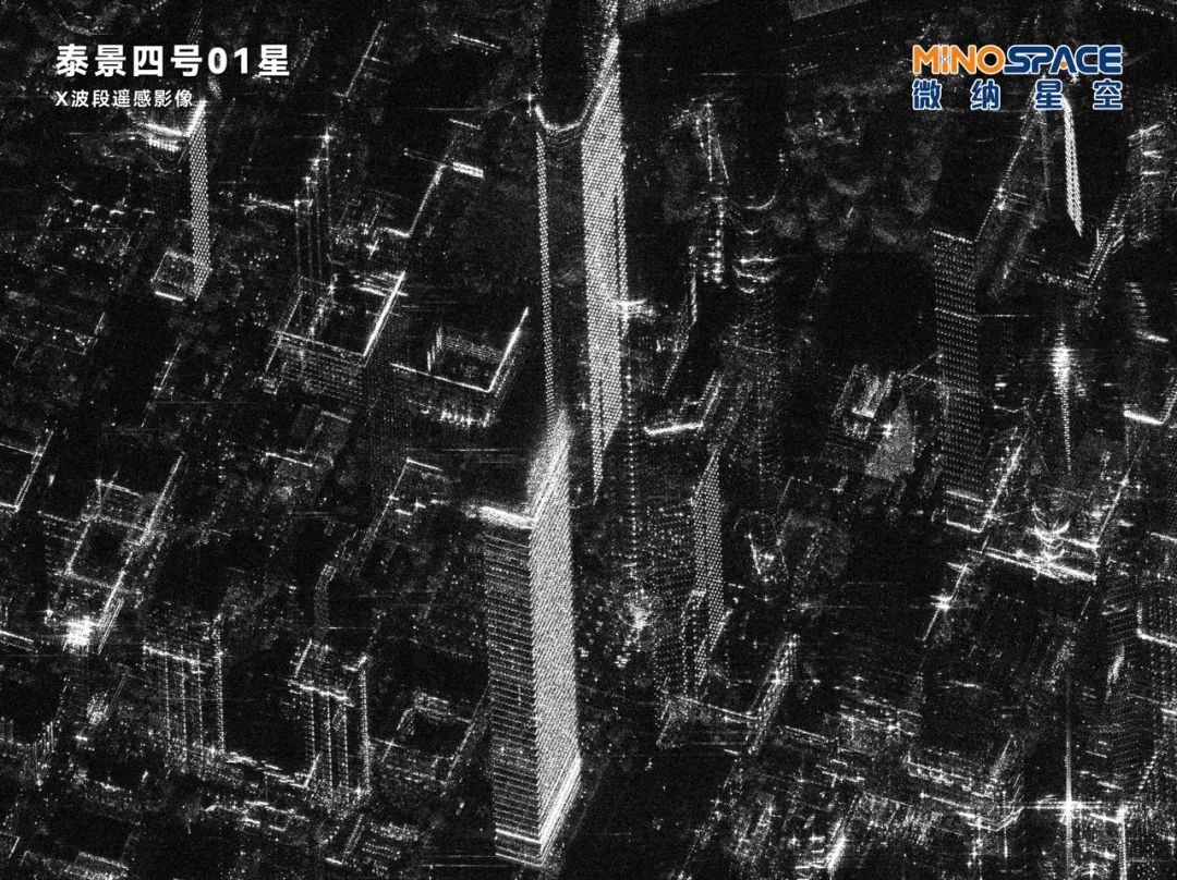
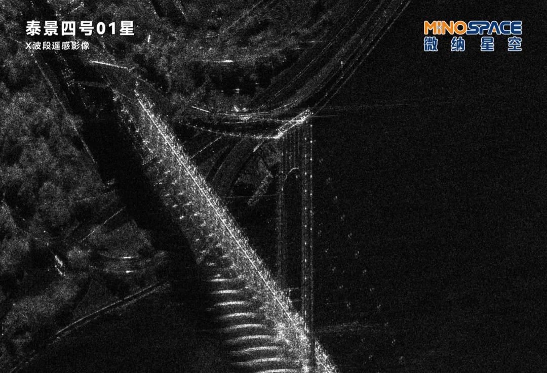
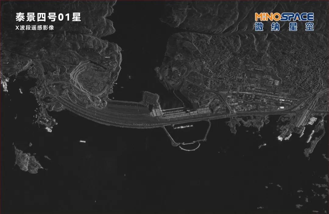
20 Feb 2023
SAR images look so cool! Here are some taken by China's first commercial X-band SAR satellite: MINOSPACE's Taijing-4-01:
The Space City Houston and home of Rockets;
Verrazzano-Narrows Bridge connecting Staten Island and Brooklyn;
Aswan High Dam of Egypt
2
22
121
30,250
TangWei retweeted

26 Jan 2023
A methodology developed by Zhuge to characterize 4D post-failure #slope #instability using a combination of #SAR and #optical #remotesensing data with a feature extraction technique & a relaxation model.
#landslide
#Aniangzhai
#China
26 Jan 2023

Exciting news! Zhuge has developed a new method for detecting post-failure slope instability using optical & radar data, along with a relaxation model. Check out our latest publication in @ISPRSJournal for more details! #geophysics #remotesensing
doi.org/10.1016/j.isprsjprs.…
5
17
1,590
TangWei retweeted
12 Jan 2023
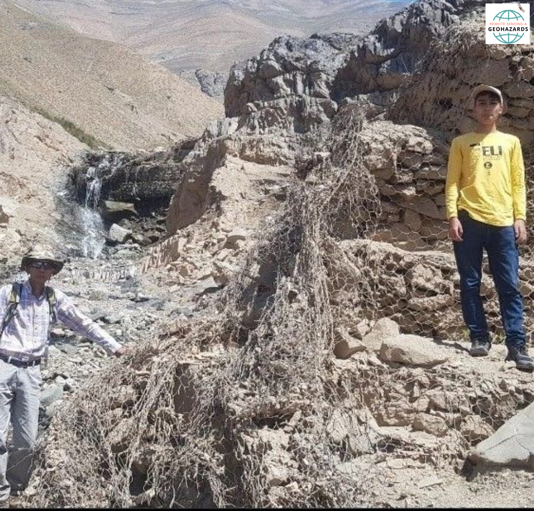
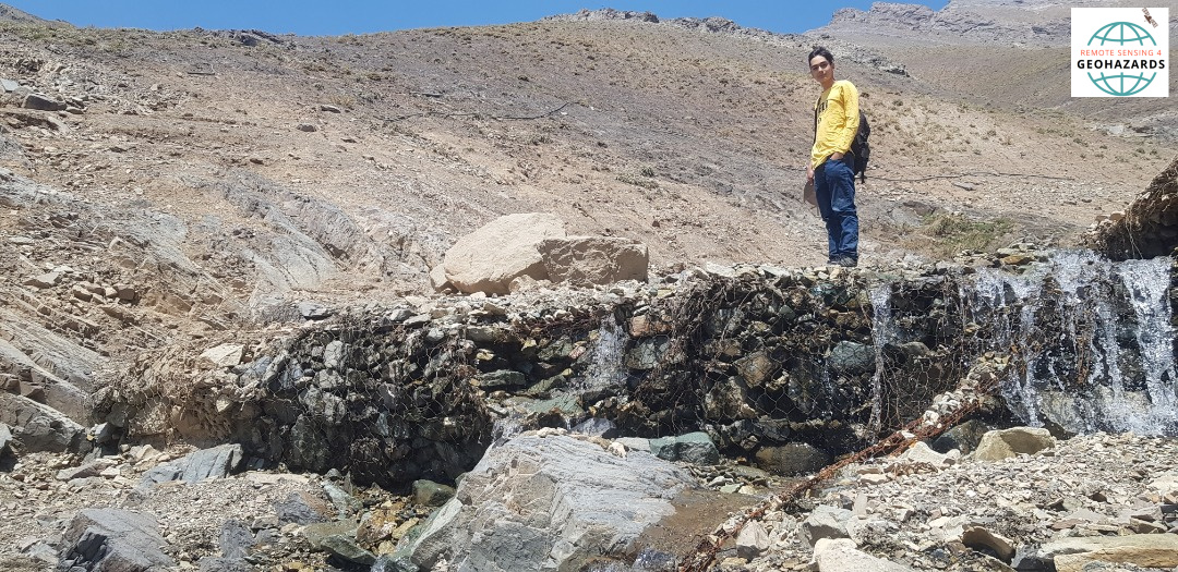
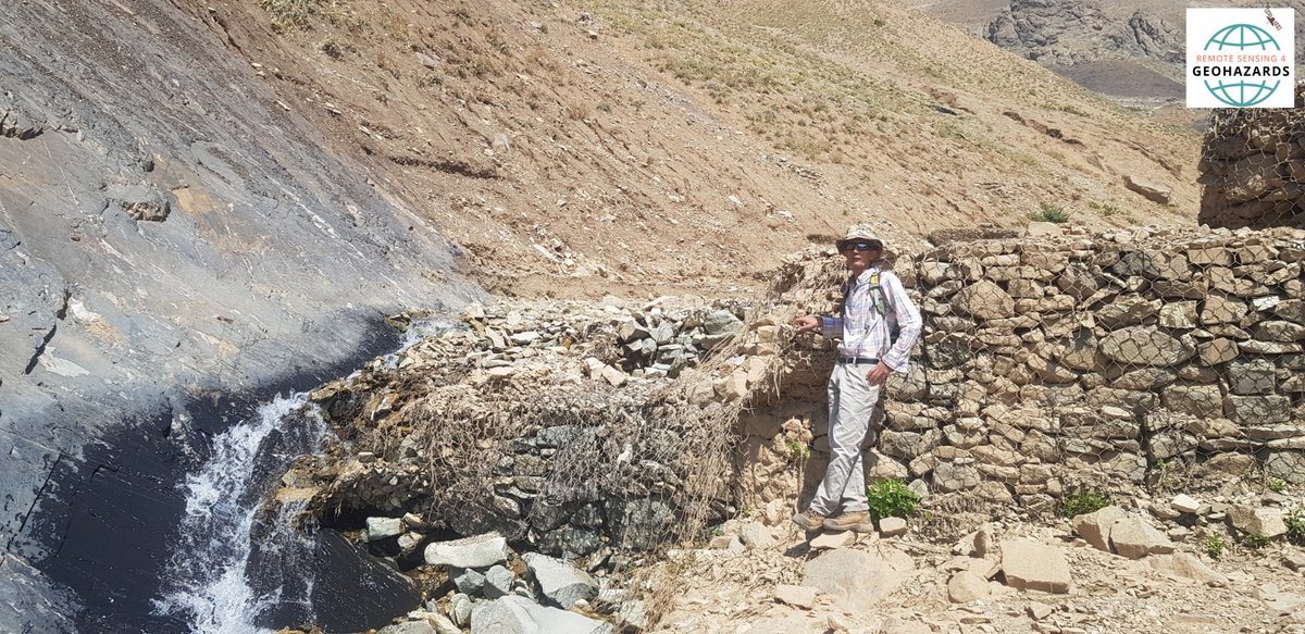
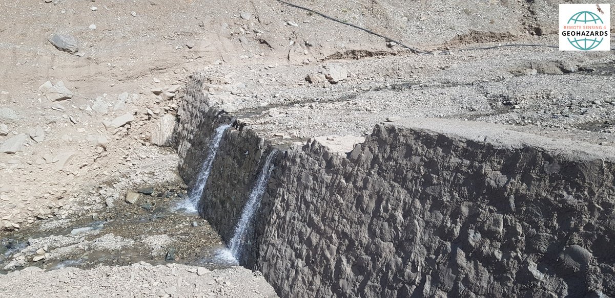
Can we rely on #checkdams for #flood control in face of changing climate? See the lessons we learned from the 28 July 2022 #flood in northwestern #Tehran
12 Jan 2023
Are check dams a sustainable solution in the face of changing climate and increasing extreme events ? @MahdiMotagh and Hossein Akhani delves into this considering Iran 2022 floods as a case study. Check it out here link.springer.com/article/10…
4
15
2,061
TangWei retweeted
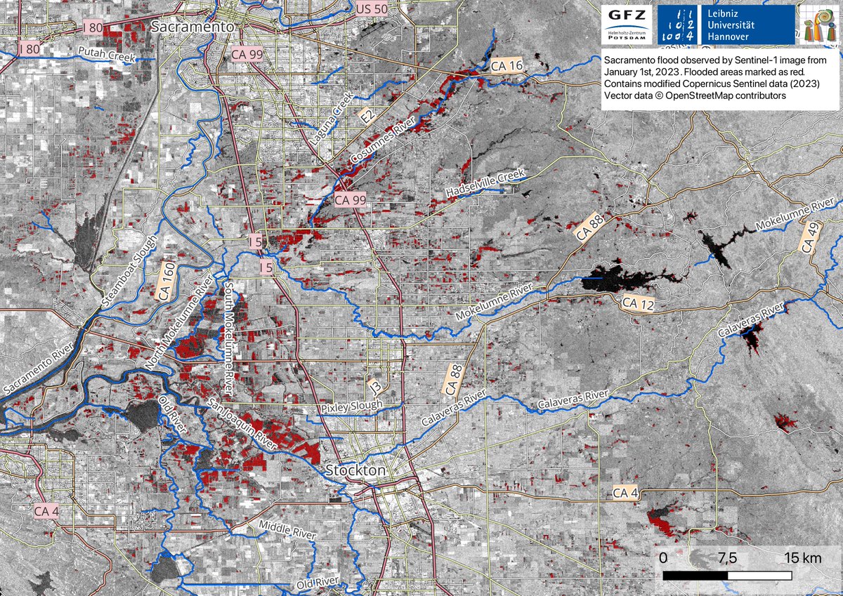
6 Jan 2023
The map below is derived using #SAR-based #Sentinel -1 image on 1st Jan 2023. Flooded areas are depicted in red; Blue color represents water bodies.
#Highway99 (depicted as CA99) can be seen flooded in the map. (3/4)
1
1
5
339
TangWei retweeted
6 Jan 2023
"When disaster strikes, our team is always ready to jump into action. Thanks to the hard work of @Mahmudhh, @MahdiMotagh, and @ShagunGarg1511, we've been able to closely monitor the recent #California #flooding using satellite imagery to create detailed flood maps. (1/4)
![Three vehicles are submerged on Dillard Road west of Highway 99 in south Sacramento County in Wilton, Calif., Sunday, Jan. 1, 2023 [Source : Hector Amezcua]](https://venexa.site/media/FlyKR36acAEe7QX.jpg)
ALT Three vehicles are submerged on Dillard Road west of Highway 99 in south Sacramento County in Wilton, Calif., Sunday, Jan. 1, 2023 [Source : Hector Amezcua]
1
1
5
1,958

3 Nov 2022
I just completed Synthetic Aperture Radar: Hazards with @edXOnline! edx.org/course/synthetic-ape…
1
4
TangWei retweeted

26 Dec 2021
[Free PDF Download] Introduction to #Probability for Data Science: probability4datascience.com by @stanley_h_chan
—————
#StatisticalLiteracy #Mathematics #AI #BigData #MachineLearning #DataScience #DataScientists #DataLiteracy #Statistics

7
222
820
TangWei retweeted
1 Dec 2021
A news article in @TheGardianNews about our recent work at #RSE journal for #subsidence and #rebound in #Taiyuan, #China. @ELSenviron @PDChina @TheWatchers_
sciencedirect.com/science/ar…
Terrawatch: what the world can learn from China’s sinking city theguardian.com/science/2021…
1
1
14
TangWei retweeted

13 Aug 2021
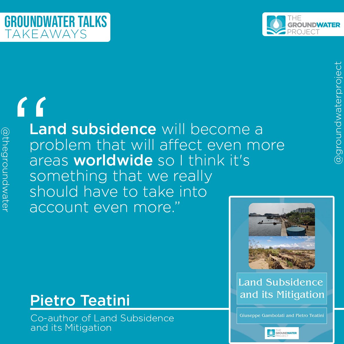
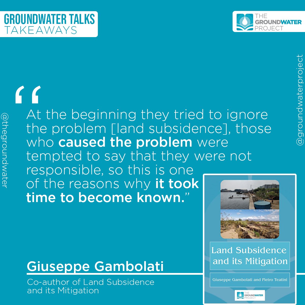
Learn about the subject by downloading our most recent release, the book Land Subsidence and its Mitigation: cutt.ly/GWP_LandSubsidence
Share it with your colleagues and friends. Every share makes groundwater more visible!
1
5
4
12 Jul 2021
Course Introduction - Observing Earth From Space via @FutureLearn futurelearn.com/courses/obse…
5
TangWei retweeted
19 Feb 2021
Using #InSAR, #GPS, and #tidegauge to evaluate spatial variability of relative sea level rise(#SLR & #RSLR) along the coastline of #Tianjin, #China, and its implication for sustainable development there, see paper by @SwiftTang
ieeexplore.ieee.org/document…

6
30
TangWei retweeted
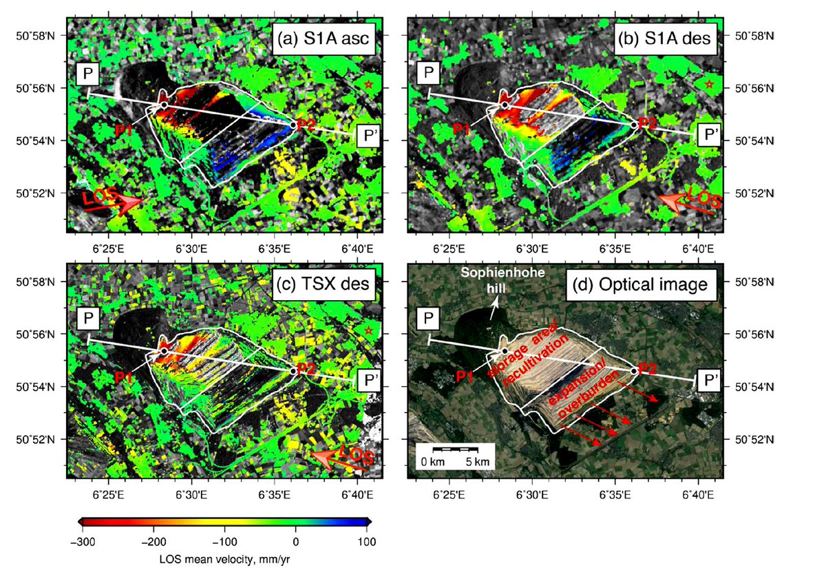
14 Nov 2020
Another German TV report about our recent work for mining induced deformation in #Hambach. This time they show #InSAR maps from our paper and discuss about the advantage of using such a technology for mining industry.
@SwiftTang
3
20
TangWei retweeted
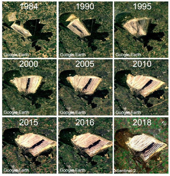
23 Aug 2020
#Hambach Forest in West #Germany has been adversely affected by #mining. As the process continues, so does instability due to compaction of waste material and excavation, as seen by #Sentinel1 & #TerraSARX #InSAR in our new paper. @EUEnvironment
sciencedirect.com/science/ar…
1
6
38