
May 26
A new MIT method highlights how traditional confidence intervals fail in spatial data analysis due to dependencies and model assumptions. It offers more honest uncertainty measures, boosting trust in scientific findings and policy decisions. Discover more at dev.to/rawveg/false-precisio…
#HumanInTheLoop #SpatialStatistics #UncertaintyQuantification #ReproducibilityCrisis
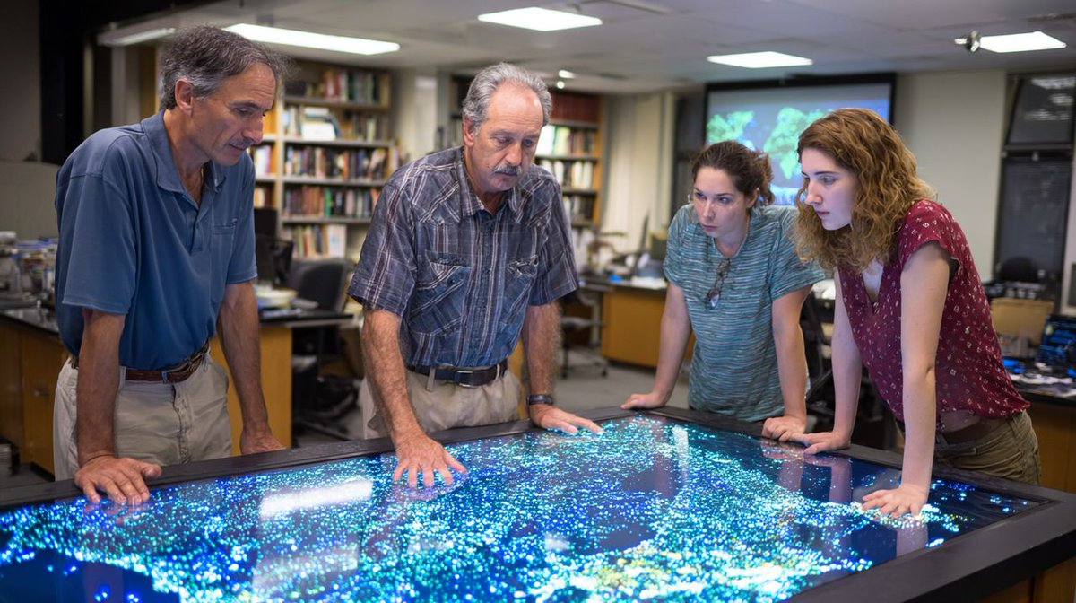
ALT False Precision in Science
1
28

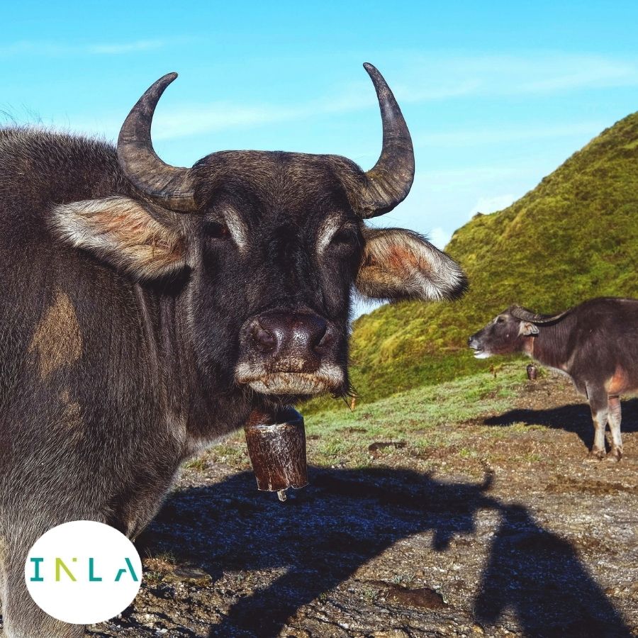
Live online course on scalable Bayesian modelling using INLA, taught by Virgilio Gómez-Rubio, author of Bayesian Inference with INLA and leading contributor to Bayesian & spatial modelling in R
4–8 May
prstats.org/course/bayesian-…
#BayesianStatistics #INLA #RStats #SpatialStatistics
1
1
27
Mar 1
MIT's new spatial statistical method tackles the long-standing flaw of false precision in environmental and epidemiological studies, ensuring confidence intervals reflect true uncertainty in spatial data. More reliable science builds public trust and informs better policies.
Discover more at smarterarticles.co.uk/false-…
#HumanInTheLoop #SpatialStatistics #UncertaintyQuantification #ReproducibilityCrisis
1
22

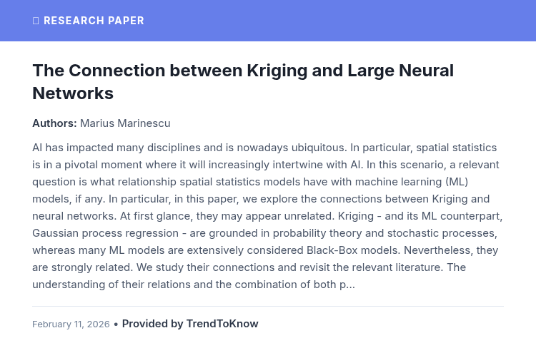
TrendToKnow AI: The Connection between Kriging and Large Neural Networks
👥 Marius Marinescu
#AIResearch #MachineLearning #SpatialStatistics #GaussianProcesses
Provided by TrendToKnow AI
🔗 trendtoknow.ai/
3

Jan 9
✅ Bottom Line
PySAL strengthens spatial data science by turning geographic data into quantifiable, reproducible, and actionable insights.
#PySAL #SpatialDataScience #SpatialStatistics #GeospatialAnalytics #GIS
1
8
Jan 8
✅ Bottom Line
GeoDa enables fast, visual, and reliable spatial autocorrelation analysis, making it a powerful tool for exploratory spatial data analysis.
#GeoDa #SpatialAutocorrelation #SpatialStatistics #ExploratorySpatialDataAnalysis #GIS
1
5
Jan 7
and environmental monitoring
Evidence-based policy and spatial decision-making
✅ Bottom Line
Using spatial statistics in QGIS and ArcGIS Pro transforms geographic data into clear insights, enabling smarter, data-driven spatial decisions.
#SpatialStatistics #QGIS #ArcGISPro
1
10
24 Dec 2025
✅ Bottom Line
Integrating spatial statistics transforms predictive models into accurate, context-aware tools, strengthening decision-making in spatially complex environments.
#SpatialStatistics #PredictiveModeling #SpatialAnalysis #MachineLearning #DataScience
1
7
18 Dec 2025
✅ Takeaway
Spatial autocorrelation turns location data into actionable insight helping health systems respond faster and smarter.
#SpatialAnalysis #PublicHealth #Epidemiology #GIS #SpatialStatistics #DiseaseMapping
1
2
16 Dec 2025
✅ Bottom Line
Spatial statistics transforms environmental data into clear, actionable insights, supporting responses that are timely, targeted, and sustainable.
#SpatialStatistics #EnvironmentalHotspots #GIS #SpatialAnalysis #ClimateData
1
4
28 Nov 2025
Accounting for it leads to solutions that are:
✅ Localized
✅ Accurate
✅ Context-aware
#SpatialAnalysis #GIS #SpatialStatistics #GeoSpatial #DataScience
1
13
27 Nov 2025
Choosing the right spatial weight matrix ensures accurate patterns, realistic models, and valid spatial insights.
#SpatialAnalysis #GIS #SpatialStatistics #GeoSpatial #DataScience
1
6
26 Nov 2025
Instead of relying on global averages, examine how patterns and relationships shift across space that’s where the real insight lies.
#SpatialAnalysis #GIS #SpatialStatistics #GeoSpatial #DataScience #SpatialStationarity #SDSSN
1
3
25 Nov 2025
Recognizing this is essential for accurate analysis, stronger models, and better decision-making.
Stay with us as we continue exploring core concepts in spatial data science!
#SpatialData #GIS #SpatialStatistics #GeospatialAnalysis #DataScience
1
15

17 Nov 2025
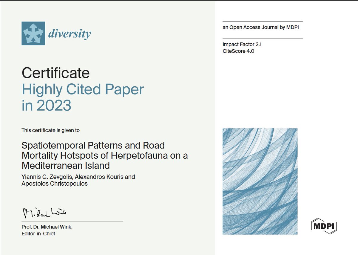
📖 Welcome to read the Diversity Highly Cited Paper:
🦎 Spatiotemporal Patterns and Road Mortality Hotspots of Herpetofauna on a Mediterranean Island
👥 Yiannis G. Zevgolis et al.
🔗 Please read: brnw.ch/21wXyLV
#Reptiles #Amphibians #SpatialStatistics #Diversity
1
66
5 Nov 2025
💡 Next time you see a map full of data, remember: Geary’s C helps uncover the hidden patterns beneath!
#SpatialAnalysis #GearyC #DataScience #GIS #SpatialStatistics #Research #UrbanPlanning #PublicHealth #SpatialData
1
11
21 Oct 2025
real estate analytics, these packages offer scalable, open-source solutions.
#Python #Geospatial #SpatialAnalysis #GeoAI #DataScience #GIS #Forecasting #MachineLearning #OpenSource #SpatialStatistics
1
20

16 Oct 2025
😱Natural disasters are on the rise, causing huge economic damage and human loss! Urban areas, like Isfahan in Iran, are at risk. Researchers once thought Isfahan was safe from quakes, but new findings say otherwise. This study determines the city center's physical - functional resilience to a hypothetical earthquake 🛡️. #UrbanResilience #Isfahan #EarthquakeSafety #SpatialStatistics #ELECTRE Link[doi.org/10.1080/10095020.202…]
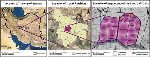
ALT Data source: Google earth (accessed June 15, 2021); Isfahan Municipality GIS database (accessed August 8, 2019).
1
4
48
2,626

8 Sep 2025
Tutorial about Geospatial Analysis with Python for Beginners to Advanced Level, Part 1
Tutorial Link: youtube.com/live/rSUhBf7XNHU…
#Python #SpatialAnalysis #Geospatial #GIS #RemoteSensing #Geoinformatics #DataScience #MachineLearning #DeepLearning #BigData #SpatialStatistics
1
45
198
8,030