Engineer @nuoninc | Previously @grafana, @TimescaleDB, @RedHat | Interested in Kubernetes, Observability, @golang | he/him | Views are my own
- Tweets 837
- Following 2,803
- Followers 1,102
- Likes 29,837


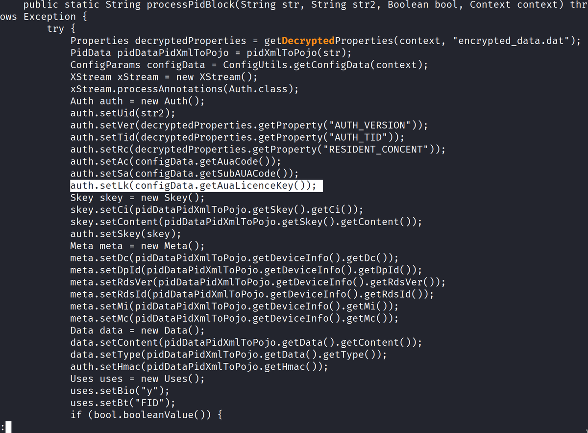
ALT Properties decryptedProperties = getDecryptedProperties(context, "encrypted_data.dat"); auth.setLk(configData. getAuaLicenceKey());
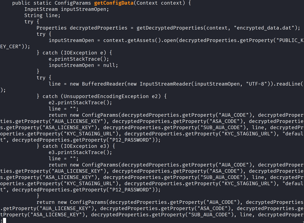
ALT public static ConfigParams getConfigData(Context context) { return new ConfigParams(decryptedProperties.getProperty("AUA_CODE"), decryptedProper ties.getProperty("AUA_LICENSE_KEY"), decryptedProperties.getProperty("ASA_CODE"), decryptedPropertie s.getProperty("ASA_LICENSE_KEY"), decryptedProperties.getProperty("SUB_AUA_CODE"), line, decryptedPr operties.getProperty("KYC_STAGING URL"), decryptedProperties.getProperty("KYC_STAGING_URL"), "defaul t", decryptedProperties.getProperty("P12_PASSWORD" ));